11 May 2016
Solo
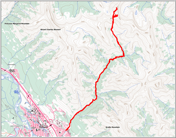
Stenton Peak is another remote summit in the Fairholme Range north of Canmore that seems to be too far away from the Trans-Canada Highway to make it on the radar of hikers and scramblers. Access is indeed difficult: it involves a 4-5 hour tramp up rubbly creekbeds, then a steep slog up scree and shale to a saddle from where one has to descend some 150 m and sideslope on rubbly terrain before beginning the steep ascent of Stenton Peak itself. This was one of the most demanding scrambles for me, both mentally and physically, due to a number of factors that made this a 12-hour exercise in resilience and endurance.
I parked in Canmore across from the Iron Goat at the trailhead for Mount Lady Macdonald and set off at a reasonably early time (7 am), well aware of the weather forecast which called for rain and snow later in the afternoon. The day started out with beautiful sunny blue skies and I made good progress on the first familiar stretch along Cougar Creek, first to the Canadian Forks (ca. 45 min.), then to the turn-off to Cougar Peak (another 45 min.). Bits of trail at the beginning made travel easy and straightforward here, just like on my two trips up this valley the previous year when I did Cougar Peak and later Mount Townsend. Higher up in the valley, the terrain is rougher and there is more boulder hopping/climbing to do. I did notice, however, that cairns had started to appear and short smatterings of a trail had popped up here and there as compared to 2015 when there were absolutely no signs of human traffic in this area. Perhaps the trip reports on ClubTread contributed to some of this change.
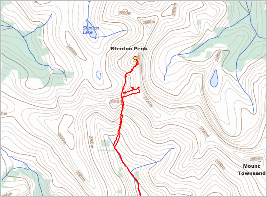
With the unfavourable weather forecast in mind, I put on a good pace and continued only with short breaks to the turn-off for Stenton Peak. The main creekbed heads straight here, leading to the access slopes of Mount Townsend, whereas a left turn (I built a cairn) takes one up a side valley for another 4 km to the access slopes for Stenton Peak. This was new territory for me, and knowing that I’ve never stepped foot into an area always gets me excited and gives me an extra adrenaline push to keep me going. The hike up this side valley was quite enjoyable – it’s mostly a flat creekbed filled with pebbles that are relatively easy to walk on. Higher up there was steep rocky section where I stuck to the right side of the creekbed to easily wind my way through large chunks of grey limestone. After this the valley narrowed to a gully, partially snow-filled, where the pleasant hike was interrupted here and there by a few short scrambles up steep rock steps. At a spectacular outcrop of brown folded strata I reached a split in the gully. The main gully seemed to aim directly for the gentle brown col above, but it narrowed significantly and didn’t look too inviting. The right fork looked much easier to navigate and I remembered from looking at satellite images back home that this might be an easy way up to the ridge. I decided to take the right arm, but stuck close to treeline high above the gully below, where ribs of rock offered better purchase to ascend.
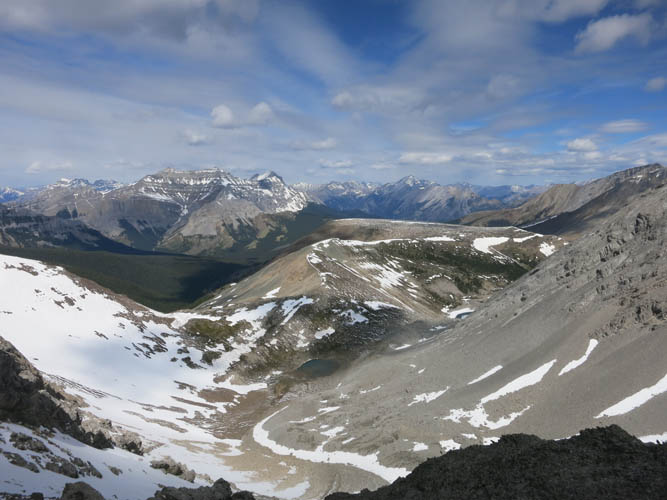
After what seemed like a long and tiring slog I eventually reached a saddle and Stenton Peak came in sight for the first time. It had taken me a good 5 hours to get here. The views north and northeast from this saddle are really extensive: broad forested areas with many unnamed peaks, Lake Minnewanka, and Mount Aylmer in the distance. And below was a pretty little valley with a small tarn and Stenton Lake, both partially frozen over. I now had a choice: 1) ascend steep slabs to my right to a sub-peak which would then hopefully connect along a N-S ridge to Stenton Peak, or 2) descend into the small valley in front of me, losing perhaps 100-200 m of elevation, and then re-gain that elevation and ascend Stenton Peak along rubbly gullies on its south side. I opted for #1, which turned out to be a very bad choice! The “sub-peak” was much higher than I had anticipated (at ca. 2810 m it’s only 10 m lower in elevation than the summit of Stenton Peak) and the ridge leading to my objective was full of vertical cliffs that would require ropes and belays to downclimb them safely. With my limited view from the sub-peak I didn’t see what was coming and naively managed to downclimb the first cliff (a 4 meter step with good but small holds and significant exposure), but soon realized that there were several additional cliffs in my way that were impossible to scramble down without protection. The cliffbands led all the way back down to near the saddle where I had come from, so I had no choice but to reluctantly scrabble back down along steep, rubbly slabs between cliffbands. The rock was dangerously loose in places and patches of ice and snow made it tricky. To make matters worse, dense clouds were moving in quickly from the west and light snow started to fall. Once I slipped on a short icy patch and slid a couple of metres, but thankfully caught myself quickly. This made me acutely aware of how I had to be very careful and really take my time to get myself out of this potentially dangerous situation. I took a short rest and then slowly made my way across several breaks in the cliffs lower down and managed to get back to near the saddle where I had started this messy detour more than an hour earlier.
I briefly contemplated scrambling back to the saddle to retrieve my poles that I had left there, but decided against it as I was too lazy to climb back up over more nasty terrain. This was my second mistake! It turns out the poles would’ve helped immensely for the rest of my scramble as the terrain that followed almost all consisted of horribly loose, unstable rocks readily giving way under the weight of my feet. In descending down from the saddle and traversing over to the base of Stenton Peak my ice axe helped a lot, but nothing compares to extending your two arms with long poles when side-bashing across such terrible slopes. There were a few steep, hard snow patches during the traverse where my ice axe was really useful and in fact a necessity to avoid an uncontrolled slide down to the bottom of the valley (I had to self-arrest twice when my worn boots didn’t grip properly). Once I had reached the base of the south face of Stenton Peak, I followed a rubble-strewn gully all the way up to the ridge. From here it was a short walk over more rubble to the summit. There was a nice summit cairn but no register, so I left the one I brought. Views of well-known mountains from unusual angles included Mount Townsend, End Mountain and Mount Pechee. Fortunately it had stopped snowing by now and I felt immensely elated to be finally standing on the summit of Stenton Peak. The unnecessary detour had really cost me a lot of energy, both physical and mental, and of course I still had to do the long trek back, including re-ascending to the saddle!
A short chocolate break was all that was needed to boost my energy levels and my morale before I embarked on the long return trip. It was still cloudy, but thankfully the snow flurries had stopped and only occasionally did it drizzle a little bit. The descent from the saddle back into the valley was fast and enjoyable on soft brown shale mixed with soil, perfect for “scree skiing”. Once back in the valley I simply retraced my steps and made it back to the parking lot by 7 pm, just in time before the heavy clouds that had built up started a real downpour of rain. I felt tired, but not exhausted anymore, but I was indeed very glad that this lengthy trip was behind me! Would I do this one again? Most probably not! Would I recommend it to others? Not if it’s an enjoyable day out that you’re looking for, but remoteness or bagging that last peak on your list…
DISCLAIMER: Use at your own risk for general guidance only! Do not follow this GPX track blindly but use your own judgement in assessing terrain and choosing the safest route.
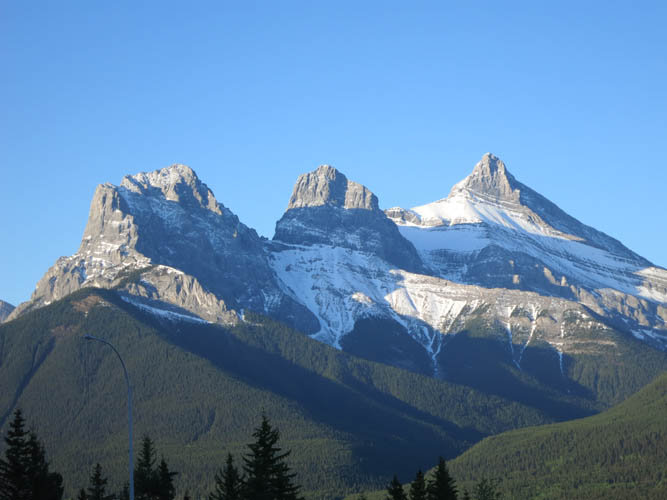
A hike into Cougar Creek starts with this classic view of the Three Sisters.
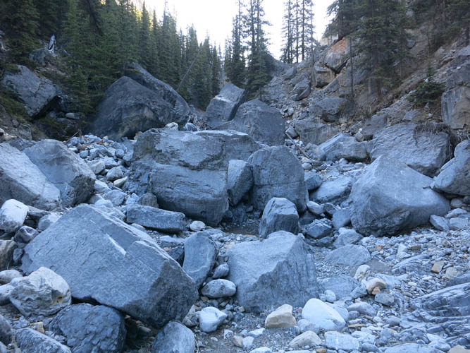
Boulders in the creek higher up the valley slow down progress, but don’t really present any obstacles.
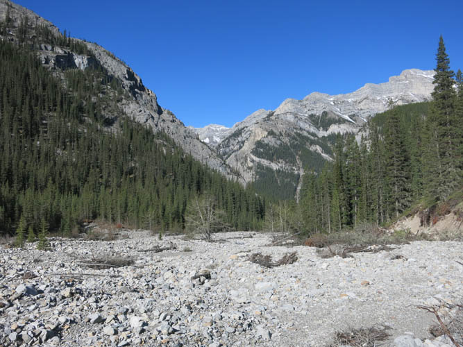
Higher up in the valley the creekbed widens again.
This is where I turned left (cairn). Going straight would get you to Mount Townsend.
As I hike up this pleasant side valley, the sky is still blue and innocently cloudless…
Looking back down the side valley. Cougar Peak takes centre stage.
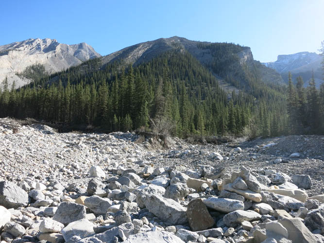
I kept going until I reached the large patch of forest, where I turned right instead of heading straight for the brown shale slopes.
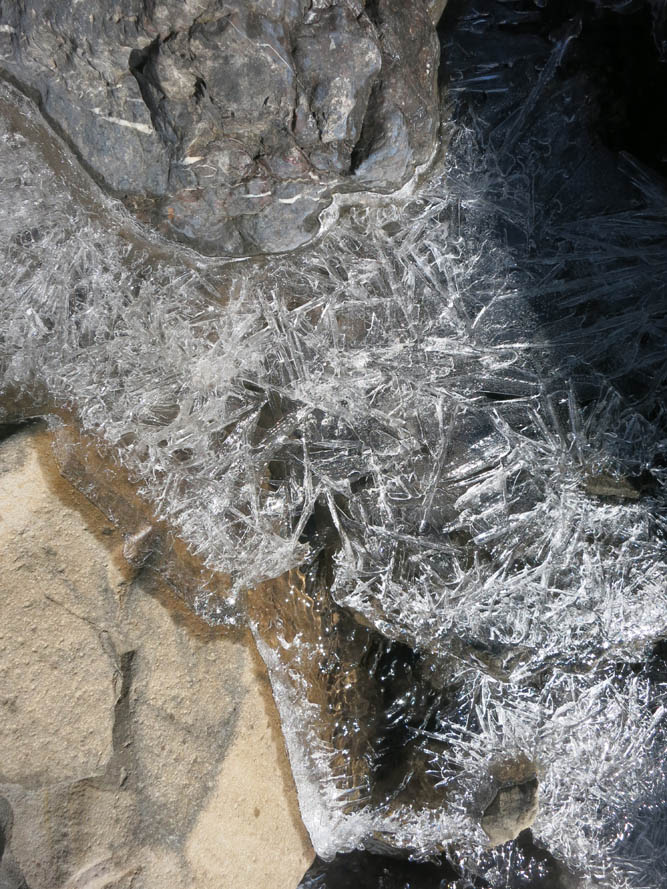
It’s still cold up here in early season!
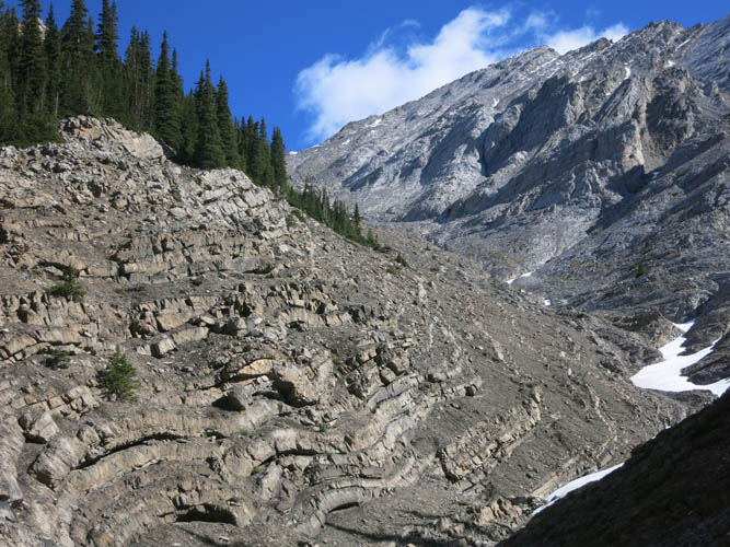
A fantastic example of multiply folded rock strata. Really shows you how the Rockies have formed: millions of years of pressure and movement have literally bent the rock.
My route takes me into a smaller gully to the right of the rock folds.
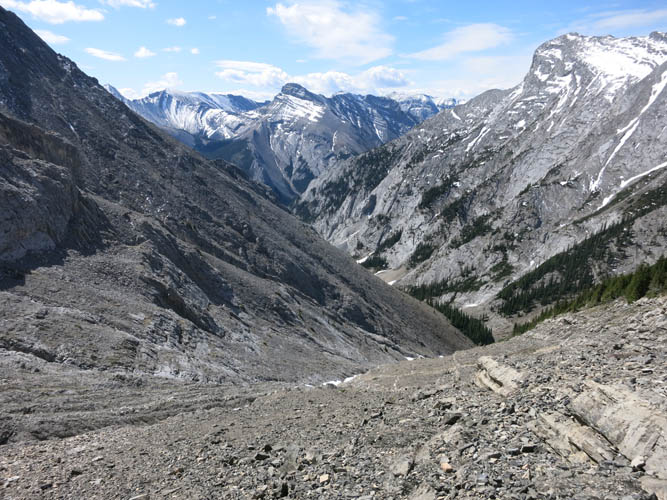
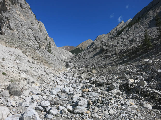
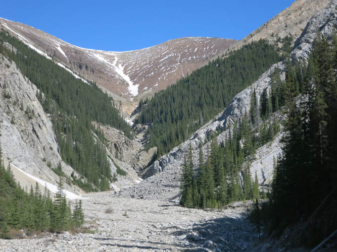
What a slog! Looking back down the gully.
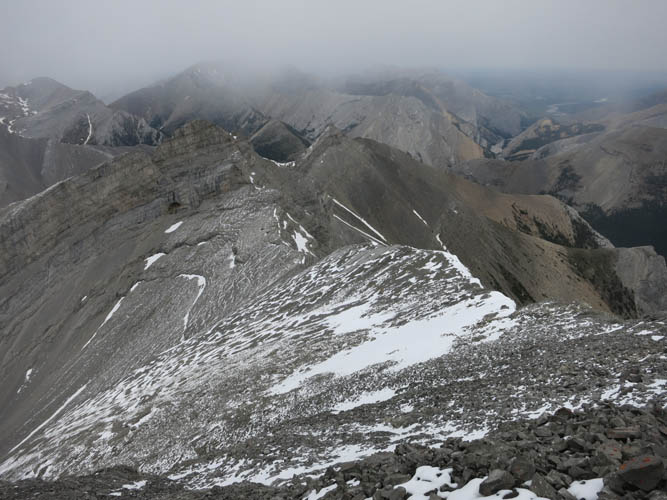
Upon reaching the col, I finally get my first views of the valleys and peaks to the north and northwest.
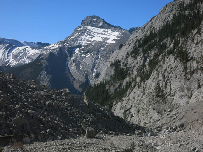
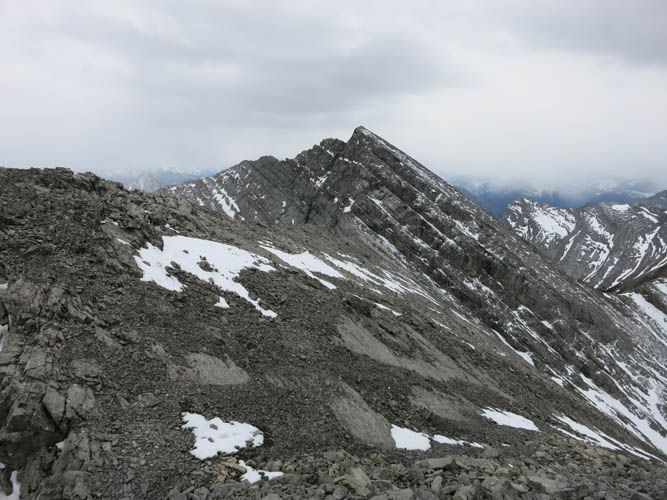
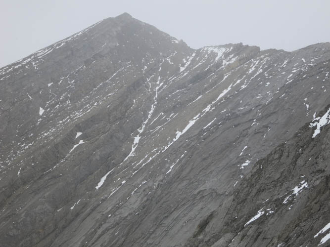
Stenton Peak comes into view for the first time. It’s connected by the ridge on the right to a sub-peak that is only 10 m lower in elevation.
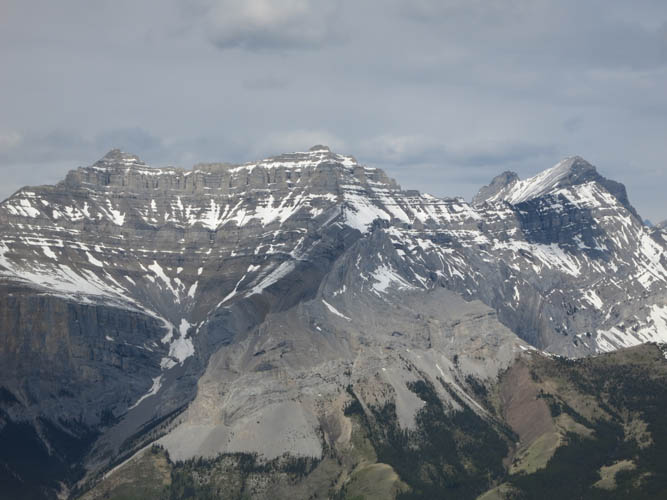
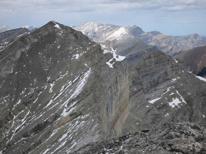
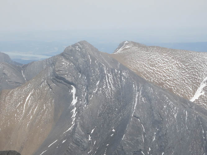
A zoomed-in photo of the massif that makes up Mount Peechee (left and centre), Mount Girouard (far right), and Mount Inglismaldie (the small peak to the back and just left of Girouard).
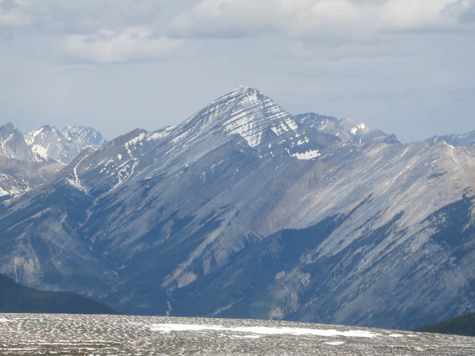
Mount Aylmer.
And behind me to the south is the impressive looking Mount Fable.
Thinking I could connect to Stenton Peak via the ridge, I head up the sub-peak to the east – a big mistake!
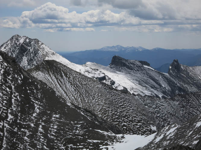
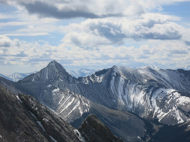
Views from the sub-peak to the SE: Mount Townsend dwarfs the craggy Epic and Mystic Towers. Far away in the background is Moose Mountain.
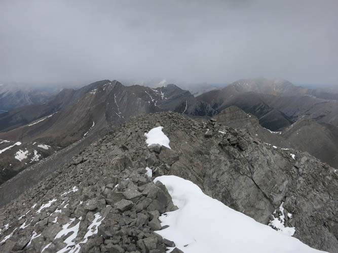
I just ascended 150 m to the sub-peak only to lose it again! The connecting ridge that leads north to Stenton Peak is barred by vertical cliffs and thus a no-go.

Here’s the first cliff I managed to downclimb. The terrain is slabby and steep.
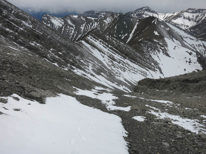
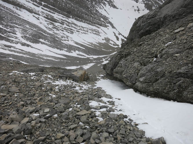
A look back at the col during my traverse on scree and snow patches to the base of Stenton.
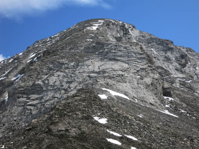
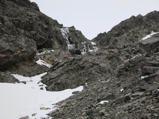
The final ascent is via a rubbly gully and patches of snow.
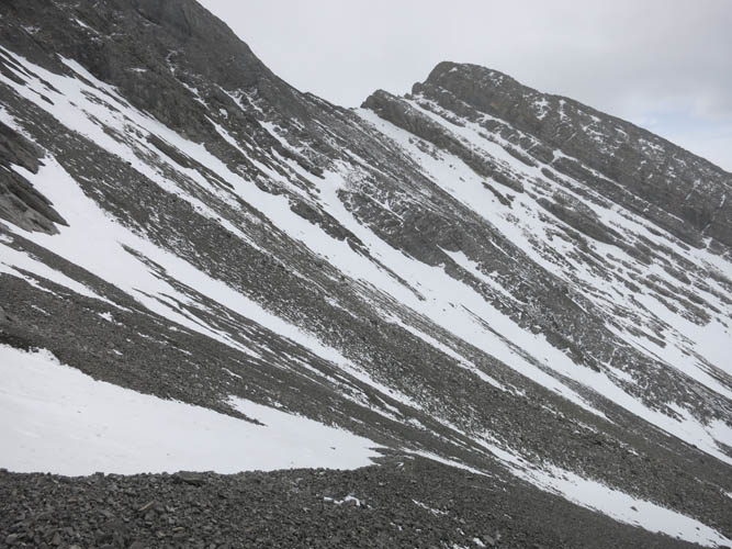
A look back at the sub-peak and it’s nasty cliffs on the north side.
At the summit of Stenton Peak. The forecast afternoon clouds are rolling in.
Views from the summit: South Ghost Peak sits straight to the east.
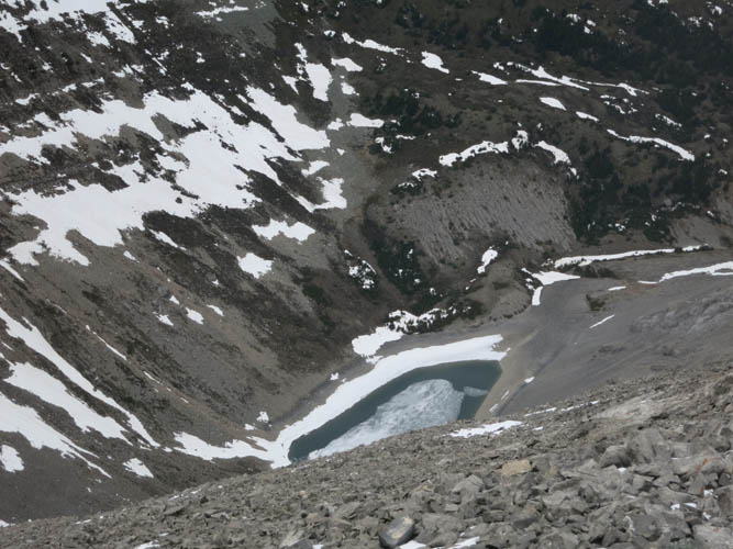
Ice partially covers Stenton Lake below the summit.
A scramble along the ridge to the north would probably end very soon at these cliffs.
Descending the snow-filled gully on the way back.
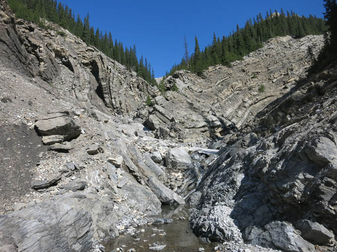
The gully looks pretty ugly, but it’s not that difficult once you break it down.
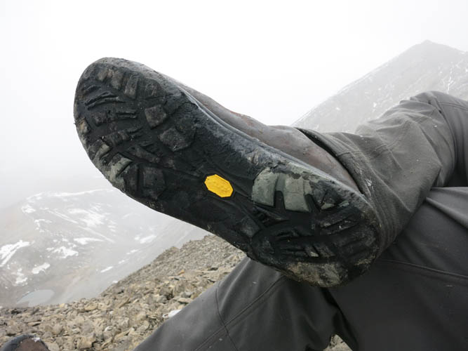
High time for new boots!
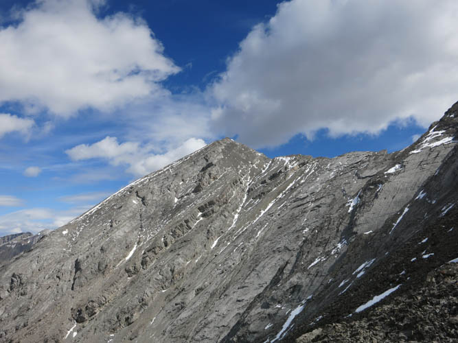
A last look at Stenton Peak. The near-vertical line of snow below the summit is the ascent/descent gully.
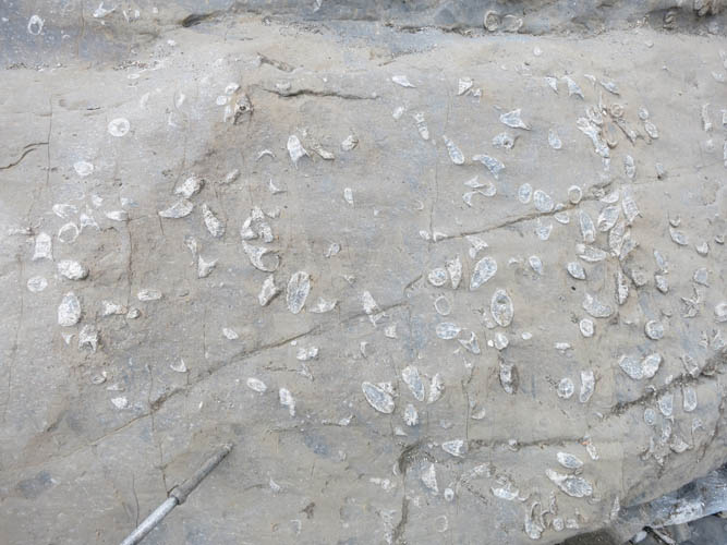
Back in the side valley near the folded rock layers, I find another interesting geological outcrop: a bed full of horn corals.
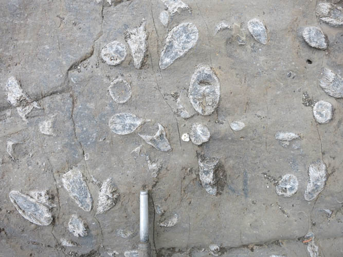
The horn corals protrude from their host rock at various angles, exposing different cross-sectional views of these fossils.