25 June 2015
Solo
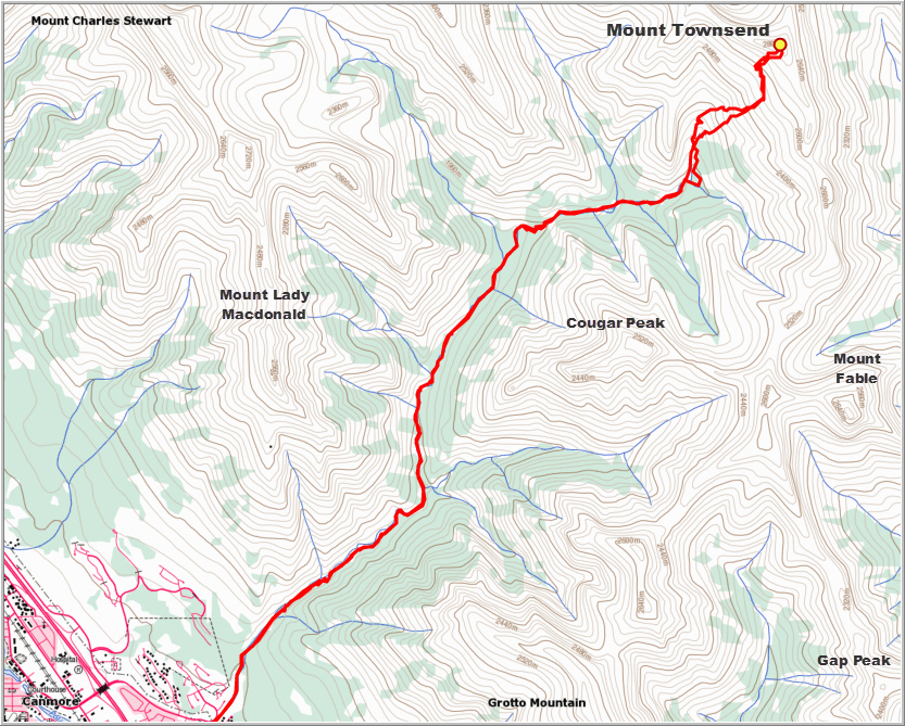
This is a long trip with a lengthy and painful approach that will get you to the summit of a remote and rarely ascended mountain. It takes about 10 km of hiking along Cougar Creek before you actually reach the base of the mountain, and by then you’ve gained almost half the total elevation. Cougar Creek is definitely one of the better creeks to hike in this area; most other creekbeds are full of jumbled logs and chock stones that have to be awkwardly negotiated (e.g. Mounts Inglismaldie and Girouard), but this creek is mostly free of such messy roadblocks.
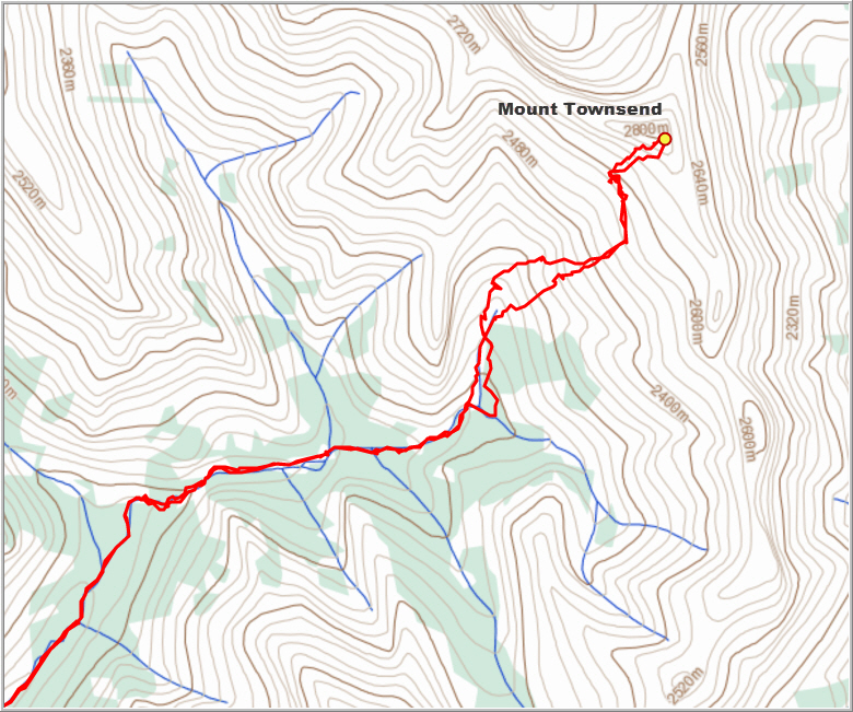
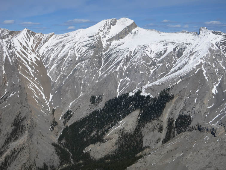
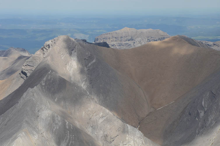
I followed the valley past the Canadian Forks to its upper reaches where it narrows and makes a sharp right turn, continuing eastward and then northeast to the SW slopes of Mount Townsend. These offer a fairly straightforward way up, first along huge steepish slabs of rock with good grip, then along a minor undulating ridge that eventually peters out in a huge slanted scree field that can easily be traversed northward to get to the base of the summit mass. From a distance, the summit mass looks awfully intimidating, with huge vertical cliffs separating an upward steepening smooth rock slope. However, as I got closer, things looked more manageable, at least as far as my immediate vision could tell. The lower rock band is easily overcome by scrambling up a ramp that leads to the upper summit slope. The rock is loose in places, but careful foot placement is all that’s needed to scramble up here. After some easy scree, I then chose the central vertical crack that leads directly up to the summit (although this can be avoided by going around climber’s right). This arte involved some moderate to difficult but fun scrambling on downsloping rock with relatively good holds and moderate exposure, and after about 20 minutes I was on top of Mount Townsend (2824 m). Gorgeous views all around: South Ghost Peak, Association Peak, and Morrowmount to the east, Fable and the “Mythic Towers” immediately to the south, and Stenton Peak to the NW. Glancing down the summit towards Exshaw Pass, it looked like Mount Townsend can also be accessed by going over the pass and circling around to the west to gain the north ridge.
Edit June 2016: The route via Exshaw Pass is a no-go. I’ve seen reports of people being turned around by very difficult vertical terrain just below the summit, so the route I took and describe here is likely still the best way to climb Mount Townsend.
On descent, I decided to veer around the vertical crack on skier’s left and thereby avoided most of the steep slabs directly below the summit. This alternate descent route took me down easy rubble first, followed by a few short sections of moderate scrambling on slanted rock faces. The remainder of the way down was easy and fast – I mostly traced back my steps and then took the easiest way down back into the valley. Another 3.5 hours of bashing over boulders and pebbles to get back to the parking lot at the Iron Goat and my aching feet definitely had enough for today!
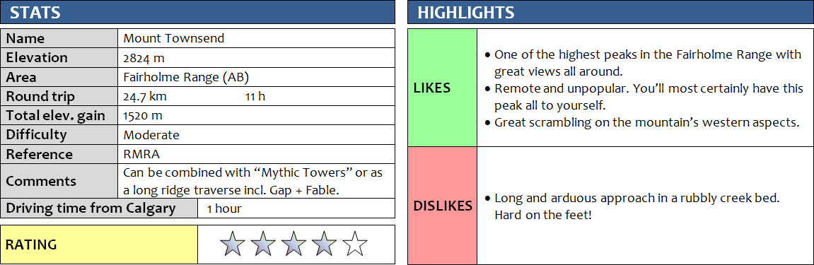
DISCLAIMER: Use at your own risk for general guidance only! Do not follow this GPX track blindly but use your own judgement in assessing terrain and choosing the safest route.
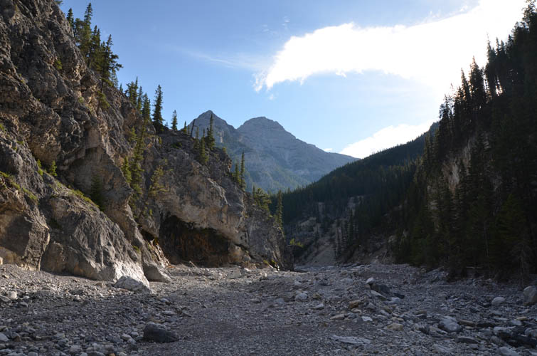
Easy travel in the broad lower valley of Cougar Creek.
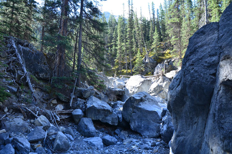
Higher up in the creek, there are some large boulders to negotiate, but nothing difficult.
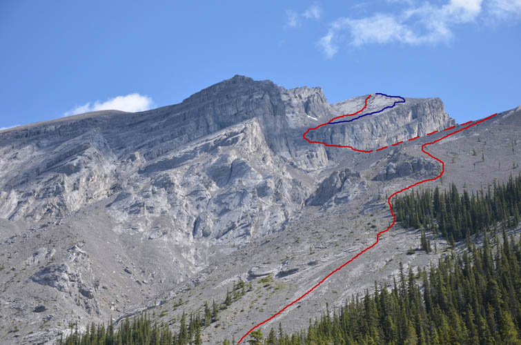
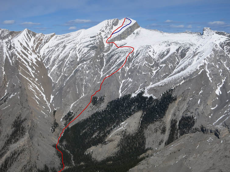
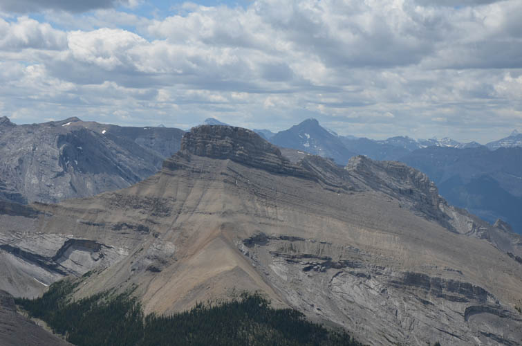
First view of Mount Townsend from Cougar Creek. Ascent route drawn in red, optional (and easier) descent route in blue.
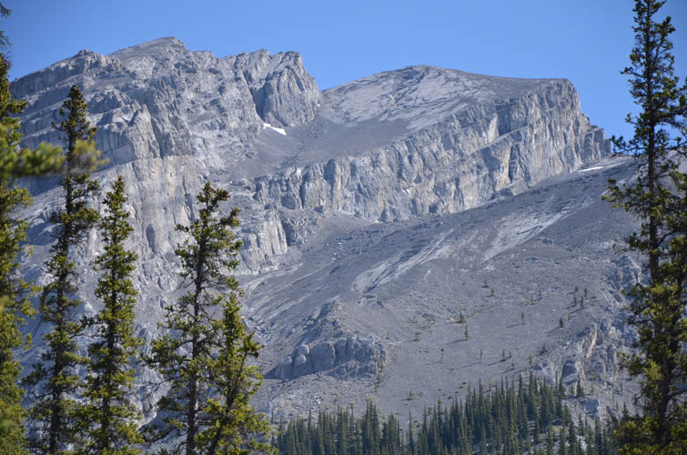
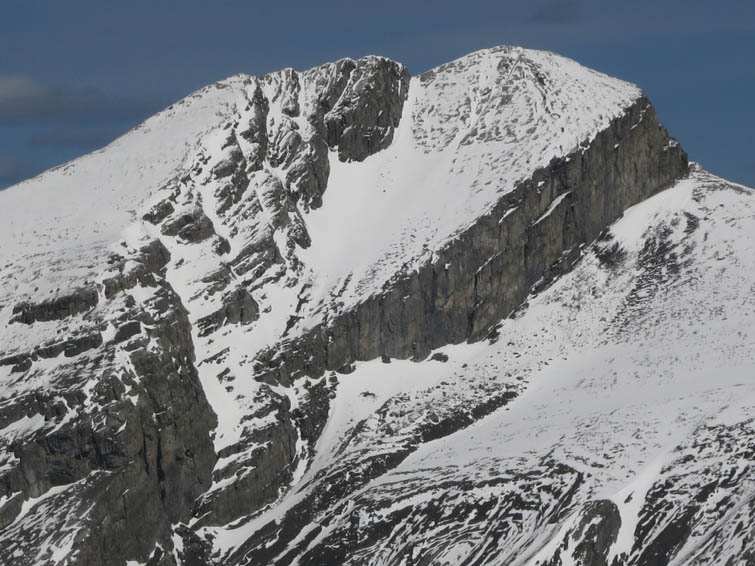
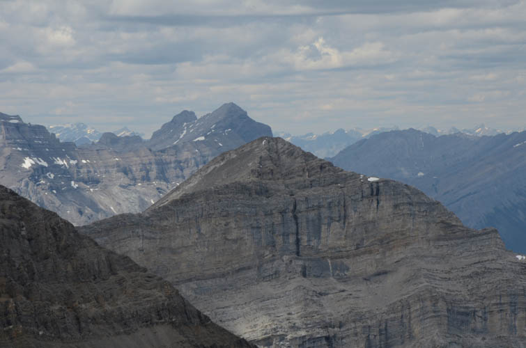
Close-up of summit mass of Mount Townsend.
This is a view of Mount Townsend from Cougar Peak earlier in the year (April 2015). The huge cliffband on the SE side of the summit really stands out. The small peak on far right is Epic Tower.
Same as above, with route drawn in.
Close-up of the summit of Mount Townsend as seen from Cougar Peak (April 2015).
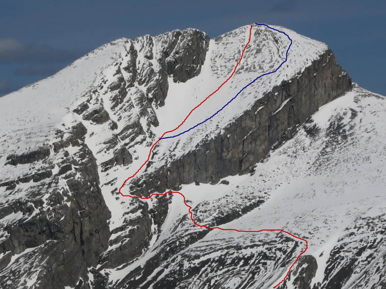
As above, showing ascent route (red) and optional descent route (blue).
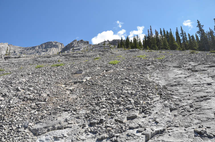
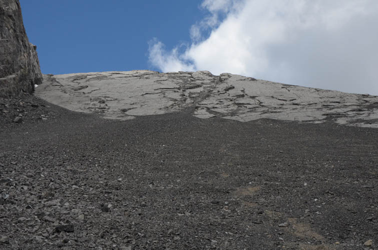
Steep rubbly slabs of rock on the lower slopes of Mount Townsend allow you to gain elevation quickly.
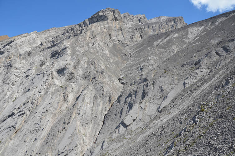
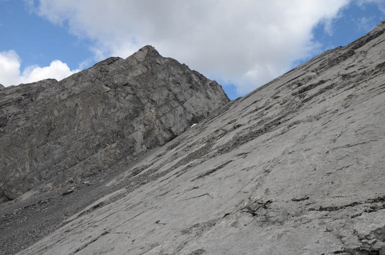
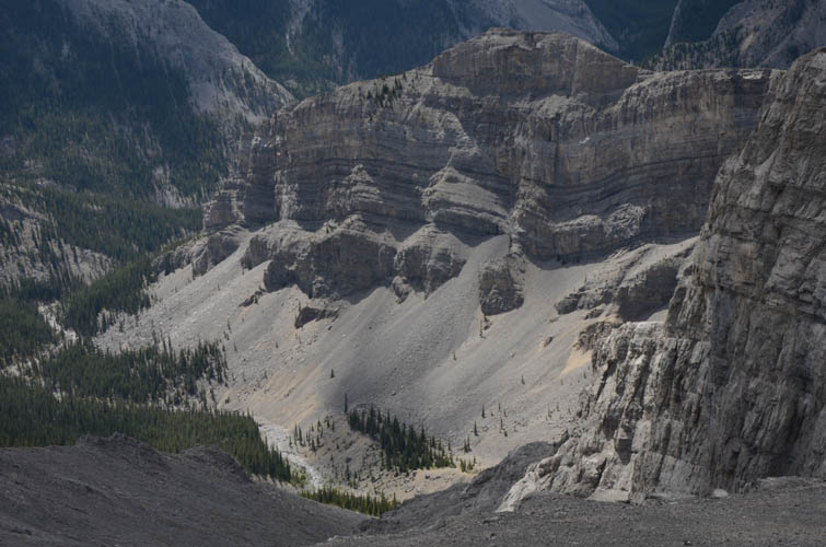
To the north of the ascent slopes and directly below the summit is a huge, near-vertical gully that would be very difficult, if not impossible, to scramble.

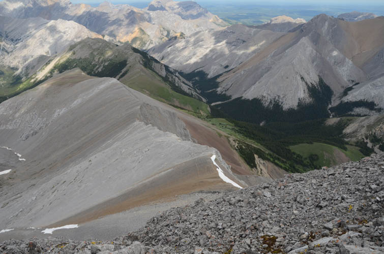
Looking back down Cougar Creek – ascent route shown in red. Cougar Peak is on the left.
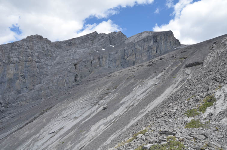
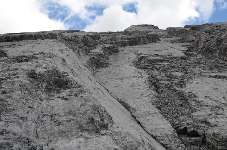
Nearing the huge vertical cliff that guards the summit.
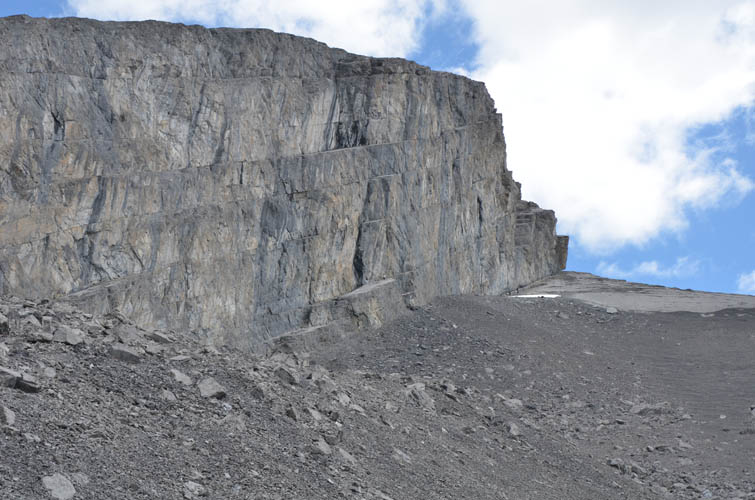
Fortunately, there is a narrow scree ramp just below this blocky cliff to circumvent this major obstacle.
Looking up the vertical crack that leads directly to the summit.
Some fun scrambling (moderate to difficult) in the vertical crack. Good holds and solid rock, but there’s plenty of rubble!
From the vertical crack, looking north towards the next cliffband. This picture really gives you an idea of the downsloping nature of the rock near the summit.
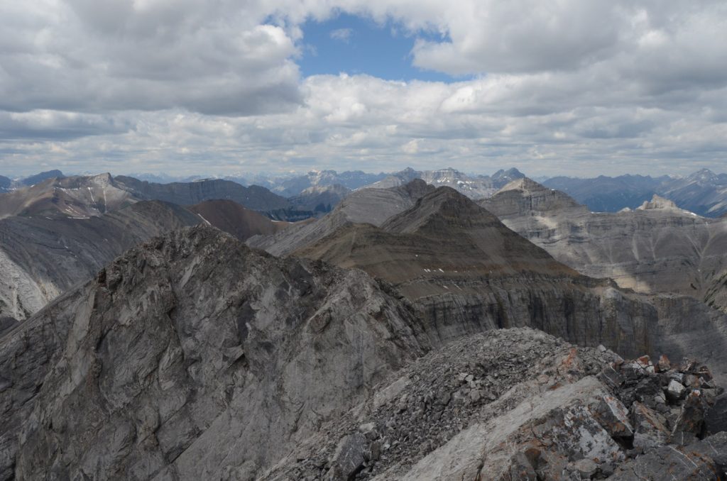
Finally at the summit! Mount Fable shows up on the left, with Mount Lougheed poking through in the distance on the right.
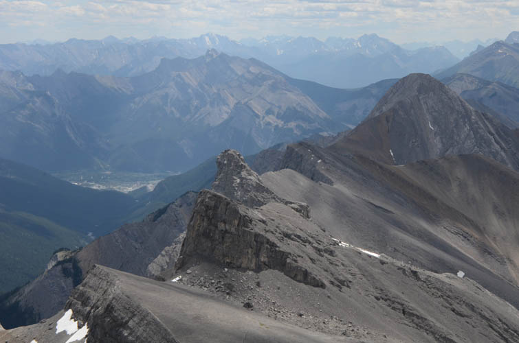
Looking back at Cougar Peak.

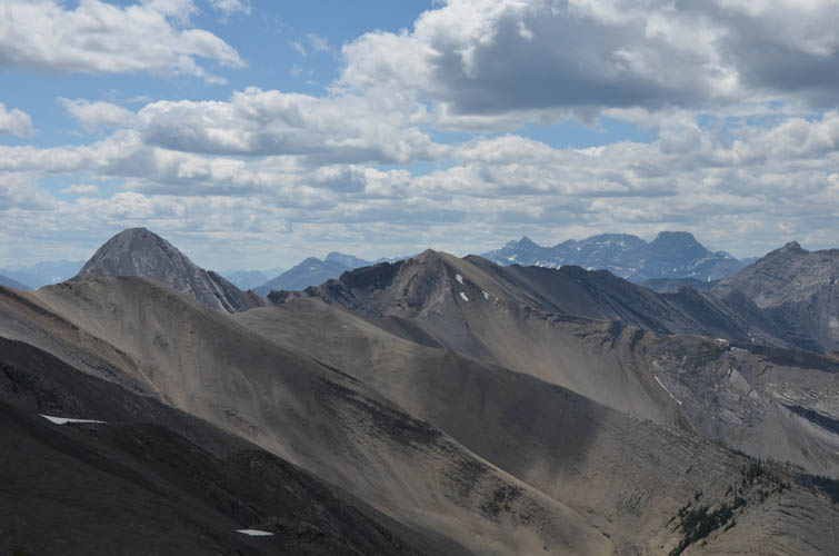
Looking west: Wendell Mountain is the broad, brown scree mound in the middle. To the right is Morrowmount. Cross Peak is on far left.
Stenton Peak to the NW. Just behind it and slightly to the left are Mount Girouard and (further left and behind) Mount Inglismaldie.
Looking down Exshaw Creek.
Epic Tower and Mythic Tower to the SE (centre), with Mount Fable on the right.
South Ghost Peak (left) and End Mountain in the background.
Impressive cliffs on descent.
Somehow this dead tree reminded me of…. a toilet brush!