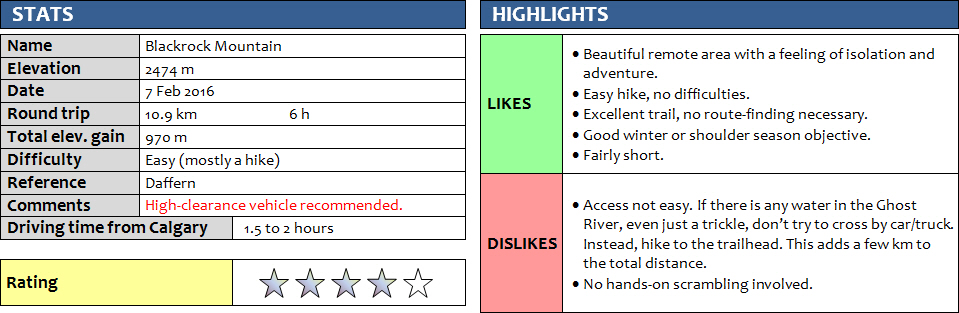
7 February 2016
With Wen
This is an easy hike with a touch of adventure, mostly due to the remote location and feeling of isolation in this area. And getting there is an adventure in itself! We were lucky to make it with our Honda CRV, which is only a 2WD but a slightly higher clearance vehicle than just a standard car. Given that this has been an exceptionally warm winter, I was not surprised to find part of the Transalta Road snow-free, but even where there was snow the drive was easy. We first hesitated when we saw the steep, rubbly road descending the “Big Hill”, but it was no problem. Down in the Ghost River Valley, there were plenty of tire tracks leading our way across the frozen stream and onto the icy levee road that took us to within a few hundred metres from the trailhead.
A couple of trucks were parked by the entrance to the creek near the trailhead and smoke was rising from the trees behind. A group of young campers had spent the night enjoying the outdoors with a generous supply of beer it seemed (judging by the number of empty cans lying around, and the headache-screaming looks of the few that were already awake at 9am!). After some brief and friendly banter (“oh really, there’s a trail up to Black Rock Mountain?”, “Here, have a beer for on the way!”), we passed by the information sign and headed up the wide, snow-covered trail. There were footsteps from a previous party, perhaps a week or two old, which made following the path a mindless task. Thankfully, the snow cover was only a few cm up to 10 cm deep, and the only tricky part really was the few icy bits here and there. The trail goes up at a surprisingly gentle grade, rising in lazy switchbacks through forest for the first hour and a half, then topping out at a beautiful small meadow with close-up views of Black Rock’s impressive south cliffs. It was a sunny day and there was no wind in this part, and the magnificent views of the Ghost River Valley from this meadow made for the perfect lunch spot. The ridge right above the meadow was another great viewpoint and a good photo opportunity with its jagged rocks inviting us for a pose, but this is also the more exposed side and the wind really picked up. From here it was a pleasant hike on a rocky trail along and through the cliffs, following a small gully, to a wide grassy plateau higher up. Here you could finally see the little wooden hut – a historic fire lookout – marking the summit of Black Rock Mountain. There is still at least 200 vertical metres to go although the summit block really looks bigger than it is from this point. The winds were getting stronger, so we kept on going without taking any more breaks and trudged up the scree path that zig-zags its way directly to the summit. The so-called “rock bridge” is near the top – the “mild exposure” I’ve read about in other reports that supposedly forms the “crux” of this trip is really nothing to worry about at all if you’ve done some scrambles before. It’s a flat, wide rock platform you simply walk across. We were very much looking forward to a break from the bone-chilling winds in the fire lookout, but the windows of this little shed are all open making this a very uncomfortable spot for a summit break. The views, however, are fantastic: Devil’s Head is the main protagonist in the east, flanked by Mount Aylmer in the background and Mount Costigan, Phantom Crag and Orient Point further south. To the west you can clearly see the skyline of Calgary in the endlessly flat prairies of Alberta.
My hands got so painfully cold after a while of snapping pictures that we decided to retreat as quickly as possible. The scree made for a fast and easy descent and lower down in the treed section the snow on the trail softened each step and made for a very pleasant return. A wonderful outing in an area far off the main tourist trails.
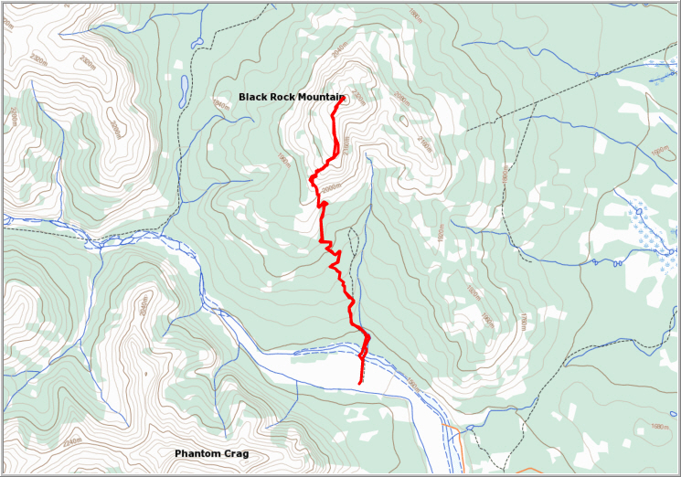
ROUTE MAP
DISCLAIMER: Use at your own risk for general guidance only! Do not follow this GPX track blindly but use your own judgement in assessing terrain and choosing the safest route. Please read the full disclaimer here.
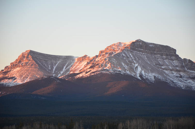
As we approach the Ghost in the morning, the eastern escarpment of Orient Point is illuminated by the rising sun.
Association Peak (left) and End Mountain (right) to the SW.
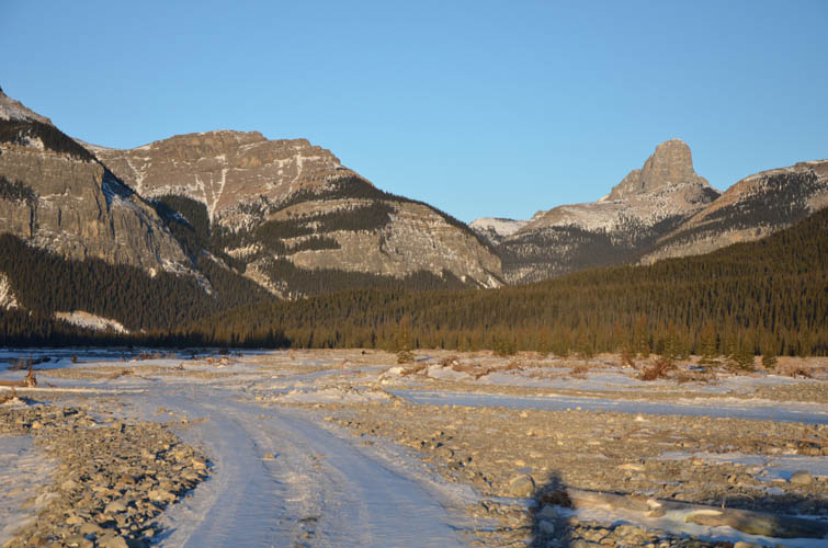
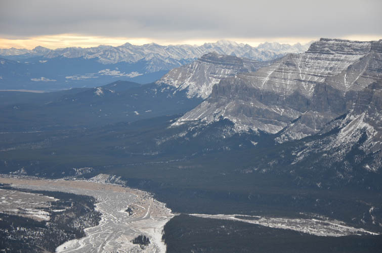
An icy road leads up the broad valley of the Ghost River. Devil’s Head on the right.

Phantom Crag, another great scramble.
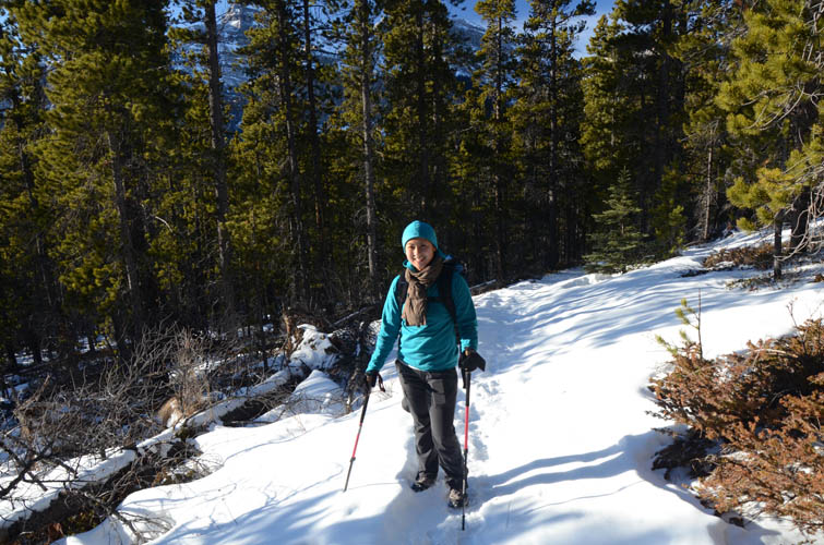
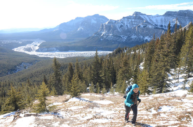
Approach on a good hiking trail with gentle grade. The sun is out – smiles all around!
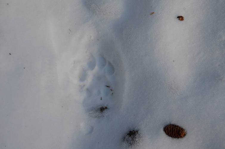
Cougar paw prints? I’m not sure.
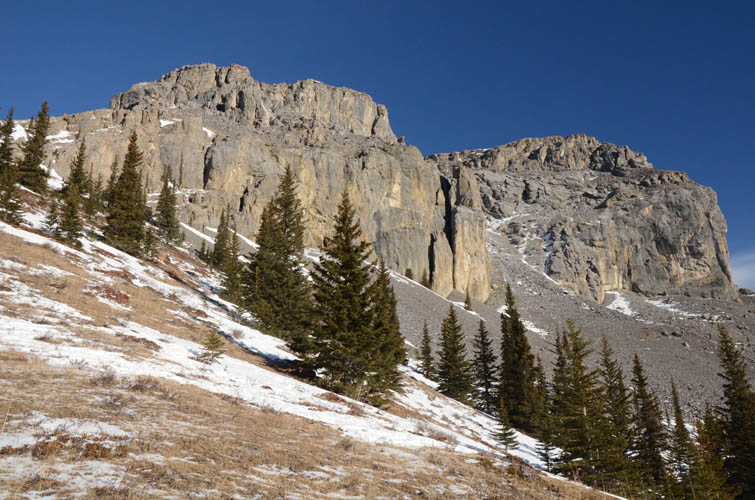
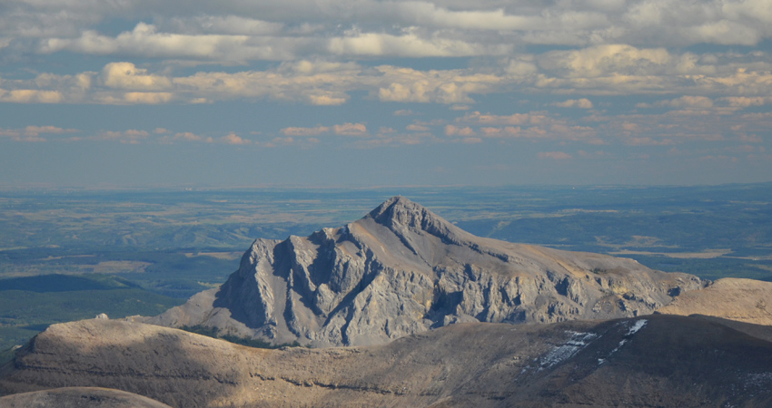
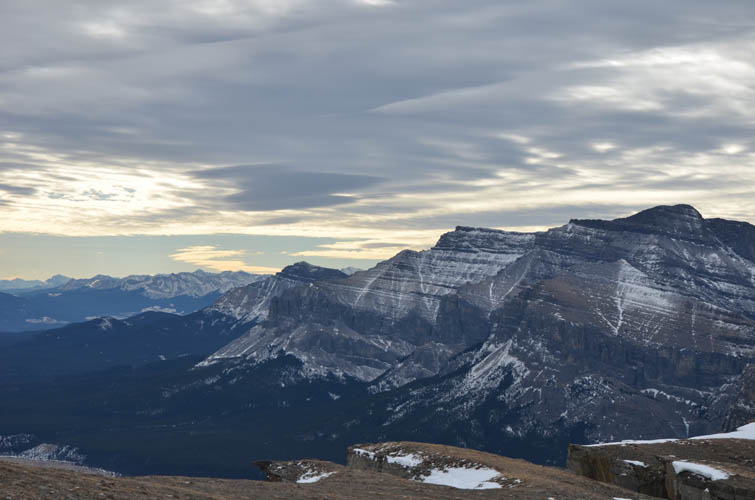
Near tree line, the south facing cliffs of Black Rock Mountain appear.
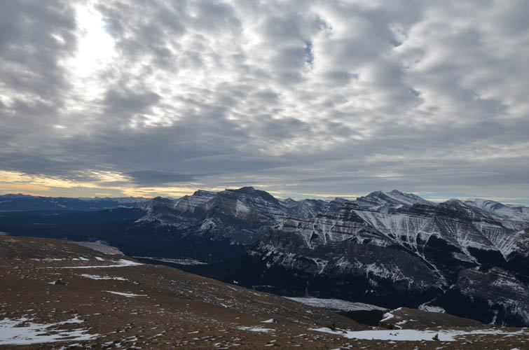
It’s a brilliant day to be out hiking in early February.
Looking east, Mount Aylmer forms the highest point in the centre of the horizon.
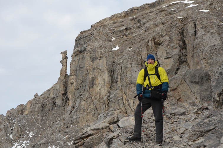
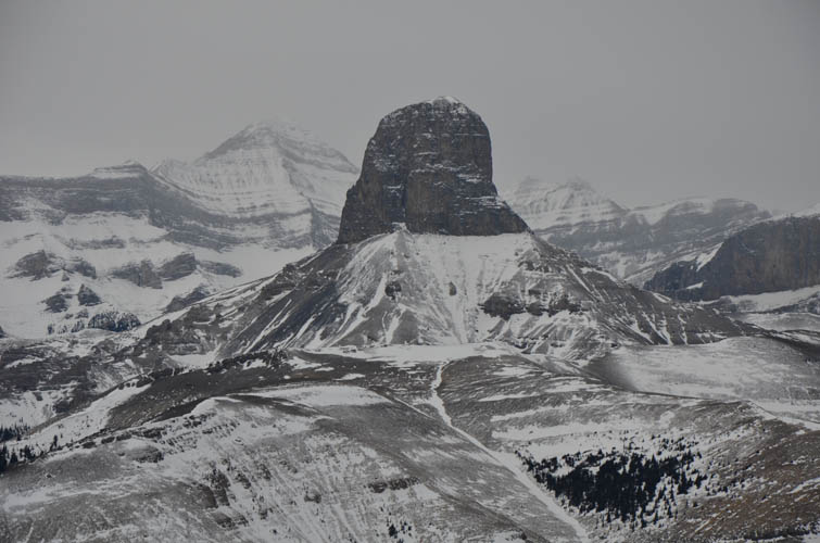
Near the famous rock pinnacle on the west side of Black Rock Mountain.
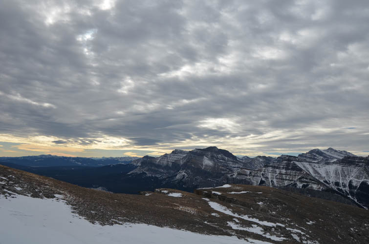
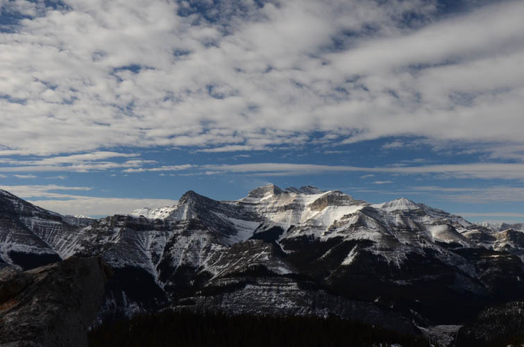
The clouds put on a spectacular show today. But it is bitterly cold and windy up here!
Looking south along the very edge of the Front Ranges.
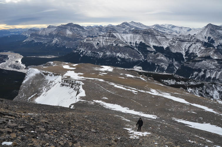
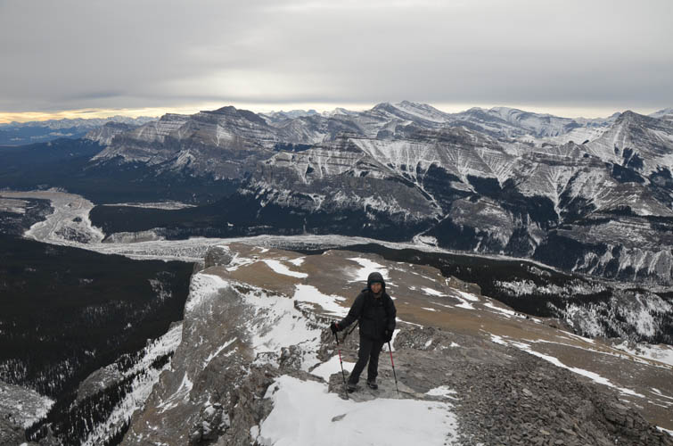
Heading up the flat, upper slopes. If there was no wind, this would be the perfect spot for a game of frisbee!
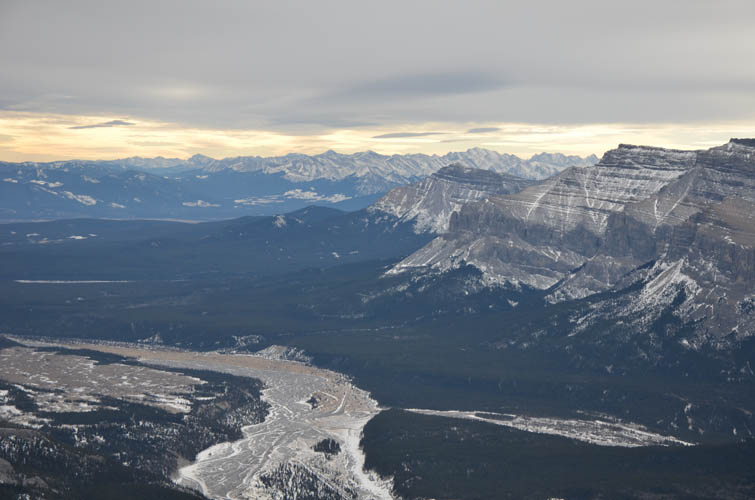
Confluence of the Ghost River and South Ghost River (coming from the right).
The only slightly exposed part is this short, 10-20 m section of flat but easily navigable rock slab.
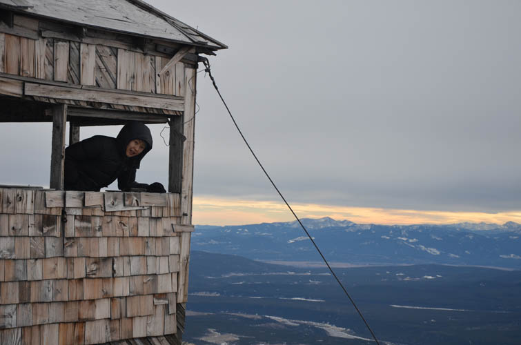
The disused fire lookout at the summit.
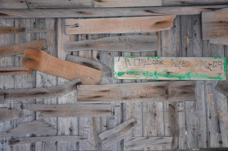
The inside of the hut is full of names and inscriptions.

View of Devil’s Head to the west.
Close-up of Devil’s Head.
Another look south.
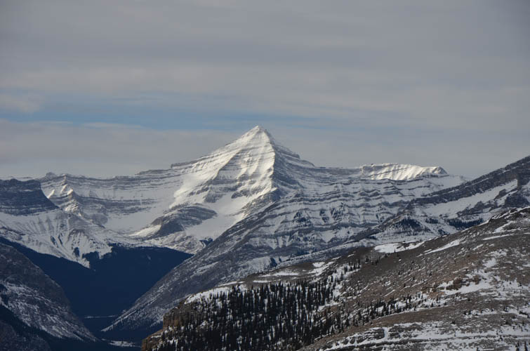
Mount Aylmer to the west.
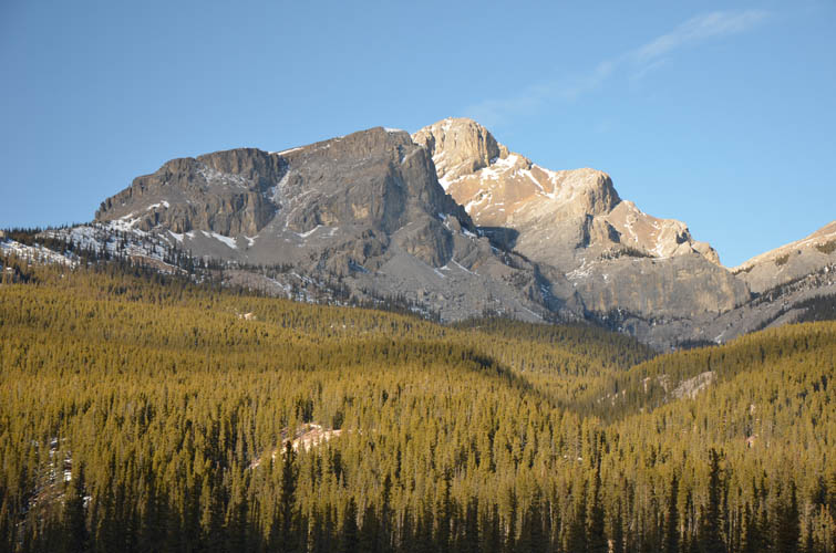
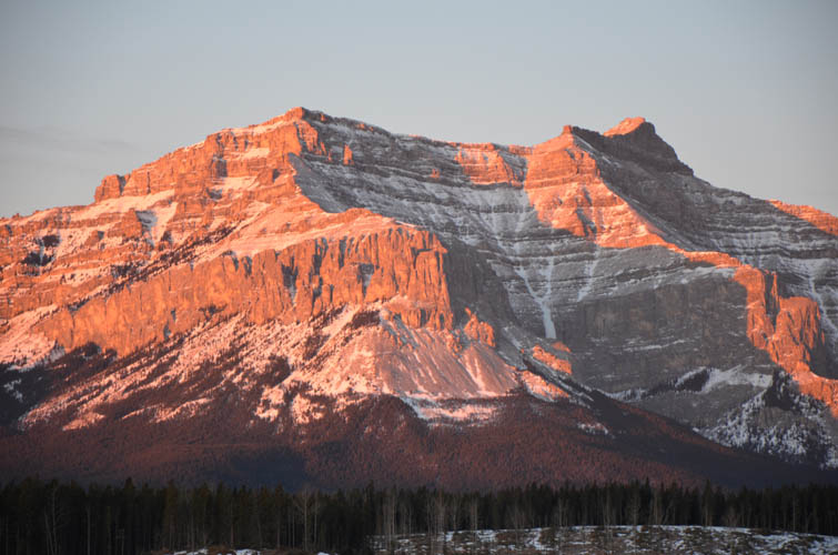
A last glance at Black Rock Mountain in the afternoon sun.