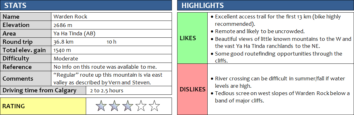
1 May 2016
Solo
Warden Rock is yet another destination in the Ya Ha Tinda area that has become quite popular (relatively speaking!) after the publication of trip reports on various websites, with a number of meetup groups and individuals recently scrambling up this landmark peak on the eastern border of Banff National Park. None of my hiking partners were available this Sunday so I decided to do this trip alone, but with a small twist: perhaps it would be possible to find a route up the backside of the mountain by going up the valley west of Warden Rock? This way, I could hopefully make full use of my bike by cycling the first 13 km to the National Park boundary, thereby minimizing the hiking time along the flat valley and possibly shortening this normally 10 hour day.
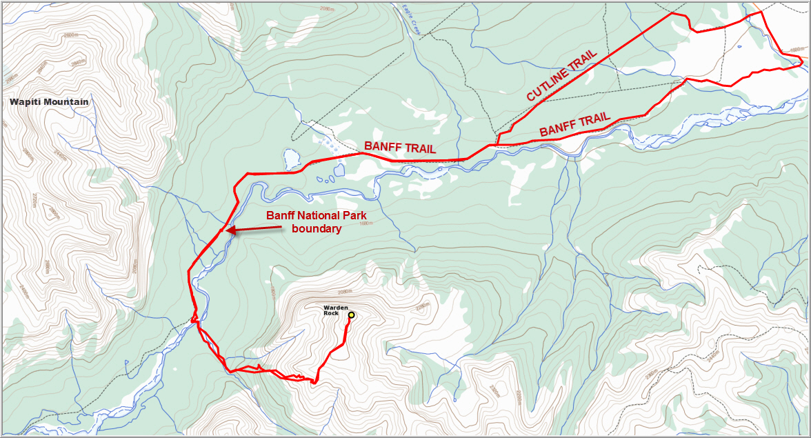
My route worked out perfectly just as I had planned – except that it still took me 10 hours round-trip! One of the reasons was that right after leaving the parking lot, my gear shift cable snapped so I basically only had one gear available on my bike. I messed around for half an hour trying to fix it, but to no avail. In the end it didn’t really matter since the road was mostly flat and shifting gears wasn’t really necessary. The second delay came when I mistakenly opted to ride to the park boundary via the “Cutline Trail”, which I found marked as such on maps displayed on a sign near the trailhead. I knew that the main path, the so-called “Banff Trail”, was a proper gravel road and therefore probably the fastest way, but I thought a little change for variety wouldn’t hurt. Well, it didn’t hurt, but it also didn’t help: the Cutline Trail is really just a horse trail that is unsuitable for bicycles. Half the time I was pushing my bike and the other half it was really slow going due to tons of fallen trees blocking the way and soft, churned up soil along the narrow trail. When this path finally linked up with Banff Trail, it was smooth sailing from there to the park boundary, where I had to stash my bike as for some reason biking is not permitted in the park (even though the trail is perfectly fine for biking). I hiked for another couple of km and then crossed the Red Deer River at a shallow gravelly section. It was calf deep and quite chilly, but my sneakers really helped ease the pain on my feet!
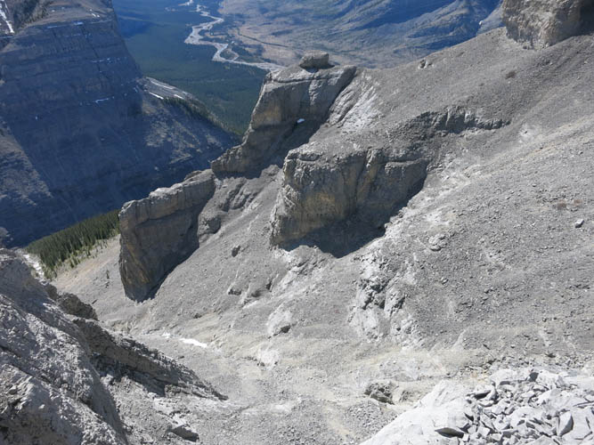
On the other side of the river I headed south by following the dry creek bed emanating from the valley that sits between Gable Mountain and Warden Rock. It was easy hiking on soft mossy ground through light forest on the right (west) side of the creek, which then abruptly ended in a headwall after some 30 minutes of hiking. Here, I found an easy way up the left side through the trees and up into the valley proper. There are probably many different possible routes up to the summit mass of Warden Rock from here, for example by following the valley a bit further south and then going up wide scree slopes back to the NE. Another route that I now think is possible, after having seen the mountain from the vantage point of Wapiti Mountain to the north in July 2016, is on a scree ledge on Warden Rock’s northern aspect that appears to be the shortest way to the summit; I haven’t tried this, so it will take someone else to figure out if this is actually possible or if there are stumbling blocks on the way. My route today led me straight up to the base of the steep cliffs on the western side of Warden Rock. I then followed the base of the cliffs south for a while, traversing through a couple of rubbly gullies on the way, until I found a break through the steep rock faces that led me up to the SW ridge of the mountain. There were no cairns or traces of trails anywhere here, but I thoroughly enjoyed searching for a route up through these impressive walls guarding the upper reaches of the mountain. Once on the SW ridge, it was an easy and enjoyable hike along a gently rising broad ridge to the base of the summit mass. This is where my route joined up with the south ridge and I could look down the east side of the mountain for the first time to see the scree slopes that others have described as their ascent route.
To my great surprise, I found fresh footsteps in the lingering patches of snow here! Apparently, a whole group of hikers must’ve been here not too long ago – certainly today, perhaps only a few hours ago. Driven by an extra push of curiosity, I put on a brisk pace to find out if anyone was waiting for me at the summit, still about 30-40 minutes away. I arrived at an empty summit, out of breath and slightly disappointed to have missed my fellow scramblers by possibly mere minutes. I looked down the slopes below me, but couldn’t see anyone, although I thought I heard voices in the distance. Final proof that I wasn’t the only one on this mountain today was in the summit register, a simple glass jar placed only in September 2015: not one, but two separate groups had come to conquer Warden Rock today! I guess I was the unknown third, and due to my choice of a different route it was no wonder I had missed all the other people on the mountain today (I think I counted some 7 or 8 in total!).
It was also no wonder that so many people had chosen this Sunday for an outing in the mountains. It was an absolutely beautiful spring day with sunny skies and clear views in all directions. I really enjoyed sitting up here, gazing in the distance and admiring the many unknown and unclimbed mountains to the west, and the few little peaks I had hiked up in more familiar territory to the east.
The return was quick and straightforward. I wanted to avoid running into bad surprises in those steep, vertical cliffs on the western side of the mountain so I stuck to almost exactly the same route that I came up. Going down the scree below the cliffs was much faster than going up of course, but the real time-saver on the way back was biking along Banff Trail. It only took me an hour from the park boundary to my car, where in the morning it had taken me two hours along the miserable Cutline Trail!
In retrospect, I think it would probably be smarter to use the published “eastern route” in spring if snow remains on the eastern scree slopes. With an ice axe (and the skill to use it!), possibly also crampons, these snow slopes will be an easy way up and a super-fast way down. Without snow, perhaps the “western route” would be faster since you can bike along Banff Trail for a total of 26 km. Either way, I think Warden Rock is a wonderful and remote place to visit and worth the long drive from Calgary.
For a detailed map of the area, including all existing trails and many possible scramble routes, see the Ya Ha Tinda & Surroundings Trail Map on Avenza (a free mapping app for offline navigation and tracking). The map is also available in print at MapTown or GearTrade.
DISCLAIMER: Use at your own risk for general guidance only! Do not follow this GPX track blindly but use your own judgement in assessing terrain and choosing the safest route. Please read the full disclaimer here.
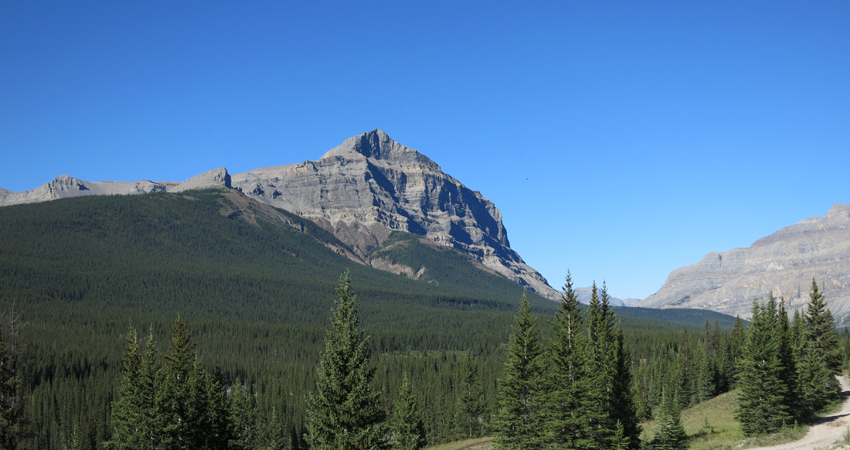
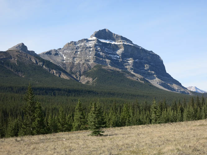
First shot from the parking lot: Warden Rock is just left of centre.
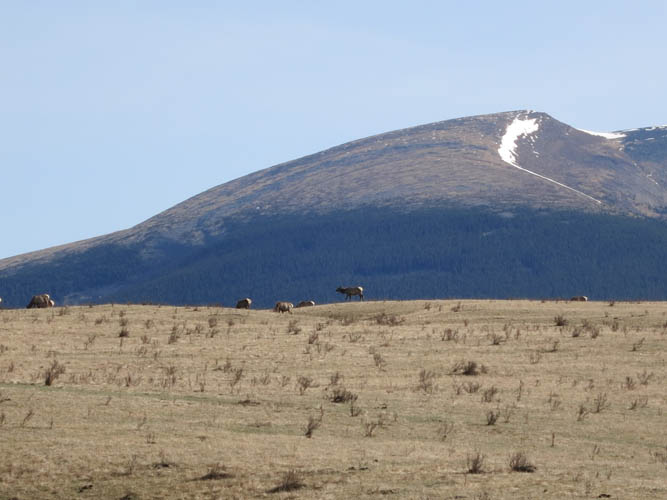
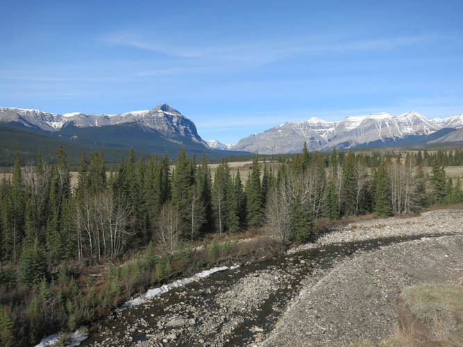
The gentle meadows of the Ya Ha Tinda ranch, with Evangeline Peak behind.
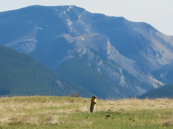
A gopher stands tall in front of Eagle Mountain.
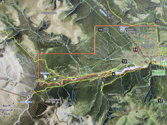
This is the area map I came across at a sign on my way to Cutline Trail.
Cutline Trail. This is one of the better sections.
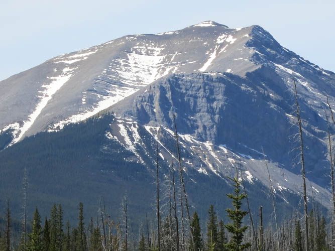
Warden Rock.
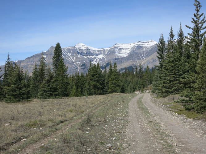
Banff Trail, a gravel road that is great for cycling. In the background is the long, snow-covered south ridge of Wapiti Mountain.
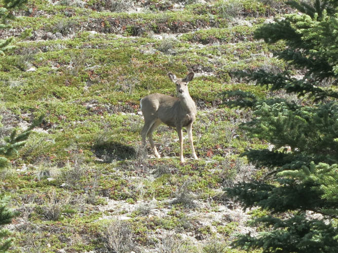
A curious deer near Banff Trail.

The mysterious “Outpost at Warden Rock”, a remote backcountry lodge for visitors seeking solitude and spectacular natural surroundings.
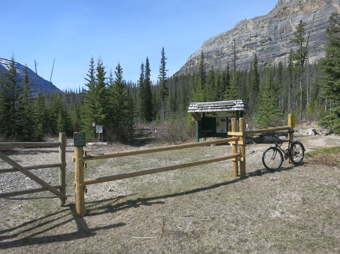
The park boundary where I had to leave my bike. Banff National Park starts right here.
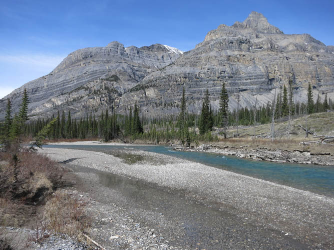
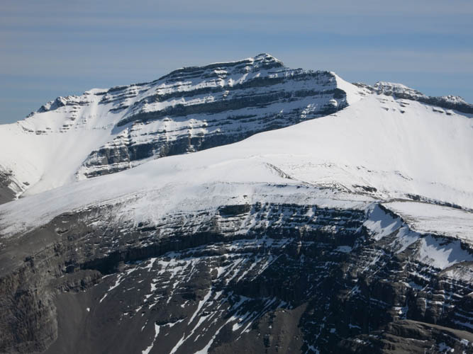
Gable Mountain.
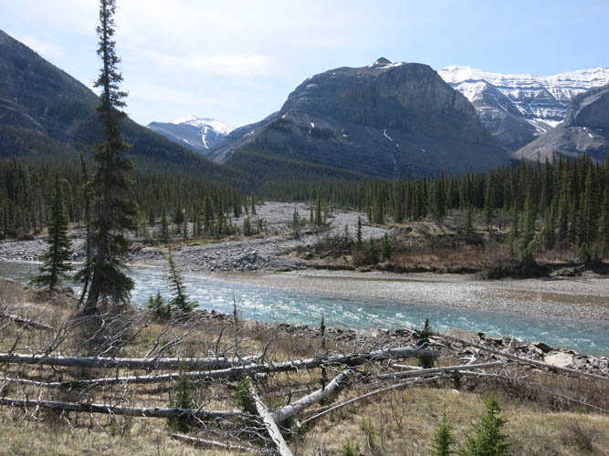
This is where I crossed the Red Deer River. I then headed south along the dry side creek towards the valley between Warden Rock and Gable Mountain.
Looking back to the north at Wapiti Mountain.
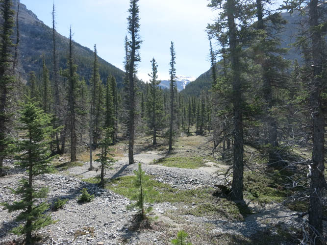
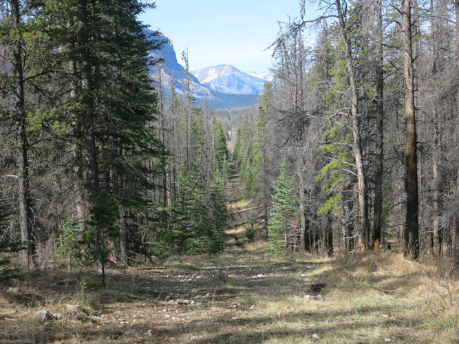
Hiking through light forest alongside the dry creekbed.
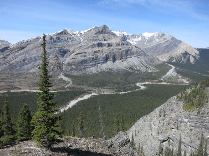
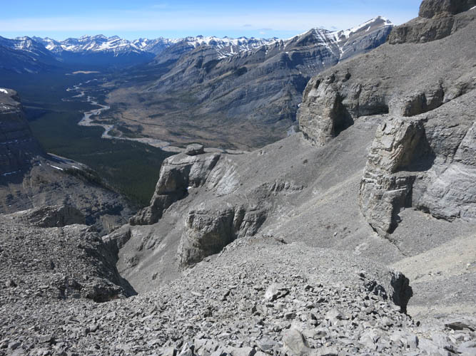
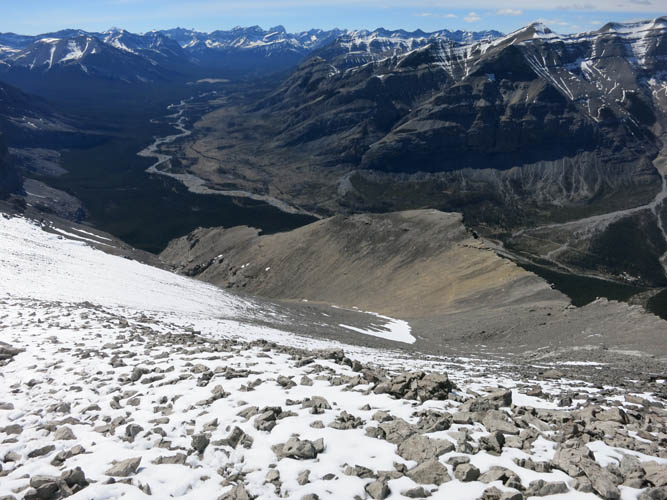
Higher up, I get my first views of the Red Deer River Valley with Wapiti Mountain behind.
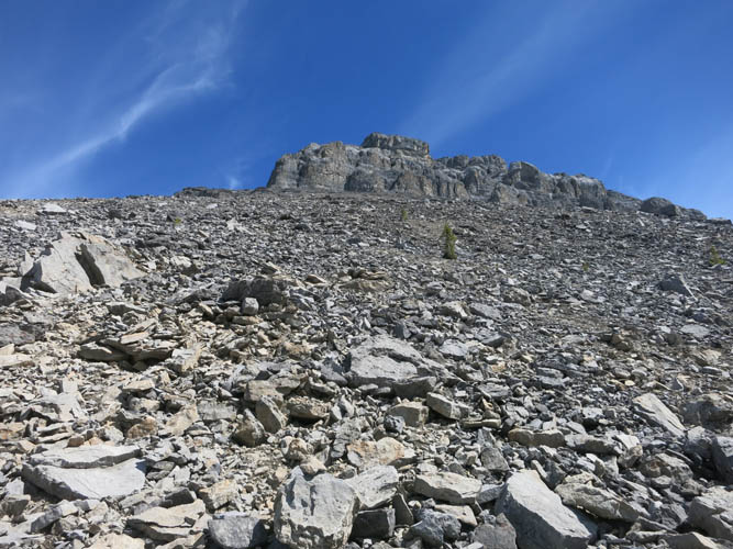
Slogging up a pile of scree to get to the cliffs on the western side of Warden Rock.
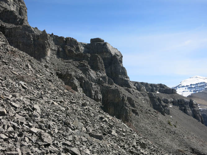
Along the cliffs looking south.
I easily traversed along the base of the cliffs until I found a feasible break through the walls.
Along the climb through the cliffs.
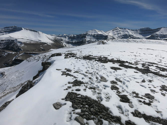
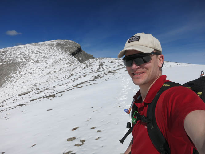
A flat-topped ridge makes for pleasant hiking towards the summit. This view is looking south towards Barrier Mountain.
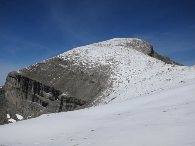
A gentle ridge walk leads to the summit of Warden Rock.
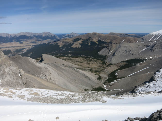
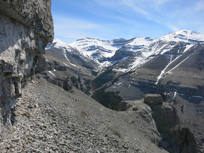
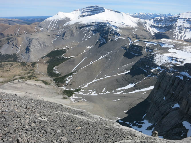
Looking down the eastern scree slopes.
Fresh footsteps, perhaps 1-2 hours old, along the summit ridge.
Looking back down the ridge on my way up the summit.
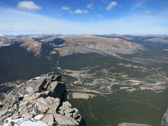
Summit panorama of the Red Deer River valley. The broad brown “mound” in the centre is called Well Site Mountain.
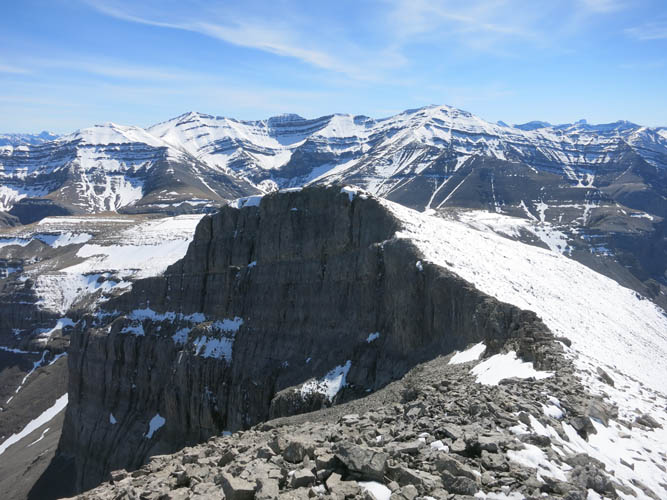
To the south is the rarely-ascended Barrier Mountain.
Vertical cliffs form a “barrier” on the east face, but the backside (west slopes) are probably much tamer.
Descending easy terrain.
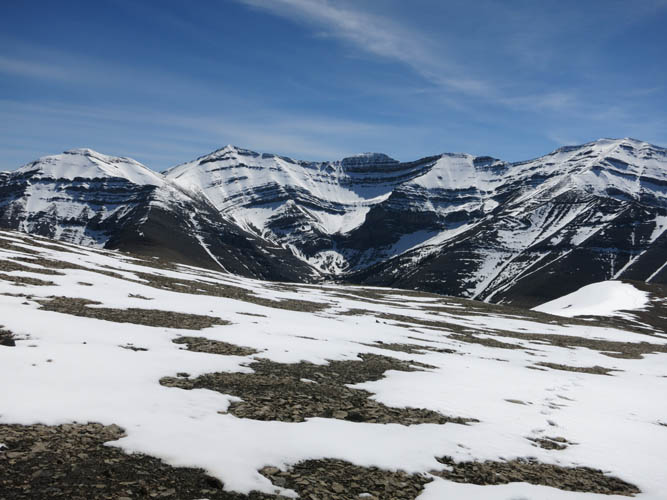
I love the contrast between snow-covered mountain tops on the one hand, and hiking in t-shirt and sunscreen on the other.
On descent, I re-traced my route through the cliffs.

Warden Rock in the glowing late afternoon sun.