22 November 2016
Solo
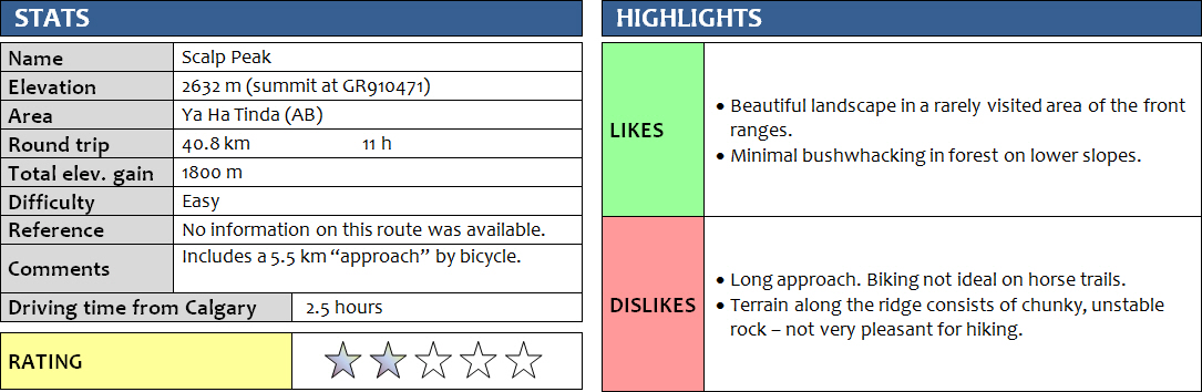
There are mountains that require very little effort for a lot of fun in return. And then there are those where the opposite is the case. Scalp Peak was, unfortunately, in the latter category.
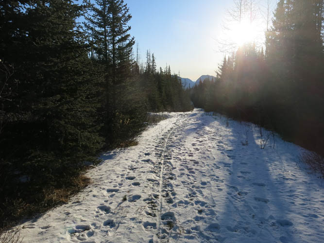
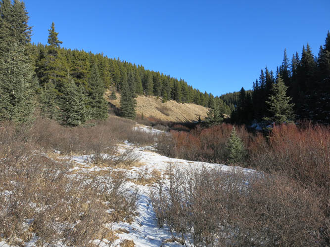
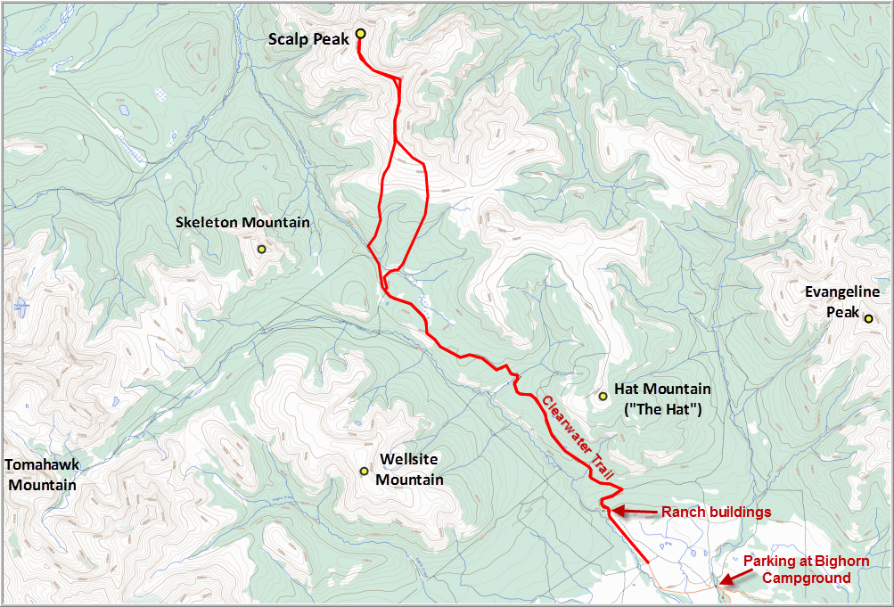
I had hoped for a snow-free approach, but there was a thin layer of snow covering the approach trail all the way from the Ya Ha Tinda ranch to the base of the mountain. Biking up Clearwater Trail was a lot of work! Though wide and without too many unnecessary ups and downs, the trail was quite bumpy as the churned up soil from horse traffic had been left frozen. It was a chilly -8 degrees when I set out in the morning and parts of the trail were covered in ice. After about 5 km of strenuous biking all the way uphill (in parts simply pushing my bike was easier), I eventually had enough and ditched my bicycle in the forest and continued on foot instead. It was so much more pleasant, but of course a little slower as well.
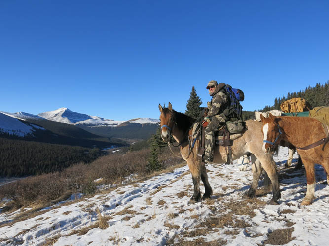
This is a very quiet area that doesn’t see many hikers, and now in the winter everything seemed even more deserted. I had passed through the ranch after parking my car down the gravel road and hadn’t seen a soul. It was thus with much surprise that I found myself bumping into Paul, an outfitter based in Sundre, who was riding towards me with four of his horses. He had just spent the night in his camp somewhere in a side valley, cleaning up and winterizing his equipment as the hunting season was drawing to a close. I think he was just as surprised as I was to see someone else hanging out here (he was the only person I saw all day!). It was really interesting to chat with him as he obviously knows the area really well (he’s been hunting for 18 years), including all the creeks, valleys and mountains around us. “Skeleton Mountain” is one of those peaks he pointed out that I might come back for one day, who knows… […and yes, I did – in 2020 with Richard!]
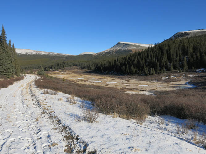
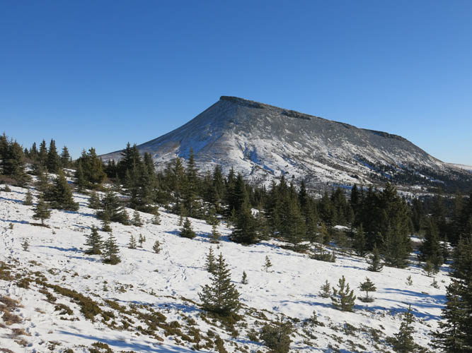
After this short and uplifting break, I put my head down again and continued the lengthy plod to the southern reaches of Scalp Peak. There is a path marked as a dashed line on the local trail map that’s displayed on signs throughout the area; a rudimentary trail supposedly leading part way up Scalp Peak on the side of a creek. I followed a very faint trail initially, but it soon disappeared in thickets of shrubs and I eventually left the creek bed to simply hike straight up through the forest. This turned out to be the easiest and fastest way to gain the upper part of the mountain above treeline as the forest was light and there was almost no bushwhacking involved.
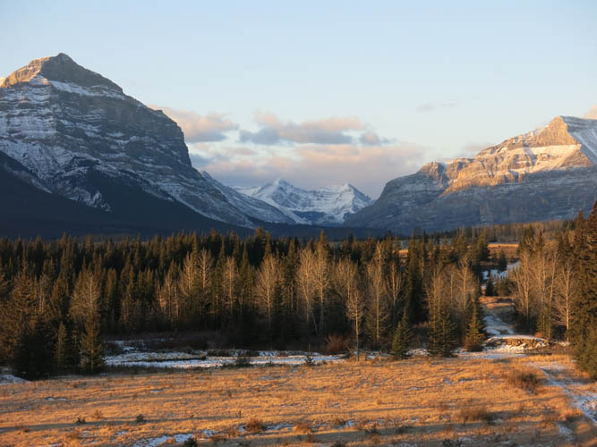
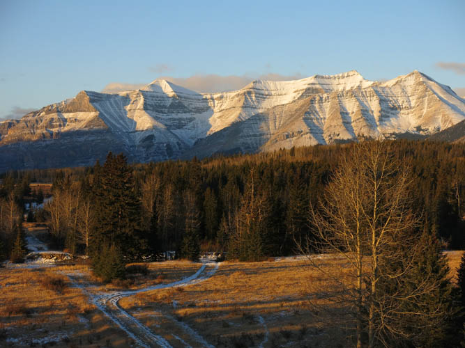
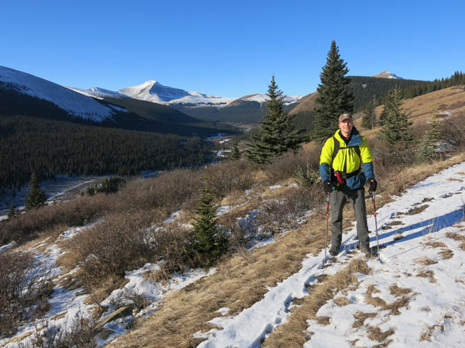
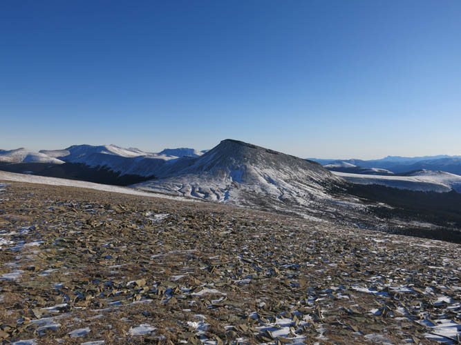
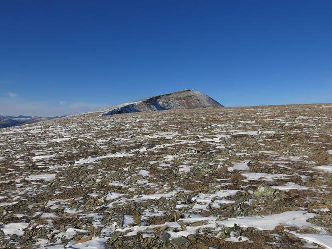
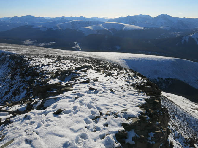
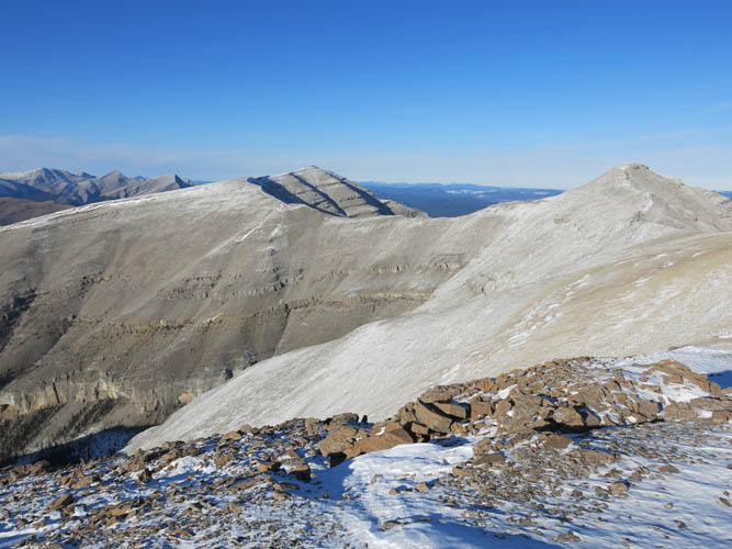
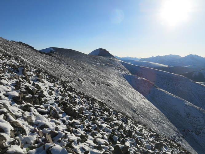
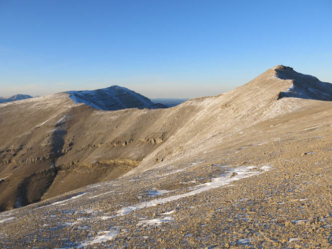
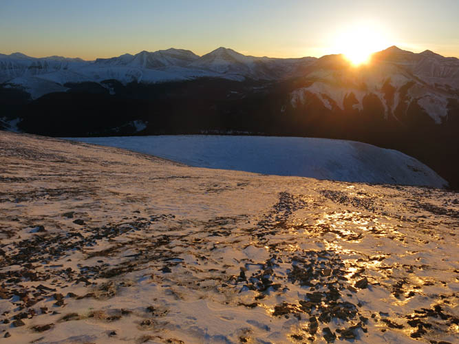
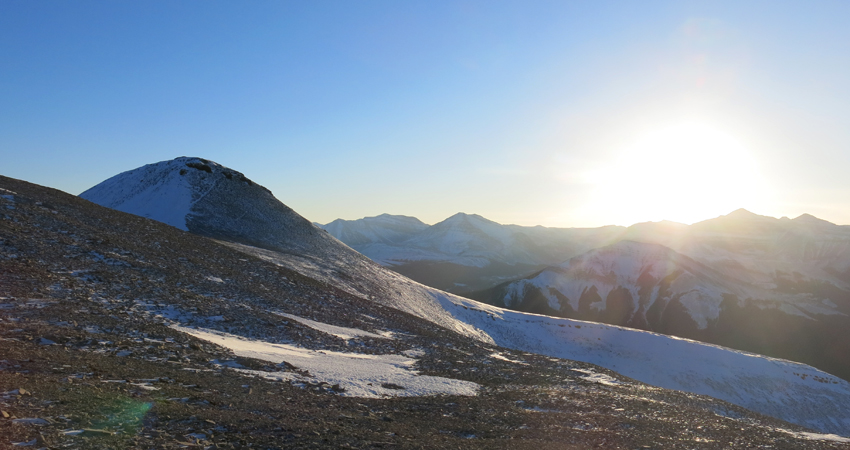
After leaving the forest, a wide, flat and barren slope opened up, leading to the long, sinuous ridge of Scalp that stretches for a good 5 km from north to south. It took me a while to reach the first high point: from here, the summit still looked far! The terrain appears gentle and perfect for hiking, but unfortunately the rock is chunky and loose and not very pleasant to walk on. Thankfully, it was a brilliant day with bright blue skies and not a cloud on the horizon, and the superb views of the beautiful surroundings gave me plenty of reason to continue.
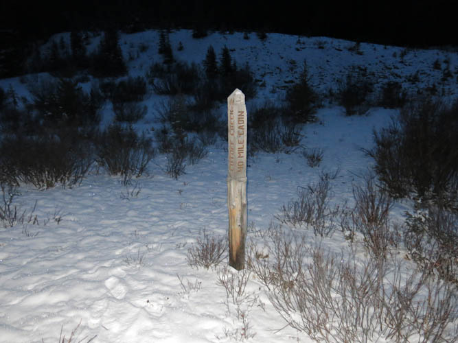
The ridge narrows in places but is easy to follow, with a couple of minor bypasses to the left (west) where the ridge spine gets too broken up. I contoured around the high point in the middle of the ridge by following a goat track – again, unpleasant to walk on, but probably easier than going all the way up and down this sub-peak, which I did on the way back (the sub-peak is only about 15 m lower than the summit). At the summit there was a brand new register, placed in June this year by someone as a geocaching site. To my surprise, the only other entry was just 10 days before my visit! Ben Nearingburg, author of the brand-new scrambling book “A Peakbagger’s Guide to the Canadian Rockies North” (co-authored by Eric Coulthard), had apparently biked in along Cutoff Creek and camped near “40 mile cabin” to the north.
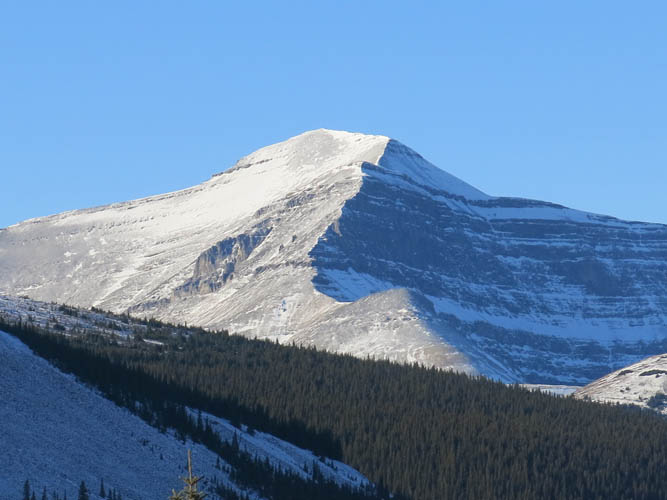
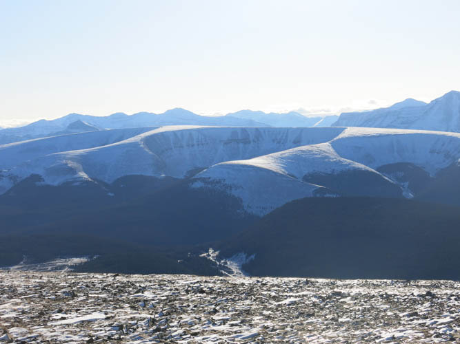
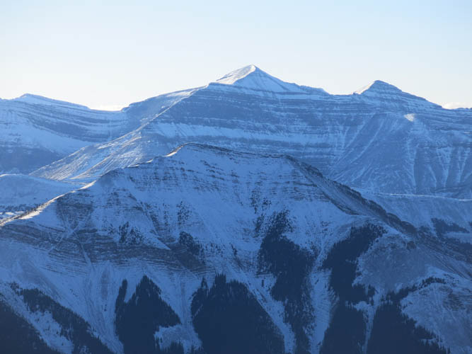
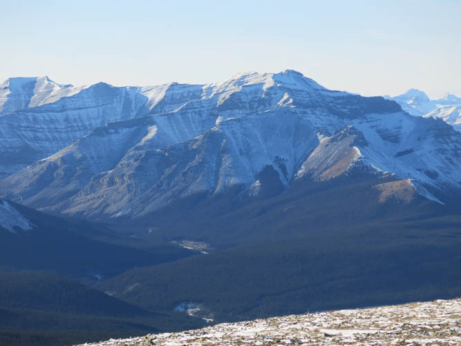
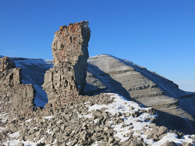
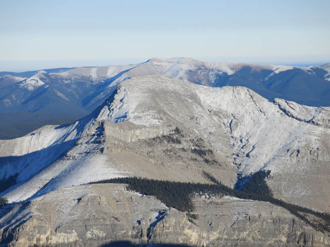
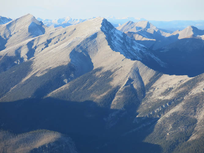
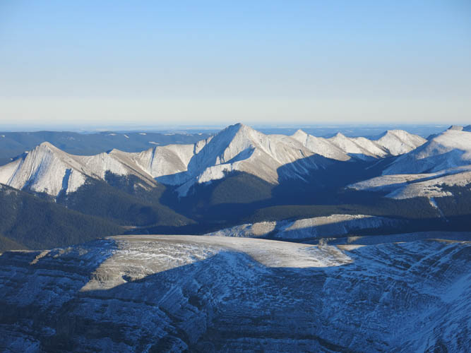
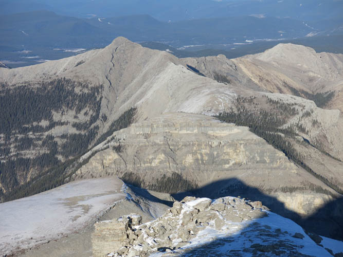
The views from the summit were all new to me, I had never been this far north in the Ya Ha Tinda area. The mighty Tomahawk Mountain and the ominously named “Forbidden Peak” are to the west, flanked to the north by an impressive-looking but unnamed peak with a summit tower reminiscent of organ pipes. To the northeast and east there is a plethora of lower-elevation front range peaks, all unnamed but no less pleasing to the eye. The easternmost ridgeline is particularly intriguing with a series of delta-shaped peaks that form a nice, symmetrical zig-zag pattern.
I left the summit just after 3pm with only a couple of hours of sunlight left for the day, so I kept pushing without any breaks until I was through the forest and back on the main trail in the valley. The line I chose on return was a bit more direct and worked just as well. Back on the trail I took a much needed energy break as darkness surrounded me. Sitting there in the dark, with complete stillness around me and a sea of stars appearing in the sky, was something supremely magical but a bit eerie, too. It definitely felt far away from civilization and very “exposed” to nature.
It was still a 13 km trip back to my car, so I switched on my “autopilot mode” and just kept on walking. My headlamp was a big help and it felt reassuring to see my tracks from earlier in the day. Once I reached my bike again, I knew it was a simple matter of just cruising downhill all the way to the car and making sure I didn’t fall off on the bumpy track in the dark. I got back to the car feeling very relieved I had put this one behind me. Although it was a great adventure, it was a huge amount of work and I’m happy not to ever repeat this lengthy outing.
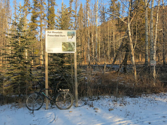
Note: I parked along the gravel road leading to the ranch buildings, just before a sign saying “No parking authorized beyond this point”. I later found out that parking is only permitted at the Bighorn Campground and Bighorn Falls trailhead. Also, the area around the ranch buildings is now closed to the public, which means that you’d have to take the Old Forestry Road instead – the wide track that runs straight north from the Bighorn Falls trailhead towards Hat Mountain, then turns west at the foot of it. This adds about 6 km to the total round-trip distance.
For a detailed map of the area, including all existing trails and many possible scramble routes, see the Ya Ha Tinda & Surroundings Trail Map on Avenza (a free mapping app for offline navigation and tracking). The map is also available in print at MapTown or GearTrade.
NOTE: This GPX track is for personal use only. Commercial use/re-use or publication of this track on printed or digital media including but not limited to platforms, apps and websites such as AllTrails, Gaia, and OSM, requires written permission.
DISCLAIMER: Use at your own risk for general guidance only! Do not follow this GPX track blindly but use your own judgement in assessing terrain and choosing the safest route. Please read the full disclaimer here.