10 December 2016
With Richard
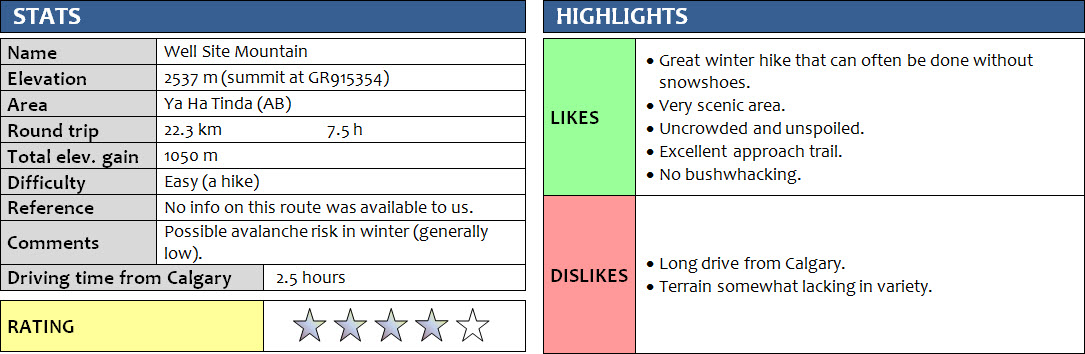
Well Site Mountain was a nice surprise. I had never really considered this flat and relatively low mountain as a proper objective before, but with a forecast high of -18 degrees C, little snow cover, and no avalanche risk it was perfect for today. For Richard and me it was also a sort of experiment to see if with the right equipment we could manage to still enjoy a hike at temperatures in the -20 to -30 range. Our experiment ended up as a great success!
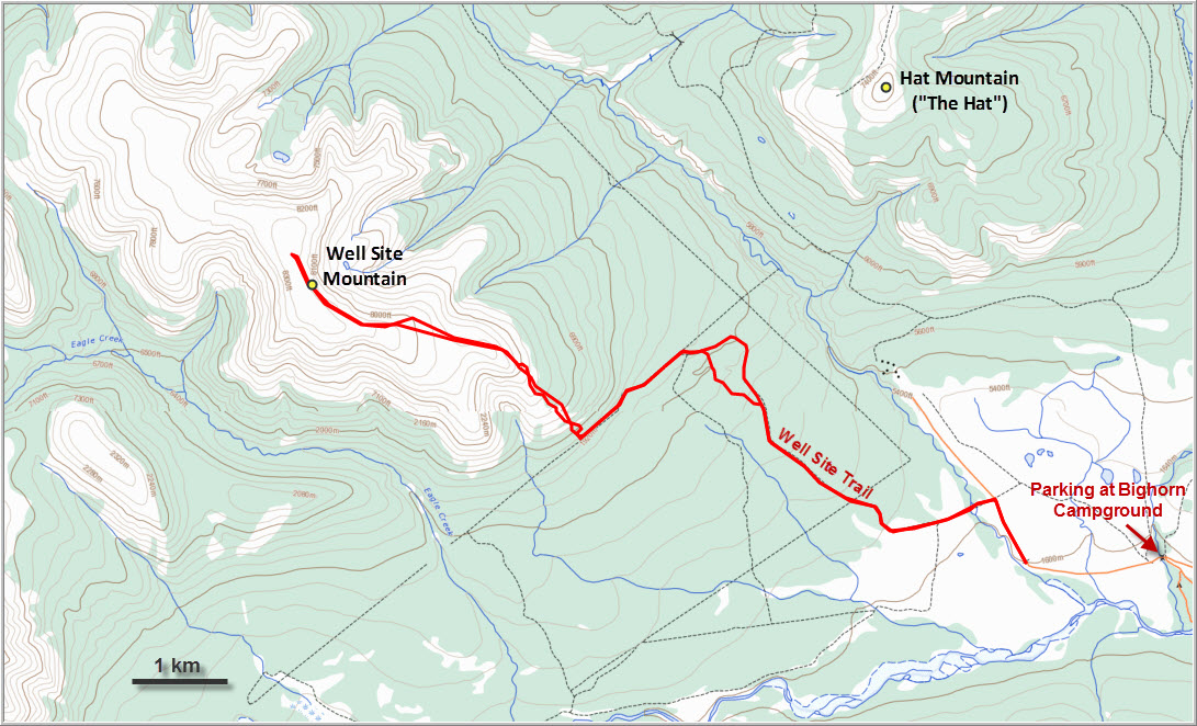
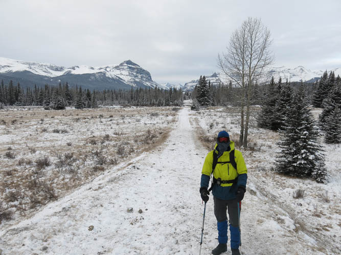
The track I had mapped out using Google Earth a few days earlier turned out to be straightforward and a nice route up Well Site Mountain. The approach led us along the wide “Well Site Trail”, which – as the same suggests – leads directly to a former wellsite at the southern end of the mountain. The first hour or so was definitely on the chilly side, and despite wearing long underwear and using toe warmers our legs and faces were freezing! But as we tramped on, with time our core temperature rose and we started to warm up. We tried to take a brief shortcut through the trees at one point, but it wasn’t worth it and following the old wellsite road on return was a much better choice.
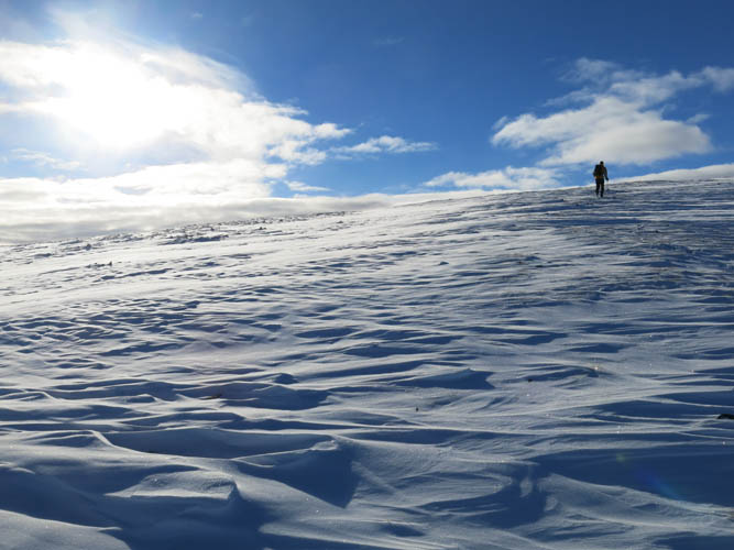
Just before the wellsite we left the path and made a sharp right, straight up the slope. The first few hundred metres were the steepest, involving quite a bit of slipping and sliding on soft, loose snow. There was only about 10-15 cm of snow on the ground, but it was enough to make this section tricky. A short cliff band was easily stepped through, the only hands-on action of the day (the cliff band can probably be avoided altogether by going around it on the left/west). We soon came out of the trees and the slope gradually became gentler. Beautiful views of the surrounding peaks started to open up, the perfect place for a short break. We had to be careful not to linger too long during our breaks – each one was a maximum of 5 to 7 minutes, then our core temperature dropped and we started feeling the cold creeping in again, so we had to keep on moving. Surprisingly, my bottles of water and juice did not freeze at all the whole day, perhaps because I kept them close to my back in my pack where there was some body heat.
On the open slopes half way up we came across a wonderful sight: a large group of bighorn sheep was grazing here, perhaps 50 or 60 animals in total. They used their front legs to push the snow away to reveal bits of frozen yellowish grass underneath, leaving behind a messy patchwork of trampled snow and grass. It was quite surprising to see how unfazed they were by our presence. We were able to pass by them within a 10 m distance, and even then only some of the animals started to scuttle away.
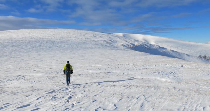
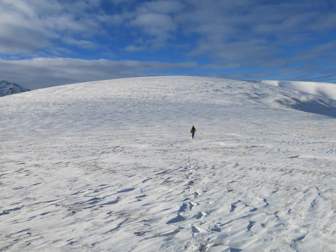
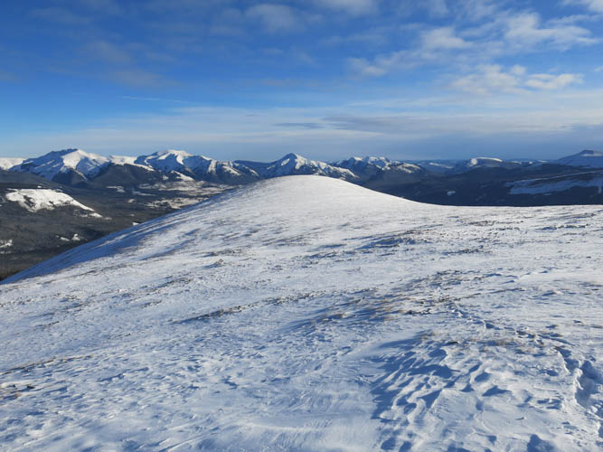
After the last patches of trees, we ascended a short rocky bump consisting of brown shale to the top of the main ridge. From here we had our first view of where the summit was supposed to be in the distance. It was still 2 km away and ahead of us was one giant flat plateau! I’ve never been on a mountain as flat as this one. Thanks to a beautiful sunny blue sky and the near absence of any wind up here we thoroughly enjoyed the hike across this plateau on grassy terrain covered with a thin layer of snow. The landscape up here is quite unique, a wide platform surrounded by higher, snow-capped peaks in the distance. It almost felt like walking on some other planet!
Finding the actual summit would’ve been very difficult up here because you can’t really see where the highest point is. Fortunately, a large cairn near the edge of the mountain’s eastern escarpment marked the spot and spared us from the tedious task of erring around trying to find the maximum elevation with a GPS.
We took some brilliant summit shots in perfect, low-angle light conditions with nice contrasting colours of white snow and deep blue sky. But the wind started to pick up and we really felt the cold now (it was probably -25 to -30 by now), so we cut our break short and headed back. Following our ascent tracks was easy and quick and we made really good time on the return, only stopping once briefly for some hot tea from our thermos bottles, a comforting treat on chilly days like this. By the time we reached our car we really started feeling the drop in temperatures as the sun was setting, and we were surely relieved to see my car start up right away.
Note: Officially, parking is only permitted at the Bighorn Campground and Bighorn Falls trailhead. This is about 1.5 km before where we parked, which is on a pull-out up on a rise by a wooden corral. I’d only recommend parking here if you’ve been given permission by someone from the ranch (as in our case).
For a detailed map of the area, including all existing trails and many possible scramble routes, see the Ya Ha Tinda & Surroundings Trail Map on Avenza (a free mapping app for offline navigation and tracking). The map is also available in print at MapTown or GearTrade.
DISCLAIMER: Use at your own risk for general guidance only! Do not follow this GPX track blindly but use your own judgement in assessing terrain and choosing the safest route.

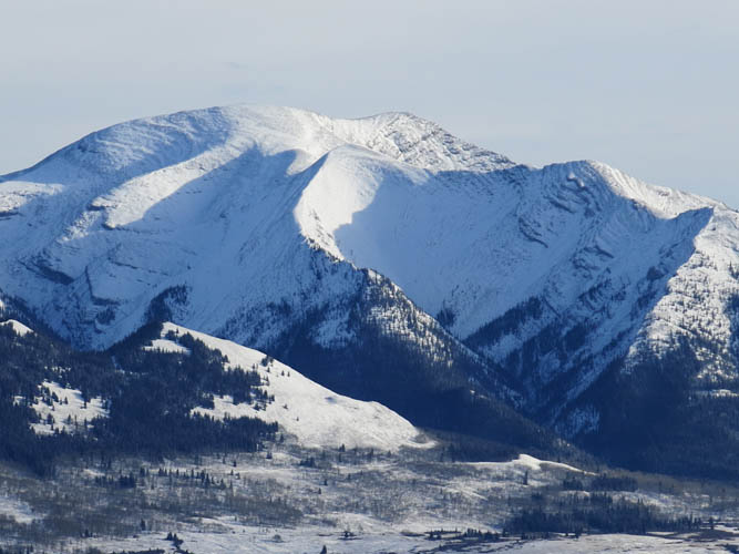
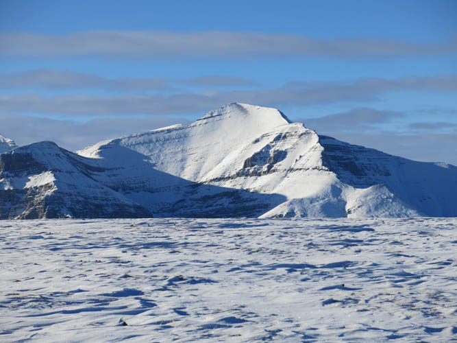
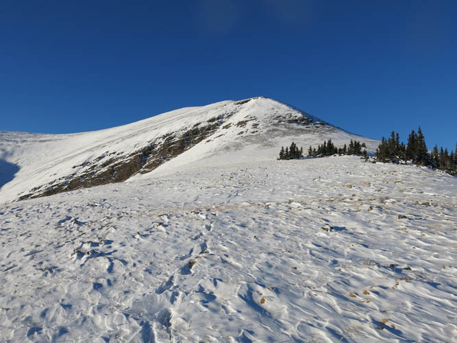
Well Site Mountain from near our starting point.
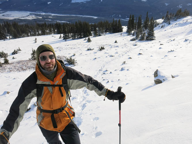
Ready for a day at -20 deg C and below! Warden Rock is the prominent peak on the left.

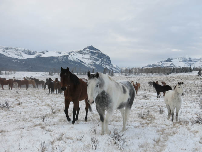
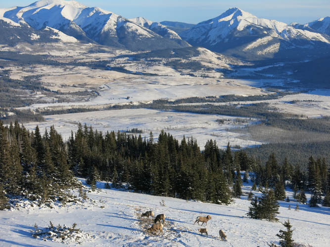
Horses from the Ya Ha Tinda ranch with Wapiti Mountain in the background.
We walk right through the team – they are as curious about us as we are about them.
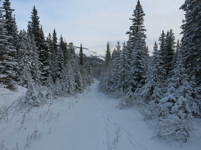
Well Site Trail
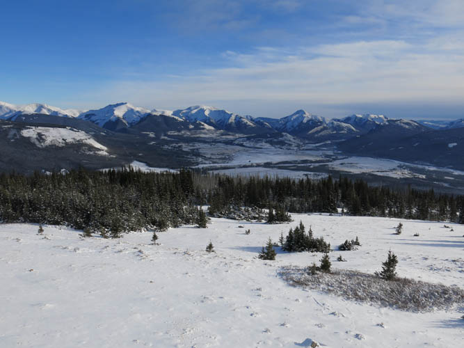
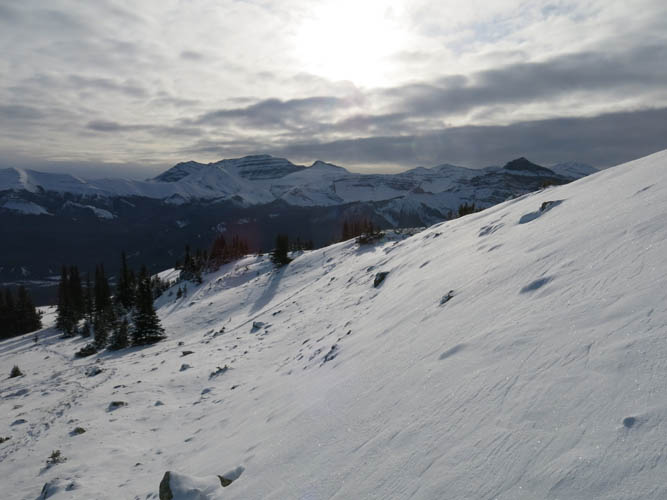
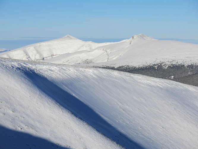
Just above treeline, we enjoy sweeping views of the ranch area below. There are a number of peaks on the horizon that make for great scrambles here.
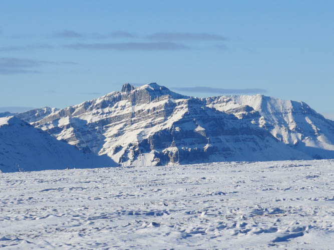
Close-up of Maze Peak.
Close-up of Eagle Mountain.
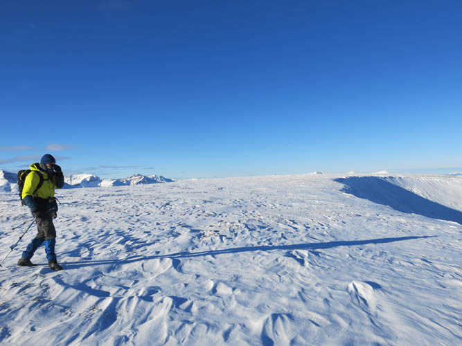
Richard taking a breather as we tramp up open slopes.
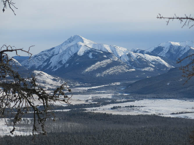
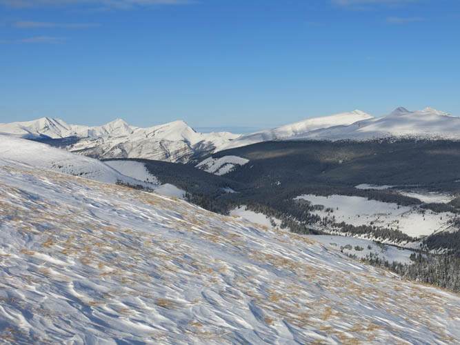
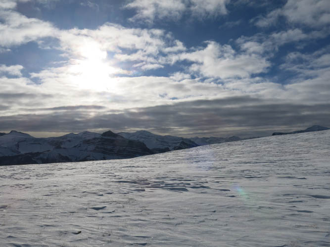
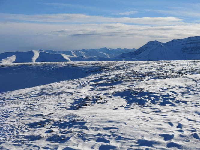
In the distance to the south is Barrier Mountain.
What a beautiful day to be out!

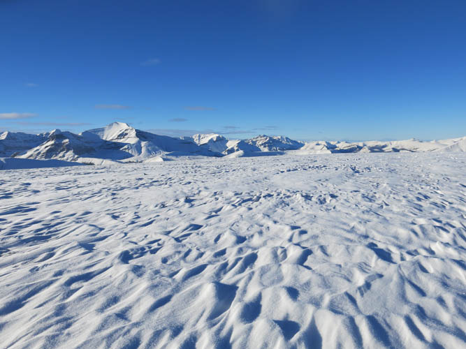
The top of Well Site Mountain is a wide and flat plateau.
This is very atypical for the normally craggy and rocky Font Range peaks.
Thankfully, the snow is only some 10-15 cm thick, making for easy travel up here.
Looking back along the “ridge”.
If there was more snow, this would probably be a nice snowshoeing trip.
Tomahawk Mountain
Scalp Peak to the NE
It feels like a different planet up here!
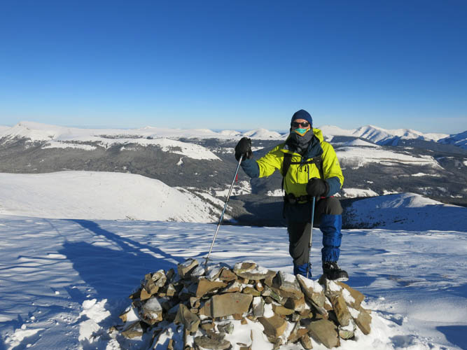
At the summit.
We wander around a bit further, but everything looks like this here: flat and barren.
Lost Guide Peak lies far to the north.
Many other unknown (and mostly unnamed) peaks wait for discovery in the distance to the NW.
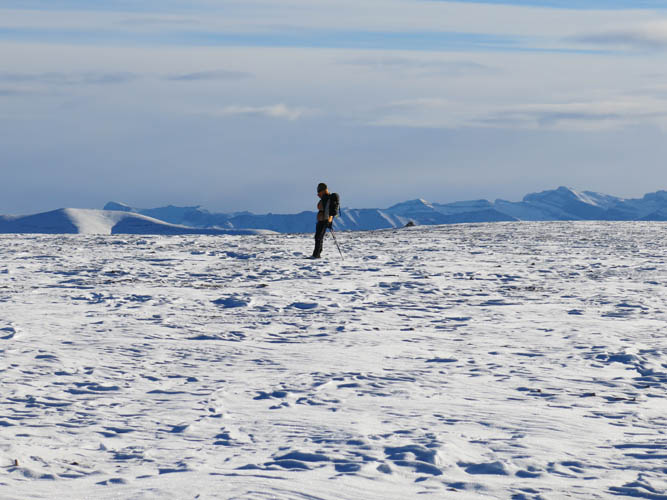
Richard in the middle of nowhere 🙂

Sun, sky and snow.
Looking back at the brown shale bump as we descend.
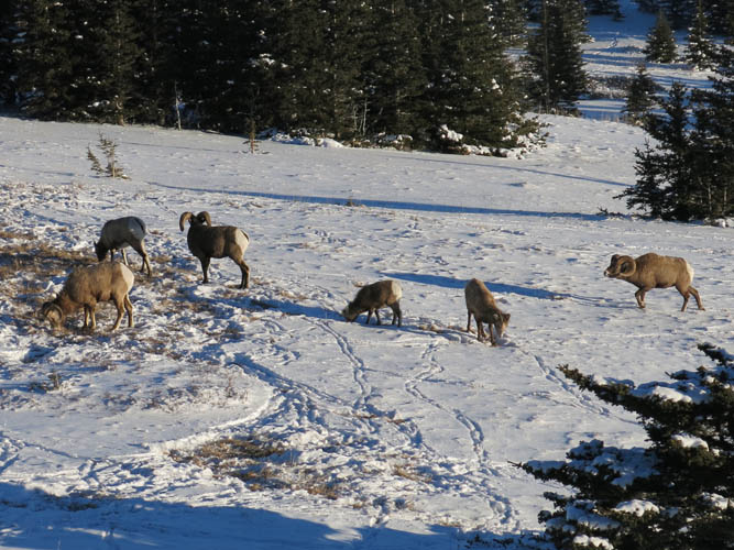
We pass by several groups of bighorn sheep again on our way down.
Great views from up here!
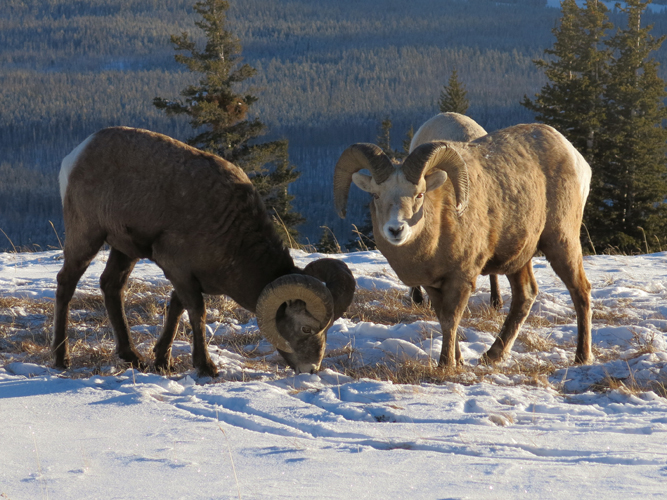
A closer look at these magnificent animals.