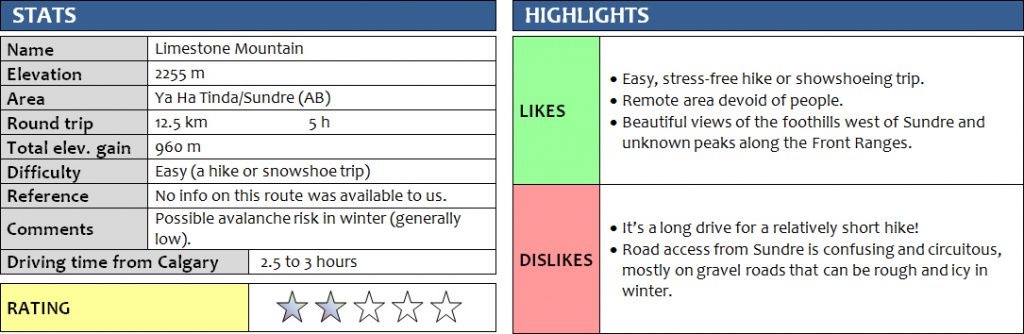
22 January 2017
With Richard
Our original objective for today was Onion Peak in the Ram Range, which we had to drop due to poor road conditions on the last 54 km stretch to Ram Falls, where the road is unmaintained. Not wanting to risk getting stuck in the middle of nowhere, we opted for Plan B – Limestone Mountain. No, not Limestone Mountain near The Wedge in Kananaskis, which is a relatively popular scramble and fairly well-known among hikers. This is “the other” Limestone Mountain – that obscure little peak near Sundre that takes forever to get to!
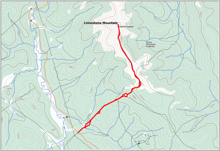
The crux of this trip was driving to the mountain itself. There is a myriad of wellsite roads, cutlines, logging roads and other tracks in this area, most unmarked and with unknown destination (at least to us). We had some info from Sonny Bou’s trip report, which greatly helped in getting into the area, but some of the smaller roads closer to the suggested trailhead were in rough shape and impassable because of too much snow. We checked our maps and decided to approach the mountain from its western side up a cutline.
The plan worked out perfectly. A decent gravel road led us to the start of the cutline, which runs straight up the western side of the mountain, providing easy access to the main ridge. There were some snowmobile tracks, perhaps a few days old, which made the snow supportive enough for us to simply hike up in our winter boots. We left our snowshoes, helmet and ice axe in the car as the terrain looked gentle and there really wasn’t much snow on these slopes – no need to lug up all the extra weight.
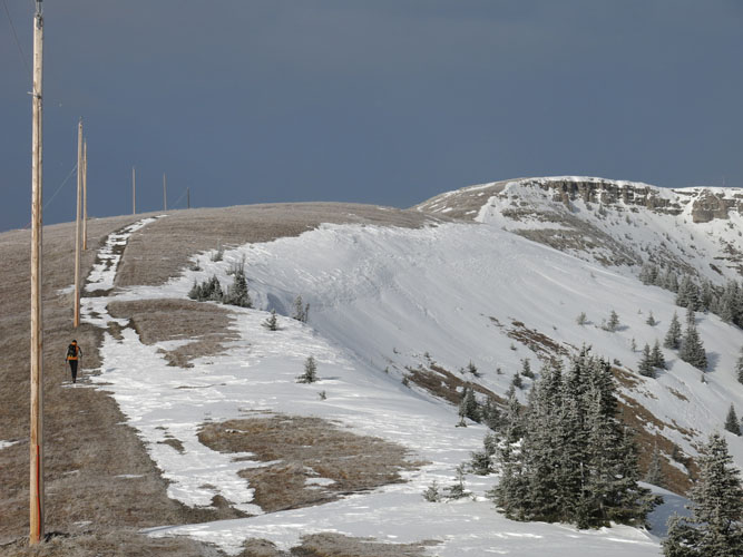
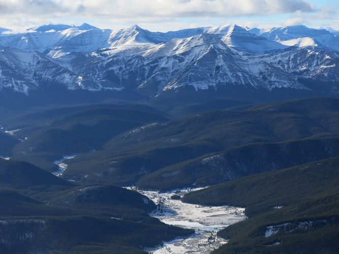
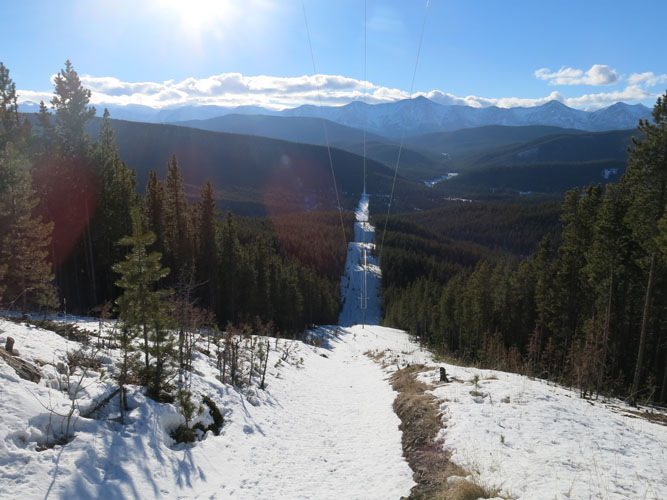
After crossing a small creek at the beginning, which was completely frozen over, we steadily gained elevation following a powerline that runs along the cutline. It eventually intersected an old wellsite, then veered slightly left (north) before reaching the main ridge. To be honest, the views weren’t that great on the way up, with forest on both sides and the steep, snow-covered cutline ahead. It was a lot better on the way down, though, when we had a clear view of the distant Ya Ha Tinda Front Range peaks to the west.
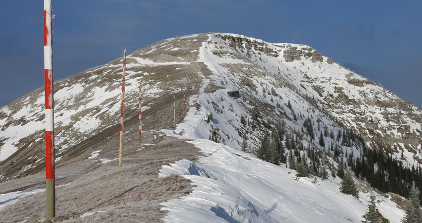
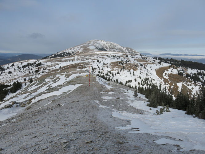
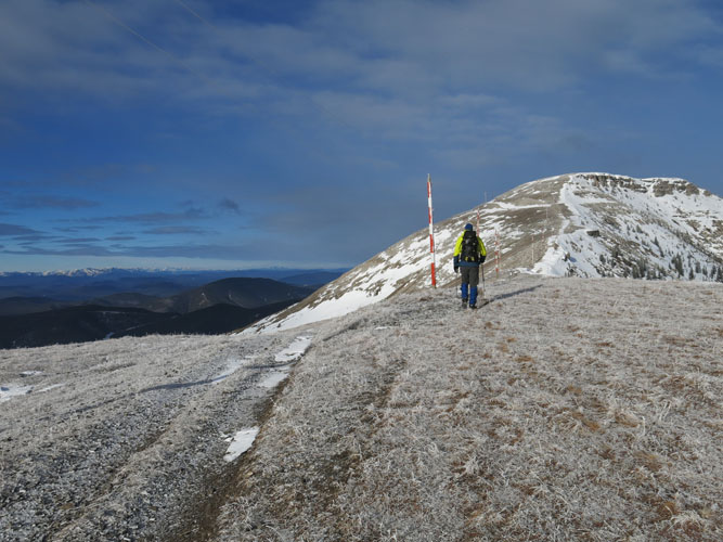
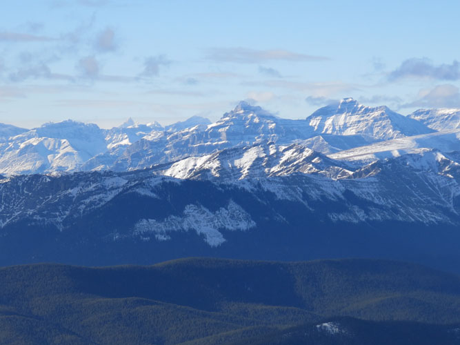
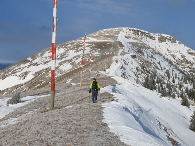
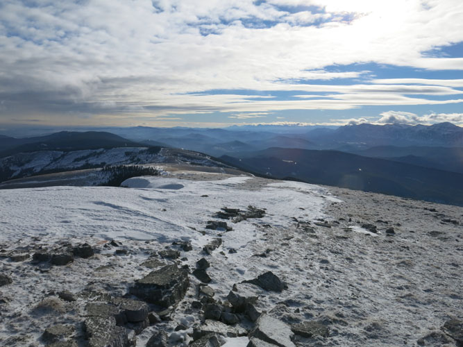
Once on top of the ridge, we turned north and easily followed a rough track along a set of powerline poles to the summit. There are several minor ups and downs along the ridge here. At the summit there is a little hut with a shed and an outhouse – Limestone Mountain Fire Lookout. It’s still operational, but not in use in the winter. The walk up here was really quite scenic now that the clouds had moved away, leaving us with us with a beautiful sunny day and blue skies all around. The views are pretty unique from this little “outlier” of the Front Ranges: dark green wooded hills to the east as far as the eye can see, jagged peaks of the Ya Ha Tinda and Cutoff Creek area to the west, and in the distance to the north Ram Mountain pops up like an island in a green sea. The visibility was spectacular today, very much unlike the plains further east, including Calgary, which was completely shrouded in dense fog all day.
For the return we contemplated descending down a gentle rib just south of the summit to link up with an old wellsite road shown on maps. However, it looked like there was a lot more snow on this road in the sheltered valley down below, so we simply went back the same way we came. In the summer, this wellsite road may offer an interesting loop route back down the west side of the mountain.
This trip was a nice winter hike perfect for a season starter, but it’s definitely a lengthy drive from Calgary. We both really enjoyed the outing, however you can’t help but wonder if 5 hours of hiking is worth the effort of driving for 5-6 hours and having to deal with a confusing network of rough gravel roads…
Note: Just below the lookout hut, which sits on top of the summit, there is a “trespassing prohibited” sign warning of the dangers of entering this zone, probably due to frequent helicopter activity in the summer months and to protect the privacy of the staff working here. Technically speaking, you are thus not allowed to hike to the actual summit. In the dead of winter, however, the lookout is not manned and we felt the summit wasn’t any more dangerous than anywhere else on the mountain.
DOWNLOAD ACCESS DIRECTIONS (GPX FILE)
DISCLAIMER: Use at your own risk for general guidance only! Do not follow this GPX track blindly but use your own judgement in assessing terrain and choosing the safest route.
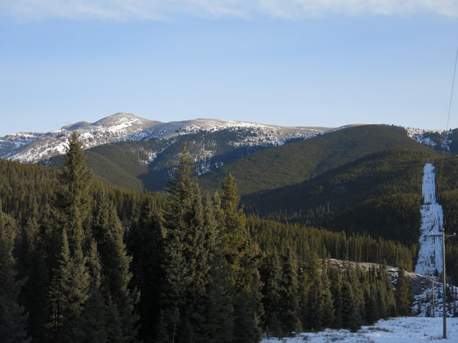
Limestone Mountain, with summit on left and cutline on right.
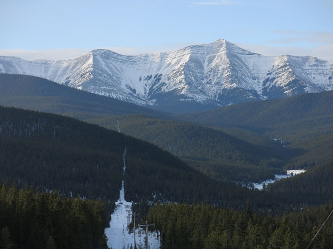
Looking back down the cutline. The Front Range Peaks of the Ya Ha Tinda area look quite impressive from here.
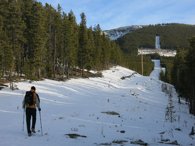
Richard heading up the wide cutline. An old wellsite is just ahead of us.
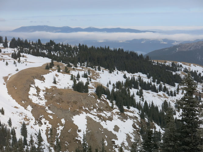
Forest covers much of the gently rolling foothills around Limestone Mountain.
Views to the NW.
On top of the main ridge, heading north.
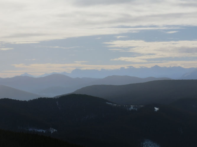
The clouds disappear in the plains below us… time for some sunshine!
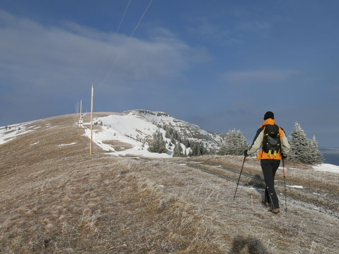
A wide track runs along the top of the ridge.
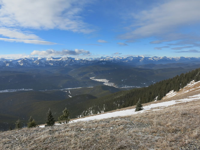
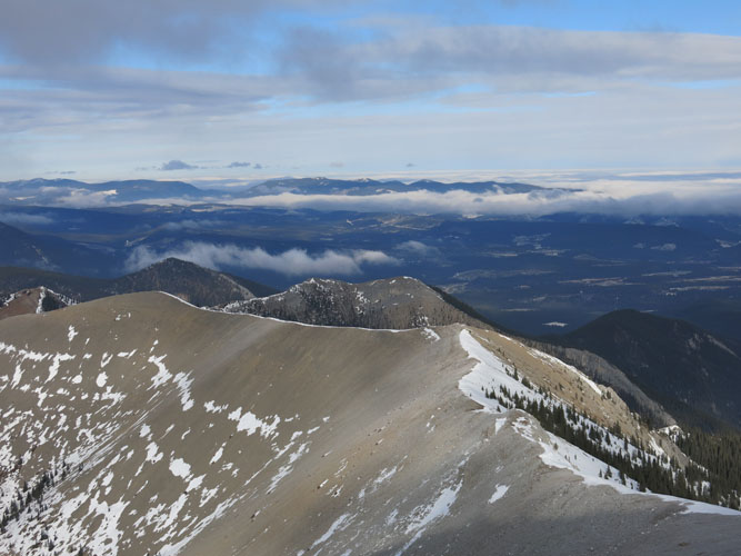
There are so many opportunities for exploring Front Range peaks here!
Along the gentle ridge.
There’s almost no snow up here. It’s a good thing we left our snowshoes behind!

Looking west towards the Ya Ha Tinda and Cutoff Creek areas.
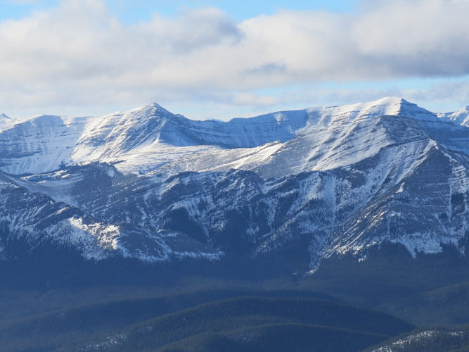
Close-up of Forbidden Peak (centre).
Scalp Peak. True summit is on the right.
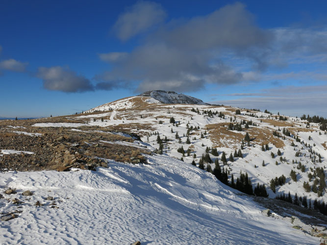
Nearing the false summit.
We are the only people around today…
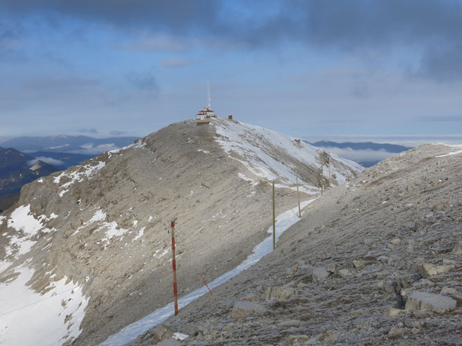
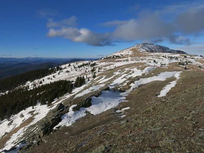
Last stretch to the summit.
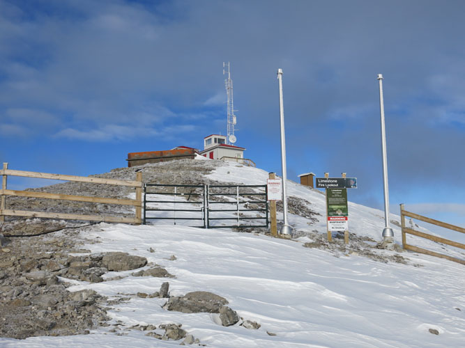
Limestone Mountain Fire Lookout.
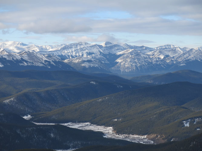
Another look to the many unfamiliar Front Range peaks in the west.
The ridge continues to the north on what looks like easy terrain. There are probably many different possible routes up this mountain. In the distance, Ram Mountain pokes above the clouds.
Heading back down.
Another look at the summit ridge before we descend down the western slopes.
Back down the cutline – almost looks like a ski slope!