5 May 2017
With Wen
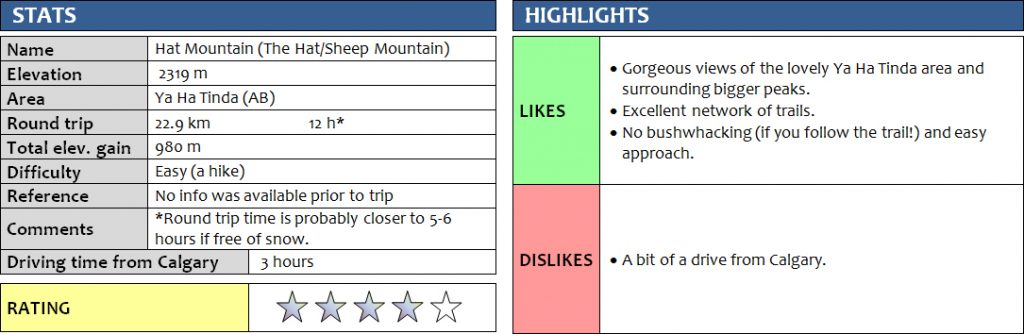
Some trips take a LOT more time and energy than they should and today this is exactly what happened. Hat Mountain, also referred to as The Hat or Sheep Mountain, is a relatively minor high point just above the Ya Ha Tinda ranch. There are a number of good horse trails that lead up the peak, providing great hiking opportunities in this beautiful area. Going up and down Hat Mountain along the route we took should normally take perhaps 5-6 hours in dry conditions. Today, it took us double that time – 12 hours!!
I’m still baffled by how specific snow conditions can turn an otherwise simple hike into an exhausting and lengthy ordeal, but I should really know better by now. There had been a major snow dump that covered the Front Ranges in April while we were away on vacation, but it had been at least a week already since the snow had melted in Calgary and consistently high temperatures in the high teens and 20s surely should’ve melted most of the remaining snow at lower elevations in the mountains… WRONG! Although south and southwest facing aspects were relatively snow-free in the 1600-2200 m range at Ya Ha Tinda, sheltered areas in the trees were not. Snowshoes wouldn’t have helped much because the snow was simply too soft and too deep.
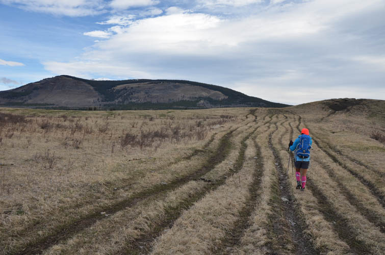
Our hike started out really well. We leisurely ambled north along the Old Forestry Road past Big Horn Falls towards Hat Mountain, taking numerous photo breaks along the way. (This initial path is on the west side of Big Horn Falls, but the best views of the falls are from the east side – a track leads to a viewpoint with benches in a few minutes from the parking lot.) There are several paths that lead up the mountain from the south and southeast side. The first option we came across was marked with bright flagging, but purposely blocked with branches, so we decided to keep walking further around the SE side and then followed a good and recently used horse trail through forest. This is called “Sheep Mountain Trail” on some maps. There wasn’t much snow, but Wen’s microspikes came in really handy as the trail was iced up most of the way. The trail eventually joined with another very good trail (presumably the same as option 1 we came across earlier) at a wonderful viewpoint, where a group of goats were lingering in the sun.
From here, the main path rises straight up in the forest, while a smaller track veers left just above the rocky hillside. We followed the smaller track and although it was a one-way street, we enjoyed this pleasant detour. The trail rose above a small rocky gully and led to a wide grassy platform that offered a perfect spot for a picnic including views of Wapiti Mountain and Well Site Mountain to the west.
We couldn’t see a continuation of this small track, so we hiked back and rejoined the main path. Now in the forest, we quickly lost it as patches of snow grew bigger and deeper. Nobody had been here in a while it seemed, leaving us to posthole through knee-deep snow and bushwhack through the forest for the next couple of hours… Tough going and lots of hard work!
Reaching the open slopes near the summit was such a relief. The snow was very thin to absent here and it was a nice hike, no scrambling necessary. A large double cairn adorns the summit and we thoroughly enjoyed 360 degree views of the Ya Ha Tinda area from this terrific vantage point. Here we were hiking in t-shirts in 26 degree sunny weather and all of the mountains surrounding us were still blanketed in lots of snow!
The descent was terrible. Reluctant to retrace our steps through snow and forest again, we opted to return via the col to the north, then down two established trails on the west side. We were hoping that the west facing aspects would have much less snow, but we were wrong… Once past the col and down at treeline, we had to put up with several hours of stomping through deep snow again. Everything was melting in the warm temperatures and the snowpack was super soft and slushy, with a layer of water running underneath it. Lower down on Scalp Creek Trail we had to cross a small temporary creek that was running underneath half-melted snow and ice, but by this time our boots were completely soaked so we just walked right through it.
Thankfully, the last hour of our trip made up for all the struggles. Walking through the open Ya Ha Tinda ranchlands at sunset with Maze Peak illuminated in the last glows of light and seeing large herds of mule deer move across the mellow pastures was truly an unforgettable sight.
As a side note and a warning, we did come across a grizzly near the ranch buildings, so bringing bear spray is definitely a good idea. Also, ticks are common here in spring. I found three clinging to me when I got home!
For a detailed map of the area, including all existing trails and many possible scramble routes, see the Ya Ha Tinda & Surroundings Trail Map on Avenza (a free mapping app for offline navigation and tracking). The map is also available in print at MapTown or GearTrade.
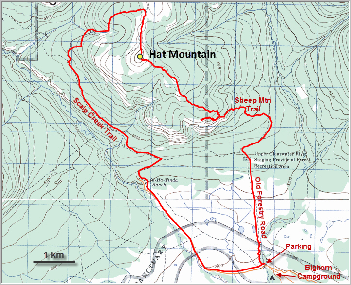
Note: The map above and the GPX track shows our route going through the Ya Ha Tinda ranch buildings. Public access to the gated area with the ranch buildings is not allowed anymore, so you will have to take the connecting trail from Scalp Creek Trail to the Old Forestry Road.
DISCLAIMER: Use at your own risk for general guidance only! Do not follow this GPX track blindly but use your own judgement in assessing terrain and choosing the safest route. Please read the full disclaimer here.
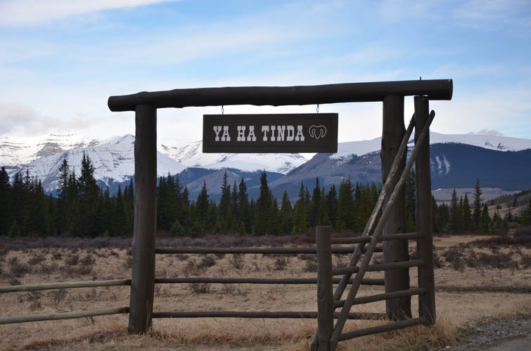
Ya Ha Tinda entrance gate.
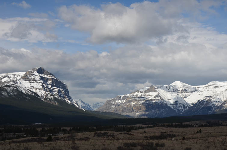
One of my favourite views in this area: Warden Rock (left) and Wapiti Mountain (right) guarding the entrance to Banff National Park.
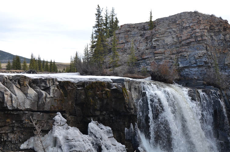
Bighorn Falls
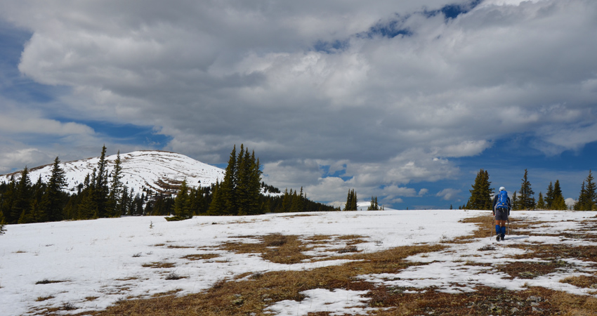
The Old Forestry Road looks like a highway because of all the horse tracks here! Hat Mountain is rather flat and unassuming from this vantage point.
Wapiti Mountain still holds lots of snow. The summit is all the way on the right.

Signs with a detailed map showing all the trails in the area can be found at various points.
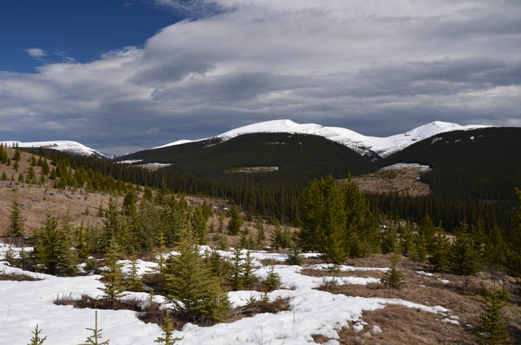
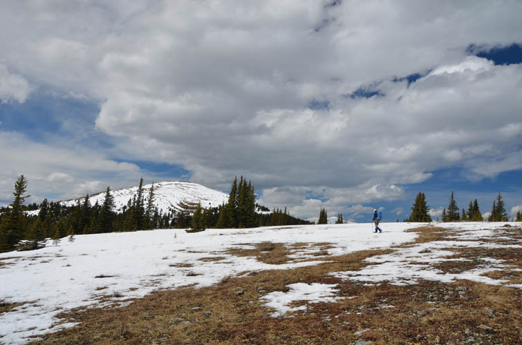
Most of the snow has melted on the gentle eastern flanks of Hat Mountain.

Hiking up Sheep Mountain Trail.
An open viewpoint makes for a great rest stop! A herd of goats is there to greet us.
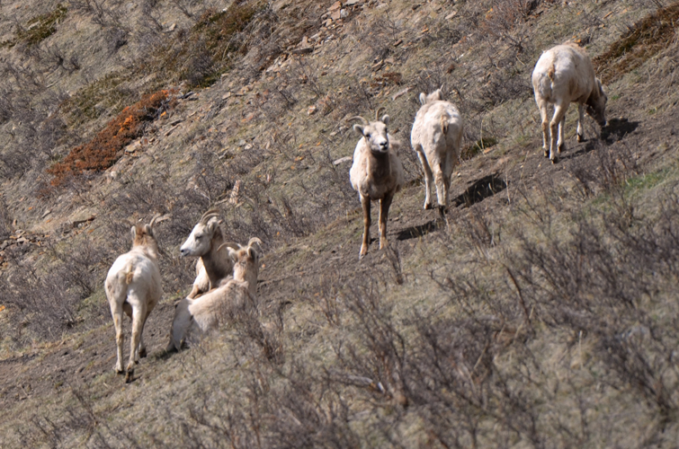
A closer look… they don’t seem to be too bothered by our presence.
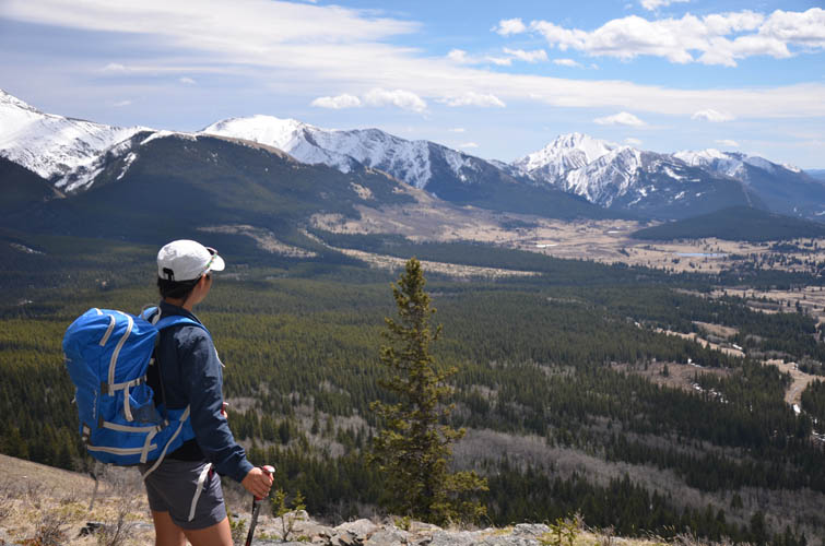
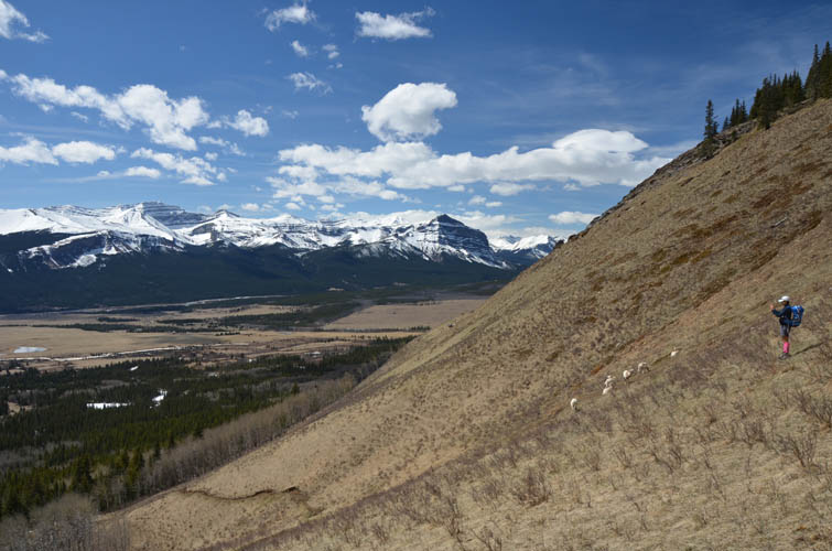
Sweeping views over the lovely Ya Ha Tinda basin.

A picturesque detour leads us to another beautiful viewpoint (but it seems to be a dead end, so we have to backtrack to get back on the main trail).
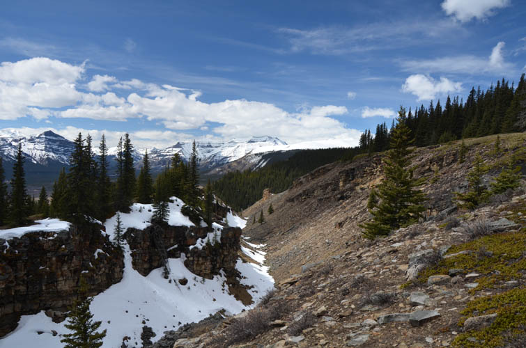
A flat ridge leads to the upper part of Hat Mountain.
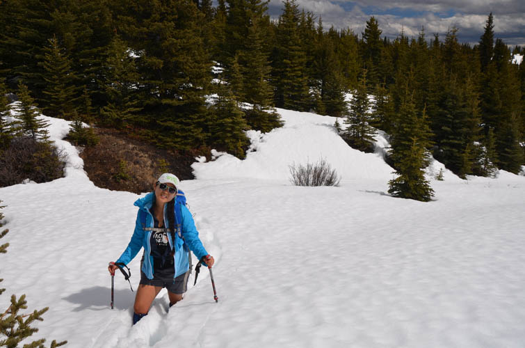
Awful snow conditions! It’s soft and deep, with water running underneath it.
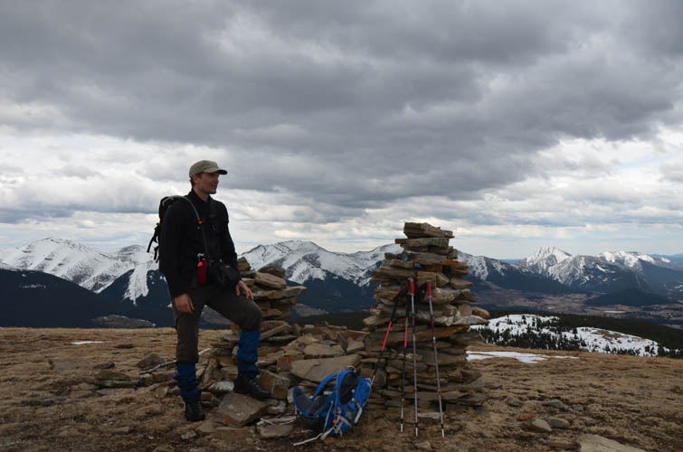
The large double cairn at the summit of Hat Mountain.
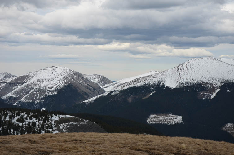
Views to the NE still show lots of snow clinging to the slopes of Evangeline Peak (far right) and other unnamed mountains.
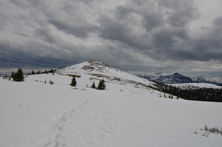
This is a look back (south) at Hat Mountain’s summit. More and more snow here.
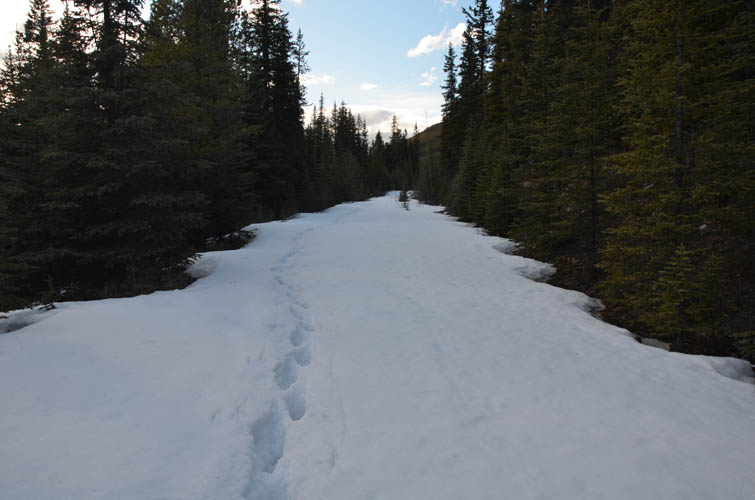
Deep postholing through soft snow on an otherwise good trail as we descend to Scalp Creek Trail. This part was absolutely terrible.
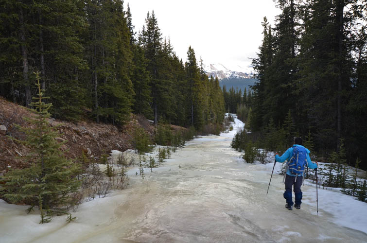
Portions of Scalp Creek Trail are completely iced over.
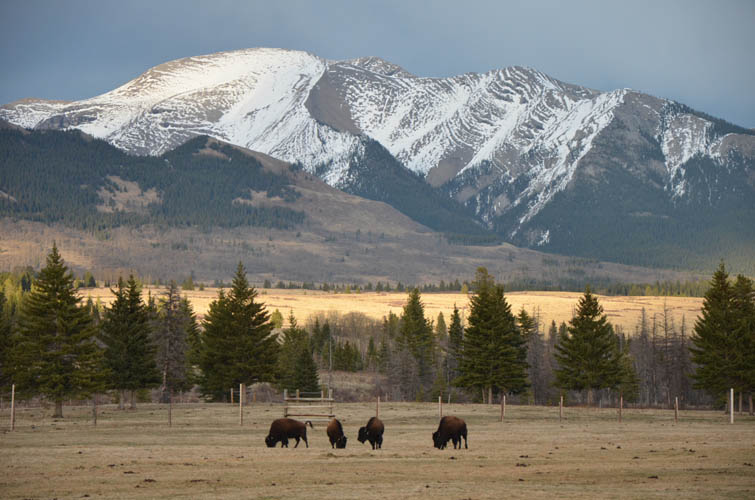
A group of bison at the Ya Ha Tinda ranch. Eagle Mountain provides a fitting background to this scene.
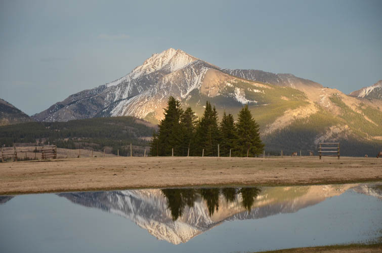
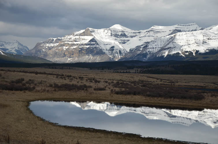
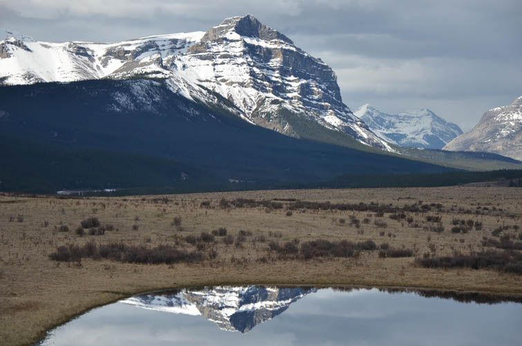
A reflection of Maze Peak in a small pond.
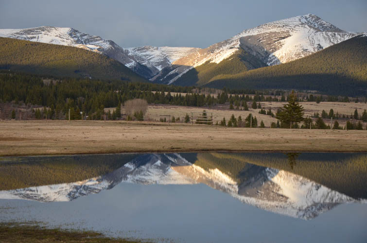
More reflections on a beautifully calm day.
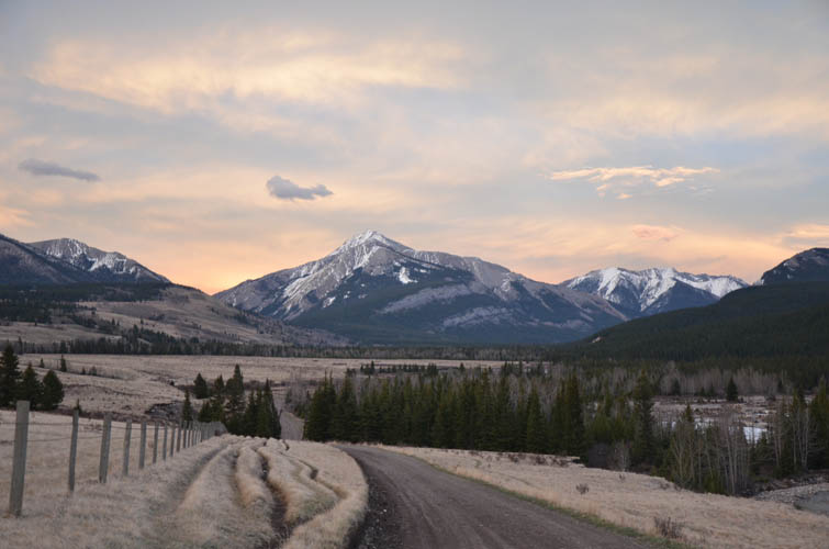
Walking back along the ranch road as daylight fades over Maze Peak.