19 September 2017
Solo
Otuskwan Peak is located in a seldom visited area west of Sundre and probably does not rate very highly on most people’s to-do list. The only report available online that I could find (as of the time of my trip) is of an ascent in October 2013 by Steven Song, Ben Nearingburg and Eric Coulthard – but tales of an arduous approach, bushwhacking and sidesloping don’t exactly sound encouraging. Perhaps this is also the reason why my previous attempts to convince my scrambling buddies Richard and Phil had failed; the perceived effort and suffering involved in attaining this peak just seemed too much so we always ended up putting it off…
Until this week, when the weather forecast unexpectedly called for a sunny day amid all the grey clouds this September and I found myself with an opportunity to get out mid-week. My plan was to ascend the long ridge that extends eastward from Otuskwan Peak because I wanted to 1) cut down on the long approach in the valley in favour of a hopefully scenic ridge walk, and 2) avoid some of the narrow canyon features that apparently had caused quite a bit of grief to Steven’s group during their trip four years earlier.
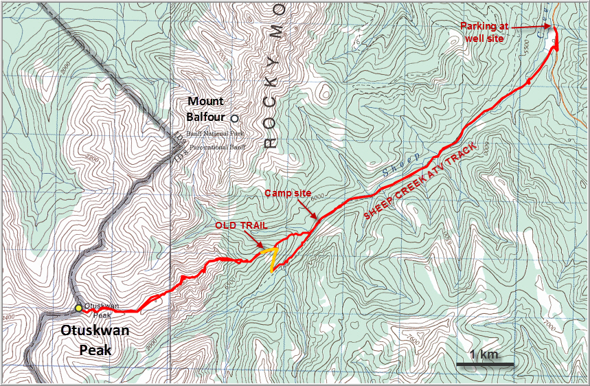
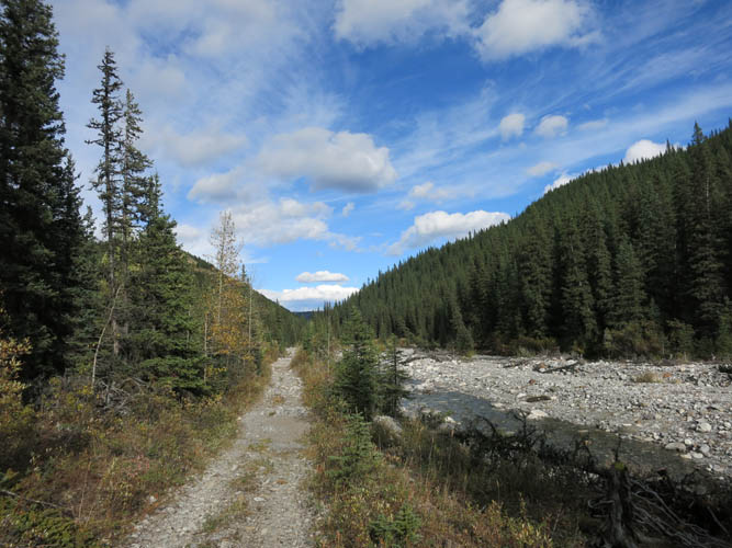
I parked in front of the same well site that served as the starting point for my 2016 Winchester Ridge trip. The ATV trail that starts just south of the site was a pleasant surprise to me: I had expected an overgrown track with lots of washouts, but it’s a straightforward track that is a delight to hike along. There were perhaps a handful of crossings over Sheep Creek, but I was able to rock-hop all of them, albeit not without some long leaps. In the spring and summer, when water levels are higher, you’d almost certainly have to wade the creek every time.
After 6 km of brisk hiking, I left the ATV track and turned right to start up the long east ridge of Otuskwan. One thing I really like about the Ya Ha Tinda area is that the forests here are typically not very dense and bushwhacking is normally easy, if at all necessary. This was also the case on the lower treed part of the ridge and I was able to gain elevation quickly. After picking my way through the trees for a while, I unexpectedly came across an old trail – mostly overgrown and pretty rough, but still a man-made trail! It followed the ridge crest for a few hundred metres before petering out…
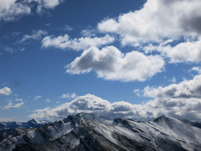
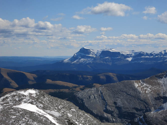
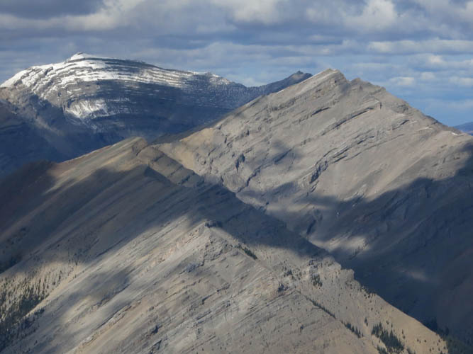
Continuing through light forest and patches of open meadows along the ridge, I soon passed tree line and finally had good solid rock under my boots. Gorgeous views opened up, with Winchester Ridge to my right and Zombie Peak to my left, in addition to many, many unnamed peaks in between. An explorer’s dream!
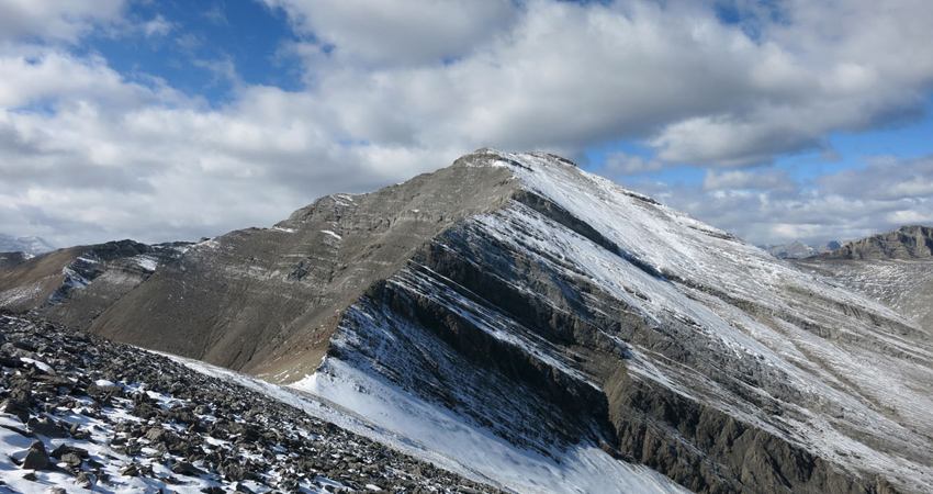
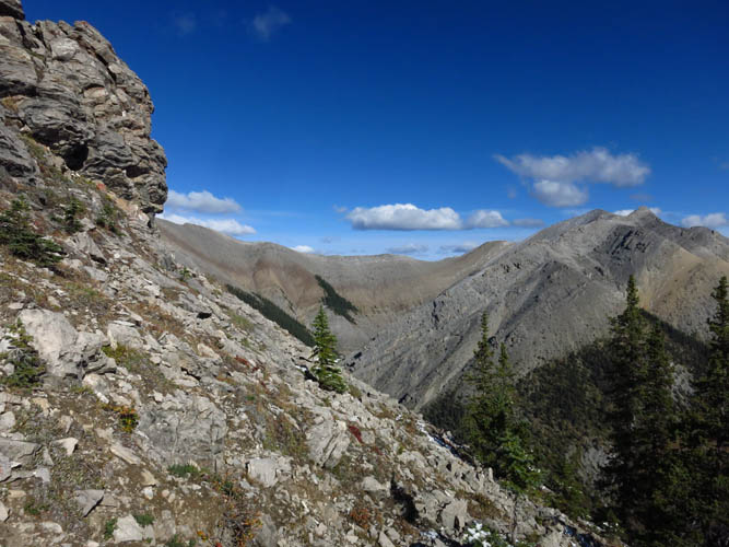
Over the next couple of hours I enjoyed a delightful ridge walk interspersed with sections of easy to more demanding scrambling, including many route finding challenges. Otuskwan’s east ridge is interrupted by a series of steep cliff bands that look menacing from a distance, but are all easy to bypass if you pick your route carefully. I counted 5 main cliff bands, all of which required detouring around the left (south) except the second one, where you bypass on climber’s right. The first obstacle is probably the most intimidating: it’s a near-vertical wall with seemingly no way up or around. Fortunately, as I got closer, I was able to find a very faint game trail that hugged the left side of the cliff and then looped back up the ridge to the right. The terrain is steep and the exposure serious enough, but there are plenty of ledges and steps to choose from. I built a number of cairns here and along the other obstacles because the terrain can be a bit confusing, and I’m glad I did – they were of tremendous help on my way back! The second break along the ridge involved a bypass on snow-covered talus on the right. I only had a few inches of snow to deal with, which made it tricky enough as the slope is steep and there’s quite a drop to the right. In winter, if there was a substantial amount of snow clinging to the slope, this section could be downright dangerous. Two or three more vertical rock bands appeared further along the ridge, all of which were overcome by seeking out weaknesses to climber’s left only about 30-50 metres away from the ridge crest.
Five hours after setting out, I topped out on the ridge and reached the summit cairn. A huge sigh of relief that this route worked out and wasn’t blocked by impenetrable cliffs or overhangs… you never know until you try! I was rewarded with the most brilliant views of a mountain world unknown to me, with a sea of snow-clad peaks to the west in Banff National park. There are some serious looking and lofty summits here – among them the rarely ascended Puma Peak and Panther Mountain. I found the old register placed by Rick Collier in 1991, but the booklet was iced up and completely frozen inside – evidently, the omnipresent black PVC tubes aren’t the best option for preserving pen and paper in the harsh mountain conditions over the years.
After enjoying a beautiful sunny summit break, I headed back exactly the same way I came up. The few cairns I had built helped immensely as the drop-offs and detours aren’t always obvious from above; on this ridge route finding is much easier going up. Upon reaching the faint path in the trees again, I followed it as it turned south-southwest, linking up with the Sheep Creek ATV track in the valley below. This small detour probably didn’t save me any time as compared to sticking with my original ascent route through the trees along the ridge crest, but it was definitely more relaxing to simply follow an established trail. Then all I had to do is follow the ATV track out to the road, a pleasant hike on a sunny September afternoon.
Otuskwan was a nice surprise and I thoroughly enjoyed the ridge walk. It’s an isolated little peak and a fairly long day-trip from Calgary, but it’s exactly that “accessible remoteness” in beautiful surroundings that makes it so special.
For a detailed map of the area, including all existing trails and many possible scramble routes, see the Ya Ha Tinda & Surroundings Trail Map on Avenza (a free mapping app for offline navigation and tracking). The map is also available in print at MapTown or GearTrade.
DISCLAIMER: Use at your own risk for general guidance only! Do not follow this GPX track blindly but use your own judgement in assessing terrain and choosing the safest route.
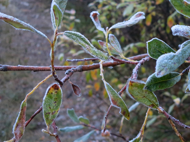
Frosted leaves in the morning – it’s cold for this time of the year! I had to bring my winter jacket on this outing and I was glad I did.
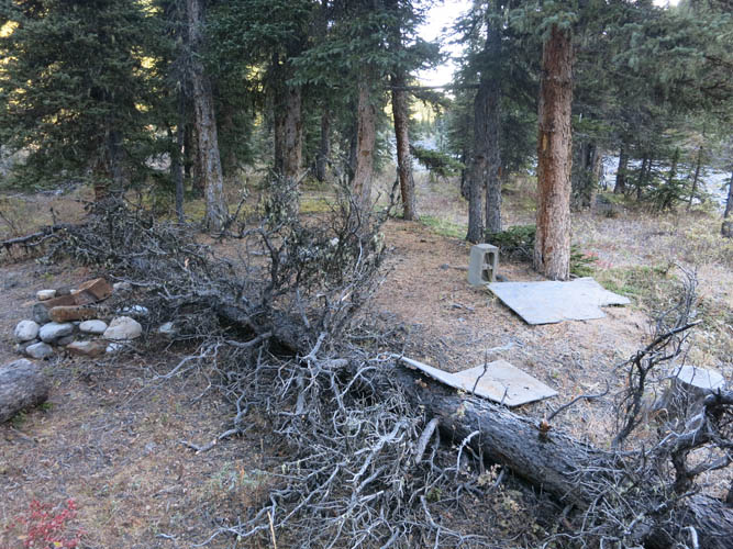
An unofficial camp site right by the ATV track (see map).
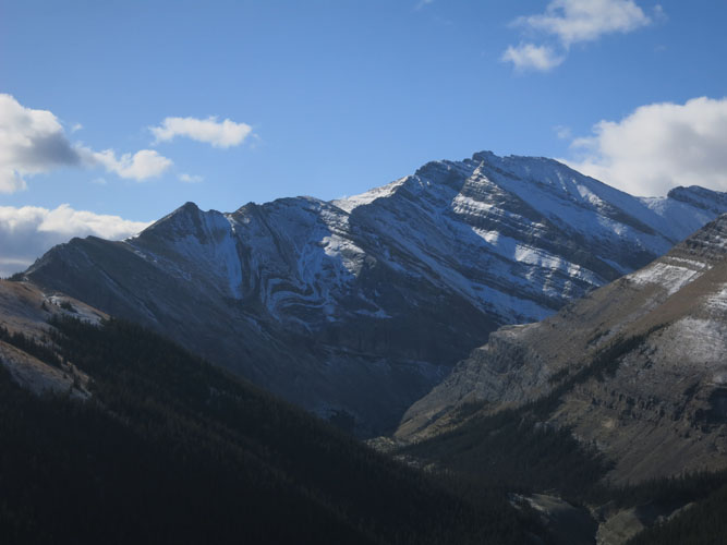
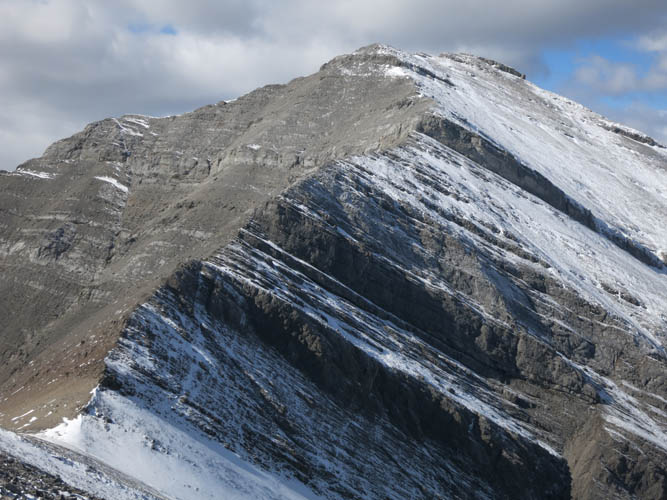
Zombie Peak appears to my left.
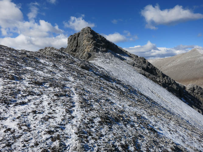
Gaining the east ridge above treeline. What a gorgeous day!
Looking back down the start of the east ridge.
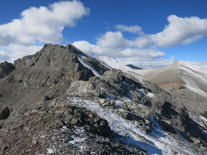
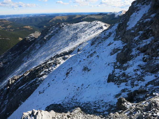
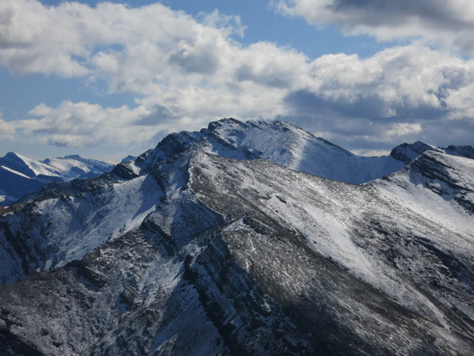
Otuskwan’s long east ridge.
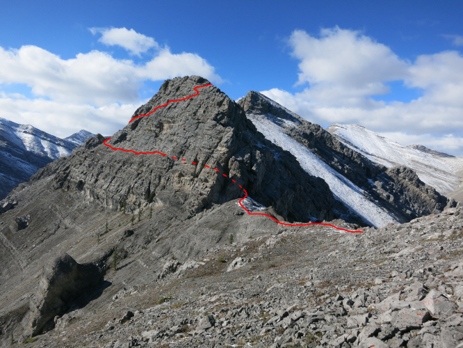
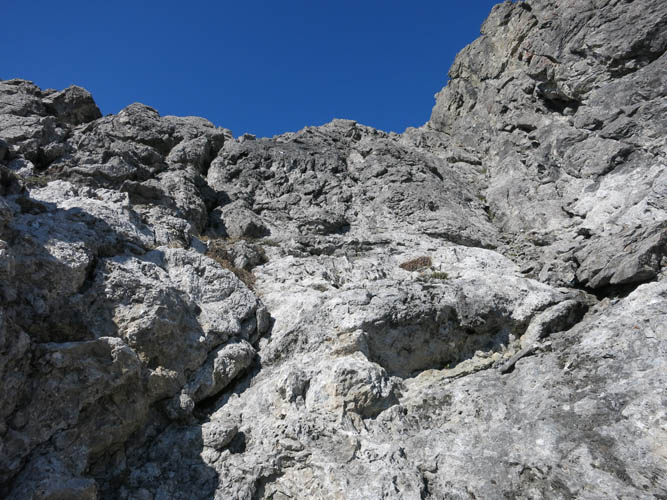
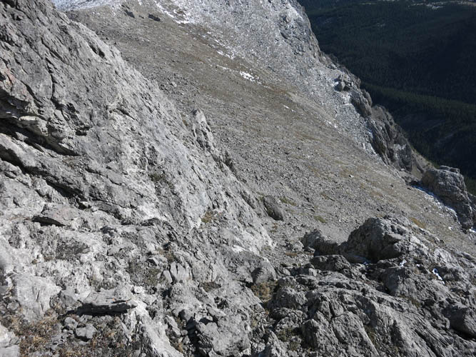
Approximate route to bypass the first obstacle that stands in the way along the E ridge. I followed a faint game trail that heads left along a ledge, then I scrambled up rock steps back to the ridge crest.
Looking back along the ledge.
View down the steep part of the first bypass. With a bit of route finding it’s all moderate scrambling.
Following a game trail towards the next obstacle…this one is circumvented on the right.
Looking back along the bypass of the second cliff band. The traverse along this north aspect is steep and potentially dangerous if there’s a significant amount of snow.
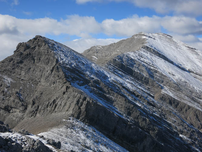
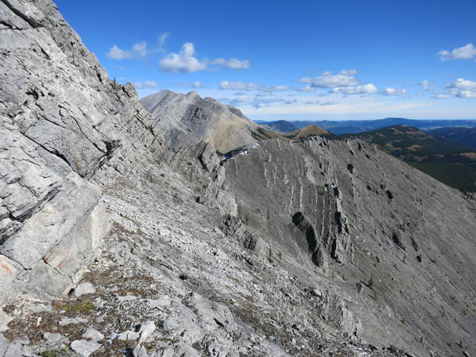
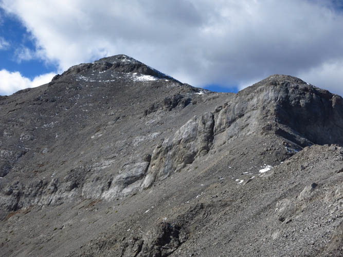
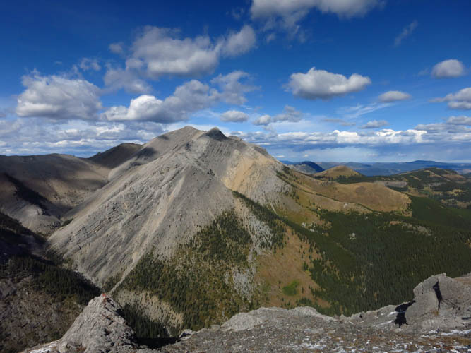
Plenty more challenges await on the way to Otuskwan’s summit (far right). The lowermost rock band seen here can be tackled via a weakness on the left.
Scrambling up the weakness.
Steep and with a few difficult steps.
More fun along the ridge!
I tried to climb up the ridge crest here, but the holds were too small for my big boots. Going around the left brings you to another break in the cliff.
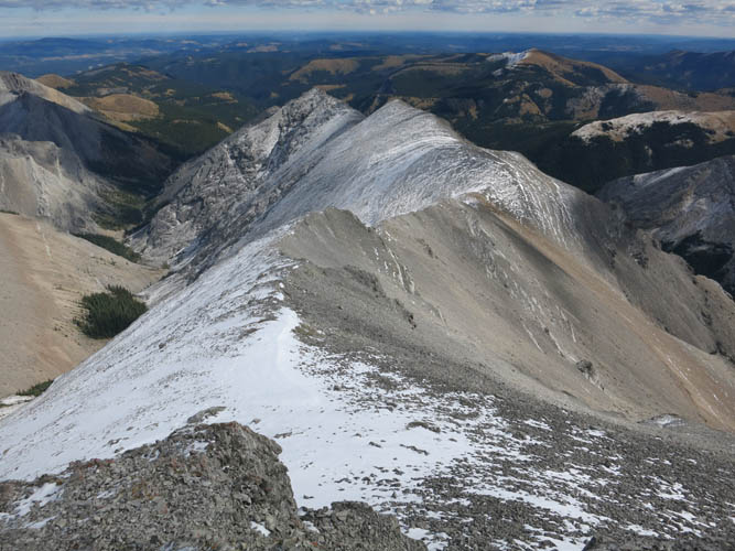
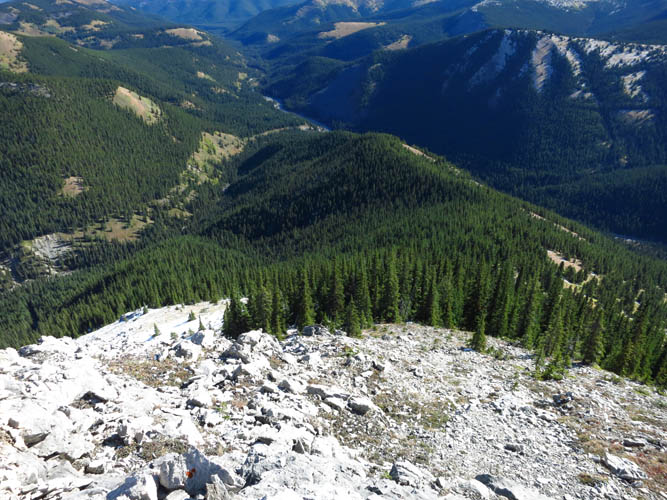
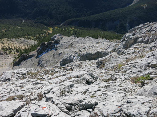
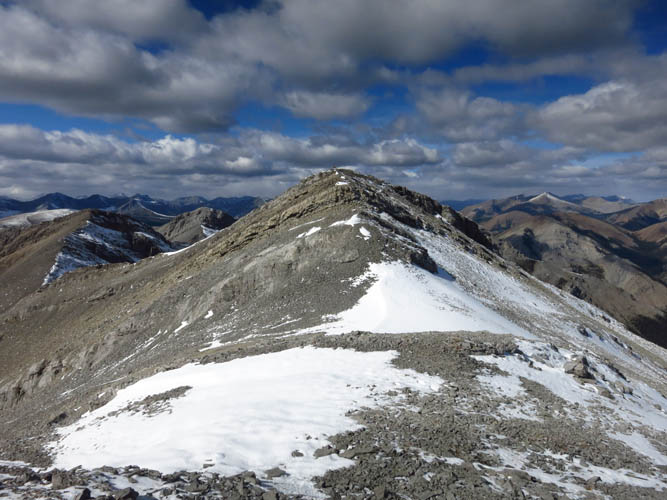
Looking back down the entire length of the east ridge.
Summit shots! The highest point left of centre is Zombie Peak.
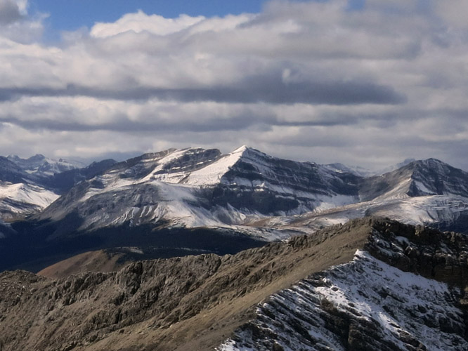
Panther Mountain
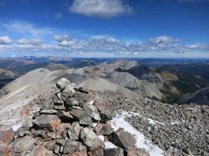
Otuskwan Peak’s summit cairn.
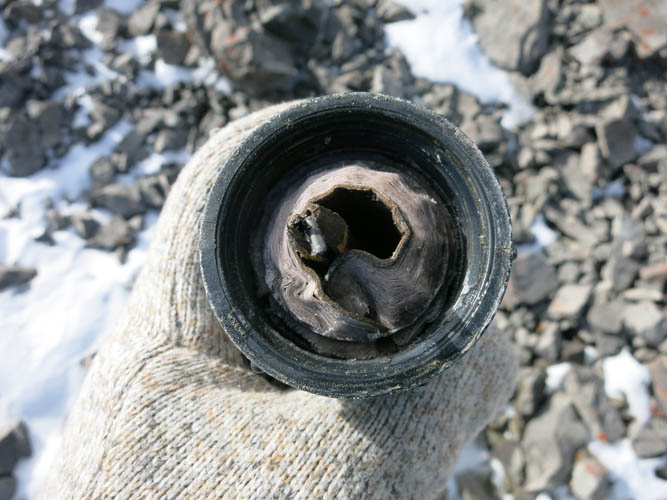
Frozen summit register.
The distinctive Ghost Peak to the south.
Close-up of Zombie Peak.
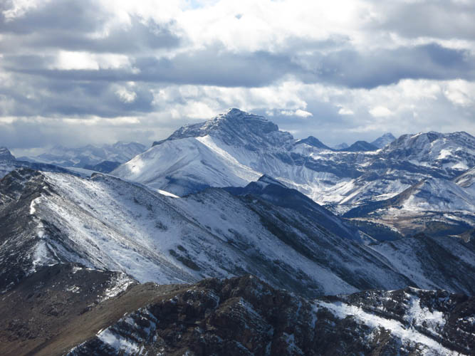
Lots of interesting peaks and ridges, including this unnamed mountain to the west.
Puma Peak

Looking NW
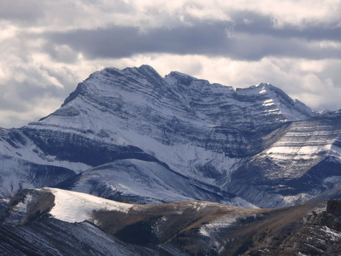
The unmistakable shape of Barrier Mountain (left), with Dormer Mountain to the right.
On my way back down, I turn to take another look at the summit.
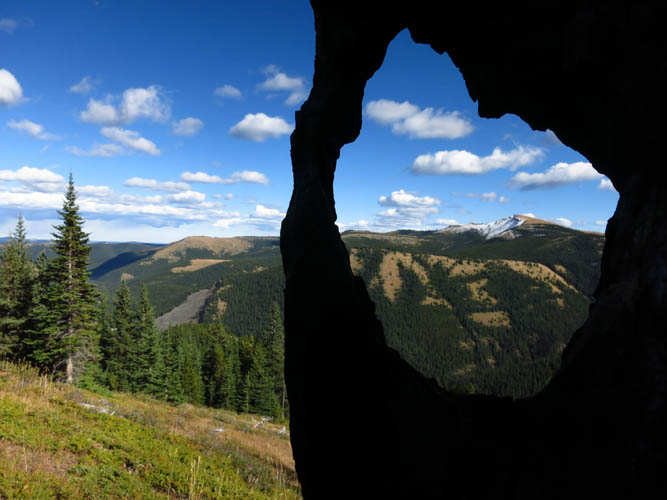
A burnt tree provides a great photo opportunity.
Sheep Creek and the ATV track.