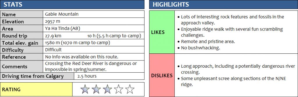
9 October 2017
With Richard
Combining Gable Mountain with Barrier Mountain for a short weekend getaway in the Ya Ha Tinda area was a trip that Richard and I had been keen to do for a long time now. Somehow, our plans were always put off… either by lack of time, lack of decent weather, or too much water in the Red Deer River that needs to be crossed to access the massif. Although this weekend didn’t look ideal in terms of the weather, with recent snow fall and temperatures below freezing point forecast for the night, we decided to just go for it as it also turned out to be my last trip to the Rockies this year before leaving Calgary.
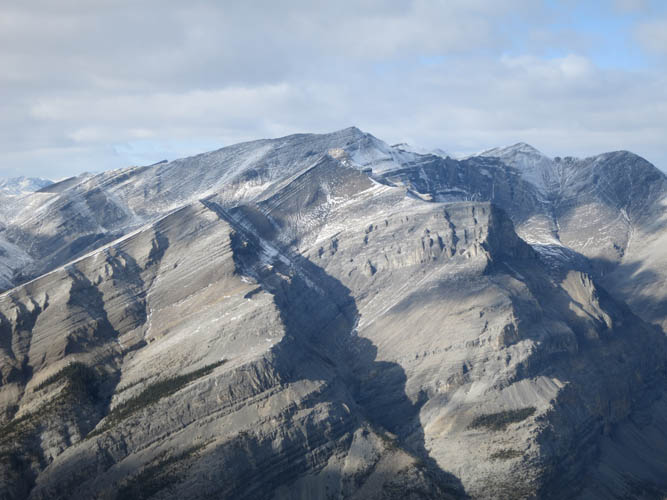
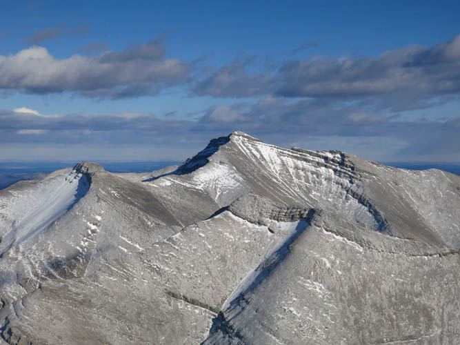
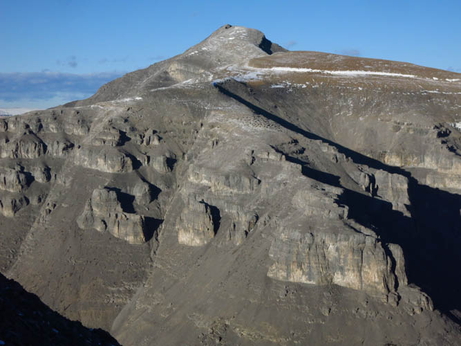
Barrier Mountain features prominently in the landscape of the Ya Ha Tinda front range peaks and I knew from a previous trip up Warden Rock via the west side that it would probably make for a really interesting outing with a pleasant approach. In 1992, Rick Collier and party ascended Barrier, Gable and Warden from a camp that they reached via the main NW valley from the Red Deer River, as documented on bivouac.com, but route details are scant. Our rough plan was to head up the creek to where it intersects with a tributary, set up camp, and then climb the NE-N ridge of Gable to its summit.
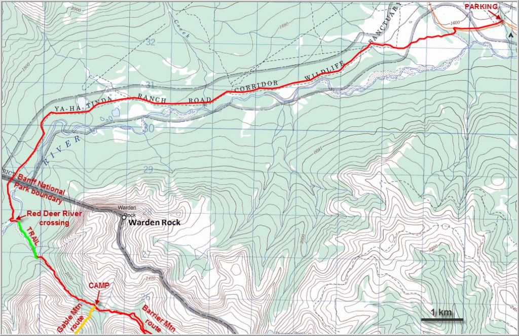
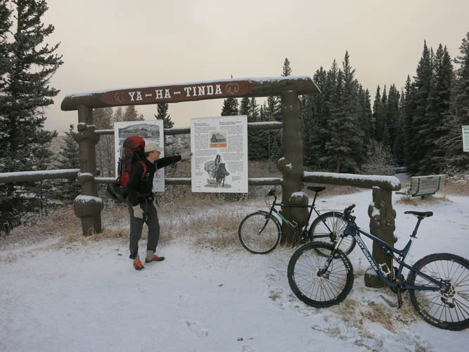
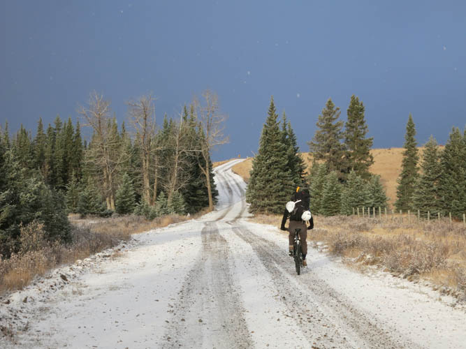
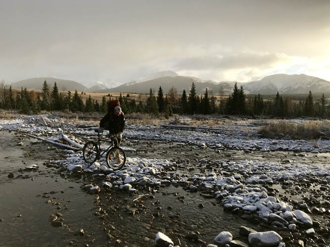
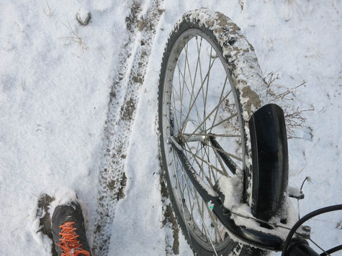
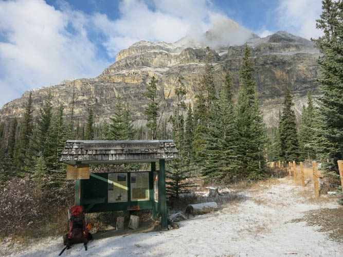
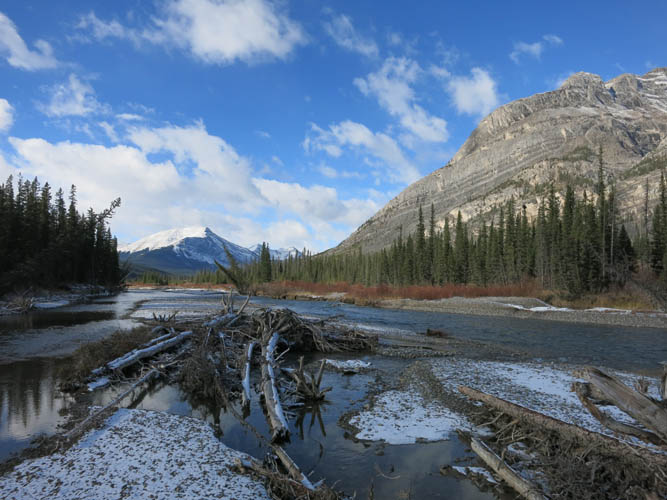
The bike ride along the gravel road from the Bighorn Campground to the Banff National Park boundary, familiar to us from previous trips into the western reaches of the Ya Ha Tinda, was quite fast (approx. 1.5 hours in, 1 hour out), although a thin layer of snow made it a bit more slippery than before. We stashed our bikes at the park boundary fence and continued on foot for another kilometer along the good trail before heading south to the banks of the Red Deer River. The snow cover wasn’t thick, but together with the rising temperatures and resulting meltwater it was enough to make us worry about crossing the river safely. Back in July we had been at this same point hoping to cross the river, but quickly forgot about the idea once we saw the raging water masses that were churning downstream. Today, fortunately, the river looked a lot tamer and the knee-deep crossing was nor more than a short and uncomfortable undertaking.
We hadn’t seen a soul all day, not even any tracks in the snow that had fallen overnight, so it was with a great deal of surprise that we discovered two tents perched on the embankment of the other side. A young couple appeared, looking just as baffled as we were, and explained that three of their friends had set off to climb Gable Mountain in the morning while they were resting up after doing Warden Rock the day before… Three other people in this remote area, climbing the same mountain on the same day as us?? What are the chances!?!
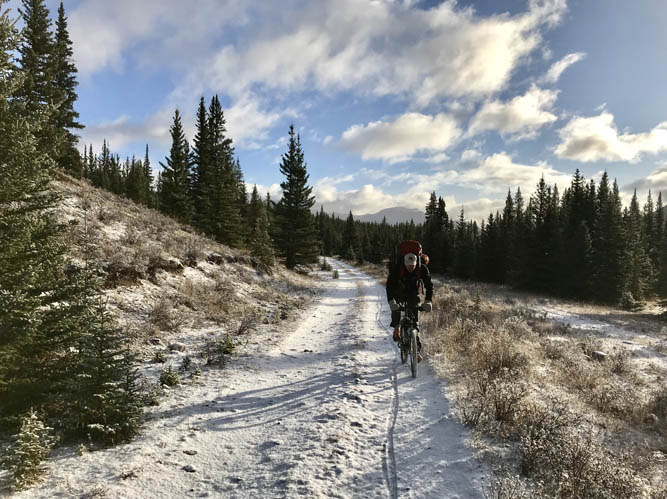
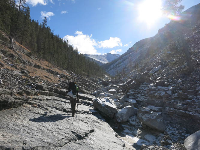
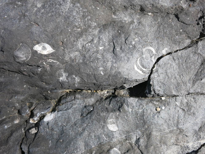
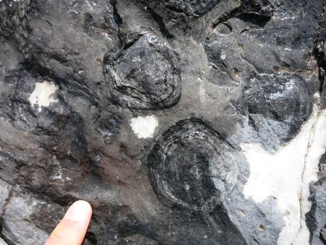
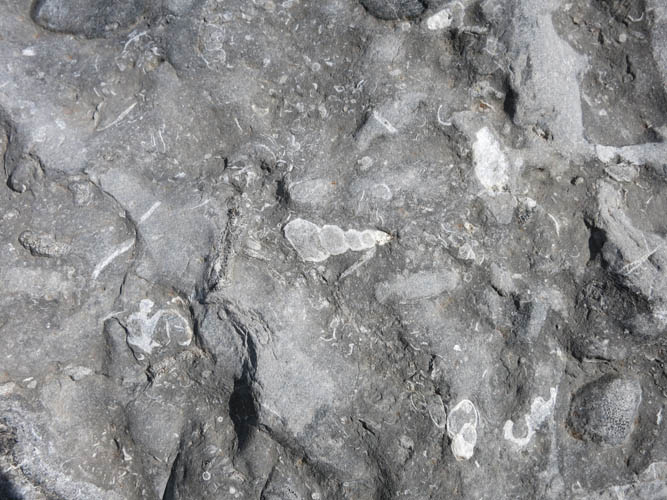
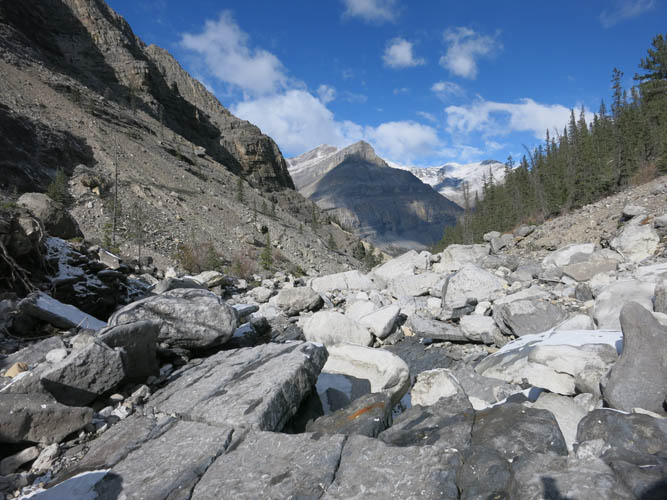
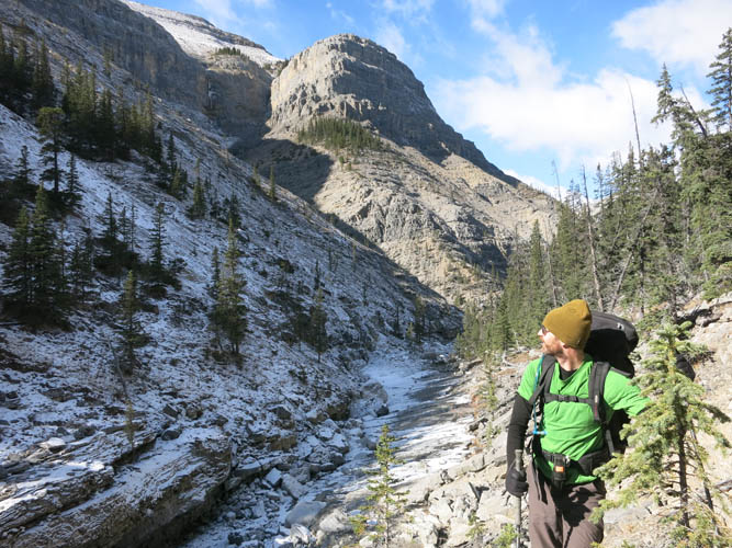
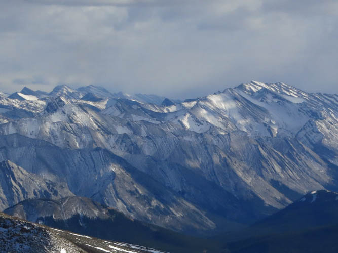
There is a decent horse trail on the left (east) side of the drainage that emanates from the NW valley between Gable and Warden Rock. We followed this trail until it peters out near a steep cliff in the creek bed, then hiked up a steep slope through light forest to the point where I had turned off for Warden Rock on my previous trip in 2016. Now some sidesloping was necessary to get back down into the creek bed, which we then followed with a few minor detours all the way to a small natural camp site at GR132725. This is a really pretty little valley, with tons of interesting geological features to admire along the way. Much of the rock in the creek bed is exposed in the form of smooth, gently dipping slabs that are a joy to walk on, but there is quite a bit of boulder-hopping, too. Some of the beds revealed an abundance of fossils including shells, corals, gastropods (snails), and algal concretions. The tilted slabs are interrupted by short rock steps and small waterfalls that replenish pretty pools and round puddles carved into the surface. It was a formidable sight and both Richard and I really enjoyed our stroll through this little piece of paradise. While there wasn’t much water lower down in the drainage, which made us a bit worried about finding a source of water at first, a small stream appeared in the upper portion of the creek. Our campsite, only metres away from the creek, was perfectly positioned on a small patch of grass in a little dip sheltered by the trees.
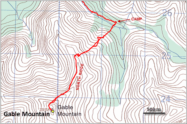
After setting up our tent and dropping all the overnight gear, we wasted no time and embarked on the actual climb. It was already 1 pm and we wanted to be back before nightfall, which was around 8 pm at this time of the year. We didn’t know much about Rick Collier’s ascent back in 1992 and exactly where he had ascended the ridge leading up to Gable, so we decided to stick to what we had mapped out ourselves based on satellite images.
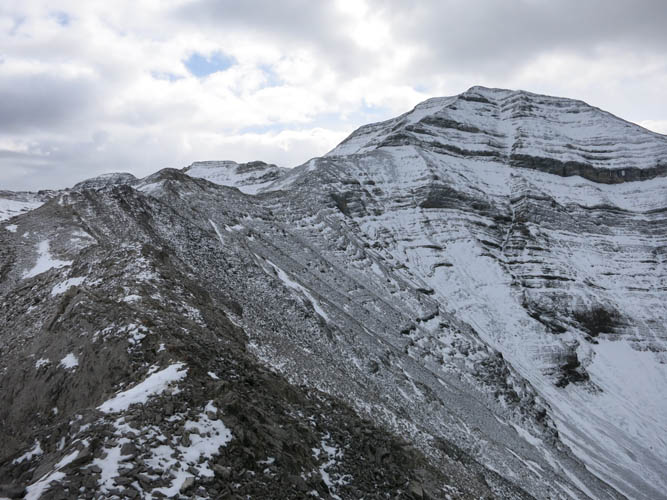
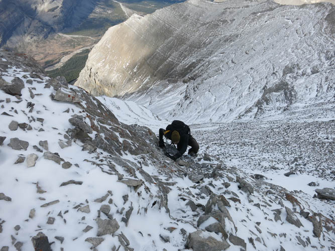
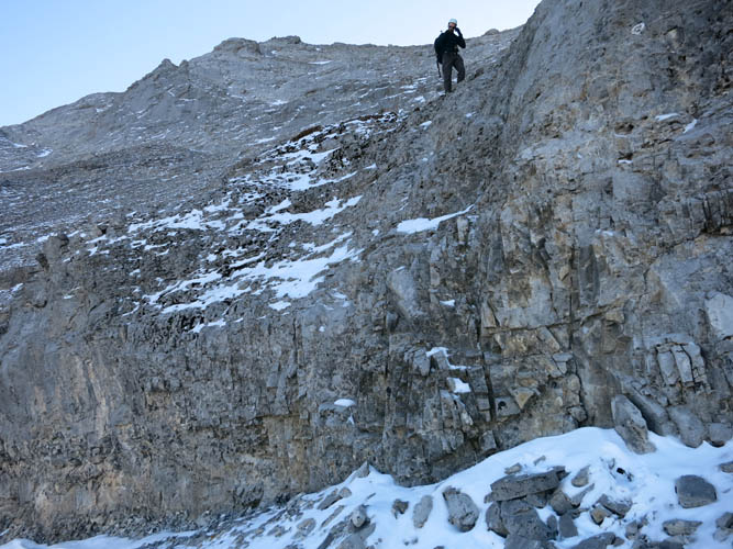
From camp, we headed straight up the forested lower slopes on the other side of the creek. We quickly reached treeline and then had to trudge up some unpleasant rubble to gain a subsidiary ridge that extends in a northeasterly direction from Gable’s north ridge. A small cliff band not far above the last tree stands was easily overcome, but higher up past some brown shale and annoying scree we encountered the crux of the day: a prominent rock band, some 4-5 metres high, was blocking our way. The only weakness we could find in this vertical wall was about 30 metres to the left of the ridge crest, where a few awkward steps on small holds and downsloping rock allowed us to climb above it. Although the crux is short and the exposure moderate, it’s definitely in the realm of difficult scrambling. We regained the crest of the secondary ridge and enjoyed some more easy to moderate scrambling to where it connects with Gable’s main north ridge.
We had quite the surprise as we topped out: There they were, three small figures slowly moving on the neighboring ridge to the west! Our three mystery friends from the two tents we had discovered earlier in the day down by the Red Deer River! They must have taken a very challenging route that landed them on Gable’s NW ridge, we thought, and their ridge certainly didn’t look easy. They were at about the same elevation and at the same distance from the summit as us, but we lost sight of them about an hour later and would never run into them as it turned out.
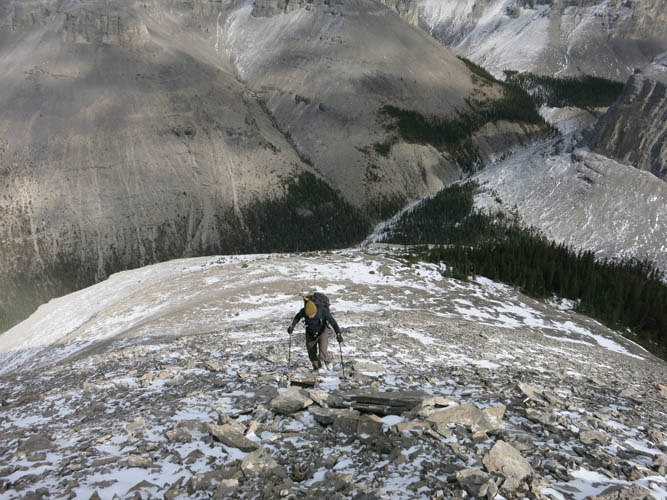
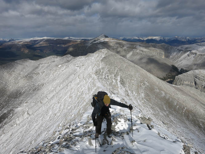
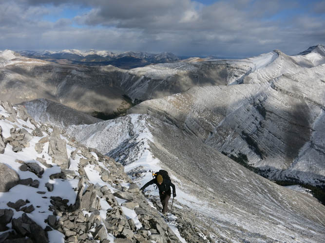
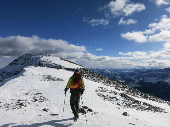
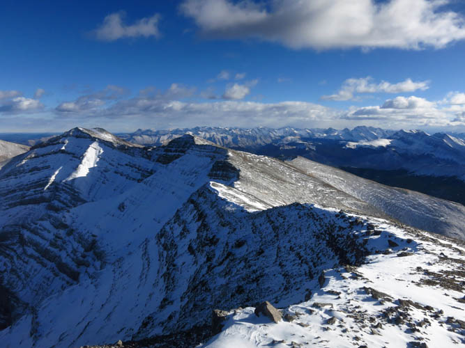
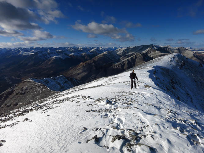
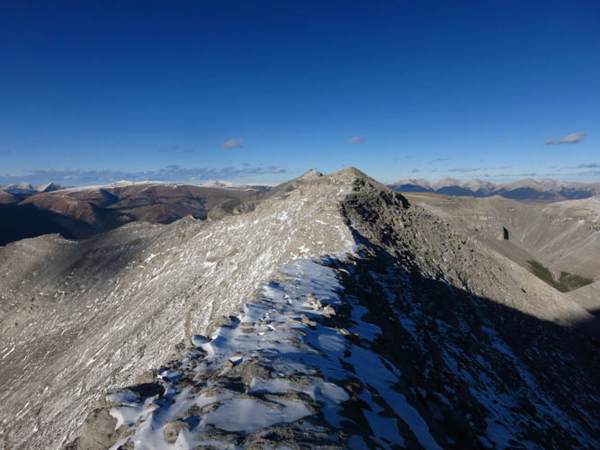
Up until now, Richard and I had been going for a good 6 hours and were starting to feel the effects of today’s early start and the long approach. But having Gable’s summit finally move into sight was a big boost and were happy to embark on the final stretch of our ascent. The north ridge (it really trends NE to NNE to N, to be technically correct) is a thoroughly pleasant affair. There are no major roadblocks so it’s easy enough, but a few sections are narrow and slightly exposed, which was a welcome change and made things interesting. Most difficult spots can be bypassed, except near the end where the angle gets steeper and there are fewer options to detour around them. Lots of hands on scrambling here, but the rock is often loose and chossy so wasn’t as enjoyable as we had hoped for. We also had a few patches of snow, which made things easier in some parts while most of the time it actually made it more slippery and treacherous. We had to move carefully as chunks of rock we stepped on would suddenly shift and seemingly solid holds would break apart.
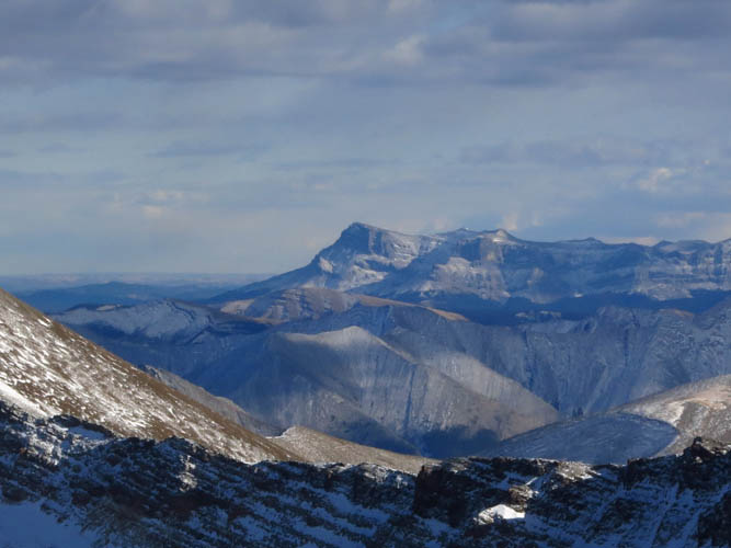
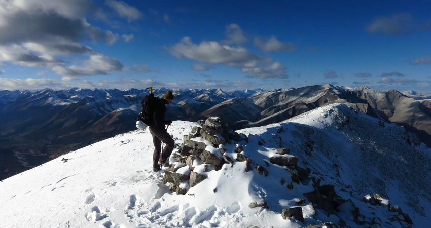
Strong winds were pounding us as we arrived at a false summit 200 m north of the true summit. An easy walk took us to the huge summit cairn, which reminded me of that on Dormer Mountain. It almost seems like someone had too much time to build this! Perhaps from a survey crew? I’m not sure, but this certainly does not seem like a popular destination for scramblers. We poked around for a bit to see if we could find a register, but quickly gave up preferring to shelter behind the ridge to get out of the fierce wind.
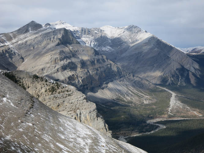
As we sat down for a quick bite and to send an OK Spot message home, we discussed options for an alternative return. The valley directly below us to the east looked promising and I vaguely remembered Collier returning this way. Loop routes are usually more interesting than a simple back and forth, but they carry their own set of risks and pitfalls. We would’ve liked to explore this little side valley below us, but were pretty intent on making it back to our camp before dusk, so in the end we concluded it only made sense to simply backtrack the same route we came up.
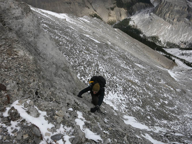
Going back down almost took as long as going up, as the many steep sections along the ridge and the crux required cautious movement and quite a bit of concentration. Nonetheless, we enjoyed the descent even more now that we simply had to retrace our tracks in the snow and the few cairns we had built to guide us back down.
It was 6.30 pm when we got back to our camp. Hungry, tired and cold, we were really glad we had brought our stove and all the extra layers. After a long chilly day there is nothing better than recharging with a nice hot meal and a cup of hot chocolate! Down here in the valley there was no wind at all and it was a beautiful moon-lit night, the air crisp and the cloudless sky clustered with stars. We wrapped ourselves in our sleeping bags like mummies and enjoyed a surprisingly comfortable sleep despite temperatures down to -10°C. A good night’s rest was exactly what we needed in preparation for the next day’s objective – Barrier Mountain.
For a detailed map of the area, including all existing trails and many possible scramble routes, see the Ya Ha Tinda & Surroundings Trail Map on Avenza (a free mapping app for offline navigation and tracking). The map is also available in print at MapTown or GearTrade.