
15 July 2017
With Richard
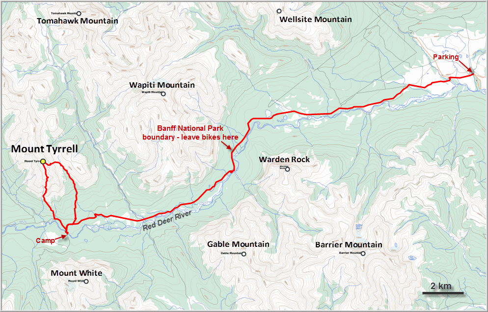
Our original plan for the weekend had been a camping trip in the Ya Ha Tinda area to scramble up Gable Mountain on one day and Barrier Mountain on the next. However, when we got to the point where the Red Deer River needs to be crossed after biking in the first 13 km and hiking another kilometer down to the river, we quickly realized that fording the water was not a good idea. Large volumes of water were gushing down the valley and the current seemed dangerously strong. While we couldn’t see to the bottom of it at the deepest part in the middle of the river, we suspect it would’ve been at least hip-deep.
We had read about the Red Deer River often being unpassable in spring and summer (and even well into the fall) due to high water levels, but had never seen it for ourselves. Fortunately, we had prepared a Plan B, which involved simply continuing on the horse trail further west into Banff National Park where we would try to find a suitable camp site from where to explore Mount Tyrrell to the north and Mount White to the south.
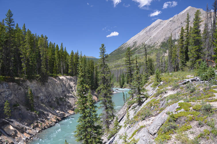
The trail leading from the Banff National Park boundary between Wapiti Mountain and Warden Rock west towards the Scotch Camp warden cabin is flat, in good condition, and delightful to hike along. Despite our heavy overnight packs we made good progress and reached a really nice spot to set up camp right by a bridge that leads over the Red Deer River (GR134724). The distance is not to be underestimated, though: it’s more than 23 km from the parking lot at Bighorn Campground near the Ya Ha Tinda Ranch.
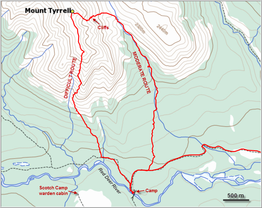
After a nice lunch break and getting all our gear re-packed, we eventually set off at the late hour of 3 pm for our Mount Tyrrell summit bid. Not much information is available on this mountain; in fact, I could only find a rather cursory description by the famous Rick Collier (who else?!), who had climbed Tyrrell from the valley to the east. My research suggested that the south ridge should also provide possible ascent routes – perhaps even a very easy one, judging by Google Earth satellite images and a single photo of the mountain I found.
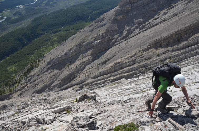
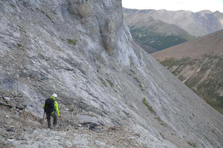
While there may be an easy route up on the south side, we certainly weren’t on it where we ascended! From camp, we first followed another very good horse trail leading further west towards Lake Louise for about 1 km before leaving the path and heading up gently undulating slopes through very light forest towards the northwest. Arriving at the start of the well-defined ridge, we were a bit baffled by how steep and exposed the terrain got. To avoid the narrow and exposed spine itself, we veered further left (west) where flat slabs of light grey limestone offered good grip for our boots and we were able to gain elevation quickly. But as is often the case on slabby terrain, the higher we got, the steeper the slabs. Becoming increasingly uncomfortable with the exposure and not knowing what was to come on the jagged-looking ridge crest above us, we decided after a while to sideslope along cracks and narrow ledges into the drainage to our left. It simply wasn’t safe anymore to continue on the wide open slabs of smooth rock that were now so steep, our boots were pushing the limits of friction. With a myriad of options and lots of exposure everywhere, I can see how it’s really easy to get into trouble in this type of terrain, therefore I wouldn’t recommend this route at all.
We found a good way off the slabs through some delicate treading along weaknesses that took us into the much easier drainage. I should say “initially easy”, as higher up even the drainage became considerably steeper and required difficult yet enjoyable scrambling in several sections before we topped out on the summit ridge.
Relieved to have put the steep ascent slopes behind us, we paused for a moment to take in the magnificent views over the broad river valley to the south. The whole area was unfamiliar to us, so it was exciting to scan the landscape trying to figure out what the peaks are and where the valleys could lead. Looking north, we realized that we still had quite some work to do along the summit ridge! The first section in particular looked quite complicated. There was a steep cliff along the ridge crest, which had to be bypassed on the right (east) by contouring across steep, broken rock. Slippery mud added to the challenge on this moderately exposed face, but had there been any snow or ice it would’ve been a no-go.
Back on the ridge crest, it was mostly an easy hike for another 800 m to the summit. The cairn here was apparently built by Rick Collier, Bob Saunders and Reg Bonney on their first recorded ascent on Canada Day in 1991, but the black plastic canister they’d placed as a register was broken and the notepad in bad shape. Perhaps lighting had struck the meagre-looking summit cairn since their visit, with evidently no other visits recorded. I repackaged the original notepad, but wonder how long my Nutella jar will last (Nutella plastic jars are by far the most economical register solution for me, given my voracious appetite for the stuff – my rate of consumption routinely exceeds the rate at which I can place registers).
It was already 7 pm now and light rain squalls were moving in from the west. Instead of heading back down the south side with its steep gully and smooth slabs, which would surely make for a slippery ride when wet, we descended directly east of the summit down slopes of rubble and in places even some soft scree. The east face of Mount Tyrrell looked feasible from here, certainly easier than the way we had come up, although there were some cliff bands lower down that we couldn’t clearly see. The slopes were broad and there seemed to be plenty of options to bypass potential road blocks, so we were willing to take the risk. Thankfully, it all worked out just fine. There were two cliffs half-way down that could be broken down into manageable steps and some fun moderate scrambling. A small waterfall at the lower one of the cliffs provided a good opportunity to replenish our water supply.
Below the cliffs we easily hiked down to the col between Tyrrell and the small, rounded outlier to the east. From here, it was simply a tramp along the creek in the valley (some minor bushwhacking) and later through open grass and light forest back to the horse trail near our camp. We were lucky that the dark clouds that had threatened to dump a big rain shower on us had slowly dissipated, leaving us to enjoy our dinner and a short but lovely evening outside our tent. It had been an adventurous and tiring day and we were really hoping that our planned ascent of Mount White the next day would perhaps be a little less demanding…
For a detailed map of the area, including all existing trails and many possible scramble routes, see the Ya Ha Tinda & Surroundings Trail Map on Avenza (a free mapping app for offline navigation and tracking). The map is also available in print at MapTown or GearTrade.

DISCLAIMER: Use at your own risk for general guidance only! Do not follow this GPX track blindly but use your own judgement in assessing terrain and choosing the safest route.
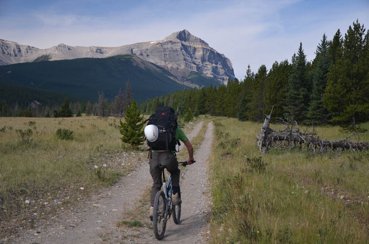
Mandatory shot of Warden Rock on our 13 km bike ride towards Banff National park boundary.
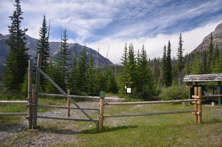
The park boundary. No bikes are permitted beyond this point.
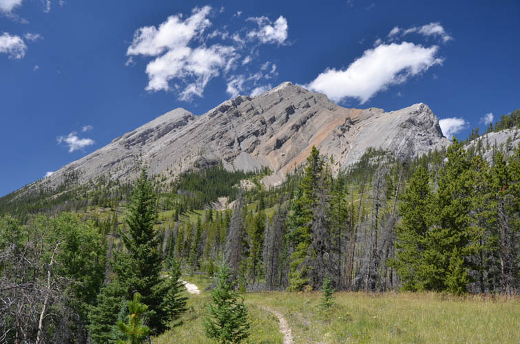
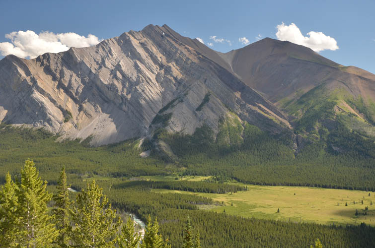
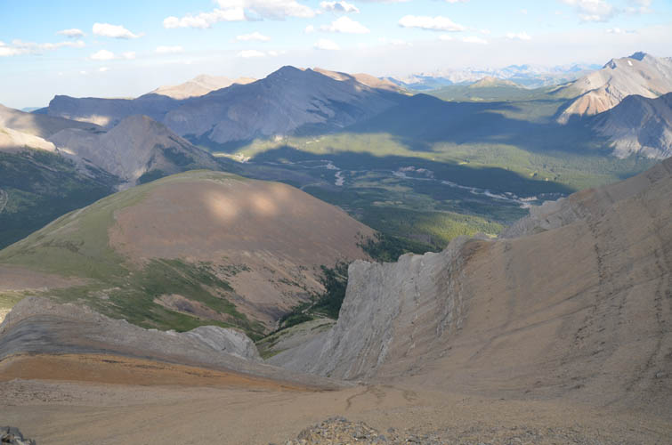
The Cascade Fire Road has been decommissioned and is now mainly used by horse riders. Mount White beckons in the distance.
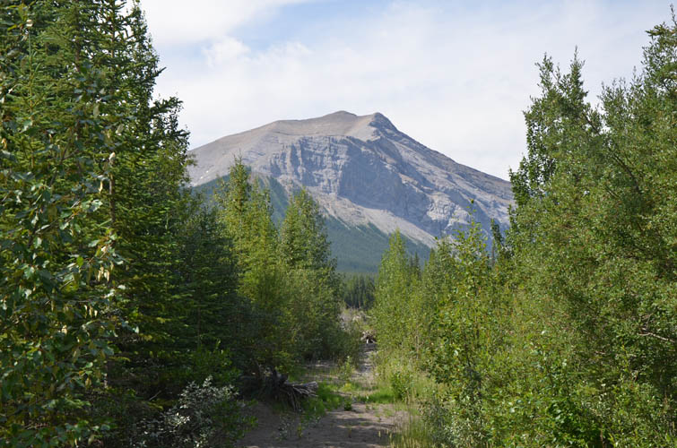
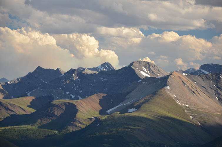
The weekend’s first objective comes into view: Mount Tyrrell on the left.
The approach is long but pleasant, with a mix of forest and open meadows.
Bleat Peak sits far to the west of our approach trail.
Prow Mountain (left) is another rarely ascended peak in Banff National Park.
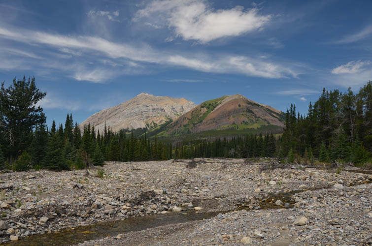
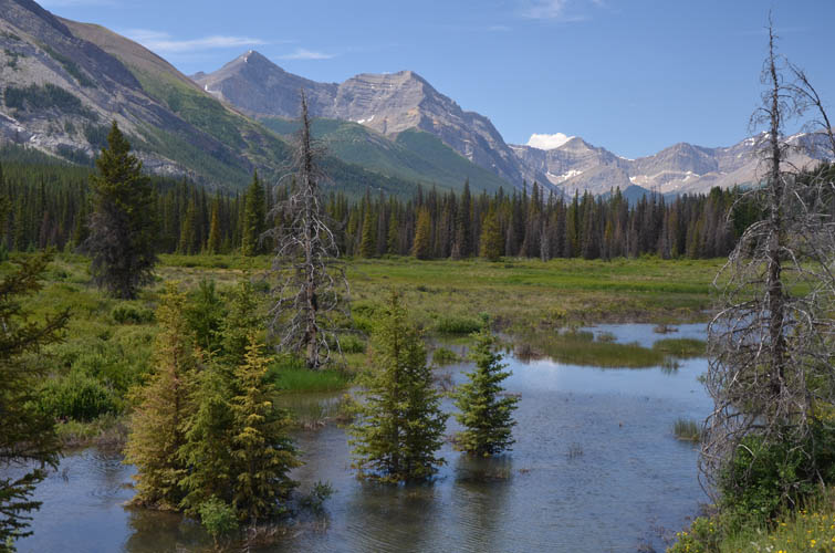
Near our camp at the Red Deer River.
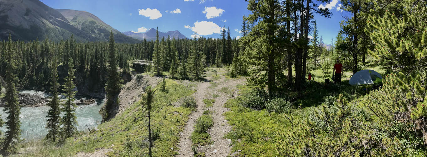
A nice, secluded spot for our tent right by the river. [Photo by Richard]
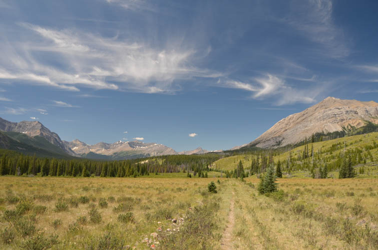
We continue on the path towards Divide Pass/Lake Louise. Mount Tyrrell behind.
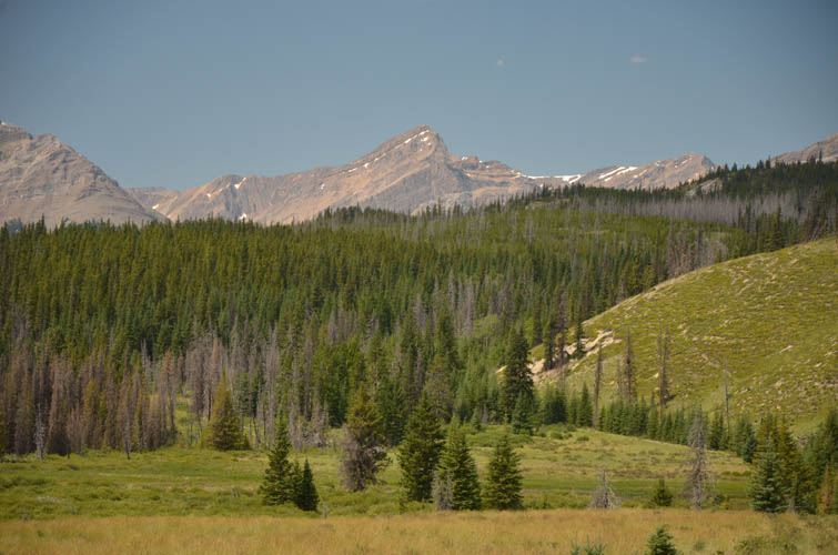
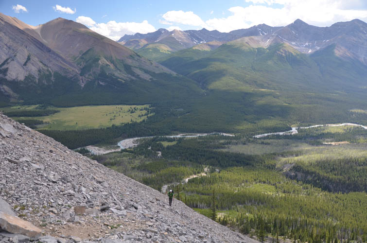
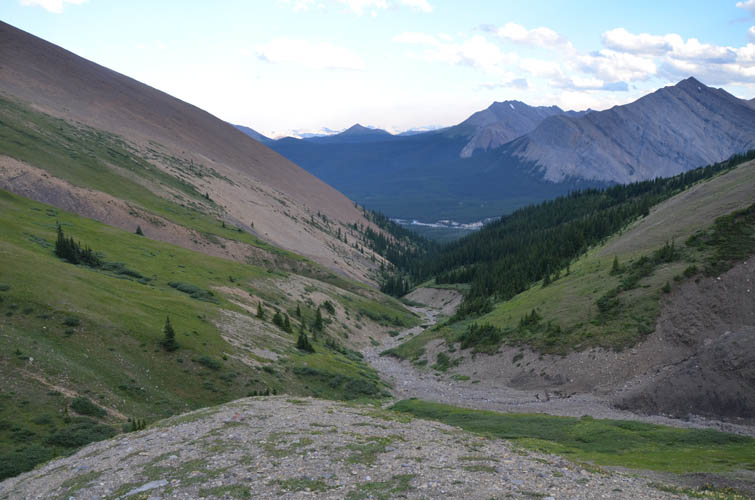
A look at neighboring Mount White to the south as we gain elevation.
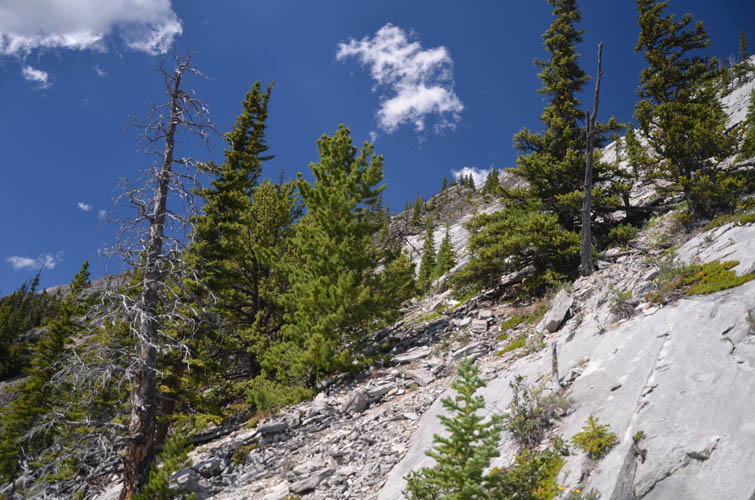
The start of Tyrrell’s south ridge: it gets steep really fast!
Richard slogging up some rather unpleasant rubble to avoid the steep ridge.
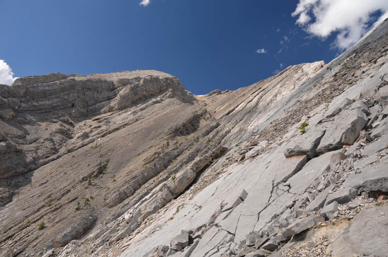
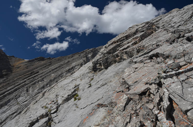
Now there’s no avoiding the steep parts anymore. It’s SLAB terrain all the way up now!
It’s steeper than it looks!
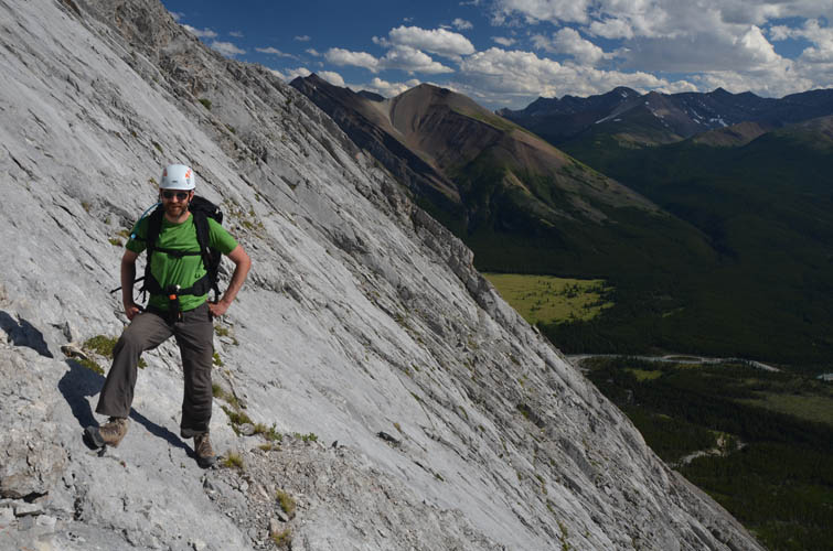
Good solid rock. Not easy because of the angle and exposure.
These friction slabs are hard to assess because they can get steep pretty fast and you just don’t know what’s beyond them. [Photo by Richard]
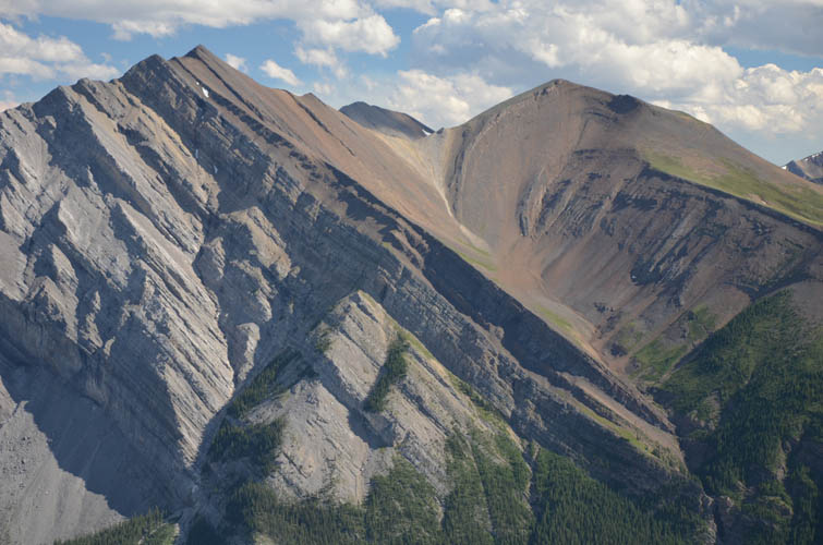
Mount White. We ascended this mountain the next day via the sub-peak on the right, then hiked down the major drainage in the middle before veering right to avoid a cliff in the trees below.
Traversing along narrow weaknesses, we manage to get off the steepest terrain into an easier drainage.
Another look at Mount White from higher up.
Mount Drummond
Cataract Peak
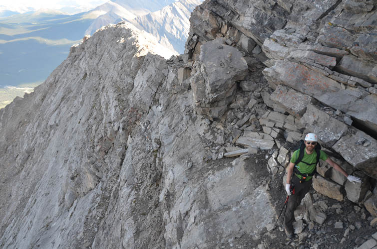
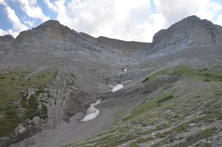
Right at the start of the summit ridge, the crux awaits: an exposed traverse across broken blocks of rock to get back on the ridge crest.
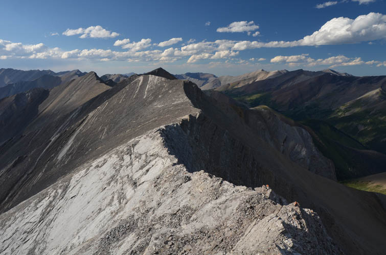
Tyrrell’s summit ridge. The summit is the dark high point just left of centre.
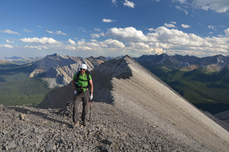
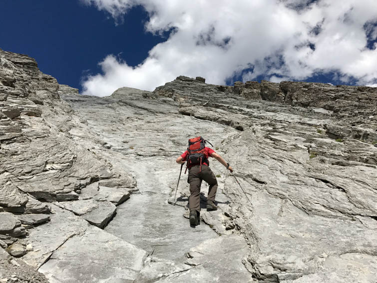
Finally an easy stretch!
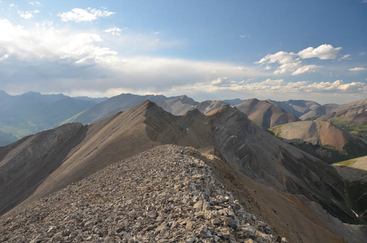
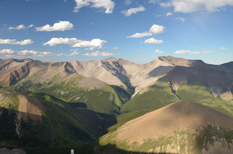
View from the summit to the north: the ridge continues for quite some distance.
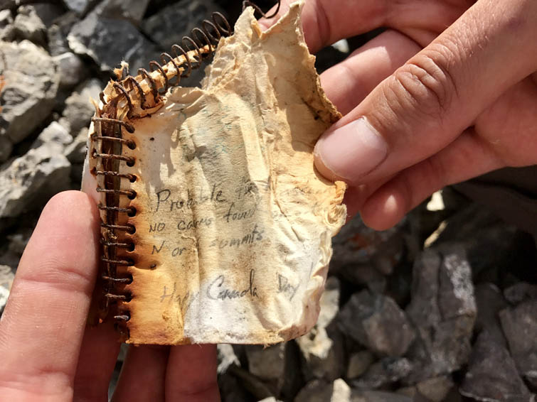
Not much is left of the original summit register placed by Rick Collier et al in 1991. [Photo by Richard]
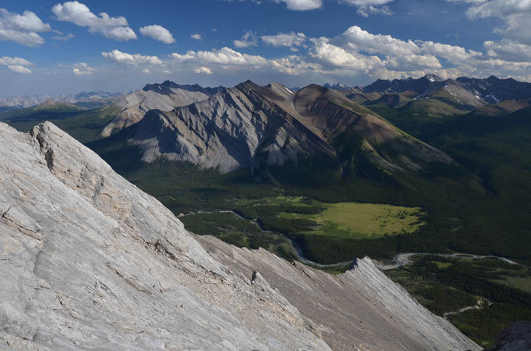
A beautiful landscape opens up to the east: Wapiti Mountain is on the far right, while Tomahawk Mountain is barely visible on the far left edge of this photo.
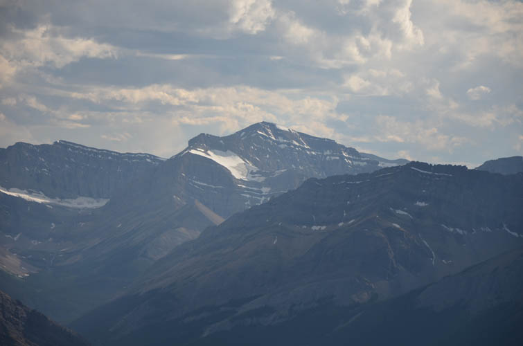
Close-up of Tomahawk Mountain (centre).
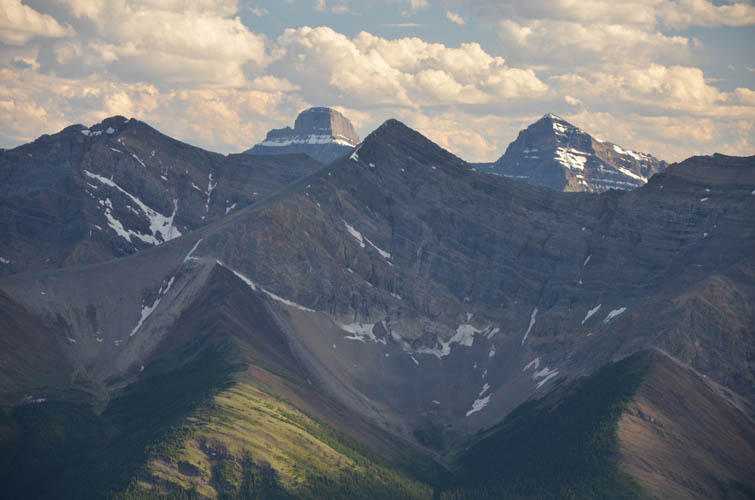
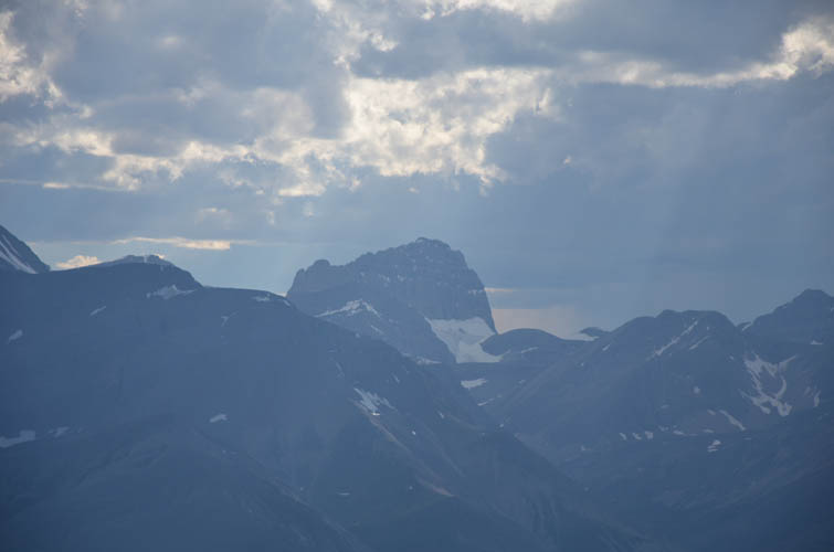
Mount Saint Bride (left) and Mount Douglas (right) are very distinctive peaks far to the SW. The pyramidal peak in the foreground is Prow Mountain.
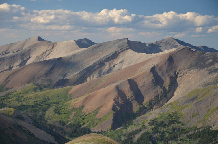
Countless unnamed peaks grace this pristine landscape.
Descent down the eastern slopes directly below the summit.
Two cliff bands are the last hurdles of the day.
Looking back up at the east face of Tyrrell with the grey cliff bands that we scrambled down in the middle.
The small creek valley between Mount Tyrrell and its eastern outlier, looking south. Mount White is in the distance on the right.