6 June 2016
With Richard
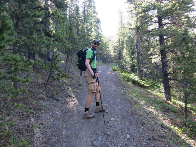
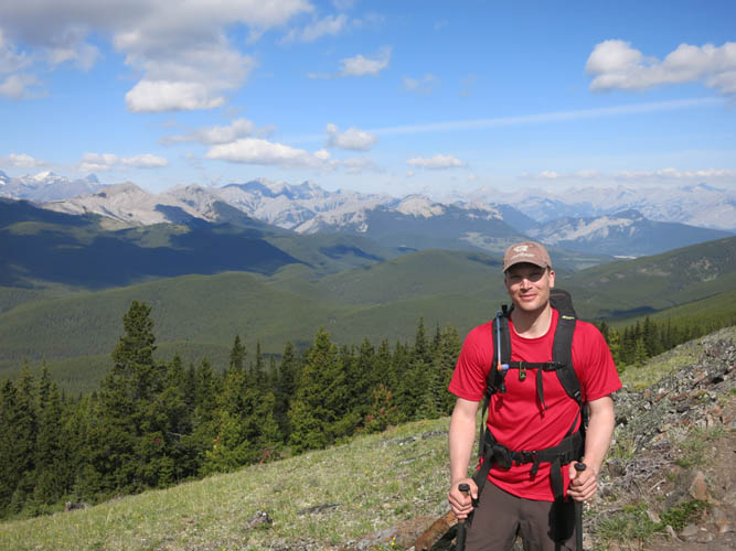
I hadn’t gone out to the mountains with Richard in a long time after his knee injury the previous year and it was nice to finally be hiking together again. This was his first hike up a “real” mountain since recovering, so it was a bit of a challenge both physically and mentally. It turned out he mastered the challenge perfectly and surprised both of us with a steady fast pace and a terrific round-trip time!
Powderface Trail had been closed for almost 3 years since the historic June 2013 floods that had ravaged many valleys, streams and trails. I’d never explored this part of the Front Ranges before but now I can say that it is definitely worth visiting! It’s full of gently rolling hills and low mountains with a multitude of trails that run from ridge to ridge and highpoint to highpoint. And once again there are hardly any people! (Ok, by European standards at least!). I will never understand how on such a beautiful summer day, so close to Calgary with a million people, there are almost no cars on this gravel road and only a dozen people on the trail we took. When we got to the trailhead around 9 am, there was only one other car in the parking lot at Lusk Creek!
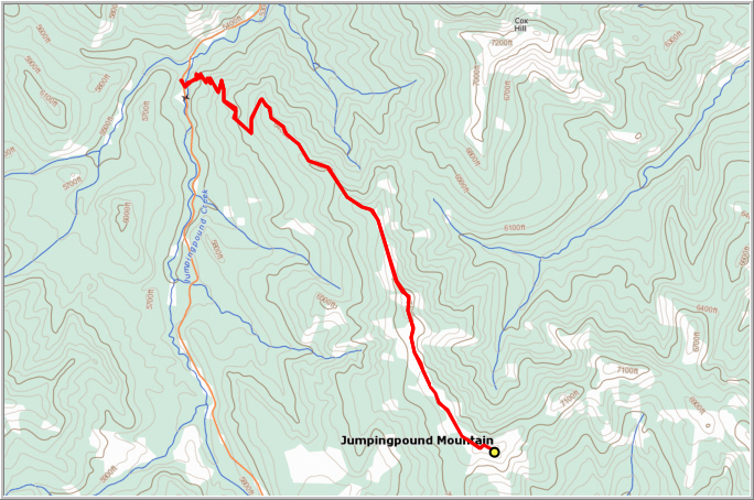
There’s not much to say about the first part of the hike. From Lusk Creek parking lot, an excellent trail winds its way through the forest in lazy switchbacks until in about an hour and a half you reach an intersection. The left path goes to Cox Hill, the right to Jumpingpound Mountain. We only met one other pair of hikers on the way up.
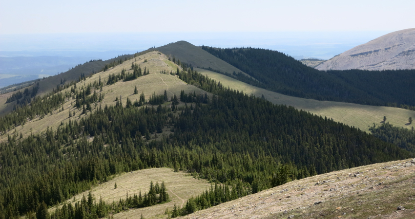
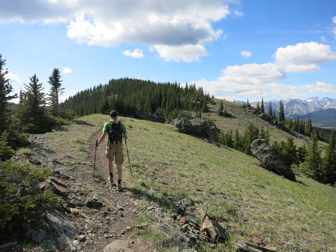
The ridge offers a lovely walk through broad meadows interrupted by short patches of forest all the way to the summit of Jumpingpound Mountain which lies some 3-4 km south of the intersection. I loved the vistas to the west because the very first range of “rocky” peaks can be seen really well from here: there is the distinctive Tiara Peak, flanked to the north by Belmore Brown Peak, Boundary Ridge Peak, Midday Peak and Midnight Peak. To the east sits Moose Mountain, the fire lookout barely visible at its summit. After a short break at the summit, we headed back the same way. It was only shortly before lunchtime and we ran into several groups on the way down – some on mountain bikes, some with dogs, some with young kids – just all kinds of people enjoying themselves in our beautiful nature backyard. Apparently, most of them prefer to sleep in and start late! I can’t blame them :).
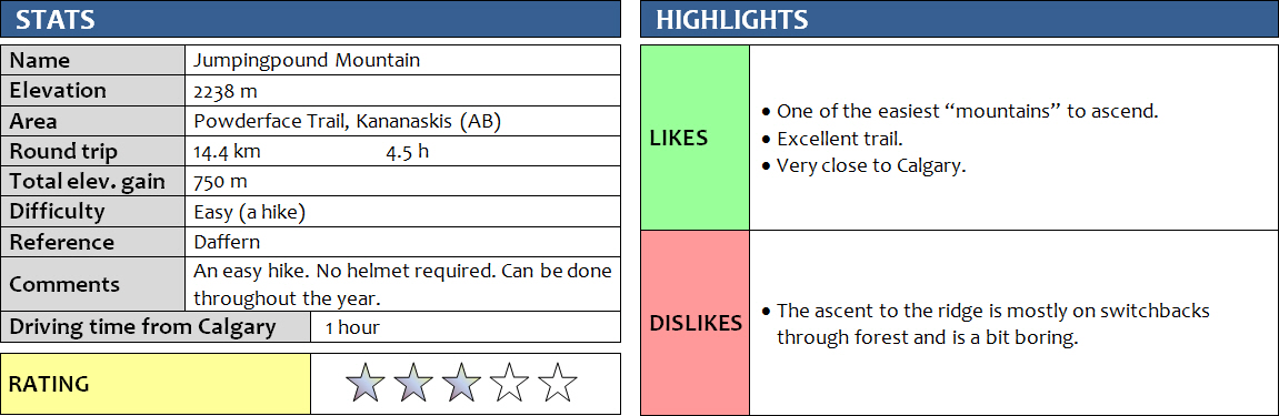
DISCLAIMER: Use at your own risk for general guidance only! Do not follow this GPX track blindly but use your own judgement in assessing terrain and choosing the safest route.
The perfect trail for an easy, stress-free hike.
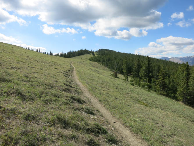
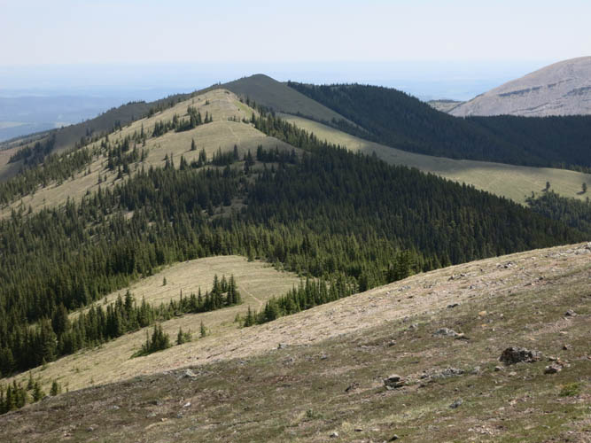
The trail follows the gentle ridge that stretches south.
Pleasant hiking on a perfect day out!
Happy to be out in the mountains!
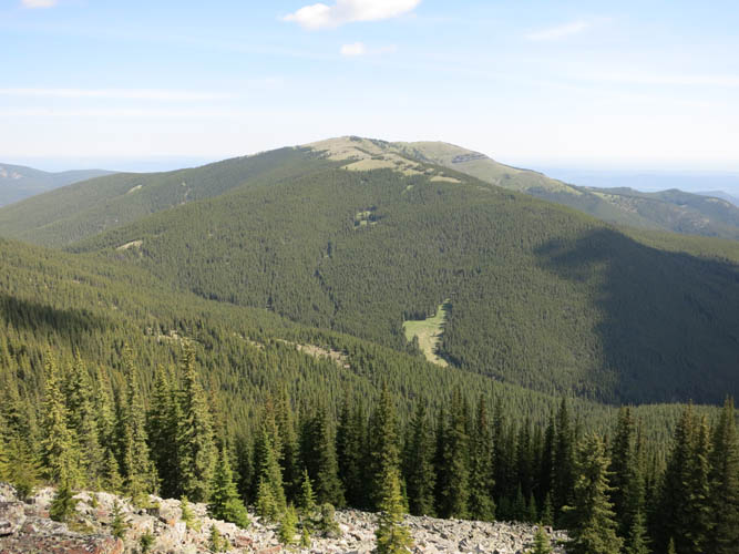
Cox Hill, another easy hike to the northeast.
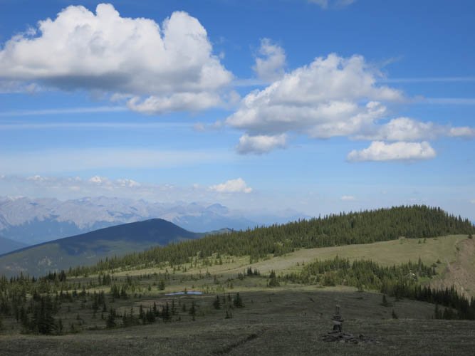
Moose Mountain to the east.
The unmistakable shape of Tiara Peak (just right of centre), one of the Front Range peaks accessible from both east (Powderface Trail) and west (Hwy 40 via Porcupine Ridge).
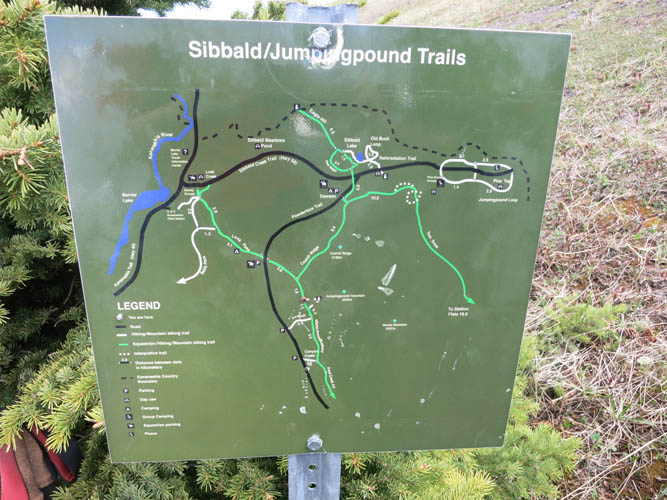
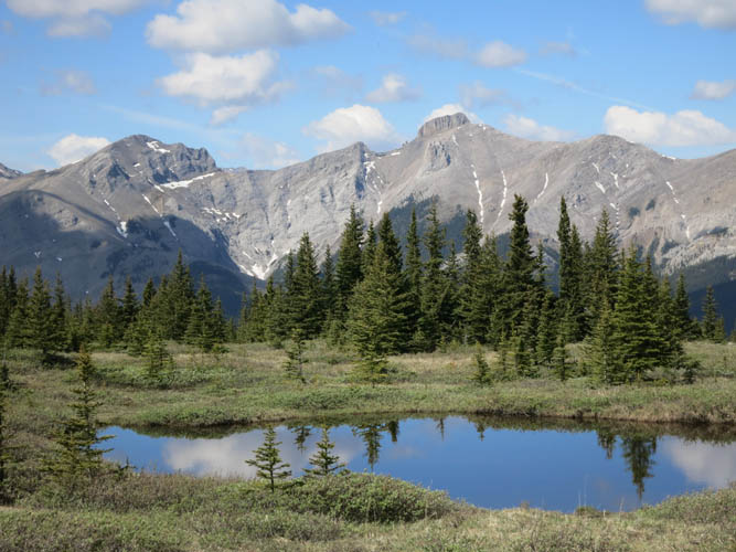
There is an extensive network of trails here.
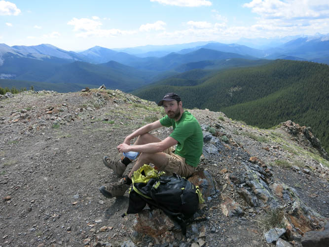
Richard at his first summit of the year!
The terrain is perfect for trail running and extended hikes.
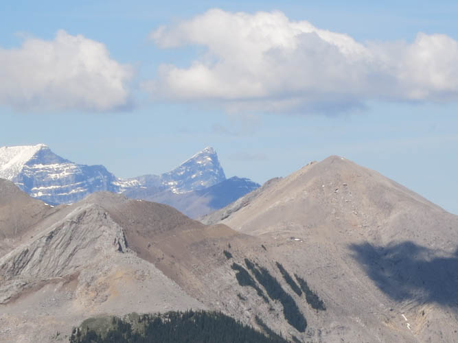
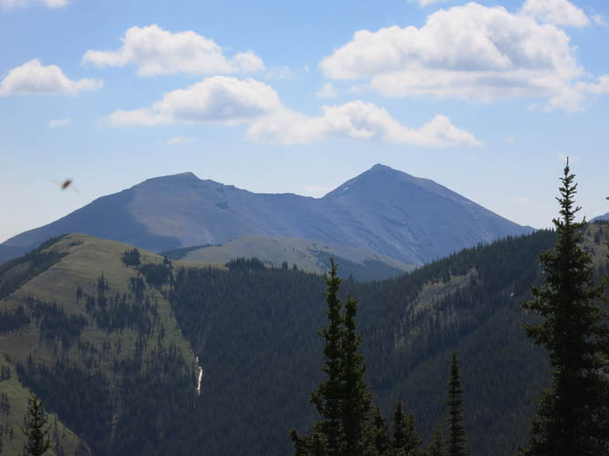
The sharp wedge in the middle is Wind Mountain (straight west from here), flanked on the right by unofficially-named Boundary Ridge Peak. On the left in the foreground is Belmore Browne Peak.
Heading back along the broad, undulating ridge of Jumpingpound Mountain.
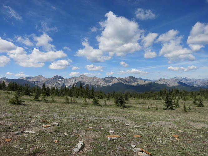
A last look at the Front Range peaks to the west.