19 June 2016
With Wen
We had been ignoring tame-sounding Pigeon Mountain for a long time, but we shouldn’t have! It is indeed a very pleasant hike that offers wonderful views of Mount Lougheed, Wind Ridge and Mount McGillivray, to name but a few. Moreover, it can still make you sweat with over 1100 m of elevation gain to overcome.
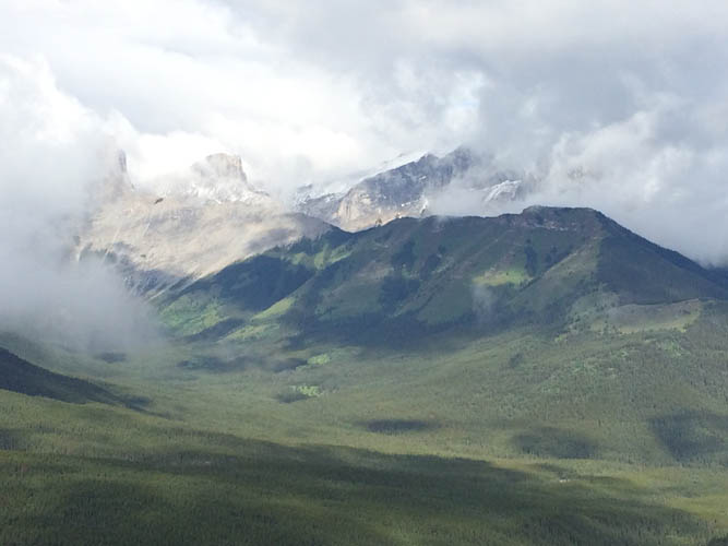
When we started out on Sunday morning it was drizzling, wet and uncomfortable. Low-hanging clouds were obscuring the mountains in the distance and we wondered if we should just turn around and head to Canmore for a nice warm cup of coffee instead… But somehow we convinced ourselves to push on – the initial trail (actually a road along the powerline) was excellent and easy to follow, and we were out to get some fresh air and exercise after all. And we were so glad we persisted as only about an hour later the clouds started to break up! We ended up enjoying a beautiful sunny day with just enough clouds to add some depth to the skies.
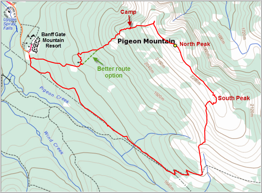
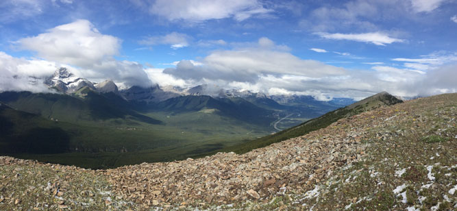
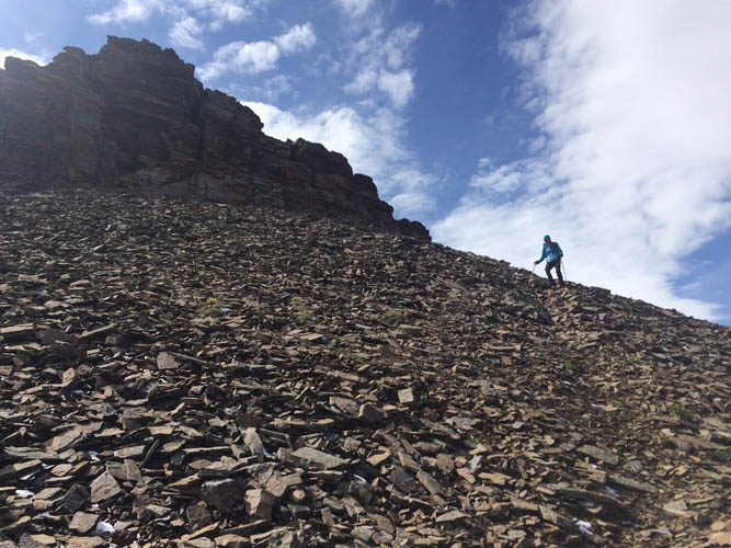
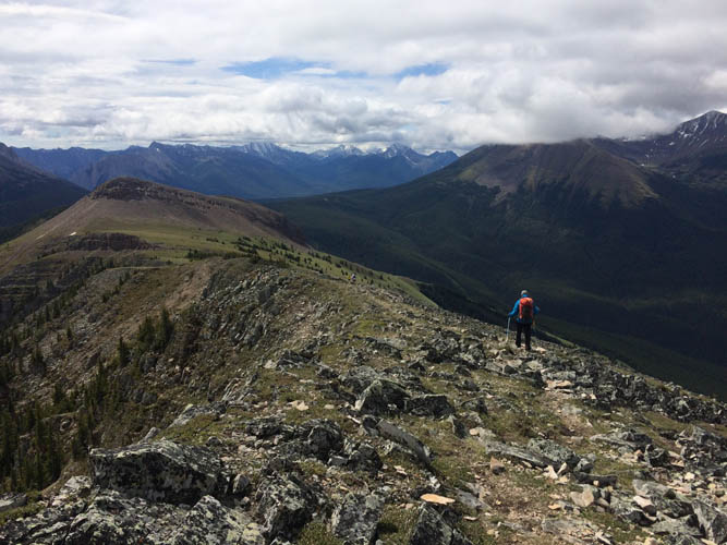
The first stretch along the powerline road was a bit monotonous, but the grade is gentle and it’s a good way to get you warmed up. After about an hour or so we came to a small sign (wildlife protection) where we turned left. Now on a narrow and initially steep path, we wandered through pleasant meadows and scree patches past some rocky cliffs to our right until the trail seemed to level off, not far below the main ridge. Here, we simply left the path and scrabbled up to the top of the south peak with its solar-powered weather station. The ridge here is broad and grassy and offers a sweeping view of the impressive N-S ridge that forms Mount McGillivray immediately to the east. To get to the higher north peak, we scrambled through a short section of rocky ledges (but this is entirely avoidable if you go around the left/west side), then easily continued on the broad ridge saddle to reach the main summit a short while later. The summit views are quite nice for such an easy and short ascent, despite having the TransCanada Highway right under your nose to the north.
Some hikers, including Bob Spirko, have continued along the ridge and then descended off the west slopes through the forest to return to the parking lot. We love switching things up a bit, so instead of just going back the same route we decided to follow the alternate descent route and make this trip a loop. The hike from the summit towards the north along the ridge is really enjoyable and there are a few minor ups and downs. At one point we saw a herd of white Bighorn sheep rushing through the trees and along narrow grassy slopes a few hundred metres below us – a fascinating sight. We left the ridge heading west and soon entered the trees. Along the northern end of the slope the trees were thin and we were able to follow a faint path for a while, but it eventually faded away. After some light bushwhacking we unexpectedly came upon a small camp where some adventurous soul had set up a temporary home complete with rock toilet and mini water basin overlooking the highway below. A great place to take a rest and have a second lunch! We wondered who would’ve come up here and why… there were lots of old food cans, a saw, an old sweater, etc… but no access trail. We continued heading down through light bush for quite some time until we eventually hit a denser part of the forest where the bushwhacking wasn’t fun anymore. After checking my GPS, we made a sharp turn to the south and to our relief soon reached the open slopes of a defunct ski hill that had once been in operation here a few hundred metres above the Banff Gate Resort Hotel, until it was permanently closed in 1983. Apart from empty patches of grass, the only remains were some concrete blocks and a few twisted steel poles. The grassy slopes offered a quick and easy way back down straight to the parking lot.
I think Pigeon Mountain is underrated as a hike, perhaps because of its rather innocent name. It’s a great workout and if you do the loop route you can test your routefinding (and bushwhacking) skills as well!
DISCLAIMER: Use at your own risk for general guidance only! Do not follow this GPX track blindly but use your own judgement in assessing terrain and choosing the safest route.
Note: Unfortunately I forgot my camera at home, so we had to use an iPhone 5 to take photos on this trip.
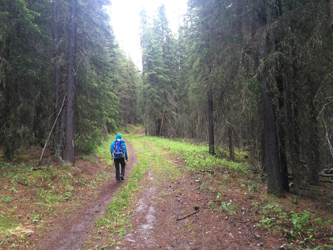
Starting out on a rainy morning. The first part of the hike is on a wide trail.
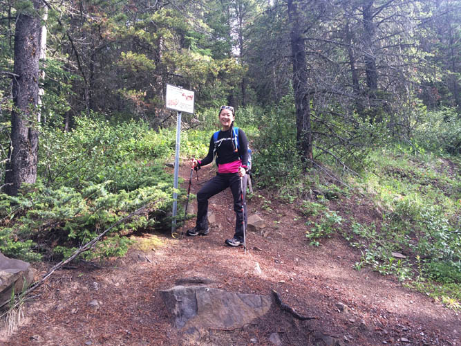
The turn-off where we leave the wide trail and now head north.
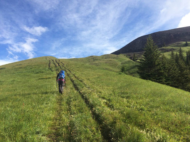
Heading up beautiful grassy slopes. The cliffs below Pigeon Mountain’s main ridge can be seen on the right.
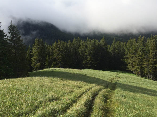
We leave the clouds behind us.
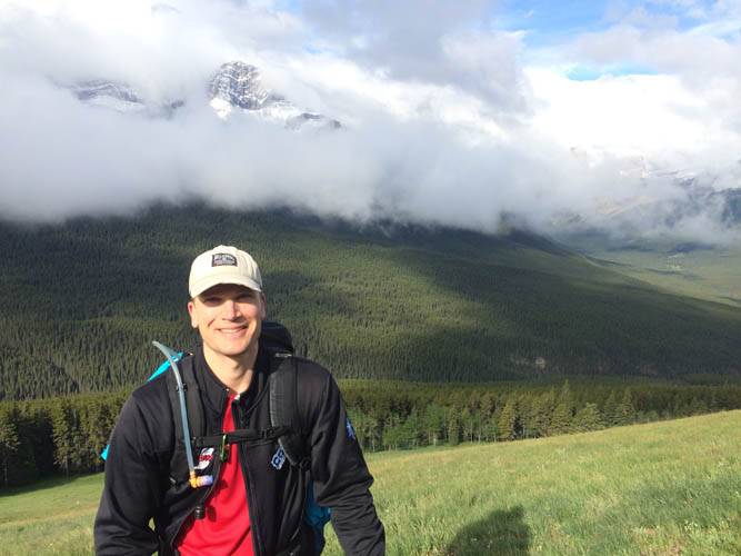
The very distinctive looking main peak of Mount Lougheed makes its first appearance.
This has turned into a gorgeous day!
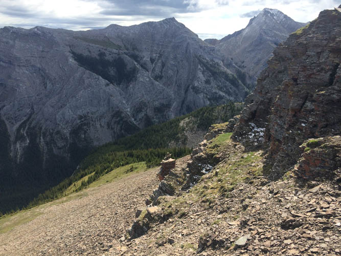
Wind Ridge to the west.
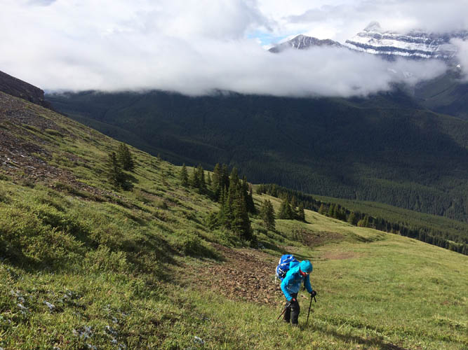
We leave the main trail and head straight up towards the ridge.
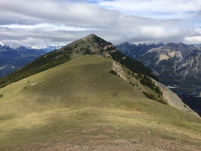
Near the south peak of Pigeon Mountain, looking towards the north peak (right). Mount Lougheed is on the far left.
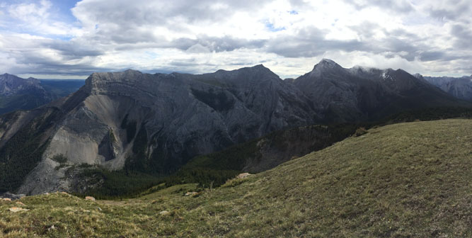
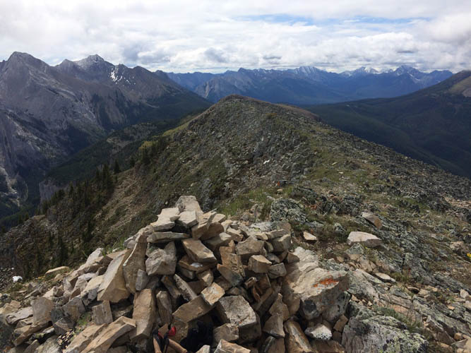
Mount McGillivray. The summit of this great scramble is just right of centre.
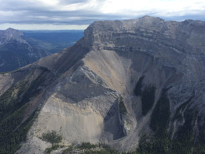
A closer look at the imposing north end of Mount McGillivray.
We head north, scrambling down a short section of rocky ledges.
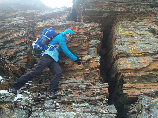
This is pretty much the only scrambling today. Short but fun!
The rest of the route to the north (main) summit is a pleasant ridge walk.
Looking back at the short cliff section.
We only saw two other groups of hikers the whole day.
At the summit, looking back (SE) along the ridge.
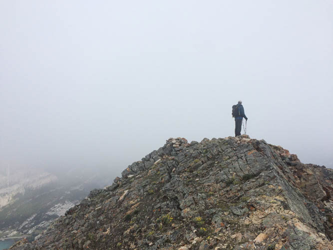
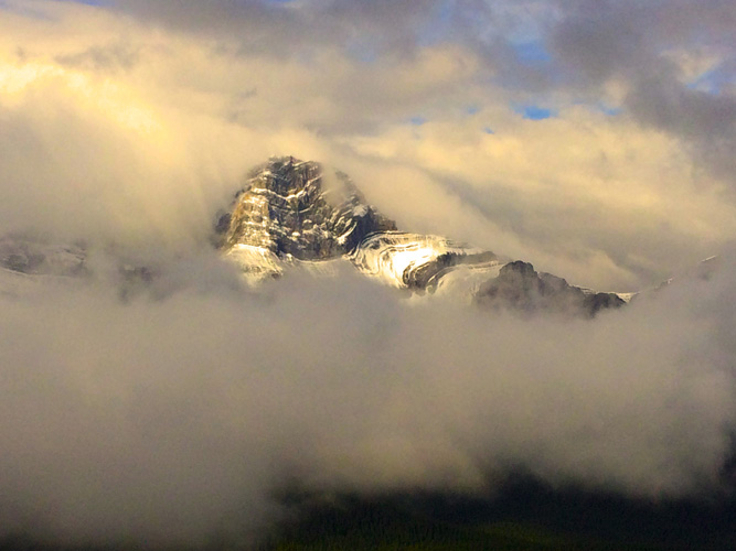
As we near the north end of the ridgeline, the clouds threaten to move in once again.
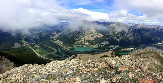
But the sun takes over again, presenting us with this sweeping view of the Bow Valley below.