13 November 2016
With Richard
Mount Bryant is one of those outings that is relatively easy and straightforward, but not one that really stands out amongst the trips I’ve done. It’s just a nice, relatively quick trip up a summit in the front ranges offering great views of neighboring peaks and higher summits in Kananaskis to the west. I don’t think Bryant will ever be a classic scramble.
Richard and I were still thinking about our long Zombie Peak odyssey two days earlier, so we wanted to do something relatively short without worrying about getting cliffed out or hiking in the dark for four hours… Mount Bryant was the perfect match!
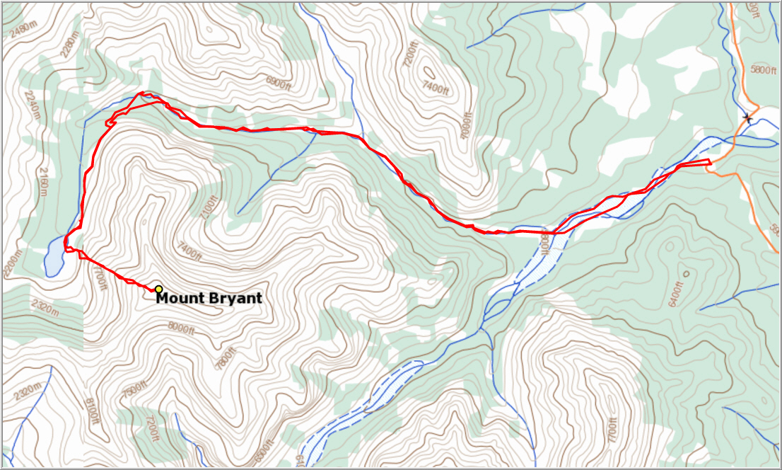
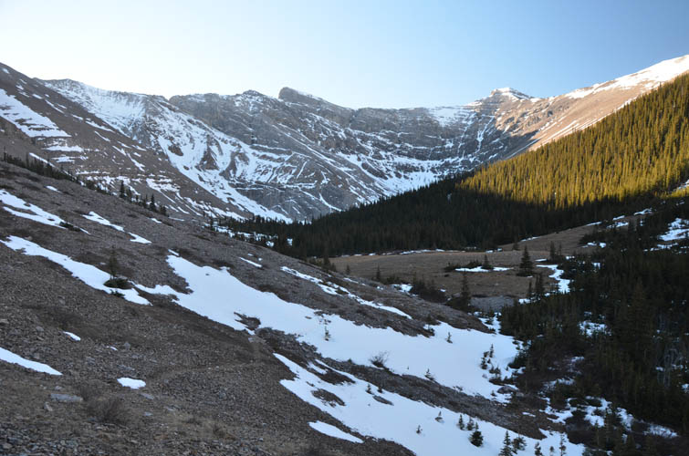
The approach is really easy, first along rubble and grassy floodplains of the wide Canyon Creek, then up Bryant Creek along bits of decent trail that flip flops between the right and the left side. Judging by the number of cairns and orange flagging, this trail sees visitors quite regularly. We saw a total of 3 groups on our way down, most were probably heading to Bryant Lake where the trail ends. On our way up, we chose to leave the creek at the second trail (apparently a newer trail) going up the left side of the valley, marked by a cairn. This is about 200 m after the point where the first and older trail ascends a steep, eroded part of the forest (also on the left side), marked by a large cairn and orange flagging. On our return we tried out the older trail and found it to be very similar in quality, but harder to follow in the upper section now that there was snow around.
The two trails merge above treeline to a beaten path in the shale that leads through the lovely upper valley to Bryant Lake. It was a pity that we were mostly in the shade now that the winter sun was so low in the morning, but it was still a beautiful hike to this point.
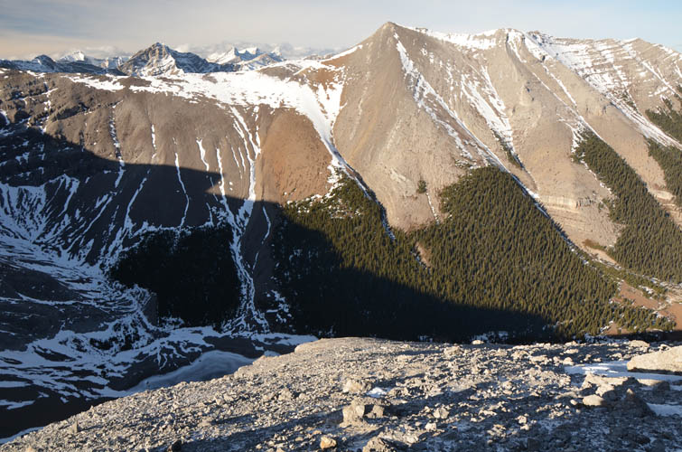
After taking in views of the almost fully frozen lake, we started up the much steeper west slope of the mountain. This is truly a slog! There’s scree, scree and more scree, interrupted by a minor cliffband that is easily broken through at several points. Thankfully, much of what would’ve been loose treadmill rubble was frozen together, slightly facilitating our progress up this seemingly never-ending slope. We just put our heads down and went into autopilot mode until we reached the summit.
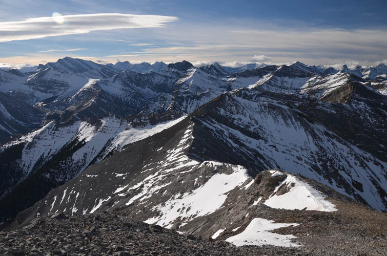
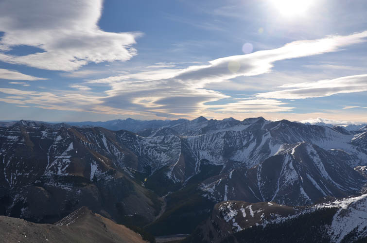
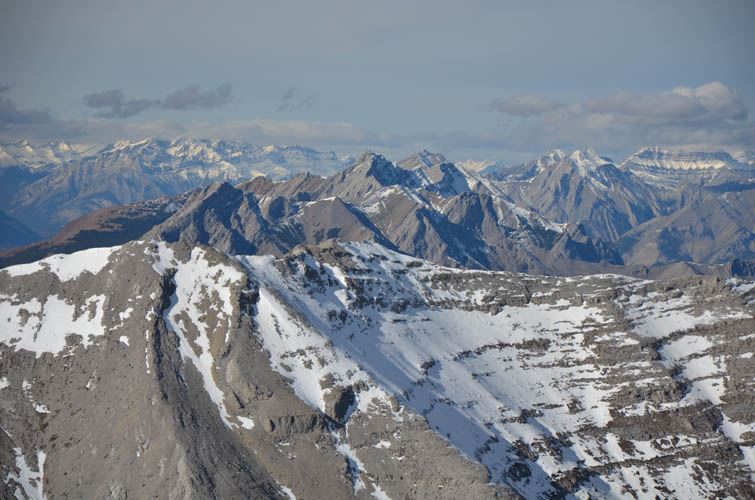
The views of higher peaks to the west really impressed me. Mount Lougheed’s snow-covered, jagged summits look particularly striking from here. To the south are Mount Howard and Compression Ridge, while Moose Mountain sticks out of the rolling foothills to the east. It was super windy and we just couldn’t find a sheltered spot anywhere around the summit mass, so after taking some pictures we quickly retreated and took an extended lunchbreak down in the valley.
We were back at the car after about 6 ½ hours and both agreed that Mount Bryant had been the perfect trip for us today. While hike itself wasn’t anything special, it was a great outing to do at this time of the year and one that thankfully didn’t involve any routefinding or bushwhacking. We have definitely seen too much of that lately!
DISCLAIMER: Use at your own risk for general guidance only! Do not follow this GPX track blindly but use your own judgement in assessing terrain and choosing the safest route.
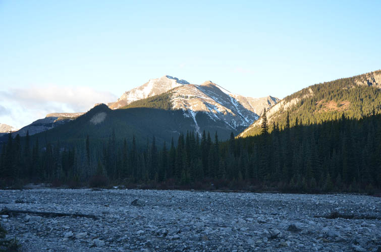
Approach in Canyon Creek. Mount Bryant is already getting some sun.
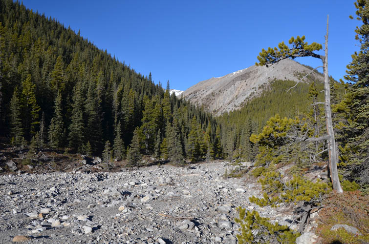
Most of the approach is on a trail, but sometimes it’s walking on rubble like here.
In the upper valley.
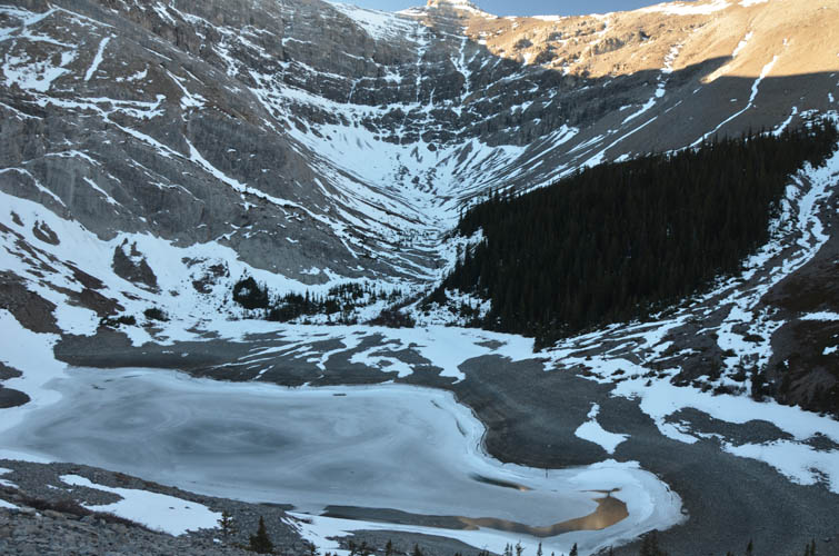
Bryant Lake
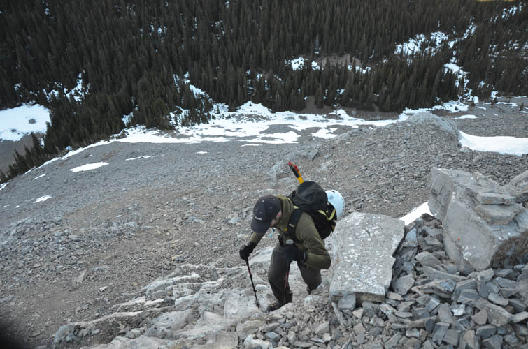
Richard working his way through the (only) cliffband.
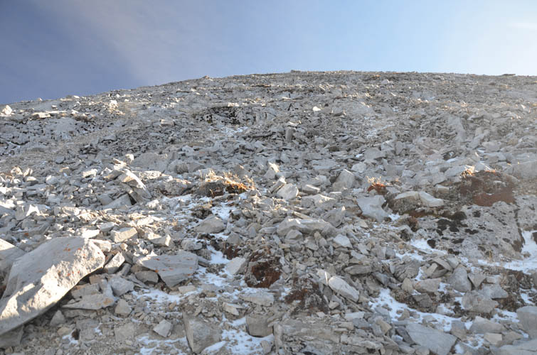
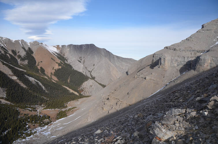
After the cliffband, it’s this view for the next hour!
The angle of the scree slope doesn’t change for several hundred metres of elevation gain.
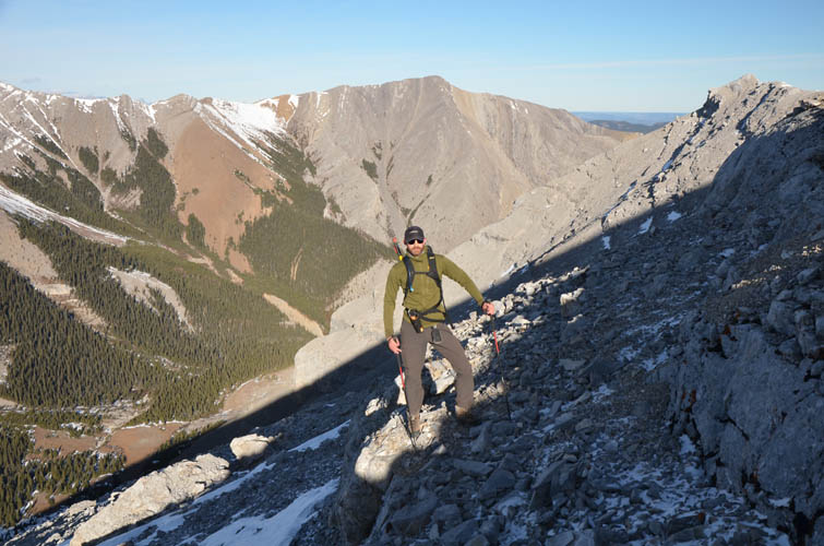
There are small patches of snow, but most of the slope is dry – typical for west and south-facing aspects that get the most sunlight.
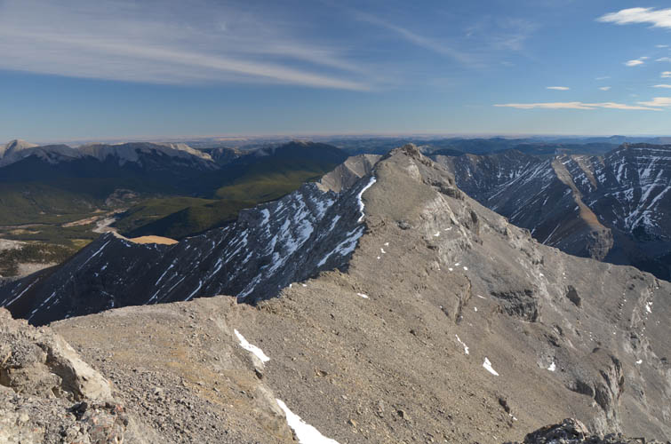
Views of the east ridge from the summit of Mount Bryant.
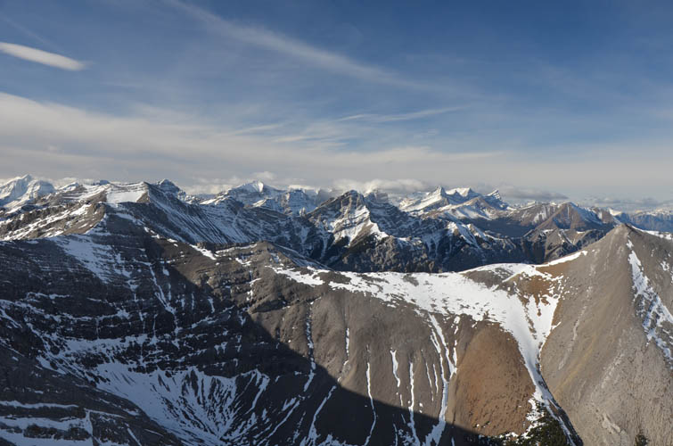
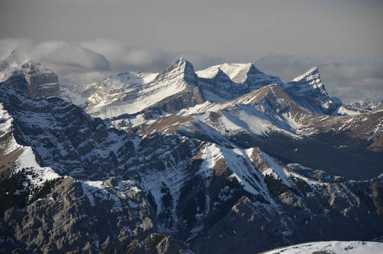
Looking SW.
Mount Howard is in the south.
More snow and more clouds on higher peaks to the west.
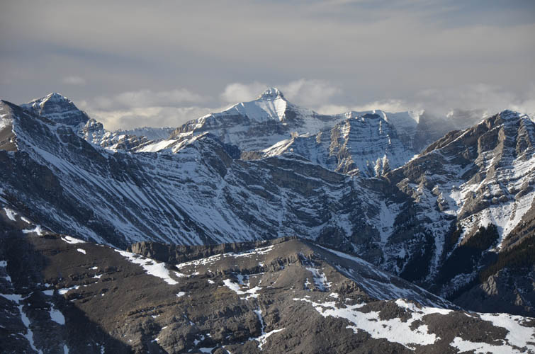
Close-up of Mount Bogart.

The prominent black tower on the right is “The Fortress”.
Many, if not most, of these mountains further west are only doable as mountaineering trips right now.
A zoomed-in view of Old Baldy Mountain.
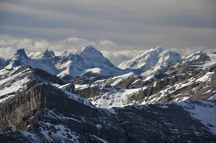
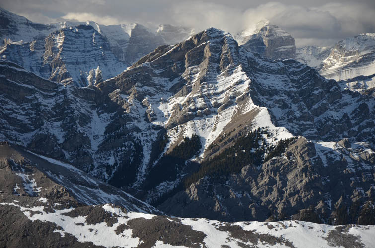
The four peaks of Mount Lougheed, with Mount Allan in front (the lower brown, rounded mountain). Mount Sparrowhawk is on the far left.
Looking NW.
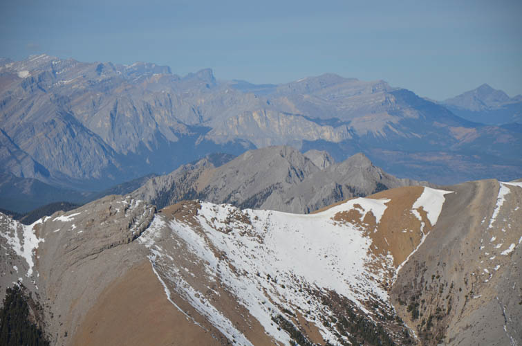
Mount Yamnuska shows its trade-mark vertical cliff face in the centre of this photo looking north. Far right on the horizon is Blackrock Mountain.
On descent, the valley finally sees some sun.

After the scree slope, we follow the good trail back along the valley.
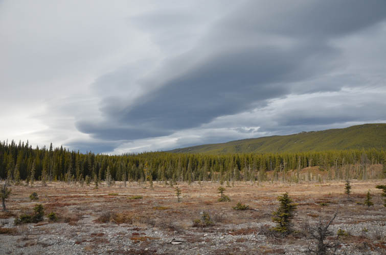
Canyon Creek is really flat and wide near the trailhead.