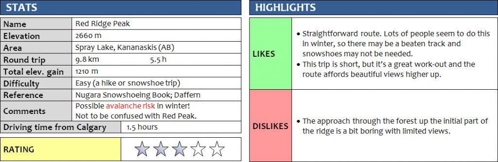
29 January 2017
Solo
Red Ridge appears to be a popular outing both in summer and winter. A few of my friends had done it in the summer months before and really enjoyed it, so I thought it should make for a great winter objective as well. The description in Nugara’s snowshoeing book gave me the motivation, but I didn’t even need my snowshoes thanks to warm Chinook-induced temperatures (+8 °C in Canmore!) and existing tracks from previous hikers that made life easy for me :).
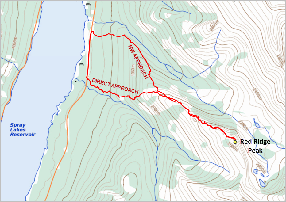
There are two ways to approach the main ridge from the road, the NW route from Sparrowhawk parking lot and the “direct” approach which starts near Spray Lake parking lot and initially follows an unnamed E-W running creek. I have to say the NW route is definitely the better choice! I went up the direct route, which sees much less traffic than the NW route and there was no clearly defined path. I hiked through light forest and higher up reached a clearing where I stuck to the left side near the trees as the open slopes could’ve been avalanche terrain (although the forecast risk today was low). It was fairly steep here and the terrain a bit tricky due to the snow covering up large chunks of rock with lots of unseen holes between.
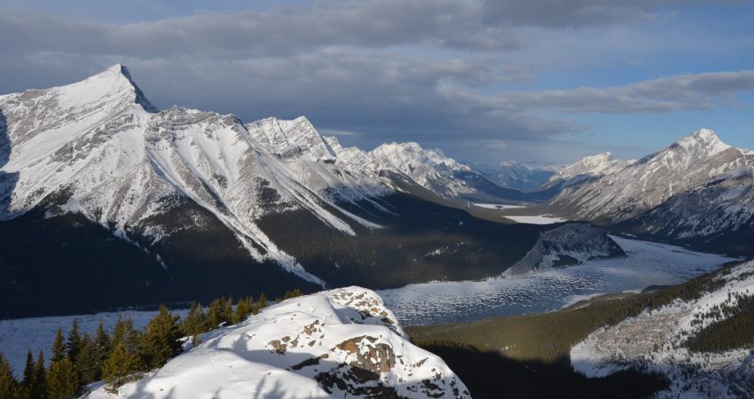
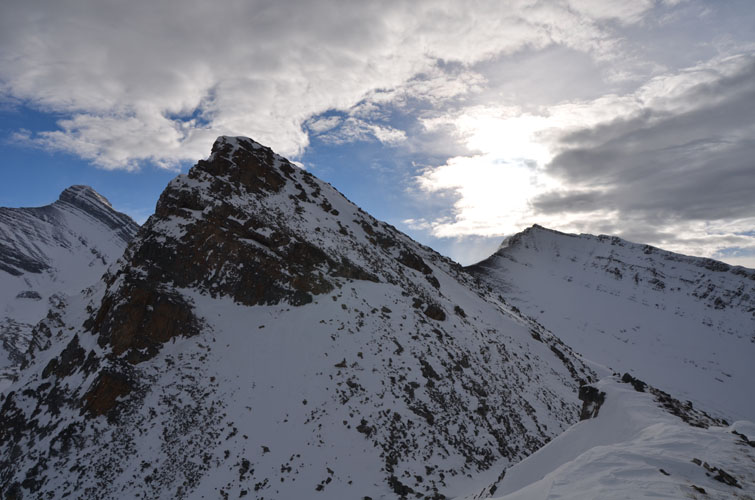
Upon reaching the main ridge at treeline, the wind really starting kicking in – this is Chinook weather after all! I was lucky to be able to follow other people’s tracks through the snow instead of sinking in waist-deep as I did a few times when I couldn’t see the footsteps anymore due to snowdrifts. Most of the ridge was blown largely clear of snow, which made for fast hiking. The higher I got, the better were the views: Read’s Tower and the outer reaches of Mount Sparrowhawk to the north, Mount Buller to the south, frozen Spray Lake to the west framed by Mount Nestor and Old Goat Mountain, and finally also Mount Bogart and Red Peak. And pretty much all of them are scrambles! It’s truly paradise here for those who love to scale peaks!
There were a few minor ups and downs along the ridge, including the crux which is just a short section where the route breaks through a small cliff, but I thought it was fairly benign. The steep slope on the other side of the cliff where the route continues uphill can be avalanche-prone, but there wasn’t enough snow on it today. When I saw the next high point after the crux I was convinced it was the ridge summit, but to my surprise it was still quite some distance and a few ups and downs away! About 30-40 minutes later I finally reached the summit. After taking a few pictures I was quite happy to head back as the sun had now disappeared, the winds were getting stronger, and darkish clouds were instead moving in from the west.
My face was getting blasted by gusts laden with ice crystals on my way down – certainly not as enjoyable as my ascent when I had the wind in my back and warm sunshine in my face! I followed the ridge back and was relieved to find a well-beaten trail in the snow when I entered the forest down the NW route. The trail was perfect: it was gently inclined and led directly down to the road at Sparrowhawk parking lot, from where I hiked back a few hundred metres to my car.
I really like Red Ridge as a winter hike, although I must say I was lucky to find a packed trail in most places which made things much easier for me. The NW route is the better approach through the forest and once you’re on the main ridge above treeline, it’s a straightforward hike all the way to the summit.
DISCLAIMER: Use at your own risk for general guidance only! Do not follow this GPX track blindly but use your own judgement in assessing terrain and choosing the safest route. Please read the full disclaimer here.
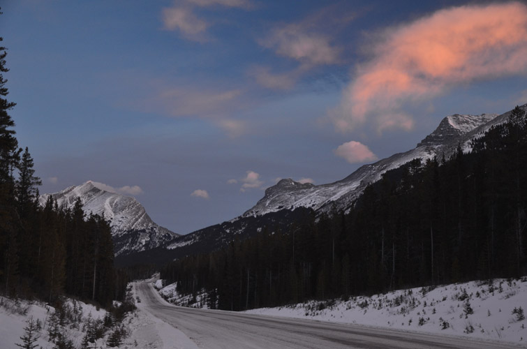
Sunrise in the clouds over Smith Dorrien Trail (Spray Lake Road).
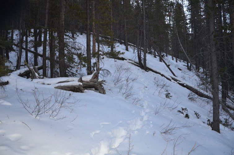
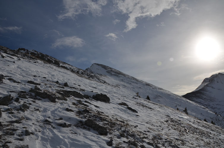
Hiking through light forest – this is the direct route.
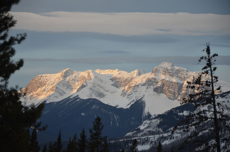
Early morning views as the sun starts to light up eastern aspects.
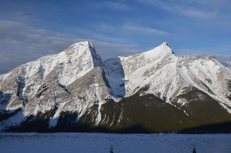
Mount Nestor (left) and Old Goat Mountain (right).

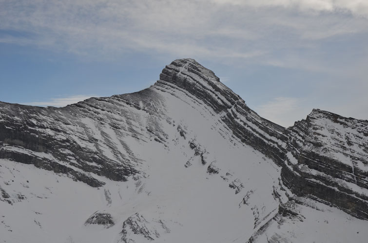
Mount Sparrowhawk.
Easy travel along the ridge.
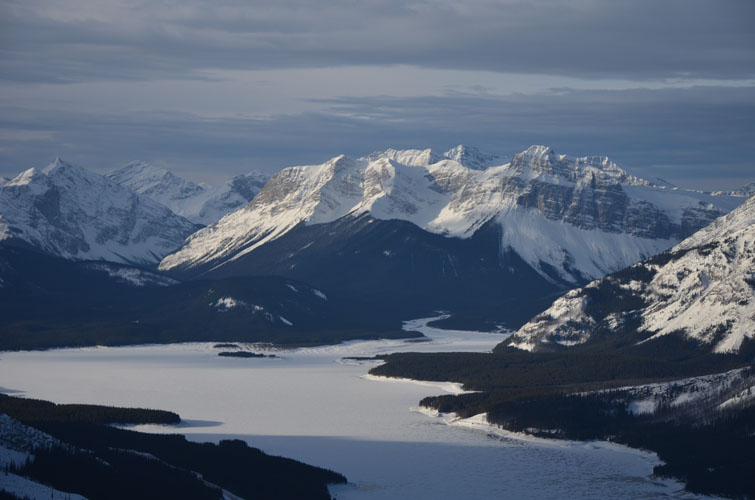
Views to the SW over Spray Lake.
And to the NW.
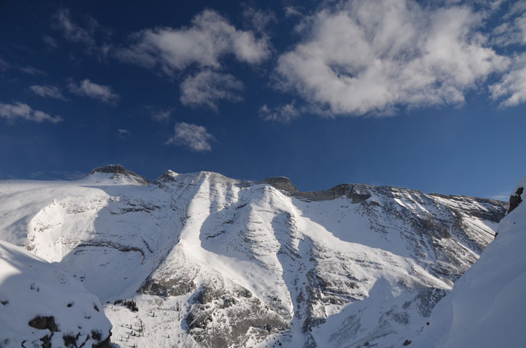
Another view of Mount Sparrowhawk and its snow-clad south ridge.
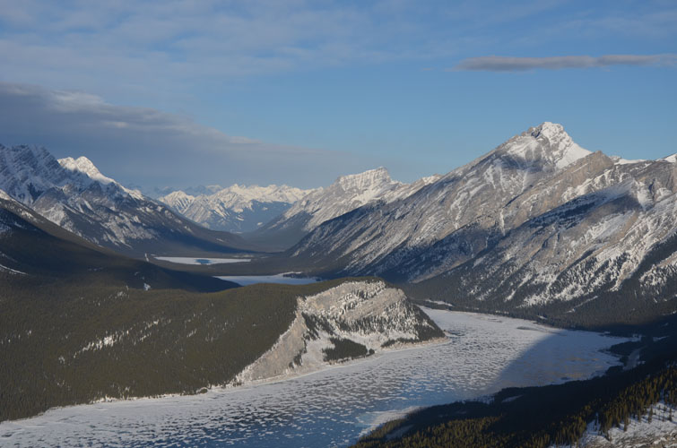
Red Ridge (foreground) offers beautiful views over Spray Lake, although Mount Sparrowhawk is even better for this!

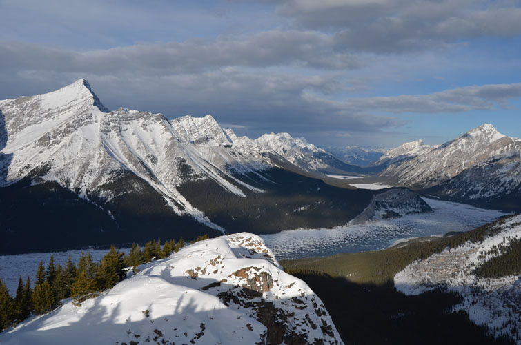
Red Ridge (right) with Mount Bogart in the distance.
This is the main notch in the ridge (with crux outside the field of view).

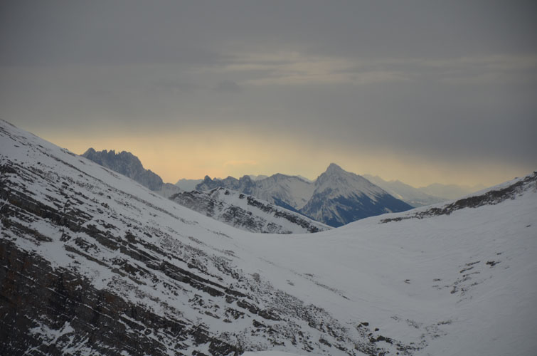
Grey clouds are starting to move in from the west as I near the summit.
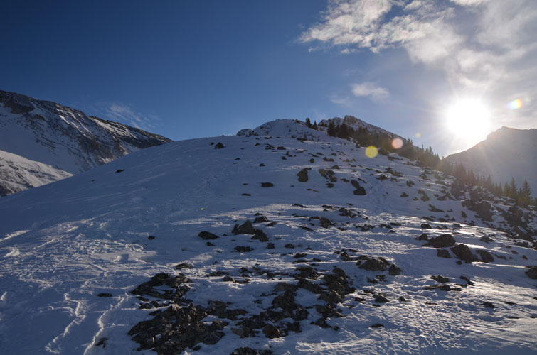
The last stretch to the summit.
There is something elegant about the shape of Mount Bogart, which sits directly to the east.
A “fair weather window” to the east.