18 May 2015
With Wen
So much bushwhacking! We really didn’t expect to be fighting the shrubs and trees so much on this trip, but this is what happens when you miss the right trail at the beginning.
The day started with a rather unfriendly encounter: after leaving the parking lot at Boundary Ranch (which at 8 in the morning was completely deserted), we followed what we thought was the right path that would lead us to the horse trail described in Nugara guidebook. Instead, we came to a dead-end with a couple of trailers behind the ranch. An older, grumpy looking man living in one of the trailers wasn’t too amused about our presence and promptly suggested we hike along one of the trails on the other side of Highway 40. He complained about the hikers in the area and the potential disturbance they can cause to horses along the trails in his area… And he was aware of the Nugara book with its route description to Old Baldy Mountain but felt that “the ranch should’ve been consulted before the route was published”. I assured him we would be respectful and watch out for horse traffic. When I asked him politely to point out the correct horse trail for us, he brushed us off again…
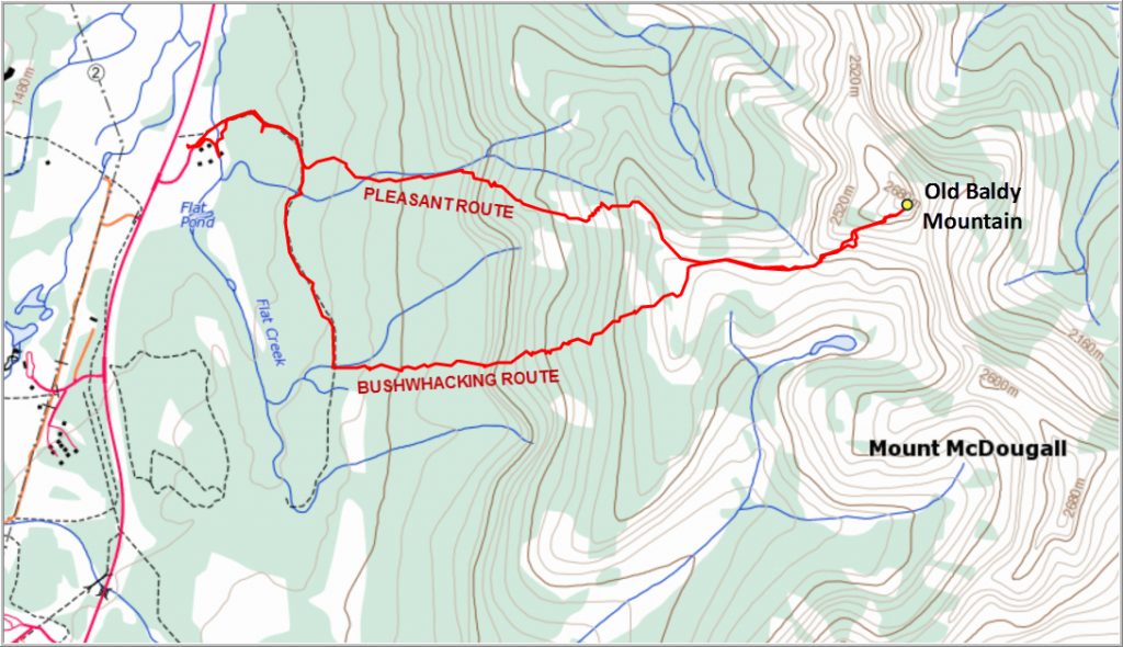
Well, this isn’t private land and there are no “No Trespassing” signs, so we went on our way and figured it out ourselves. We soon found the right horse trail and followed it along for quite a while… the turn-off to go up Flat Creek to the left was nowhere to be seen (we saw it on our way down, but it’s really hard to spot!) so we just kept on walking. Finally, with no trail branching off to the left, we decided to enter the forest and bushwhack our way up.
It went ok at the beginning, but as we gained elevation the bush got denser and those nasty alder bushes caused some real headaches along the way, especially where it was steep. There were a few clearings where the forest was replaced by boulder fields, but the big blocky rocks were hardly any better, especially since the rocks were slippery with all the morning dew still on them. But we kept our spirits up by having short, enjoyable breaks and I joked that there had to be a first real bushwhacking experience for Wen at some point, so why not today!? I have to admit, it was one of the worst bushwhacks I’ve done though… Having wonderful company made the whole thing so much better – after all, “shared pain is half the pain” as the German saying goes!
Eventually, after hours of struggling through miserable terrain, we found our way up to treeline and a broad, snow-covered ridge with spectacular views all around the valley below and the rocky mountains immediately to the east. This is “Old Baldy Ridge”, which can apparently also be reached from the SW via a decent hiking trail. All the pain of the previous hours was forgotten and we took tons of photos and enjoyed the beautiful contrast of blue sky and yellow sun above us, green forest below us, and black and white mountains and snow ahead.
A gentle, rolling saddle connects the ridge to the foot of Old Baldy Mountain and this is where the scrambling starts. It was a pretty steep and slippery affair (we were mostly on snow from hereon), and the west ridge leading up to the summit became more and more serious the higher we went. Along the way we had one fairly challenging climb up a steep rocky face that almost made Wen turn around in protest, she disliked it that much – especially knowing that she could’ve easily circumvented the whole damn thing! The ridge higher up was pretty exposed in places and all the snow meant that we had to proceed slowly and carefully.
The joy we felt upon reaching the summit was fantastic…. it felt like a real mountaineering adventure, as if we had just conquered some big crazy giant! Of course this was “just” Old Baldy – it was the wintery conditions that made it more challenging than if it was a dry and warm summer day. We briefly contemplated traversing over to Mount McDougall further east, but quickly abandoned that thought. Although it was a gorgeous sunny day, the wind was uncomfortably cold and all that bushwhacking in the morning had sucked a lot of energy out of us.
After taking about a hundred photos we made the wise choice of returning back to the saddle below and, turning slightly to skier’s right, quickly found the correct drainage that we missed earlier in the day. It was a pleasant and easy way down, and there was even a pretty good path in most places along the north side (skier’s right) of this drainage almost all the way back to the horse trail.
An excellent early season adventure!!!
DISCLAIMER: Use at your own risk for general guidance only! Do not follow this GPX track blindly but use your own judgement in assessing terrain and choosing the safest route.
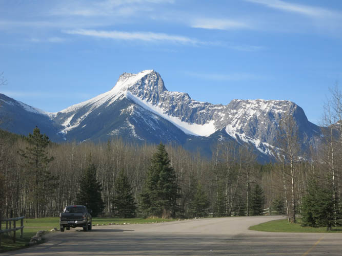
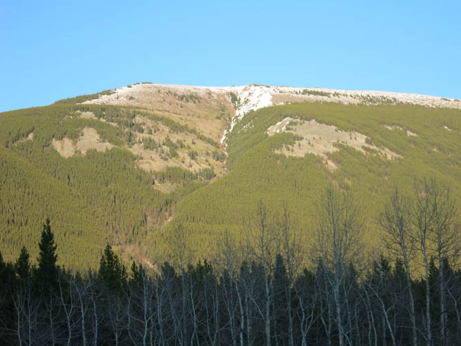
Morning view of The Wedge, another great little scramble in Kananaskis!
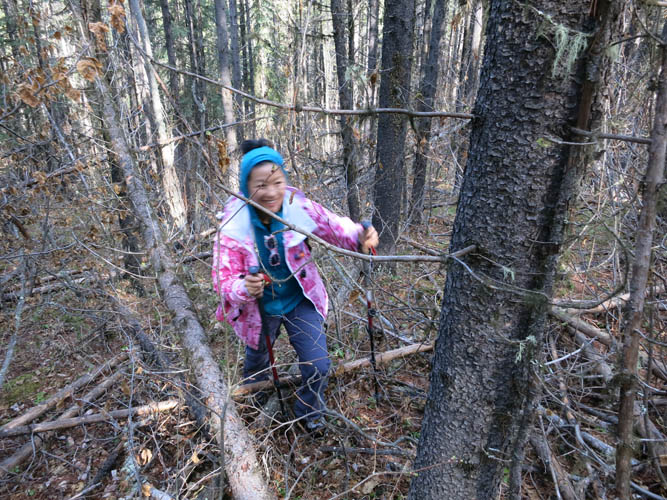
Having fun fighting our way through the trees… clearly we are not on the correct route!
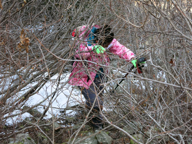
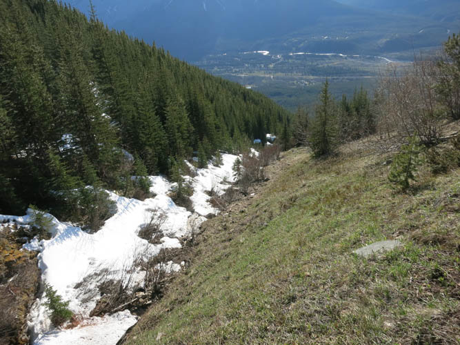
Not so much fun anymore after an hour…
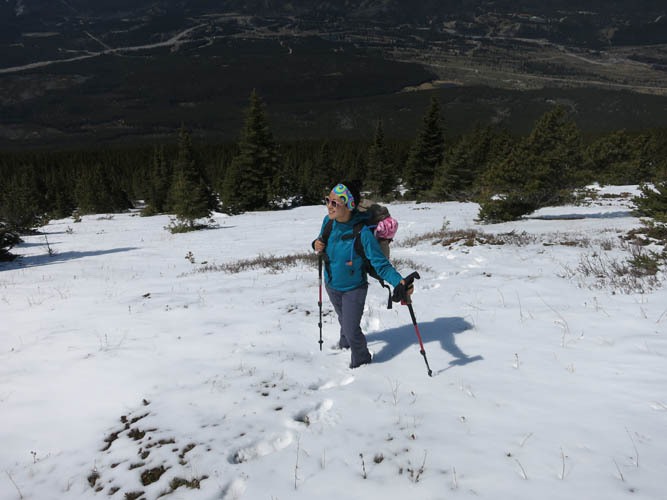
Finally we break out of the trees onto open slopes.
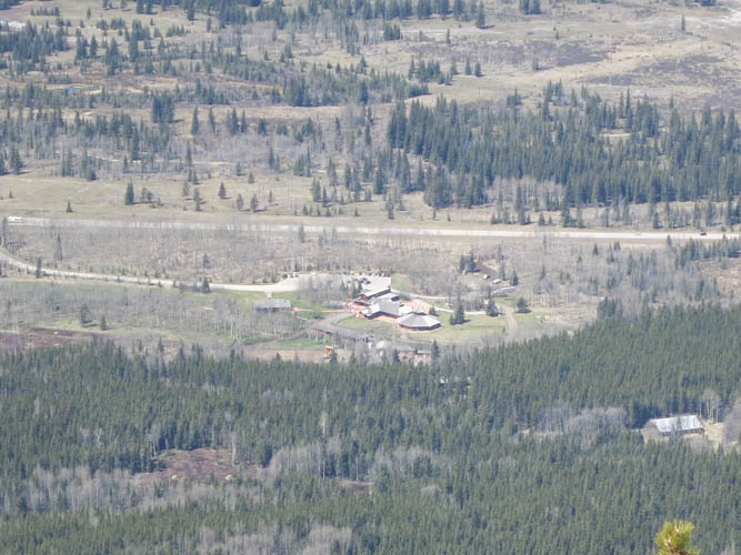
Boundary Ranch at Highway 40 in the valley below.
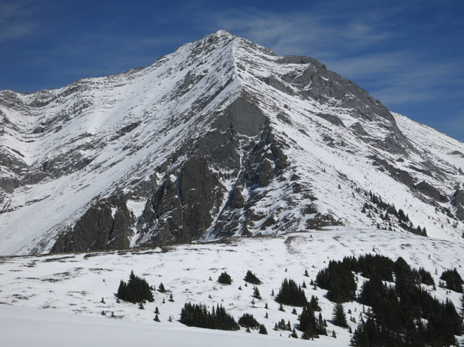
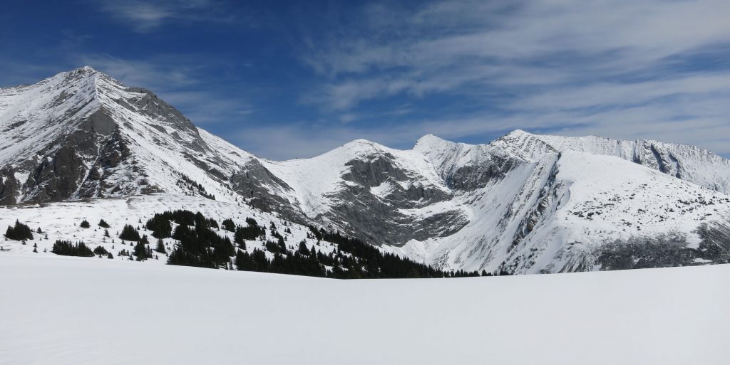
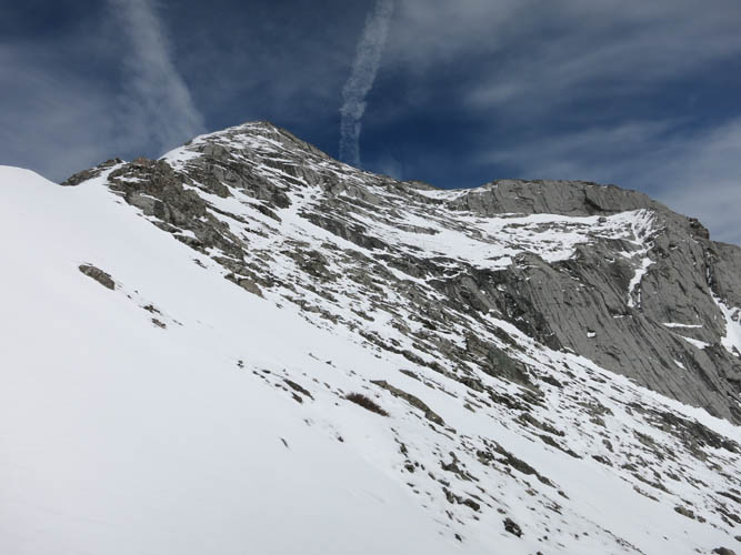
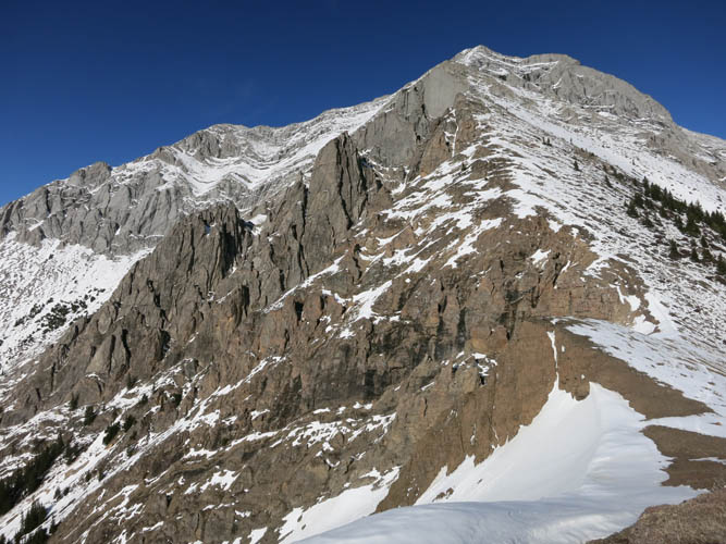
First glimpse of Old Baldy Mountain from the ridge. The smooth, vertical grey rock slab in the centre looks pretty distinctive.
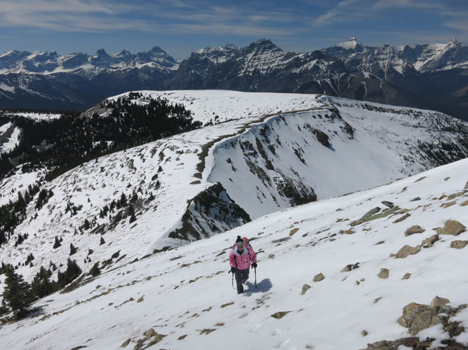
On Old Baldy Ridge.
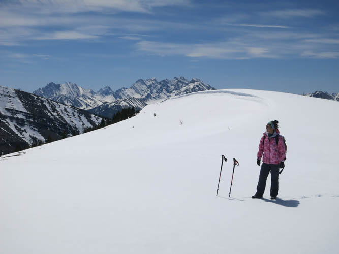
The views are already fantastic: Wen is flanked by Mount Kidd (L) and Mount Bogart (R).
Views from Old Baldy Ridge to the west.
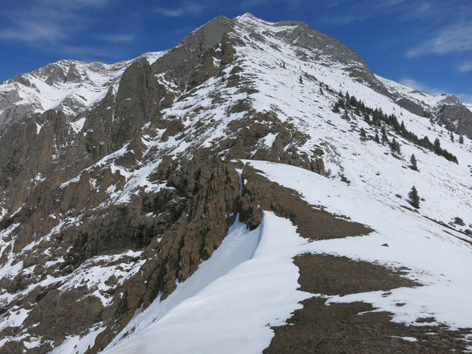
The scramble route hugs the right side of the ridge spine seen here in the centre of the photo.
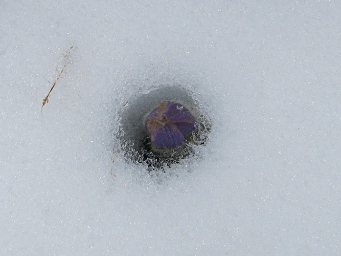
A lonely flower springing up through the snow.
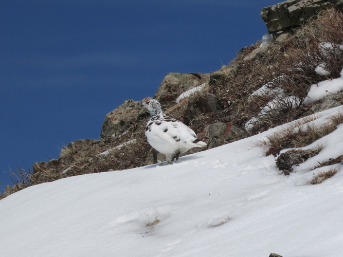
We’ve got company!
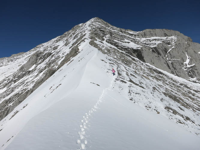
The snow offers good traction in this section.
Higher up, the soft snow makes things quite slippery in places.
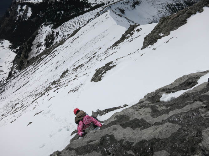
The optional difficult scrambling section. Much easier to just go around the left side.
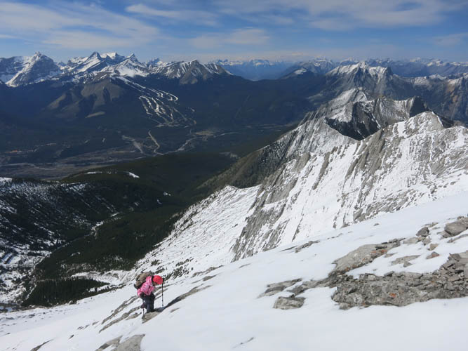
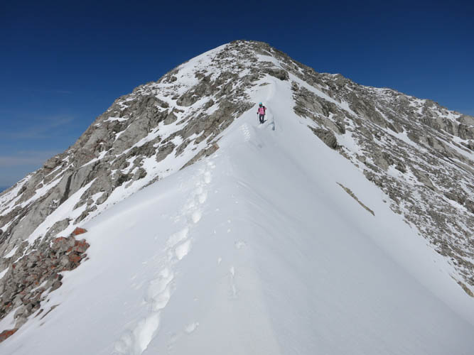
Nearing the summit ridge.
Beautiful views open up!
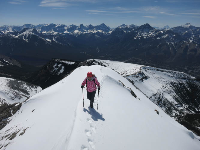
Summit ridge.
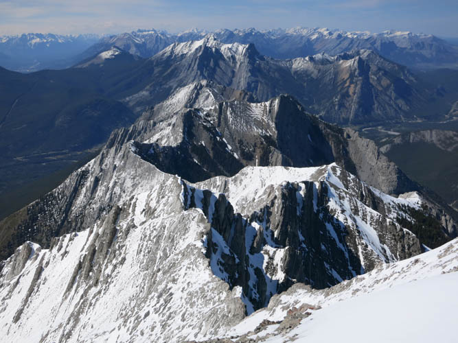
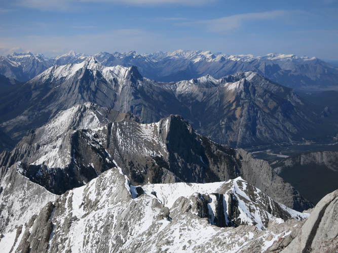
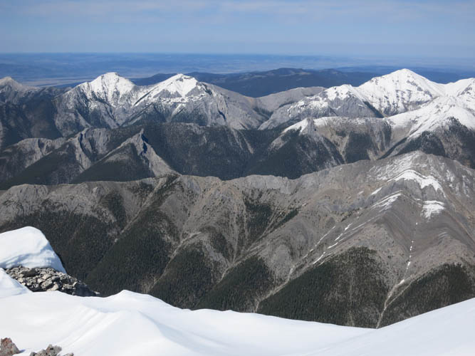
To the NW are a series of jagged ridges and peaks, including Kananaskis Peak, Wasootch Peak, Mount Lorette, and Skogan Peak.
Mount McDougall sits to the SE.
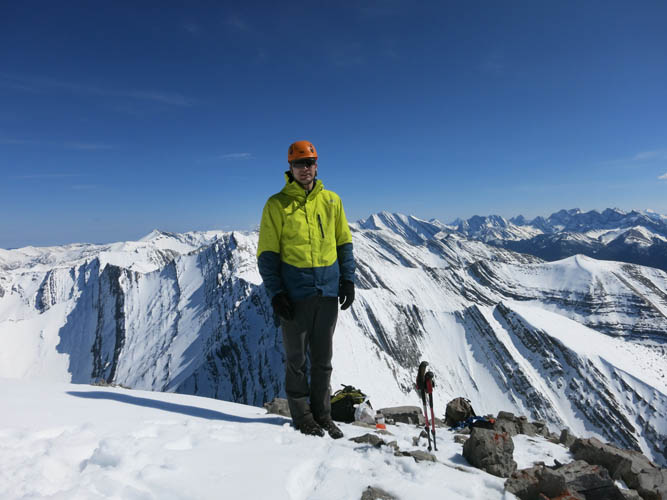
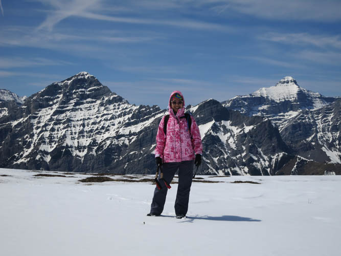
Summit pose in perfect spring weather.
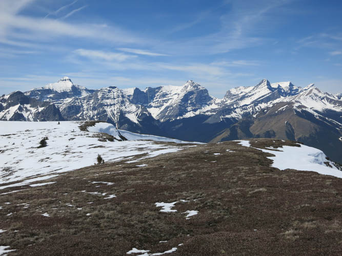
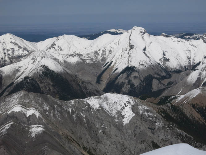
Looking east: Midnight, Midday and Boundary Peak (L to R) are all snow-covered.
The highest point here just right of centre is Tiara Peak. Tucked behind to the left is Moose Mountain.
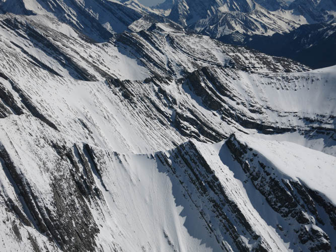
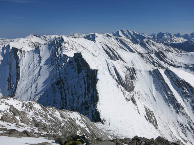
A great example of what makes this a fold & thrust belt.
On descent, we retraced our steps in the snow.
There is still lots of snow for this time of the year.
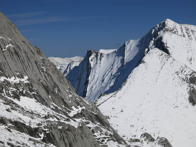
A look at the col between Old Baldy Mountain (L) and Mount McDougall (R).
Great colour contrast, almost reminds me a bit of the Castle area.
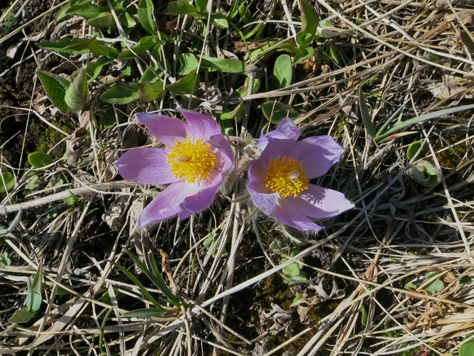
On the sun-soaked western slopes at lower elevations, the same flowers we saw tucked into snow higher up are now in full bloom. This looks like Prairie Crocus (Cutleaf Anemone).
The descent valley, which would’ve also made for a much faster and easier ascent.
A look back at Old Baldy Ridge. The correct route goes up the little valley in the centre.
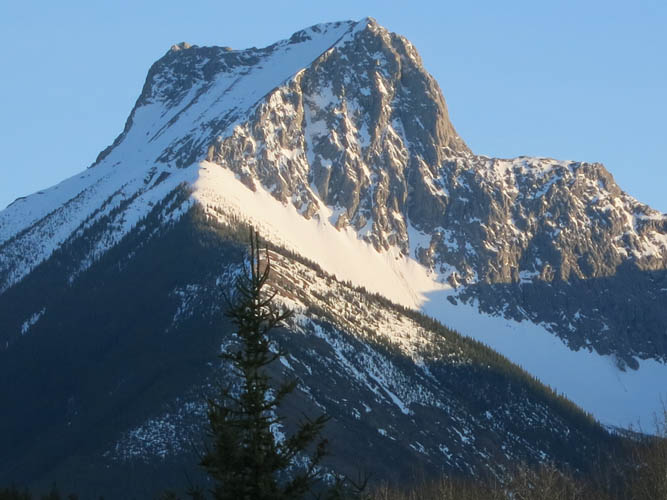
Evening view of The Wedge.