11 February 2017
With Richard
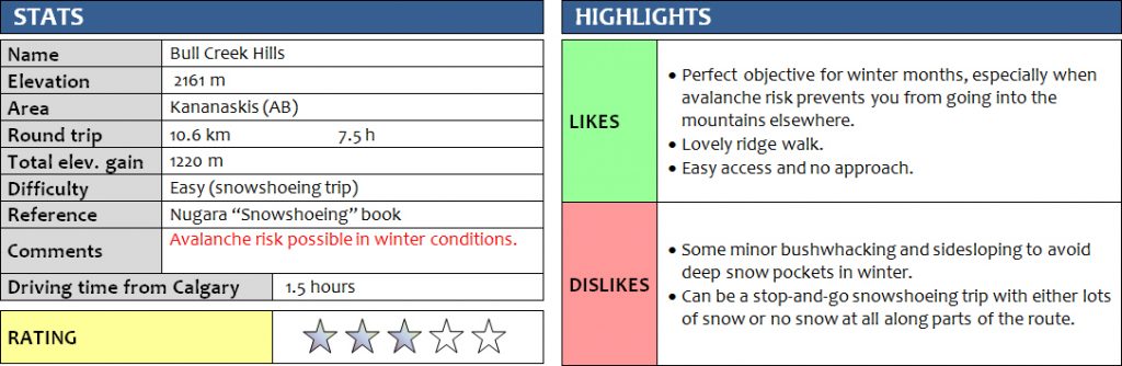
With an avalanche warning out for almost all parts of the mountains, but a beautiful sunny day in the weather forecast, we set out to southern Kananaskis to check out Bull Creek Hills, sitting right at the boundary between the Front Ranges and the foothills (technically I think they would be part of the foothills already). Nugara recommends this as moderately difficult snowshoeing trip, but we found it to be quite easy and there wasn’t all that much snow so we didn’t even use our snowshoes for much of the trip.
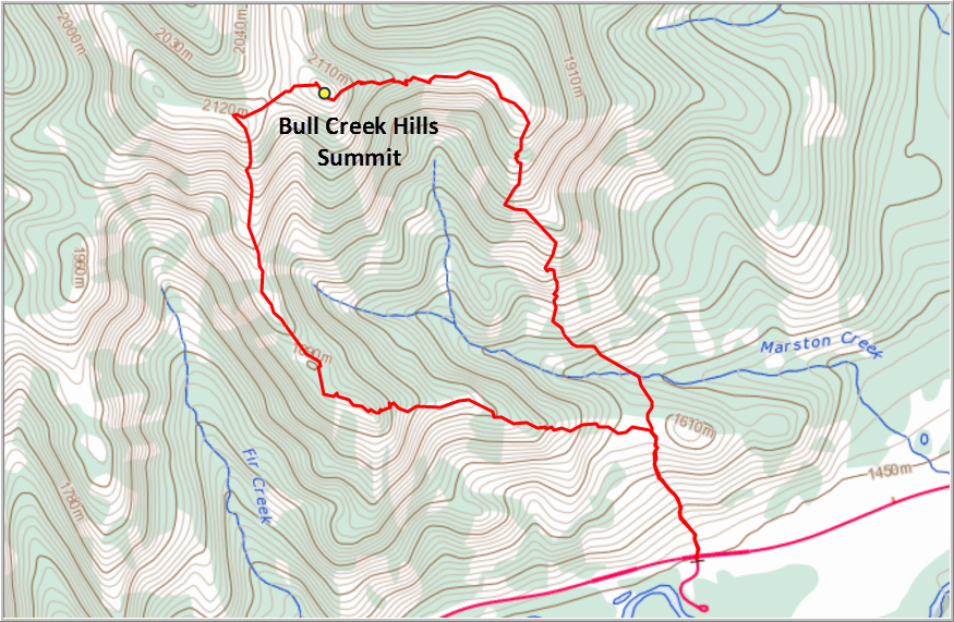
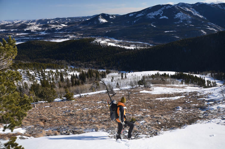
Initially, the terrain was very gentle and we were able to hike in ankle-deep snow, following the faint outline of a trail through patches of light forest and open slopes to a broad shoulder. Here, we had a good overview of the two ridges that we were planning to use to make this a loop (similar to Vern’s route detailed here).
We decided to go clockwise, which probably turned out to be the best choice due to one steepish snow slope right at the beginning which is easier and safer to ascend than descend, because you can see the whole slope better from below and, if deemed too dangerous, simply turn around. The snow was deep and soft here, so we put on our snowshoes and even then it was a lot of hard work! We approached the steepish slope carefully and then decided it was safer to avoid it entirely by going through the trees on the right, given the high avalanche risk in the forecast. This was a good choice because as soon as we reached the trees, we heard several deep, thumping “whumpfs” – that noise that results from instable snow layers collapsing onto themselves, with air escaping and cracks forming at the same time. It was an eerie, worrying sound, one that instantly put us on high alert. We scanned the entirety of the slope, but nothing had moved and it probably wasn’t steep enough to slide. We certainly didn’t want to take any chances and quickly moved deeper into the forest, where there was less snow and no risk of avalanches because everything else above us along the ridge was treed.
Once through the forest and above the steepish slope, we found ourselves along an open ridge that was only partially covered by snow. Here, we actually had to seek out the snow in an effort not to wreck our snowshoes too much on the rock! After going over a sub-peak along the ridge, we eventually took them off and continued hiking. Patches of deep snow along the crest of the ridge required some painful postholing, so for the rest of the ridge we slidesloped just below the crest on the southwestern side.
The highpoint before the summit grants fine views of nearby Holy Cross Mountain and Mount Head to the west, peaks that are most definitely off-limits in these elevated avalanche conditions. To get to the true summit of Bull Creek Hills, we had to overcome some deep snow lingering on the east side of the highpoint, which involved waist-deep “wading” and bum-shuffling – very energy-draining!
At the summit we took a well-deserved lunch break in a nice, wind-sheltered spot behind a rib of rocks. A survey marker sits at the summit, but the lack of any kind of cairn really shows the limited popularity of this destination. We certainly didn’t see a single soul the entire day.
The descent down the east ridge was easier and faster, mostly because there was much less snow as these slopes are more exposed to the sun. We didn’t need our snowshoes until almost down in the valley. But even here with so little snow it is imperative to remain vigilant and cautious: at one point we crossed a tiny but steepish snow slope, perhaps 30 x 50 m in size. We heard a whumpfing sound and instantly a small portion of the slope gave way and started to slide. Although we were in no danger here as the slope was simply too small and there was a gentle grassy run-out, it serves as a reminder of how quickly these things can happen and how important it is to avoid any snow-laden slope that is steep and big enough to cause damage.
Down in the valley, we followed a barbed wire fence through the forest and then angled right to re-gain the broad shoulder where we had started our clockwise loop in the morning.
Bull Creek Hills is a nice option for a winter hike and/or snowshoeing trip that is mostly on gentle and worry-free terrain. However, even here avalanches can occur and I would never venture into such terrain without adequate knowledge of avalanche dynamics and prior experience in analyzing snow stability. If in doubt, it’s best to turn around and come back another day.
DISCLAIMER: Use at your own risk for general guidance only! Do not follow this GPX track blindly but use your own judgement in assessing terrain and choosing the safest route. Please read the full disclaimer here.
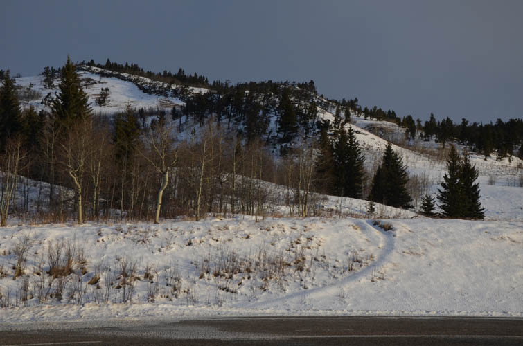
Start of the trail by the road.
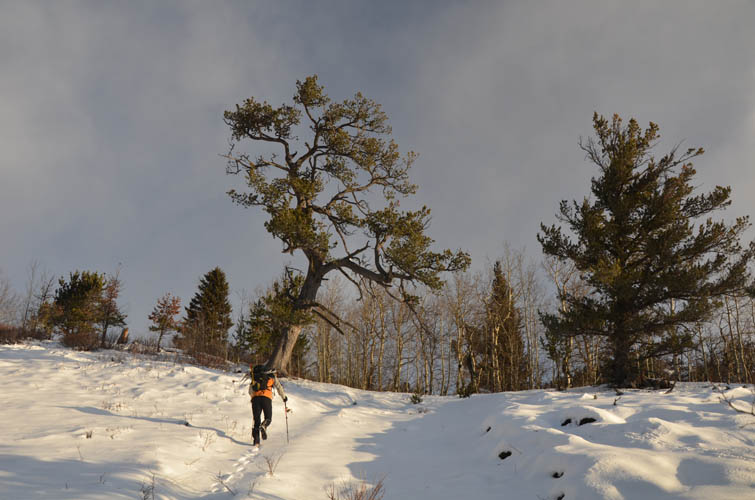
Hiking up gentle terrain.
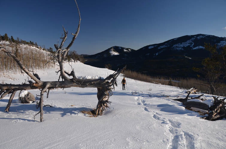
From the broad shoulder, which is reached in about 20-30 minutes, the summit of Bull Creek Hills is visible.
Looking back down the shoulder.
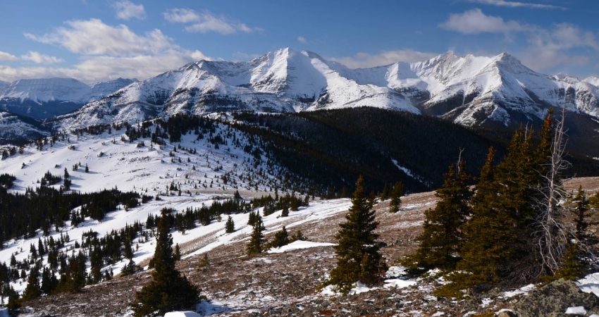
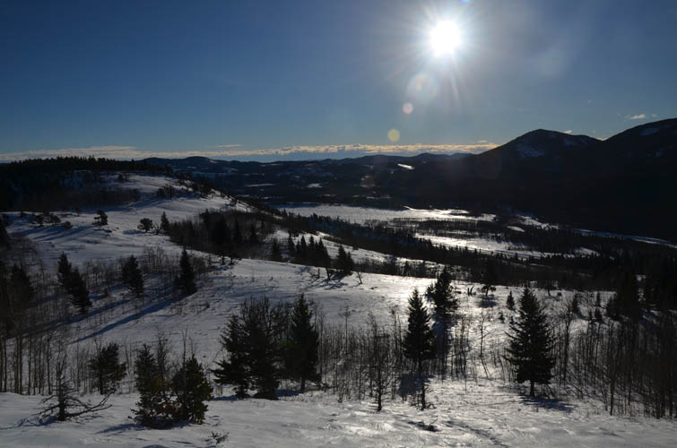
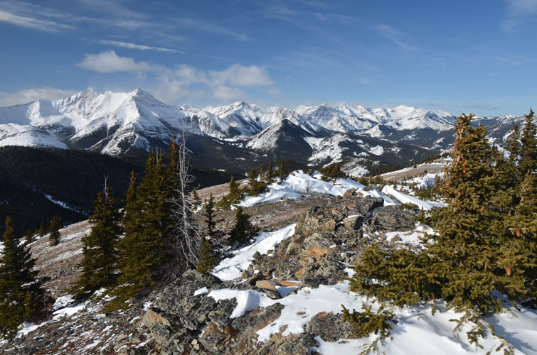
Fantastic winter landscape!
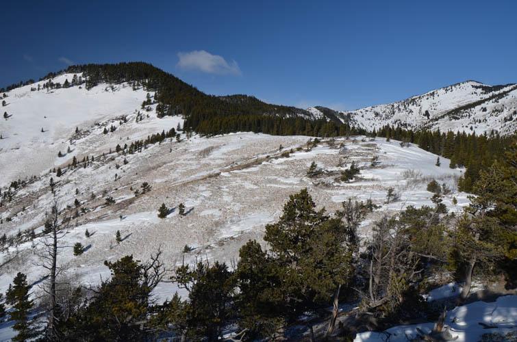
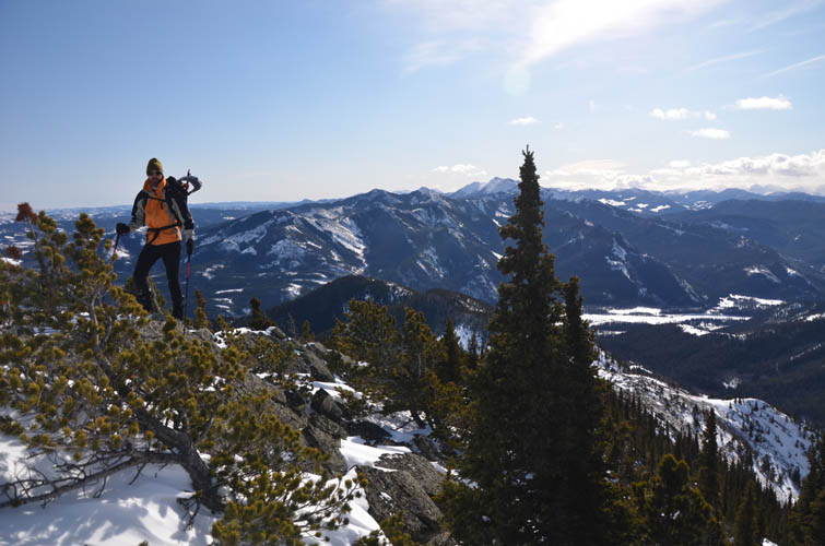
We took a clockwise loop, with the first part up this ridge. The small snow slope with potential avalanche risk is seen in top left here.
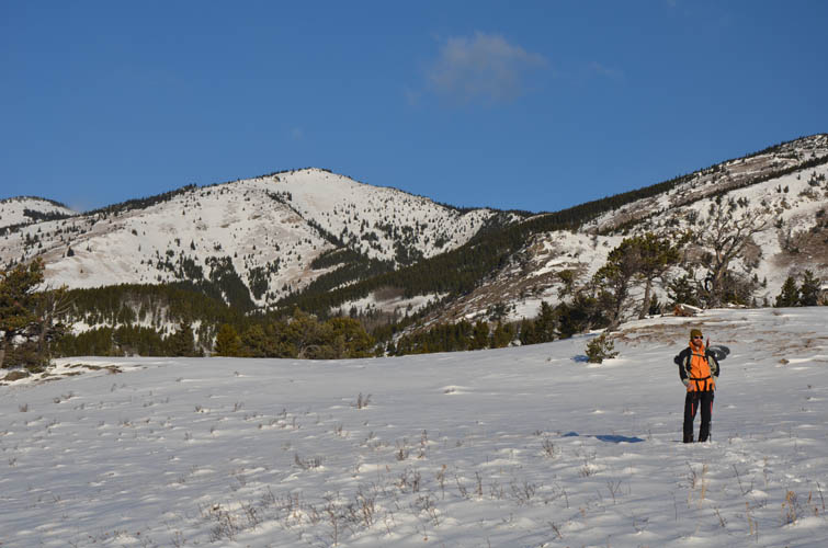
Mount Armstrong pops up to the SW.
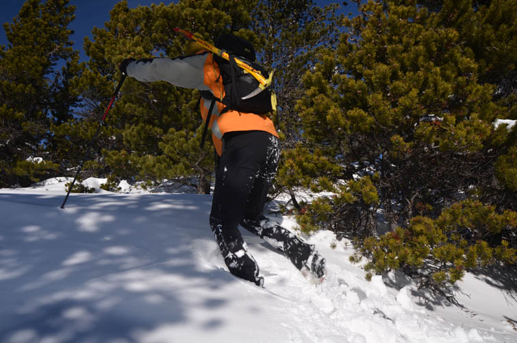
At times, the going is tough, even with snowshoes on!
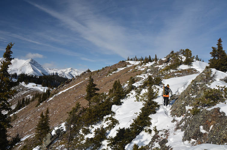
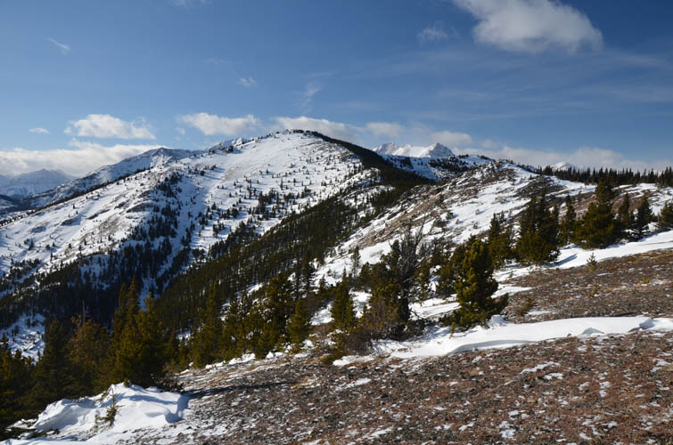
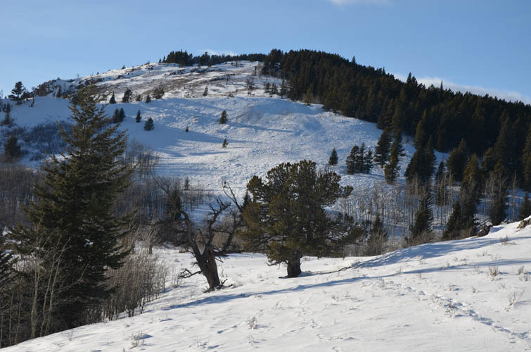
Further along the ridge, the remainder of the route can be seen. The summit is on the far right, a lower sub-peak in the centre.
It’s a nice ridgewalk with great views. Only short sections are in the trees.
Typical ridge walking.
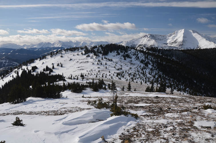
Looking back at the sub-peak from near the summit. There is an awful lot of snow that has accumulated in the lee of this high point. Holy Cross Mountain is directly to the west, in far right of this photo.
Richard nearing the summit.
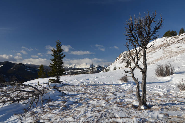
Wonderful summit views.
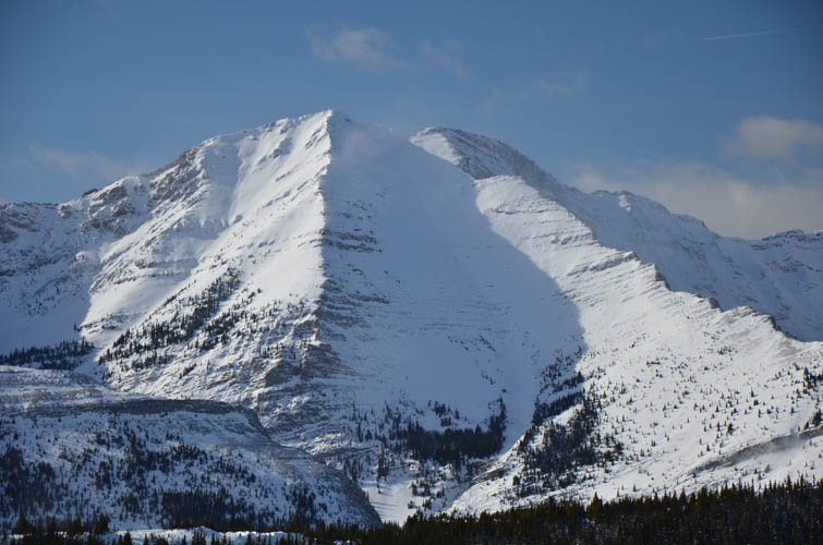

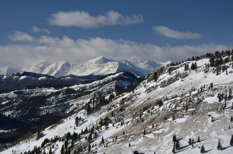
Mount Head
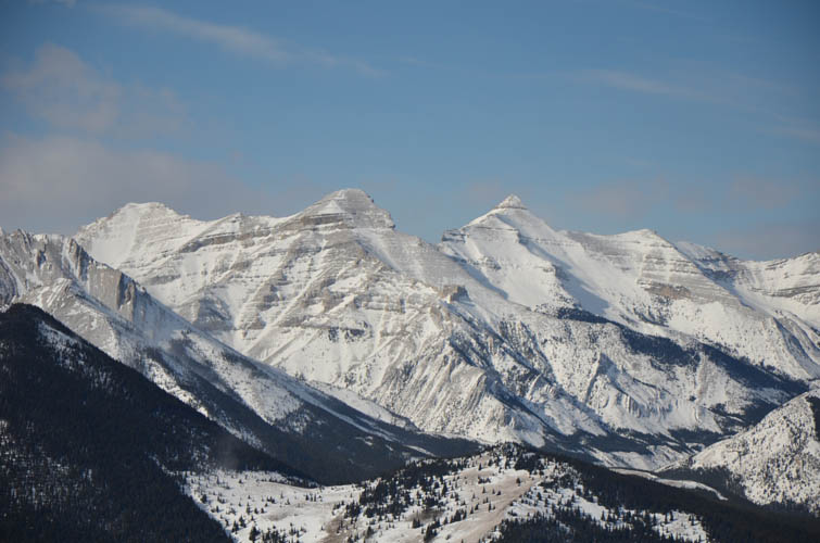
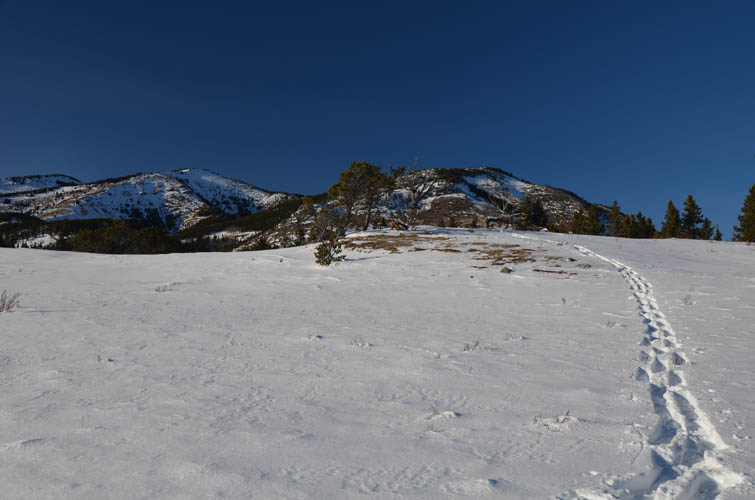
Patterson’s Peak (just left of centre) is one of the highest in the area to the NW.

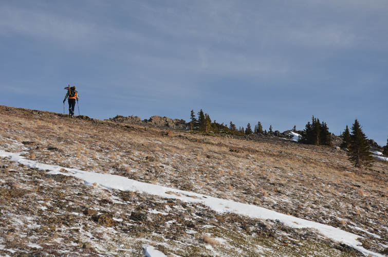
Heading down the W/SW ridge.
Much of the SW ridge is snow-free and we didn’t need our snowshoes until down in the valley.
Richard looking down the last stretch of the SW ridge towards the valley, and the climb back up through dark trees to the shoulder (to re-join our ascent tracks).
Snowshoes are back on!
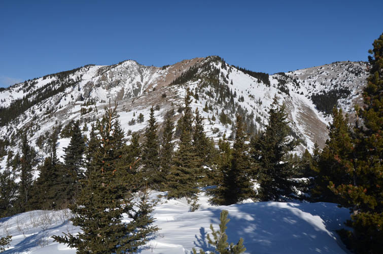
This last section of the ridge could potentially be avalanche-prone, but it actually looks steeper than it is and today the snow here was solid. Safest option would be to stick to the trees on the right.
Back on the shoulder, looking at the SW ridge.