13 May 2017
With Wen, Parag and Madhuri
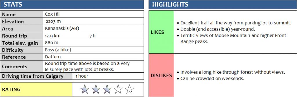
Cox Hill is a wonderful outing that’s close to Calgary and accessible year-round. The trail is well-trodden and typically in great condition even with snow still lingering on the higher slopes of this small peak in the foothills.
It was the perfect choice for introducing the mountains to our lovely friends Parag and Madhuri, who had never hiked up a mountain before. And they loved the challenge, although it didn’t come without a healthy dose of suffering! Certainly, if you’re not used to hiking 13 km with an elevation gain of almost 900 m, this is a really good workout that will make your drag your feet by the end of the day :).
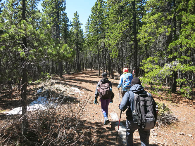
The hike is almost entirely in the forest on an excellent trail that is well-maintained. We saw perhaps a dozen other groups on this sunny but relatively chilly mid-May Saturday, with temperatures hovering around 10°C and below. Snow patches, some iced up and others super soft and deep, made for some wobbly walking, but thankfully there had already been enough foot traffic to ensure we didn’t need gaiters or microspikes. Blue skies and a glowing sun kept us company all day and made for fantastic views once we left the forest and slogged up a steep grassy slope to the short summit ridge.
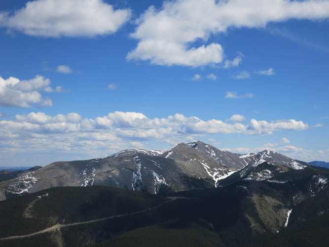
Moose Mountain dominates the view to the east, with the skyscrapers of Calgary popping up on the horizon a bit further north. To the west we enjoyed fantastic views of higher Front Range peaks such as Tiara Peak, Boundary Peak and Mount Baldy. It was such a brilliant clear day that you could even gaze at snow-covered summits further north in the Ghost area and beyond!
We were delighted to have the wide summit plateau all to ourselves and enjoyed an extended break in this beautiful spot. We were so proud of our friends, who had done an absolutely fabulous job at toughing it out and reaching their first summit! After some celebratory chocolate, we headed back down the same way, with a small detour around some snow patches. For some reason going down always feels so much longer and more drawn-out than going up, and today was no different. But it didn’t matter – great company, interesting conversations, and some good laughs is all we needed to make this a truly enjoyable day out!
DISCLAIMER: Use at your own risk for general guidance only! Do not follow this GPX track blindly but use your own judgement in assessing terrain and choosing the safest route.
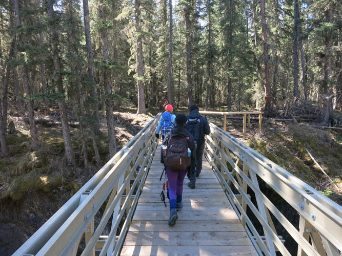
Crossing Jumpingpound Creek on the brand-new bridge.
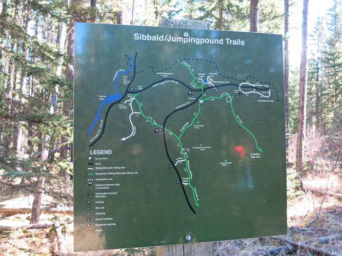
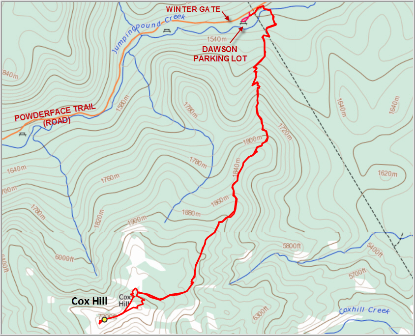
Trail map.
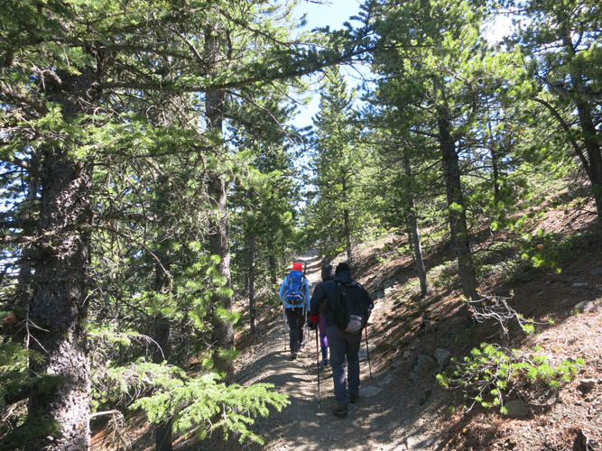
Heading up the good trail through the forest.
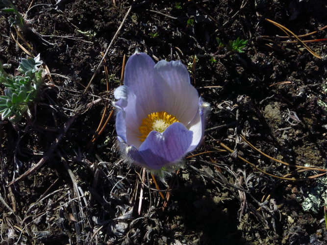
Prairie crocus
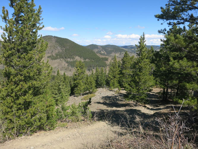
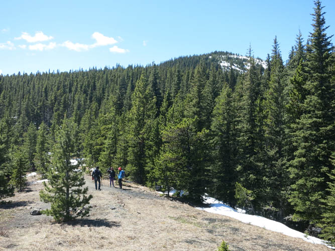
There are a few viewpoints where the forest opens up.
What a gorgeous day for a hike!
From this scenic picnic spot, the snow-covered summit ridge is visible in the distance.
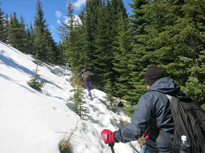
But first we have to stomp through some soft snow!
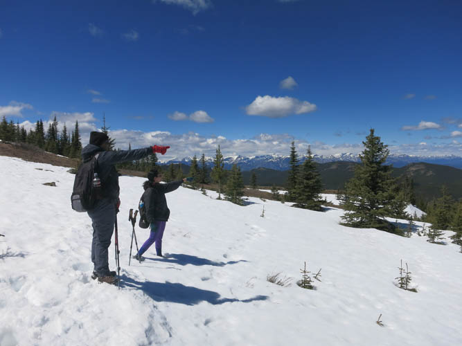
Front row view of Front Range summits: pointing out higher peaks in the distance to the west.
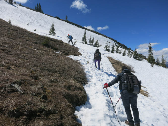
The last bit before the summit ridge is steep, but not difficult.
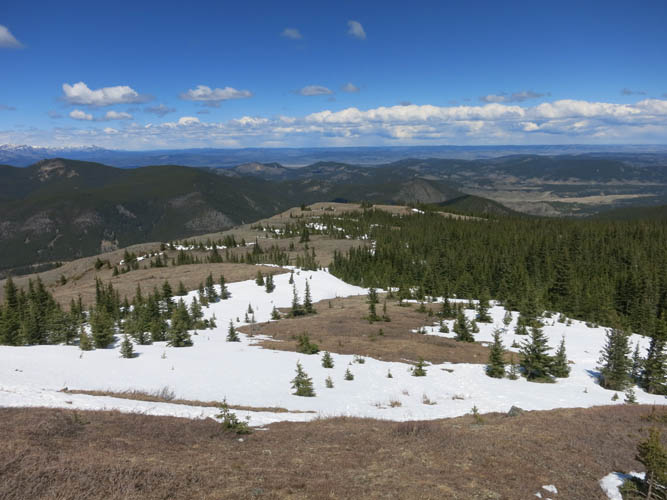
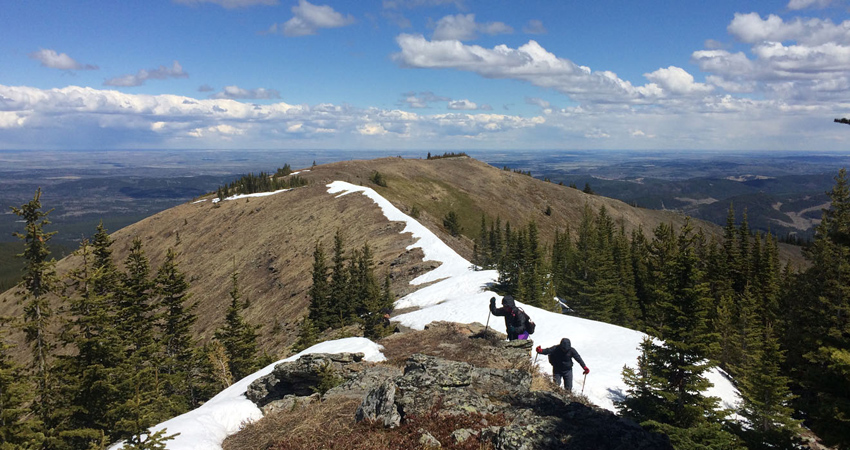
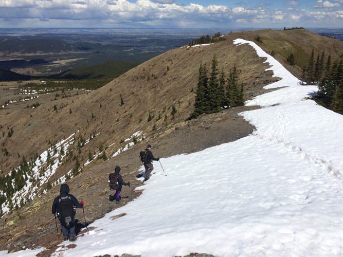
Fantastic views open up. Unusually for mid-May, there is still a lot of snow lingering up here.
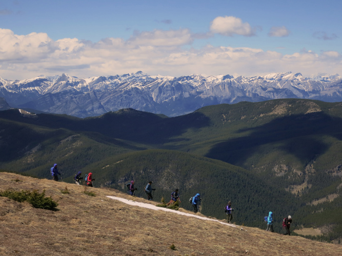
A group of hikers passes us.
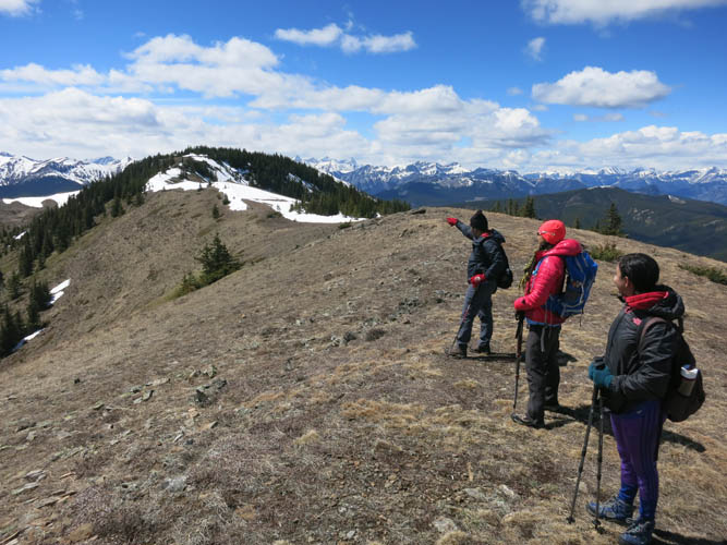
Looking at the true summit in the distance to the left. It’s only 10-15 minutes away.
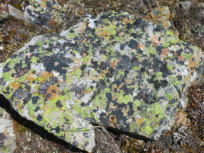
Colourful lichen-rock patterns.
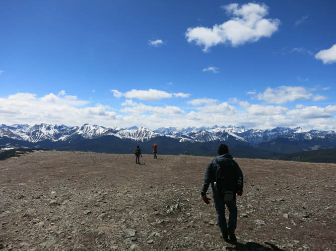
Stepping onto the wide summit plateau, the perfect stage for a scenic photo shoot :).
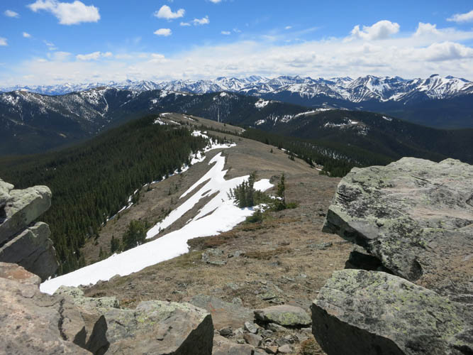
Jumpingpound Mountain can be easily reached via a gentle connecting ridge to the south.
Moose Mountain stands out like an island to the east.
Heading back along the summit ridge.