6 June 2017
With Phil
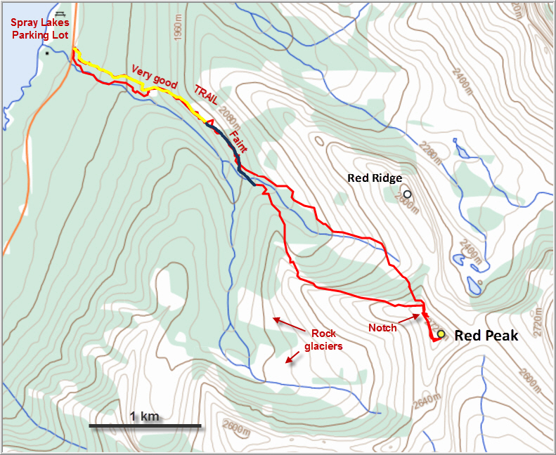
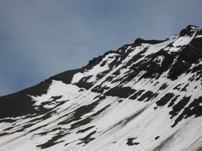
“Rubble Peak” is what it should really be called… that’s all I could think of when Phil and I scrabbled up the final gullies and slopes of Red Peak. There is just so much loose rubble here, it has even become the source of several rock glaciers in the basin below (“Red Basin”/trip #79 in Gillean Daffern’s K-Country Guide Vol. 1). Red Peak is one of the less popular objectives along Spray Lakes and I could certainly see why, although the normal route that goes via Buller Pass is probably a lot more palatable. With his inextinguishable sense for exploration, Phil had of course plotted out a completely different route up Red Peak – one that would lead us up the peak’s long west ridge, then down the valley between that ridge and Red Ridge to the north. The plan worked out quite well, but our excitement at having explored new terrain was in the end muted by the fact that our “new route” can’t really be recommended. All that rubble and loose rock, with a healthy dose of bushwhacking thrown in, doesn’t add up to a 5-star trip.
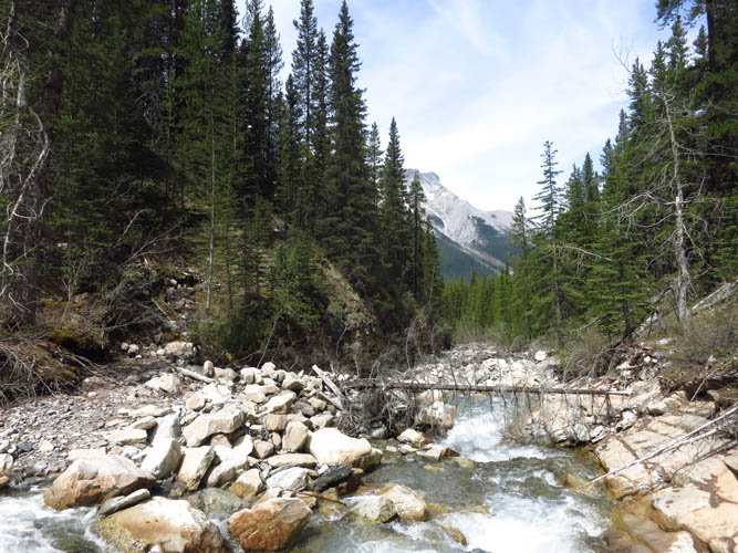
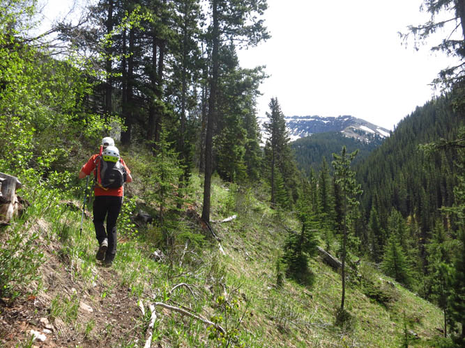
We could’ve made our lives easier from the start. Completely oblivious to the fact that there’s a decent trail on the north side of the ascent drainage we had chosen for our approach (called “Red Creek”), we instead bushwhacked for the first hour along the right side before we smartened up and crossed the creek to the path on the other side. The trail is sometimes used to access Red Ridge and starts to become quite faint past the boulder field further up the valley. Some bushwhacking was necessary to stay on the overgrown path, yet we still lost it in places – it simply doesn’t seem to be in use anymore. We found a nice lunch spot at the end of the trail (marked by pink flagging), which placed us right at the beginning of the west ridge that leads up to Red Peak.
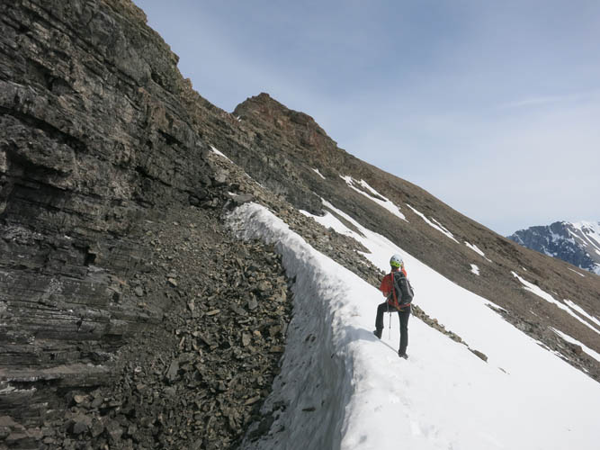
The lower slopes of the west ridge are covered in light forest and interspersed by cliffs, all of which are avoidable by going around the left (north) side and sticking to the creek for a while. Above treeline, the ridge finally looks like what a ridge is supposed to look like. A well-defined crest with a steep, craggy drop-off to the left and a gentle slope of endless shale to the right. An easy and lovely hike which, not surprisingly, is very similar to the ridge walk along neighboring Red Ridge.
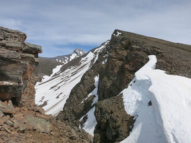
One difference to Red Ridge is that the summit of Red Peak is further to the back of the valley and it took us quite some time to complete the slog up to the summit mass. Here, the terrain gets much more serious: the ridge narrows into a jagged spine of rotten rock that just crumbles every time you touch it with boot or hand. We had to be really careful here, the shale is very unstable and loose. There is a notch in the ridge that we reached by scrambling down a few steep ledges; this is also the point that allows connecting to Red Ridge. We tried to continue along the ridge past the notch, but didn’t get very far – it became too steep and exposed. Back at the notch, we descended down a muddy gully for a few metres and then continued just below the ridge on its western side. Again, the terrain is very loose here, but as miserable as sidesloping on rubble is, at least there’s no exposure here and a simple treadmill trudge brought us up to the summit. Rubble Peak!!
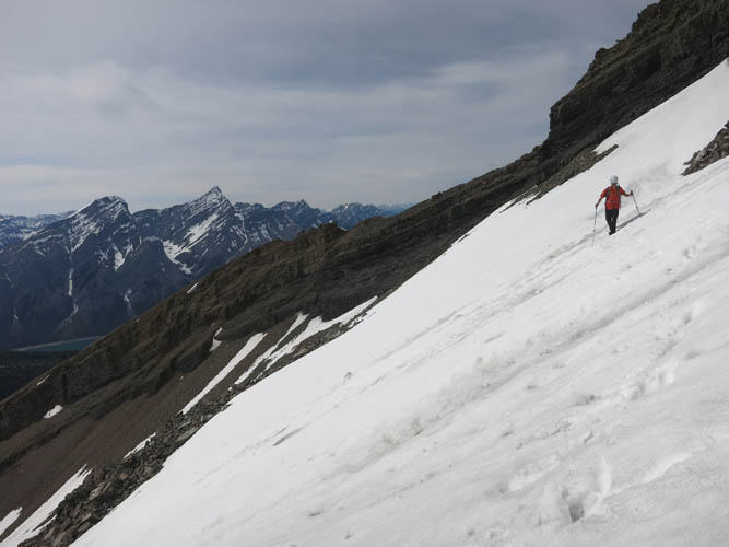
All this energy-sapping rubble plus a late start denied us a chance of continuing on to big and beautiful Mount Bogart – we will leave that for another time! [Edit Sept 2017: During a trip up Mount Bogart it became obvious that a traverse between the two peaks appears impossible as a scramble]. Instead, we retraced our steps to the notch in the ridge, then followed a short ramp on the eastern side to get to the small valley between the Red Peak’s west ridge and Red Ridge. There was a short and fast glissade down the snow slopes here, but the snow was already getting too wet and soft and further attempts at bum-sliding down the valley mostly ended in embarrassment and laughter J.
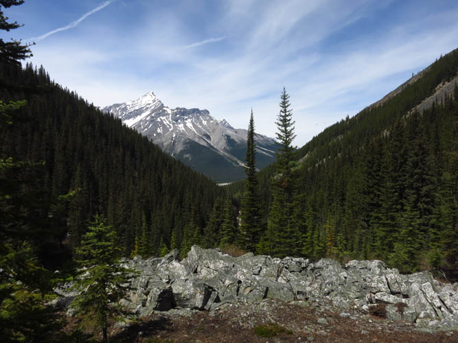
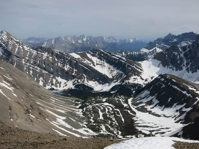
Following this valley down was a good choice as it’s quite a scenic place here with lovely patches of fir trees, meadows, boulder fields and brooks running through. It was also an easy hike that quickly brought us back to the trail, and we were home free.
This is an interesting loop – I loved the beautiful landscape and sweeping views, but couldn’t stand the rubble. For those interested in combining Red Ridge with Red Peak, the bypass via the bench and the notch in the ridge crest provides a way to connect the two. Nonetheless this is only something I’d do in the summer as any snow lingering on the east side of the connecting ridge would place the route into dangerous avalanche terrain.
DISCLAIMER: Use at your own risk for general guidance only! Do not follow this GPX track blindly but use your own judgement in assessing terrain and choosing the safest route.
Stumbling over boulders in Red Creek is NOT the way to go!
The trail on the left (north) bank – much better!
View back to Old Goat Mountain from our lunch spot.
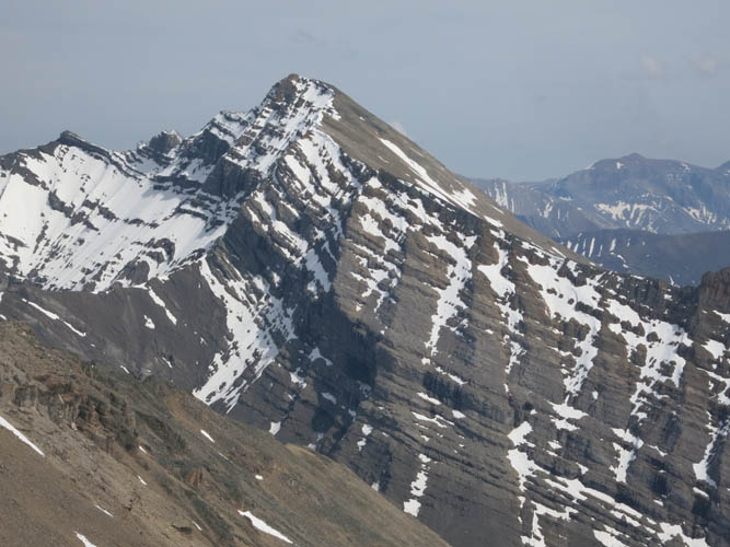
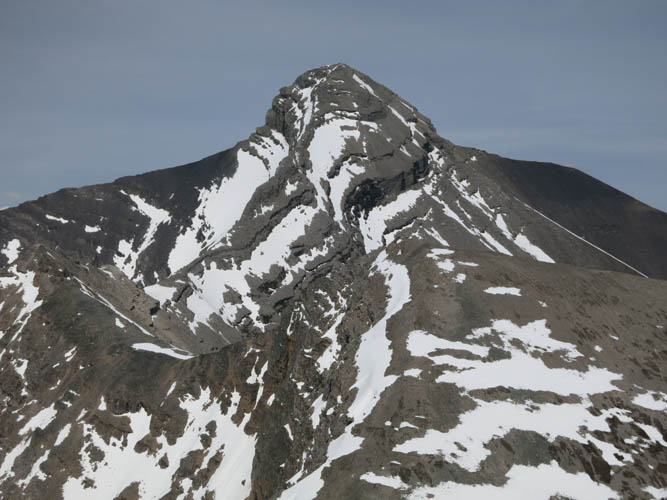
First full view of the west ridge leading up to Red Peak.

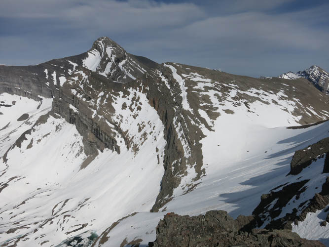
Red Ridge lies immediately parallel to the north.
Big Sister
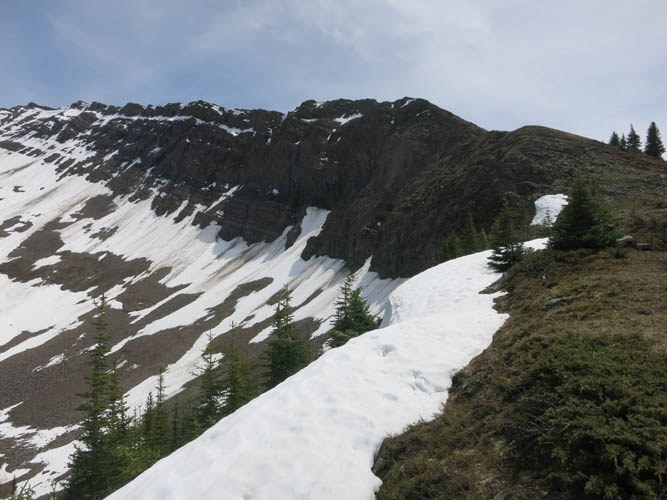
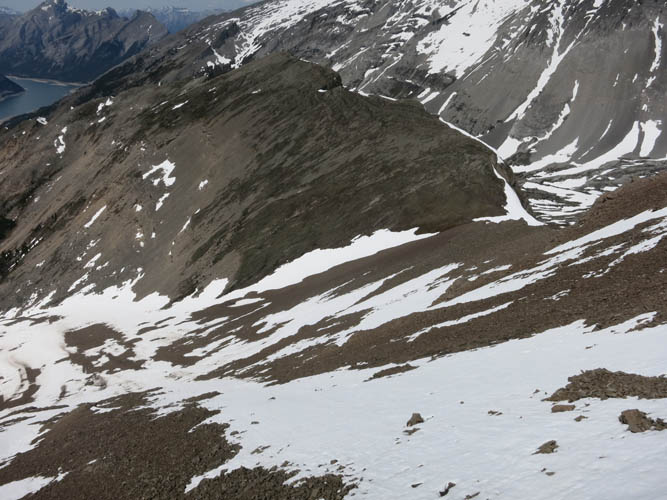
Close-up of the northerly slopes off Red Peak that can be descended on snow in the right conditions.
Some striking colours amongst all the brown rubble.
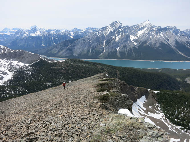
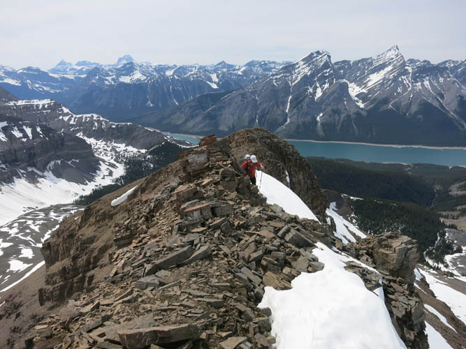
A look back along the ridge towards Spray Lakes.
Gaps along the ridge. Mount Bogart starts poking through in the distance.
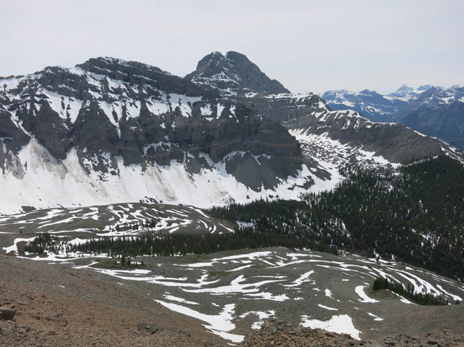
The rock glaciers in Red Basin, with Mount Buller behind.
The west ridge is quite extensive and it takes a while to grunt up all this rubble.
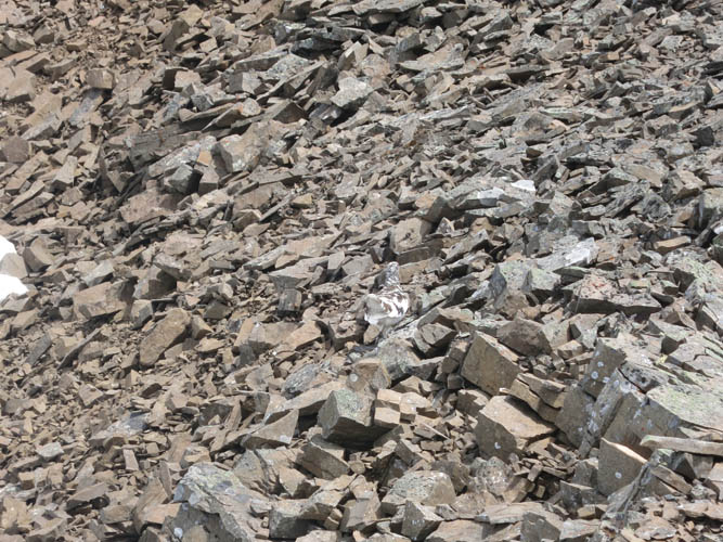
Yes, RUBBLE! Something else is hiding in there as well…
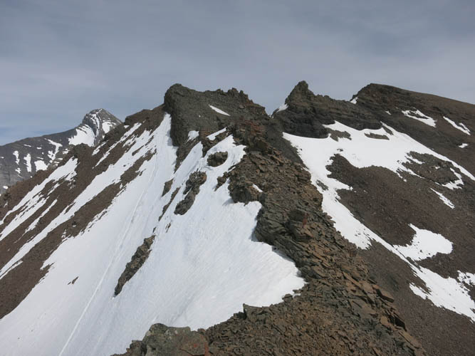
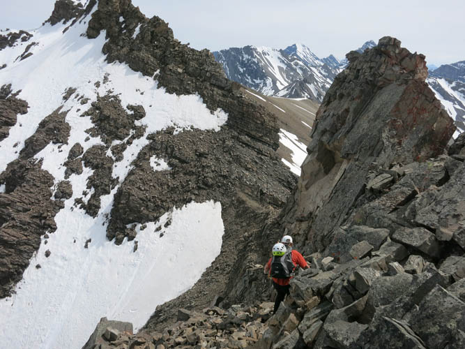
Upper and more complex part of the ridge.
Phil gingerly stepping along the narrow ridge spine.
This is the descent snow slope we used for a quick glissade/plunge stepping down.
Phil scrambling down ledges to the notch.
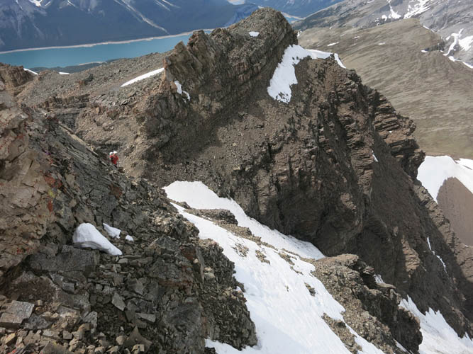
Opposite view: the ramp with the small snow patch on the right is the connection to Red Ridge. The notch on the left (where Phil is standing) allows one to link up with Red Peak.
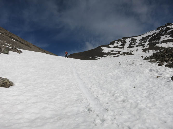
Final scree sidesloping to the summit of Red Peak.
With a short patch of firm snow, which was much easier to traverse.
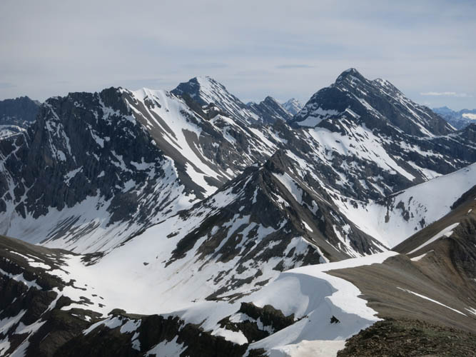
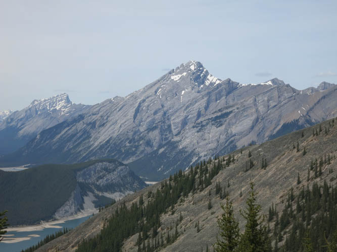
Great views of bigger peaks to the south.
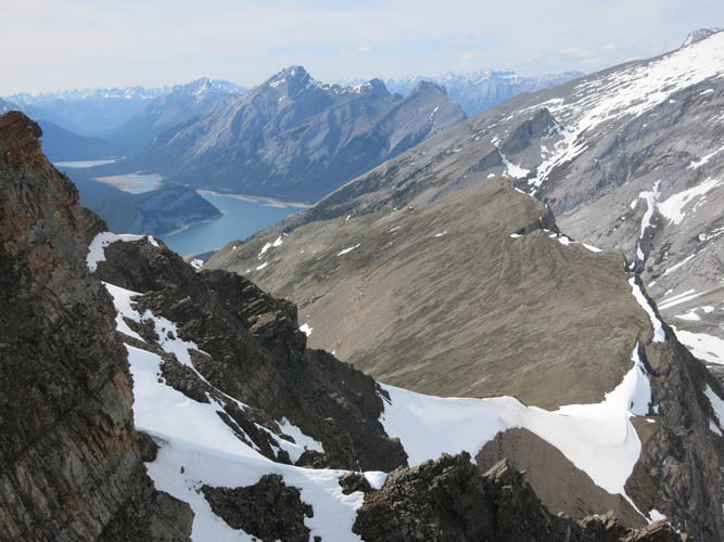
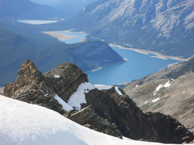
Ribbon Lake sits at the end and left of this wide valley. Mount Kidd South is just visible on far left.
Close-up of Mount Kidd South.
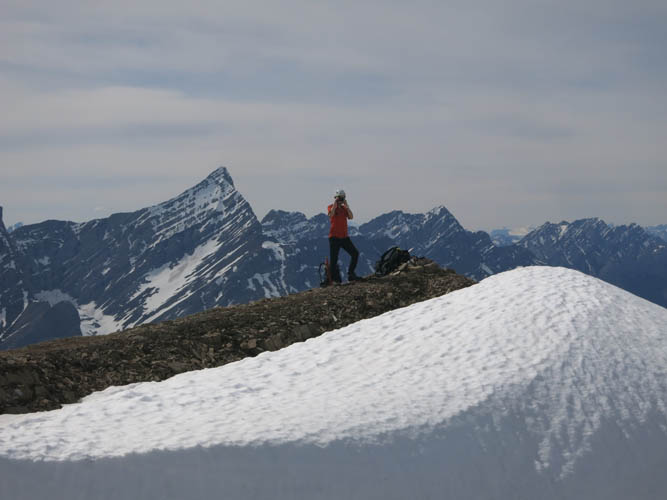
Phil at the summit. The pointy peak to his left is Old Goat Mountain.
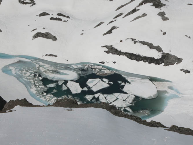
Sparrowhawk Tarns are still partially frozen.
Looking towards Red Ridge.

A fantastic day!
Looking past the crumbly ridge towards Spray Lakes.
Another view of Big Bogart.
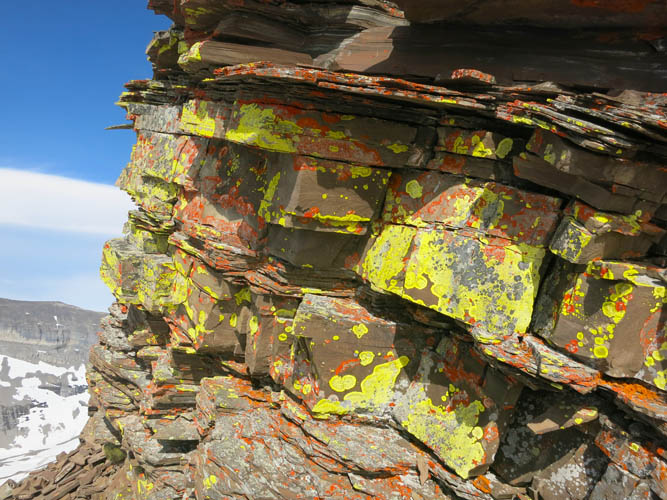
Colourful display of yellow and orange lichen on brown shale.
Snow slopes speed up our descent in the valley.
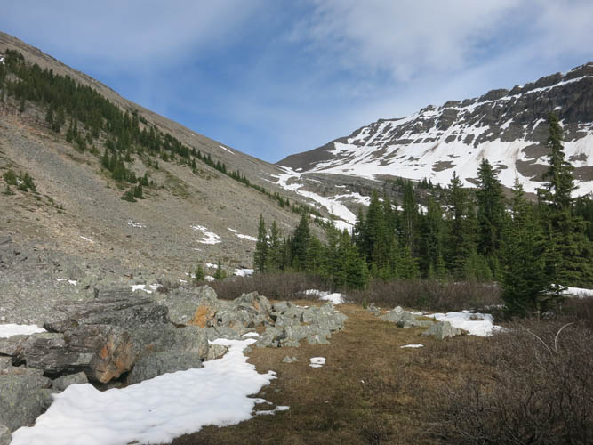
The picturesque valley is tucked away between the ridge we climbed (right) and Red Ridge (left).
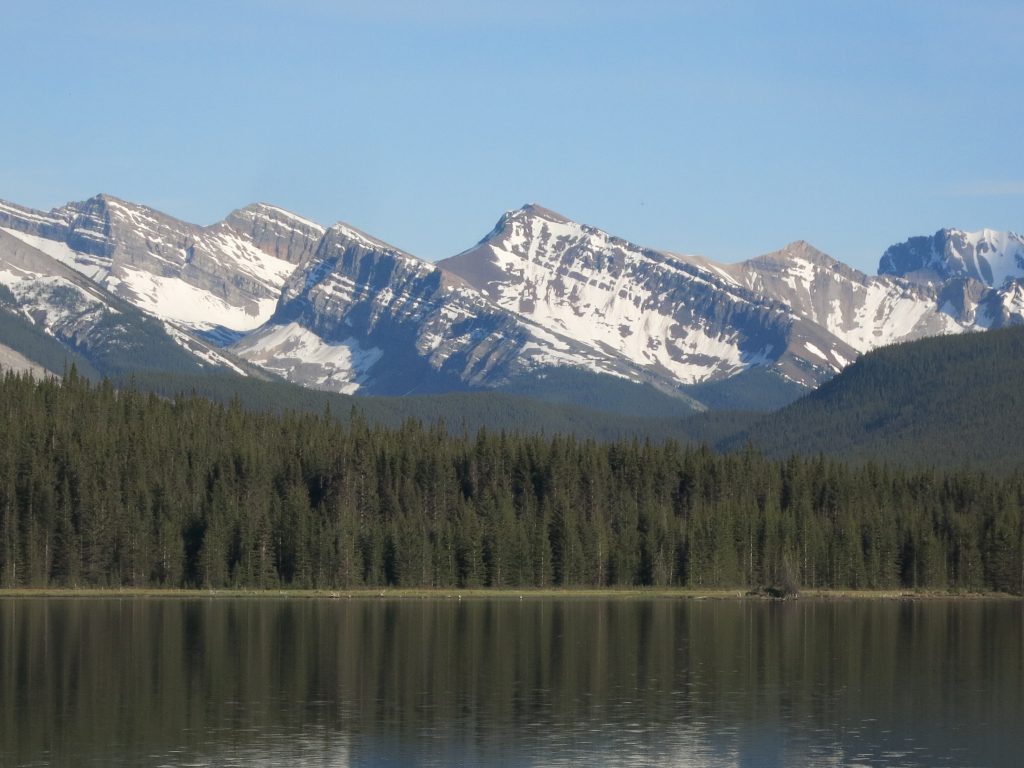
A nice profile view on the drive back (L to R): Mount Lougheed, Mount Sparrowhawk, Read’s Tower, Red Ridge, Red Peak, unnamed.