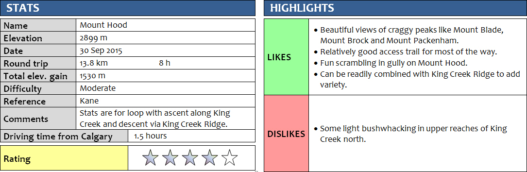
30 September 2015
Solo
Mount Hood seems to be one of the least popular scrambles in the Kananaskis area, perhaps the entire Rockies. Why? I don’t know. I thought this was a brilliant outing, despite very rubbly and loose rock in the ascent gully. There aren’t many trip reports to be found online – usually an indicator that it’s not exactly a happening place.
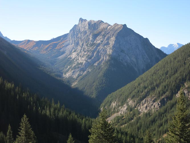
I’ve never slipped and fallen into a creek, but today it finally happened. About half an hour into my lonely hike up King Creek, which has to be crossed multiple times, I had a momentary lapse in concentration and slipped on a wet tree trunk just as I was about to reach the other side of the creek. I lost my balance and fell sideways into the ice cold water, but quickly recovered and basically “bounced” back out of the water using my right arm for support. I was half wet, but I wasn’t going to give up so quickly and figured my body heat would dry my clothes eventually, so off I went at even more vigorous pace. Wenshuang and I had hiked up King Creek before in the winter to take an ice climbing course, but there was no water involved back then – just ice and snow! The valley was actually easier to navigate than in the winter and I quickly reached the junction where King Creek splits into the northern and southern branches. This is where some people have apparently gone the wrong way before, as there is a very good trail heading straight into the forest. I simply turned left at this junction and then stuck to the left side of the northern branch of King Creek most of the time, where there was a decent path for the first few hundred metres. Later on it was easier to hike in the middle of the creek bed. There were a few fallen tree trunks to overcome here and there, but nothing too alarming. Having expected much worse from the few online reports I’d seen, I was actually surprised at how quickly I was able to progress up the valley. Soon an inviting grassy bump appeared on the right and I headed straight up – too soon as it turned out. I made it all the way up to the base of the near vertical cliffs of Mount Brock and then had to hike just below the cliffs over several minor humps to get to the ascent gully of Mount Hood. I can see how people can go wrong here again. One guy I had met on Mount Warspite a couple of years ago had told me he had inadvertently climbed Mount Brock instead of Hood (and a few entries in Hood’s register alluded he wasn’t the only one), and this is probably where he had gone up. I didn’t mind the small detour; the views were spectacular as the sun started to appear behind Mount Blane and illuminated King Ridge and the surrounding mountains with full splendor. For those looking for the most efficient route: just stick to the creek bed all the way until you’ve almost reached the saddle (high point) between King Ridge on the left and Mount Hood on the right. This is where you can start ascending grassy slopes to your right that lead directly to the entrance to the gully described in Kane’s book. There are at least two nice-looking grassy slopes on your right before this, but don’t let these tempt you.
The ascent gully is easily identified by a sharp, near vertical wall the guards the entrance on the right of the gully. Looking up, I first thought that’s going to be a tough one, but I was wrong. It was a fairly easy poles-in-hands scramble and I made good progress here. Higher up the gully became wider and the slopes were strewn with loose rubble that was a bit unpleasant to trudge up. The way to the ridge was obvious – follow the path of least resistance (a couple of cairns here) to a v-shaped gap in the ridge. From the ridge there was a beaten path that easily led to the summit in another 20 minutes. It was a spectacular day and the views couldn’t have been better. The sky was deep blue and the sun, fairly low now in autumn, cast a warm light on the landscape that made everything look richer and more vibrant. I spent a good half an hour eating my canned fish for lunch (poor choice!), while glancing at Mount Packham to the north and Mount Brock to the south. A few hikers had made it to the high point of King Ridge, but other than that there was no one in sight.
At least not until my decent. I had just exited the gully and was racing down the scree slopes towards the saddle with King Ridge, when two hikers appeared, slogging up the hill towards me. I couldn’t believe who I saw there: it was Victor, the Ukrainian fellow that had to be rescued off Mount Lawson a few months earlier when I stumbled upon him minutes after he had tumbled down a snow-filled gully. We were excited to see each other and couldn’t believe the coincidence – a Wednesday in late September on an unpopular mountain. He was in good shape and I was glad to see he was out enjoying himself again.
The way up to the highpoint of King Ridge was easy to follow on a good path at first, but this trail petered out near the base of the cliffs that guard the upper part of the ridge. I walked along the base of the cliffs for a bit until a flagged tree tipped me off: there was a short-cut that went straight up, zig-zagging through the cliffs. By no means was it well-trodden and there were no cairns at all, in fact there seemed to be no traces of others having been here at all. Half way up I found myself in difficult scrambling terrain and started to wonder if this would lead anywhere. It wasn’t too hard though and after a little bit of routesearching and careful hands-on scrambling I eventually found a way up several weaknesses and came out on top of the ridge, only some 20 metres south of the summit cairn. This had turned out to be the most challenging part of the day (other than getting myself out of the creek water!), the scrambling was short but more difficult than anything on Mount Hood. I enjoyed a second lunch in the brilliant sun and then leisurely ambled south along the gently undulating ridge. One a sunny summer day I think it’s worth coming up here for the views alone – truly stunning! On the left are the vertically tilted strata that make up Mount Hood, Brock and Blane, Kananaskis Lakes are on the right, and the precarious looking Mount Wintour with its snake-shaped ridge straight ahead. Soon, the very good path that I followed veered right and became quite steep. There were lots of cairns and it was easy to follow all the way back down to the parking lot. By the time I got back to my car, I was hot, sweaty and felt overheated. It was an incredibly warm day (around 26 degrees) and with barely any wind and not a single cloud in sight, it’s easy to underestimate the power of the sun! This was a fantastic outing in a beautiful area of Kananaskis that I will surely come back to one day, perhaps to scout out a route up Mount Brock or Mount Blane.
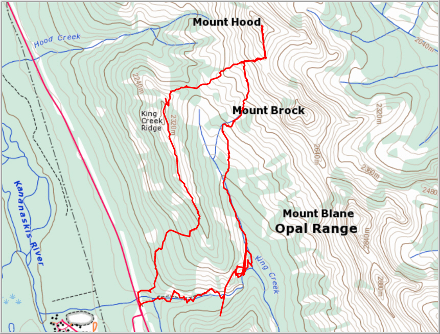
ROUTE MAP
DISCLAIMER: Use at your own risk for general guidance only! Do not follow this GPX track blindly but use your own judgement in assessing terrain and choosing the safest route.
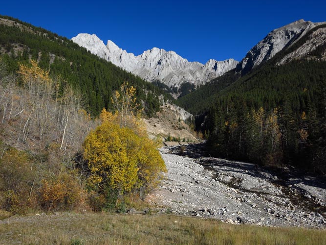
The entrance to King Creek (view E). Photo taken on return when light was much better.
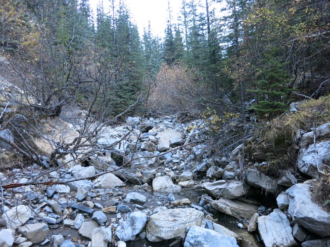
Going up King Creek North (view N). There’s a path here and there, but mostly it’s rubble and boulders like this. The going is easy, though.
Mount Wintour from E slopes of King Creek North (view S).
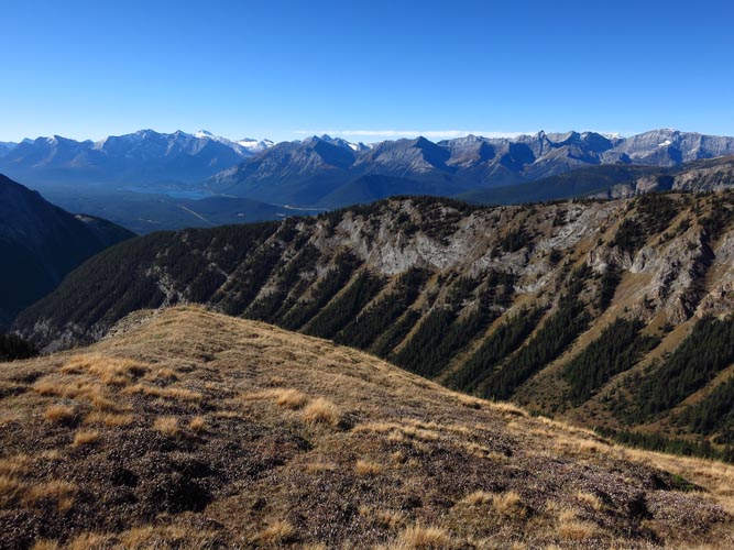
A gorgeous blue-bird day in fall 2015: looking SW toward King Creek Ridge. You can just about see the Kananaskis Lakes on the left.
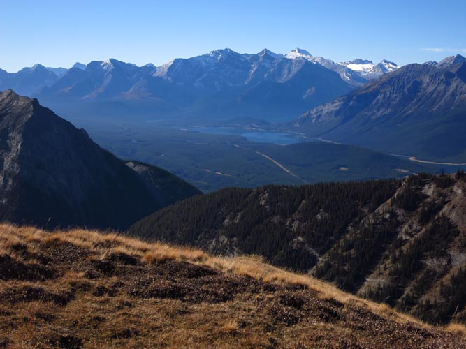
A closer look at the Kananaskis Lakes.
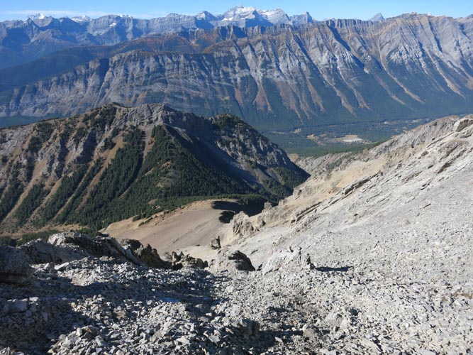
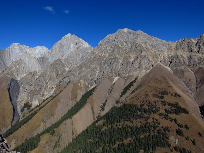
Gentle brown shale slopes from a scree pile leading up to the steep west faces that guard Mount Packenham and Mount Hood on the right. This is looking north after reaching the saddle between Mount Hood and King Creek Ridge.
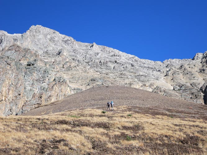
A pair of hikers, the only other people I saw all day, are going up the approach scree slope toward the gully that leads up to Mount Hood (photo taken on return).
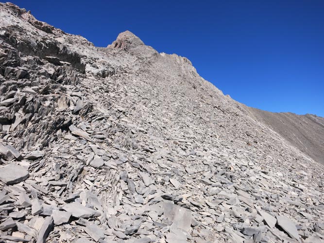
Coming up the W side of Mount Hood, in the upper part of the gully. Below is the saddle and the forested King Creek Ridge behind it.
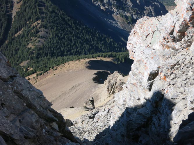
Another view from inside the access gully from saddle up W side of Mount Hood.
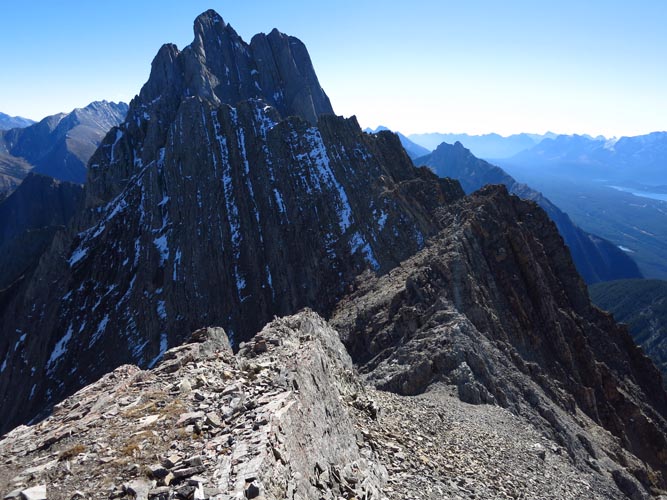
On the east side of the ridge leading up to the summit of Mount Hood, which is hidden behind this false summit.
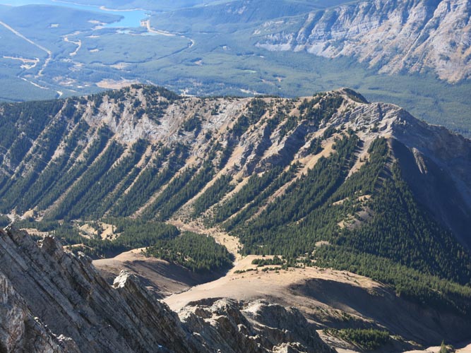
From the summit ridge, the views of King Creek Ridge and Kananaskis Lakes in the background are fantastic!
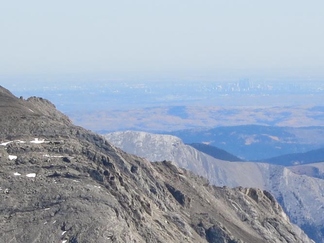
Summit view from Mount Hood: the skyline of Calgary to the east.
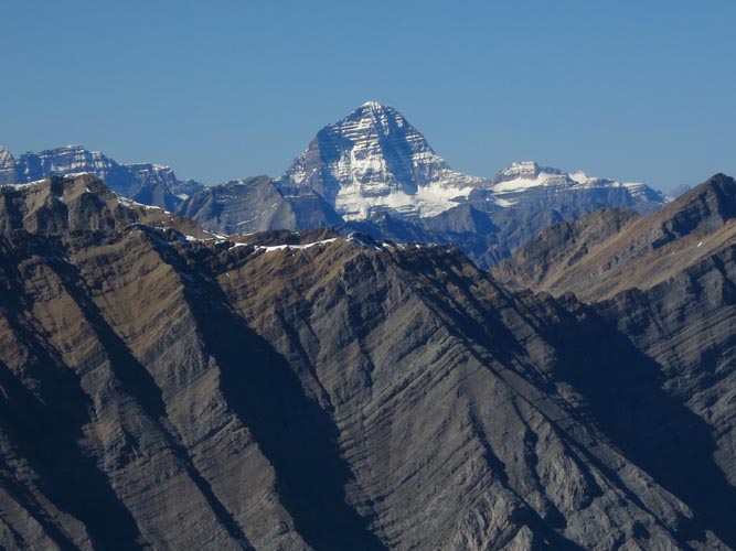
To the west, spectacular views of a giant: Mount Assiniboine.
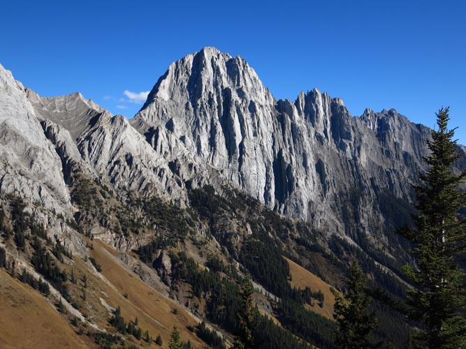
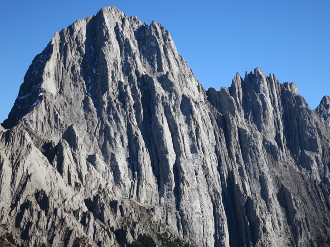
Mount Packenham to the north. I’m fairly sure this is a roped climb, not a scramble.
And Mount Brock to the south.
After summiting Mount Hood, I came back down the access ramp (seen here as the large, forested cone on the right with scree near the top) and continued back up the other side of the saddle toward King Creek Ridge.
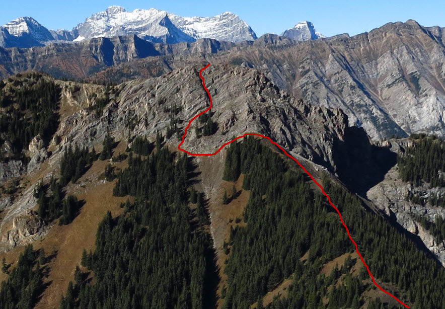
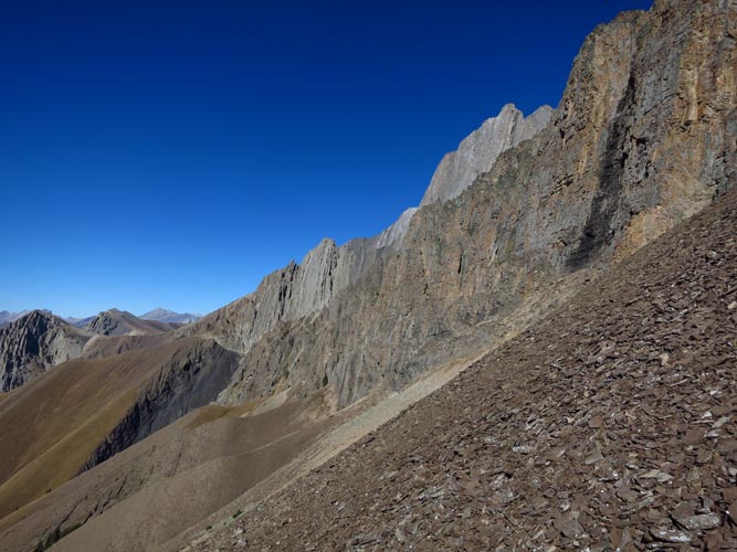
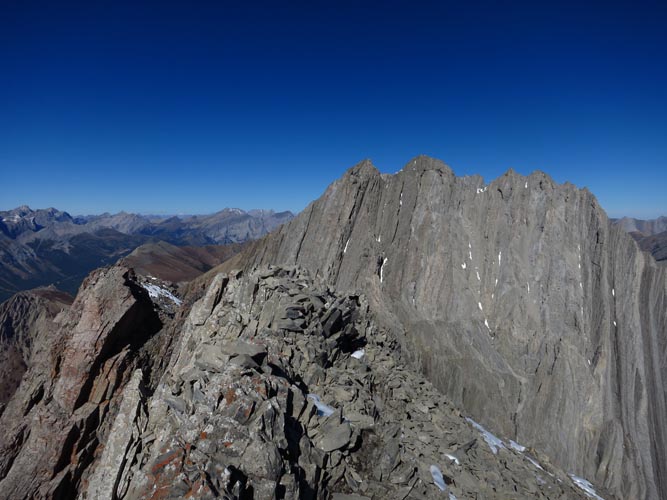
A closer look at the route I took on return to ascend the north end of King Creek ridge. Route goes up from the saddle through light forest, then angles left below steep cliffs, and climbs through obvious weaknesses up to the summit. This is moderate to difficult scrambling (more difficult than anything on Mount Hood!).

Bighorn Sheep in the forest on the saddle.
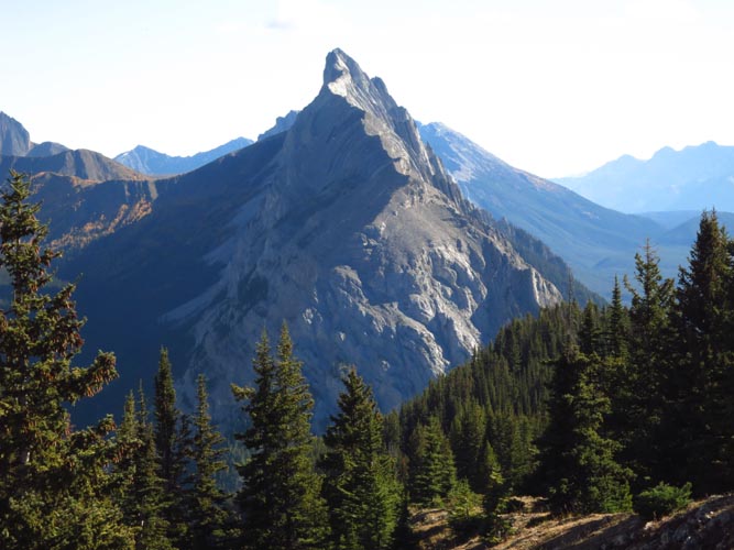
Mount Blane looks quite impressive with its jagged outline against blue sky (view SE from King Ridge).
Close-up of Mount Blane.
From King Creek Ridge, Mount Wintour looks like a thin, wiggly band of rock.