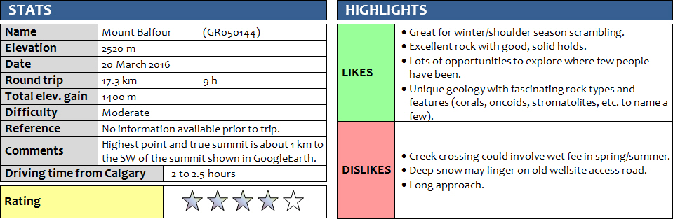
20 March 2016
With Priyesh
This is a strange mountain. No information whatsoever could be found, official maps don’t list a name for this mountain, yet in Google Earth (but not in Google Maps!) the name “Mount Balfour” shows up at the supposedly highest point along this SW-NE trending ridge that eventually links up to Otuskwan Peak in the SW. Strangely, the information associated with the label links up to the better-known Mount Balfour along the BC-AB border… a misplaced label perhaps? Regardless, I really enjoy exploring obscure and unknown mountains and finding a possible route up to the summit – and today Priyesh and I were blessed with success on what started as an inauspicious day.
Edit March 2019: After chatting with Phil about the obvious misplacement of the “Mount Balfour” naming label, we agreed on “Winchester Ridge” as an alternative and perhaps more appropriate name after the nearby Winchester Creek to the north. Phil and Vern went out to climb the peak shortly after and you can read Vern’s excellent trip report here.
When we drove out to the Ya Ha Tinda area in the early morning on this beautiful and warm March Sunday, our aim was to conquer Warden Rock on an alternative route that would require an approach by bicycle. Shortly after passing Sundre, on the bumpy road leading toward Cartier Creek, we suddenly heard a thump and saw our bikes flying past our car while zipping around a curve at 80 km/h… To our horror, the entire bike rack had snapped off the trunk and come crashing down, bouncing along the gravel road into the other lane and into the ditch on the left. Thankfully, there were no other cars at the time (this road is ALWAYS empty!) and nobody got hurt. But my bike was toast, the front wheel totally bent and the handle bar distorted by the impact. So just a week after our previous failed bike attempt (at that time we arrived with a flat tire in my bike and did the laborious Labyrinth-Minos suffer tour instead of Wapiti Mountain), our plans were thoroughly thwarted again. Sigh… it seemed we were just not meant to bike around this area!
Fortunately, I remembered drawing up rough ideas on how to scout out a route up so-called Mount Balfour (herein referred to as Winchester Ridge from now on), which is along the Panther River area nearby. The road leading off highway 40 past the Panther River Lodge is in surprisingly good shape, even after 10 km where a big sign warns that “Travel is not recommended past this point”. We parked in front of a big wellsite marked “Panther 1, ….”.
From here, it was a short hike down to the frozen over creek and a few hundred metres uphill through light forest to reach an old wellsite access road that is marked on maps. Initially we followed this road that winds its way parallel to contour lines around a low-lying E-W ridge, but snow on the north side of that ridge soon slowed down our progress significantly, so we decided to abandon the road and go straight up the ridge. There was very little bushwhacking as the forest was light, so it was quite enjoyable to take this route, but of course there were a lot of ups and downs that added unnecessary elevation gain to our day. But we were here to hike and a little extra exercise shouldn’t be a bad thing! At the first high point of this ridge, the views opened up and a narrow logging road appeared which we then followed along the spine of the ridge, almost all the way to the base of the mountain, to a grassy hill just before a col between the ridge and the main mountain. It was a great spot for lunch while we contemplated possible routes up the main ridge.
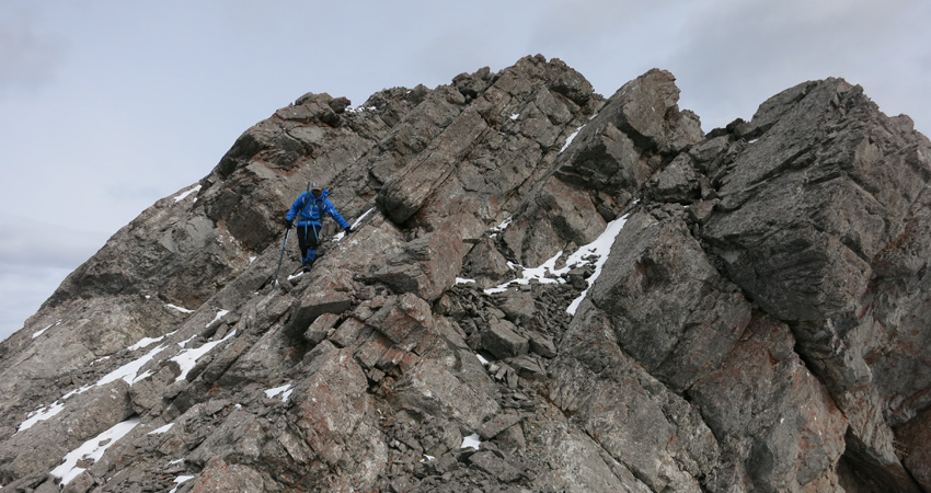
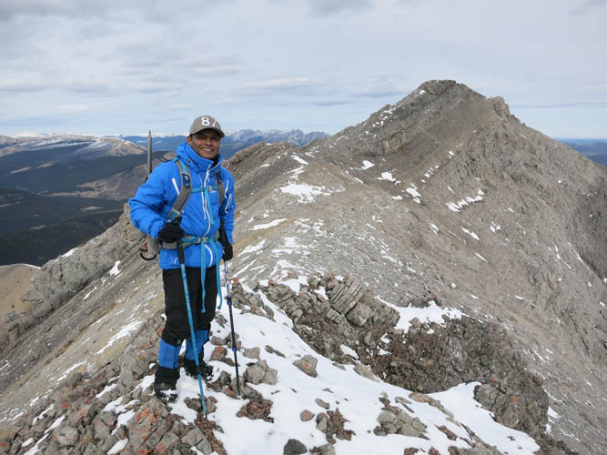
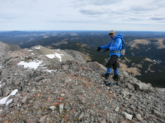
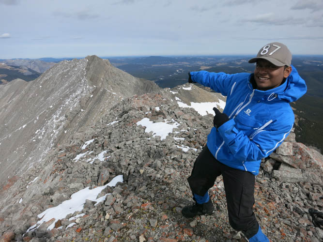
It turned out that simply going straight ahead, up the middle rib of the SE face, worked out very well and included some enjoyable moderate scrambling as well. The rock is a mix of limestone with good, solid reefal rocks forming several cliff bands that are easily overcome. We soon reached the main ridge where a decent-sized, lichen-overgrown cairn greeted us. No register was found. We briefly considered going further to the NE along the ridge to see if perhaps there were any higher points, but quickly came to the conclusion that we were at the highest elevation… except for a point far to the SW along the ridge, which looked slightly higher. So we set off on an enjoyable ridge traverse – mostly easy to moderate scrambling along the crest of steeply tilted rock slabs that sometimes required short detours to the right when the ridge got too jagged or broken up. There was very little snow left – unusual for this time of the year – and that helped greatly in providing good footing on the slabs. Most of the ridge was an easy hike. After 1 km we reached what we determined to be the true summit of the ridge. At 2520 m according to my GPS it is only slightly higher than the previous high point (with the cairn), where I measured 2507 m. There was no cairn or register at the summit, so after a relaxing second lunch we proceeded – with much enjoyment – to build a sleek and tall summit cairn.
For the return, instead of backtracking along the ridge, we decided to explore a bit more and headed straight down the E face from the summit. A convenient scree slope brought us to a few short and easily navigable cliff bands, below which we could use snow to quickly slide down a wide gully… lots of fun and a fast way to get down the mountain! We probably should’ve glissaded down all the way to the bottom of the gully, then reascended to gain the col between the low-lying ridge and the main mountain. But we didn’t want to lose too much elevation and opted to side-hill along the slopes of the mountain back to the col, which worked out well. Instead of dealing with all the ups and downs of the E-W ridge again to get back, we decided to try out the wellsite access road this time. That was a good call, since it was considerably faster despite annoying snow sections in some sections of the road. We made it back to the car in 9 hours and 10 min. A full day of adventure, worth every minute!
For anyone wanting to try this route, I would recommend doing it in the summer or at least late spring, when all or much of the snow has melted. That will speed up your approach and return along the wellsite road.
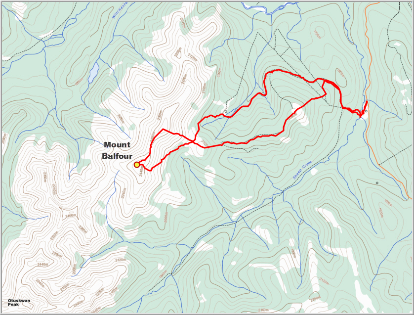
ROUTE MAP
DISCLAIMER: Use at your own risk for general guidance only! Do not follow this GPX track blindly but use your own judgement in assessing terrain and choosing the safest route. Please read the full disclaimer here.
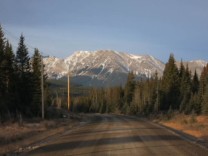
Winchester Ridge comes into sight as we drive along the very good Panther River Road.
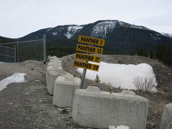
We parked just outside this wellsite.
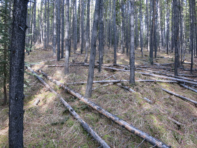
The start of the hike is a breeze through light forest without any bushwhacking.
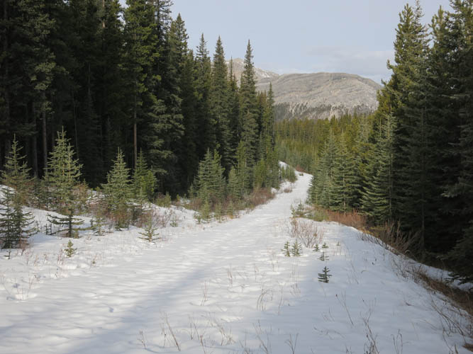
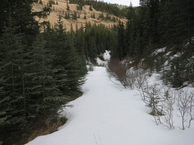
This forest road leads to a wellsite. Deep snow slowed our progress here, so we decided to head left into the trees (where there was no snow) and hike along a gentle ridge.
Ghost Peak, the most prominent marker on the horizon to the south.
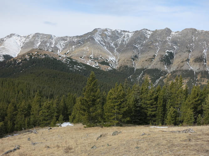
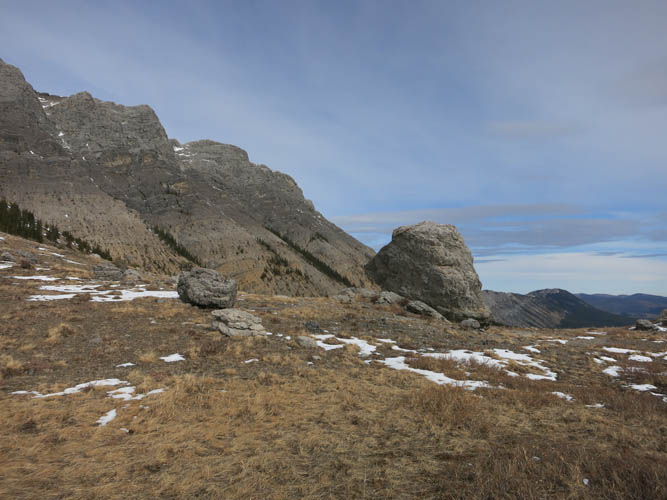
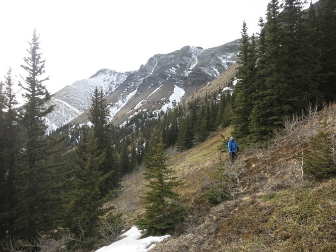
The extended ridge is still a distance away. Despite what appearances might suggest, the actual high point and summit is above the snow covered slopes on the far left. Priyesh and I had a bet on this and he was right!
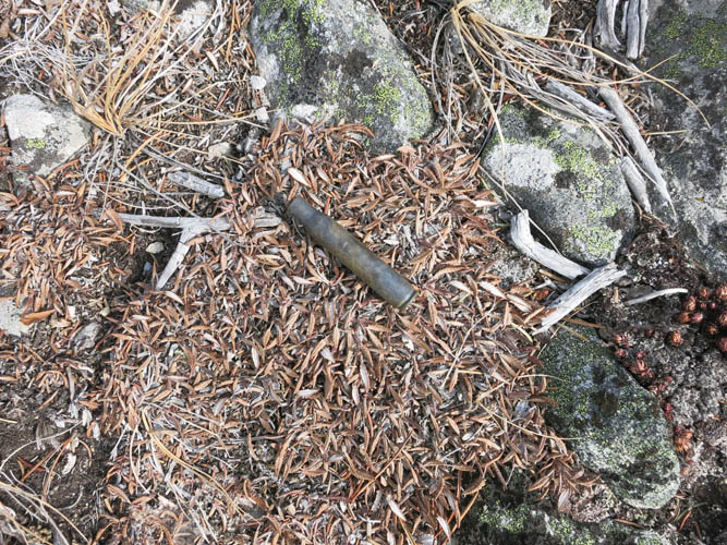
A bullet casing left behind by hunters. We did not see a single person (or animal!) during the whole day.
Looking back at the gentle, forested ridge where we came from. An intermittent old path more or less follows the crest of the ridge. To the left is the snow-covered wellsite road.
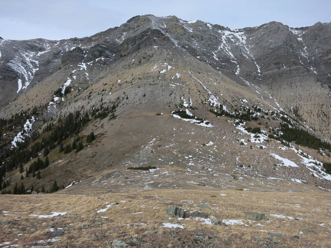
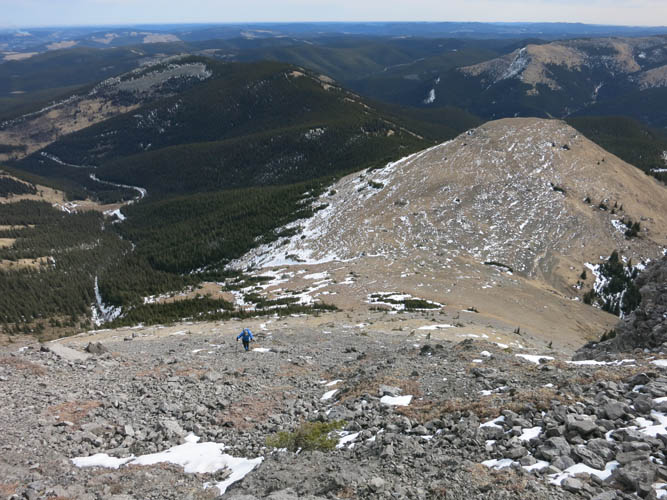
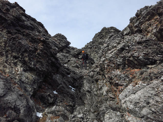
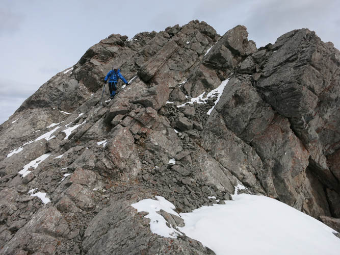
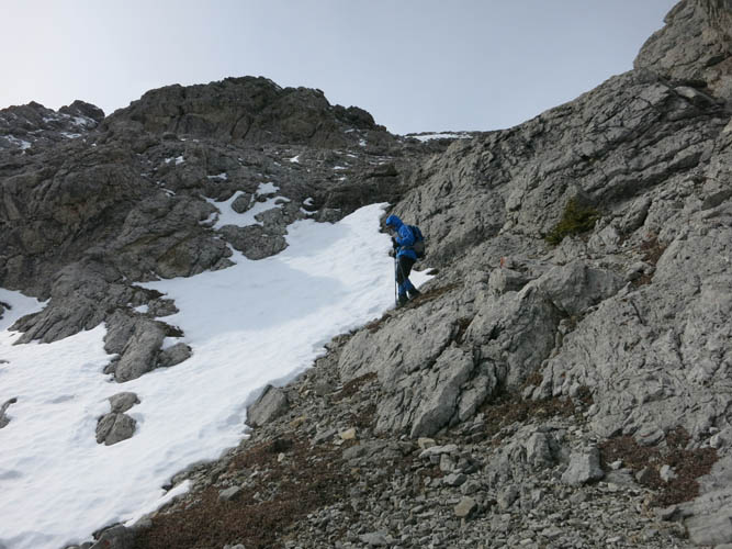
Ascent slopes of Winchester Ridge. We headed straight for the rib in the middle – an easy to moderate scramble.
A large block of rock that once formed a shallow marine coral reef.
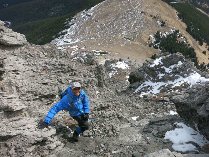
Heading up the final slope. The wellsite can be seen at the end of the road on the left.
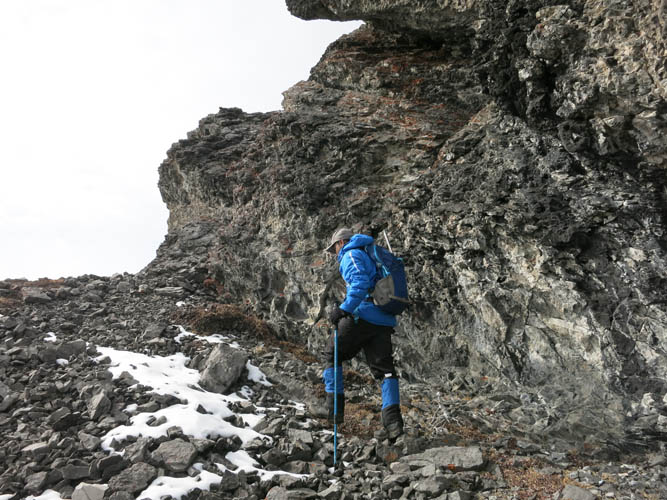
Easy and enjoyable scrambling through the rock bands.
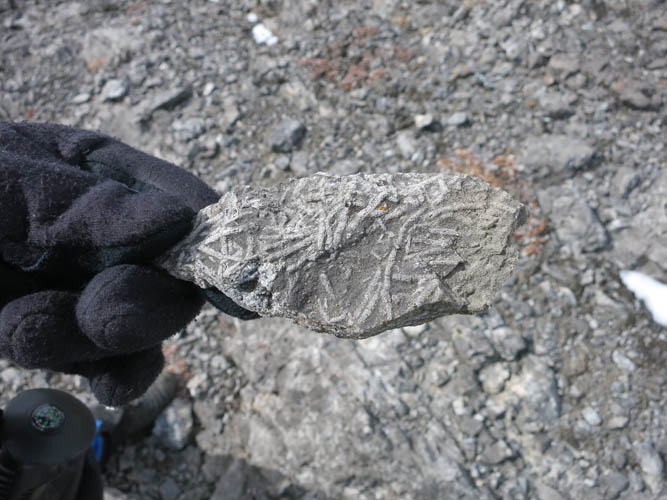
Corals
Interesting scrambling.
The rock is crumbly, but it’s not very steep and we make good progress here.
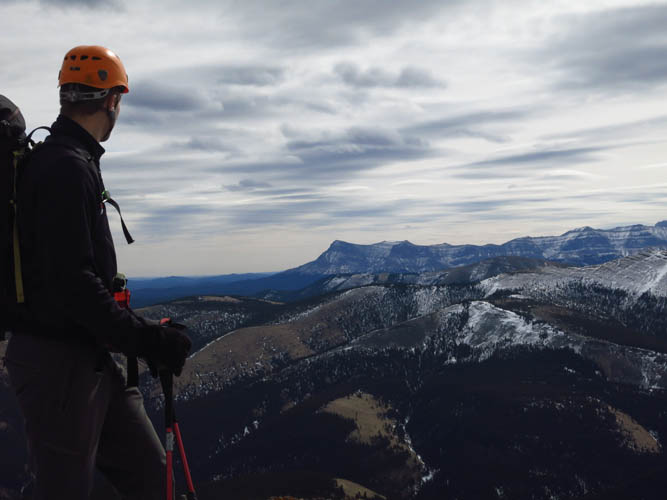
Looking south towards the edge of the Rockies. Ghost Peak is the pointy mountain in the middle of the photo.

Dormer Mountain to the NW.
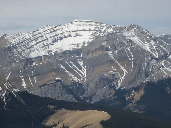
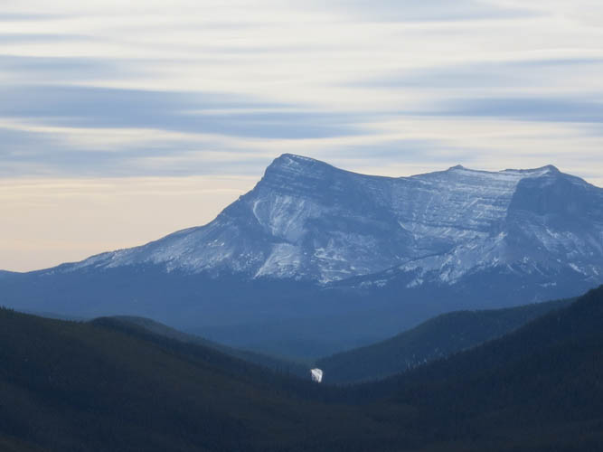
Barrier Mountain even further to the NW reveals a formidable anticline (convex dome-shaped strata).
Scrambling west along the ridge.
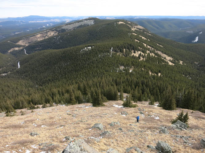
Looking back at the high point we first ascended. From there it’s a pleasant ridgewalk interspersed by short sections of hands-on scrambling.
The highest point along the ridge and the true summit! Where there was no sign of a summit cairn…
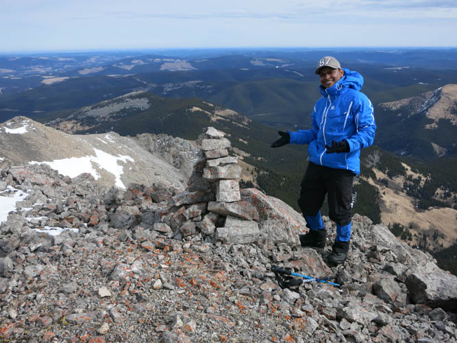
…there now stands a beautiful new cairn hand-built by Priyesh! 🙂 He had so much fun building it, it was thoroughly entertaining to watch him.
And THIS is where we came from 🙂
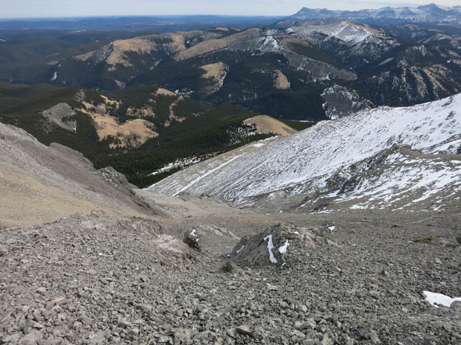
Not far from the summit is the rubbly slope we used for an easy descent.
Small rockbands were easily circumvented.
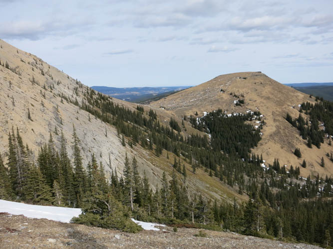
Heading back towards the dip left of the grassy bump. This bump forms part of the gentle ridge we had hiked along in the morning.
We tried not to lose any elevation by doing some sidesloping to get back to the dip. It was a bit unpleasant, but worked and probably saved us energy. The summit can be seen above the snow-covered slopes on the left.
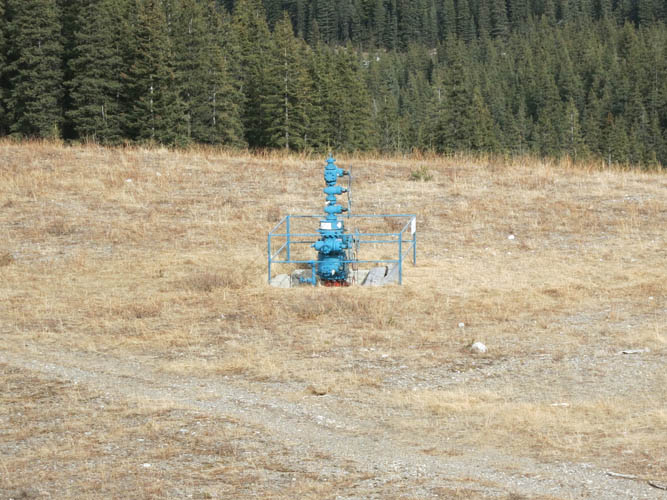
This wellsite marks the start of the road that we took on our way back instead of hiking over the ridge again.
Lots of snow here! It was tedious and slow, but together we got the job done 🙂 . “Shared pain is half the pain”, as a German saying goes.
IN MEMORIAM: Priyesh Menon
My dear friend and hiking partner Priyesh passed away in a tragic accident on Mount Lawson in Kananaskis on May 23rd, 2016. He was only 30 years old. He touched on countless lives with his most generous and loving spirit that will be remembered by many, many people in Canada, India and around the world. Like many other hikers and scramblers from Calgary, I feel hugely honoured to have met him and to have had the chance to hike with him. To preserve some of the beautiful moments we shared, I have decided to keep the reports of my trips with him on my site (after consultation with his family). We would like people to remember him for who he was: the most joyful, uplifting, kind, and selfless boy who never stopped smiling. As many of his fellow-hikers recounted, he had the unique ability to bring people together and bring positivity into their lives. There was genuine happiness wherever he was. A true ray of sunshine in our world! Thank you, Priyesh, for enriching our lives. You will be dearly missed.