13 March 2016
With Priyesh
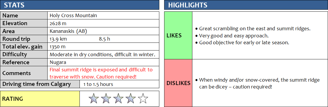
My friend Priyesh and I both felt surprisingly energetic in the morning after our epic Labyrinth-Minos suffer tour the day before. We kind of wanted to do something nice and pleasant to offset the rather tedious trip yesterday. Holy Cross Mountain in the southern Kananaksis area was perfect as it offered a good approach trail (without river crossing this time!), a well-described and easy-to-follow route, plus some great scrambling and a crazy ridge walk at the end. In the summer, the “moderate” rating for this scramble is probably justified, but in winter or early spring there can be still quite a bit of snow left on east-facing aspects of the mountain, which calls for conservative routefinding and careful assessment of the terrain. Fortunately, we were able to make our ascent in near-perfect conditions – if it wasn’t for the annoying wind!
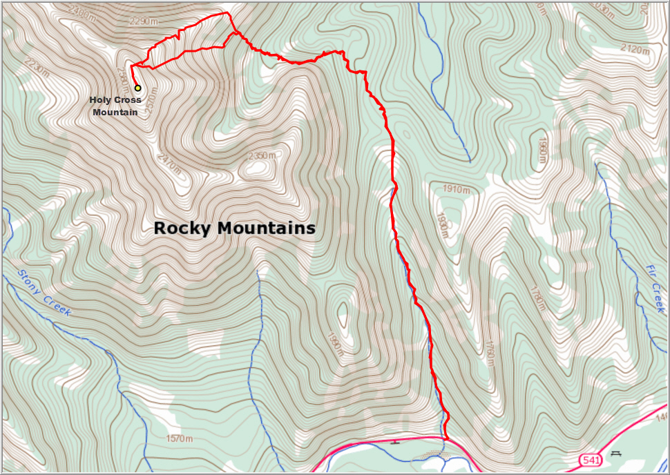
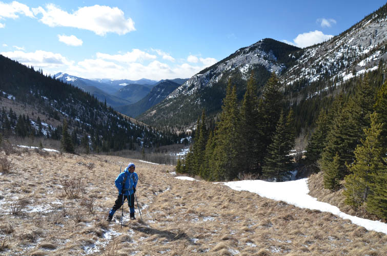
We started quite late at the trailhead – around 930 am – and started up the excellent trail that hugs the eastern side of the valley along the pretty Gunnery Creek. There were a few icy bits here and there at the beginning, but no microspikes were needed really. We made very good progress all the way to the col, where the forested section started and we had to rely on a previous party’s trail in the snow to find our way. This was very convenient since all we had to do was follow the tracks, we didn’t even have to use our GPS for navigation at all. Normally, in the summer, a GPS track might be useful as there is some light bushwhacking and probably no trail in the forest to reach the cirque on the east side of Holy Cross. The snow was quite deep in places and we were really glad to be able to just trudge along the hardened footsteps of someone else. No doubt postholing in this type of snow plus routefinding would’ve significantly lengthened our trip.
The tracks left the forest and gained a small grassy knob, from where they slightly descended back into the trees and wound their way up a steepish section of the forest which ended at a rocky trail at the end of the SE ridge of the mountain. A short traverse along this good trail led down into a gentle dip – the start of the cirque that hugs the eastern side of the mountain. There was a bit more forest to cross here, but all fairly light without any real bushwhacking to do. We then climbed up the other side to gain the ridge on the north side of the cirque. It was a gorgeous sunny day, but snow eddies higher up on the ridge already warned us that it was going to be really windy – and this was certainly true! Once on the ridge, the going was slow due to a good amount of snow covering all the rocky bits and moderate sections that we had to scramble up. I was surprised how many scramble sections there were on this route. It was windy and cold, but it got much worse once we reached the summit ridge. This was our crux – the ridge is short, perhaps only 100-150 m, but fairly exposed in parts. A narrow snow cornice on the east side and steep, snow-covered slabs on the west side made for an exciting traverse as wind gusts were making it hard to keep ourselves steady. In a few places where the ridge was particularly narrow and slippery we actually had to shuffle on our bums for a few metres. The summit itself was equally windy and inhospitable, so we didn’t hang around for long and started our return soon.
A good option for a quick descent is to glissade down the lower part of the snow-filled gully on the east side of the mountain, basically straight back into the cirque. Of course this can only be done safely if conditions permit – that is, there is no risk of avalanches, no risk of large snow cornices threatening to break off above you, and no ice in the gully. We backtracked across the summit ridge and then slowly ventured sideways onto the snow slope near the gully, where a series of short but controlled glissades with our ice axes were possible. Further down in the gully a few icy sections appeared, so we decided to veer back to the left onto grassy slopes, which led us back to our ascent tracks. From here it was just following our morning route all the way back to the car. Despite the wonderful sunny weather on this March Sunday, we did not meet anyone else the whole day. A great adventure and highly recommended for the shoulder season provided that snow conditions are ok.
DISCLAIMER: Use at your own risk for general guidance only! Do not follow this GPX track blindly but use your own judgement in assessing terrain and choosing the safest route. Please read the full disclaimer here.
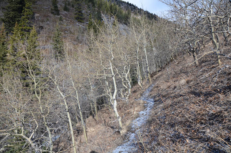
Enjoyable early morning hike on a good trail along Gunnery Creek.
Almost at the col, looking back down (south) into the valley we came up.
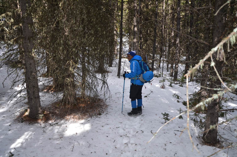
In the trees we got lost at one point… we couldn’t see the tracks of a previous group anymore since the snow wasn’t deep enough in this section!
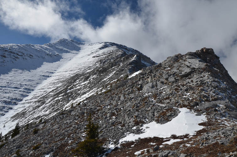
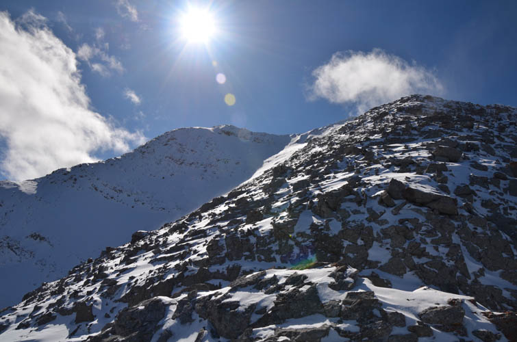
Holy Cross Mountain and the ascent ridge on the right.
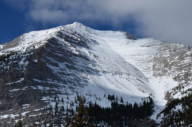
A closer look at the upper reaches of the mountain.
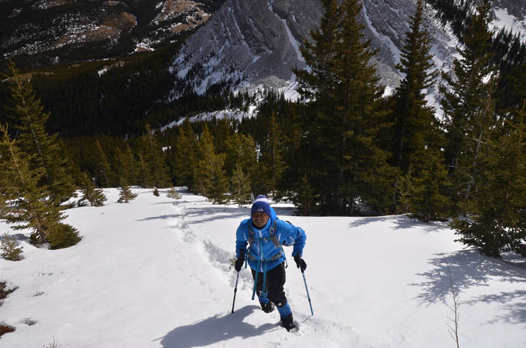
After some more trudging through deep snow in the valley below, we break out of the trees on the ascent ridge.
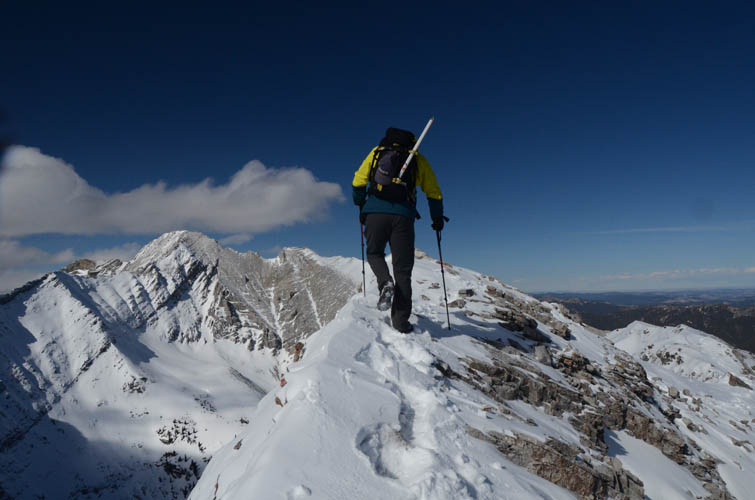
Great scrambling along the crest of this ridge! The summit is on the left.
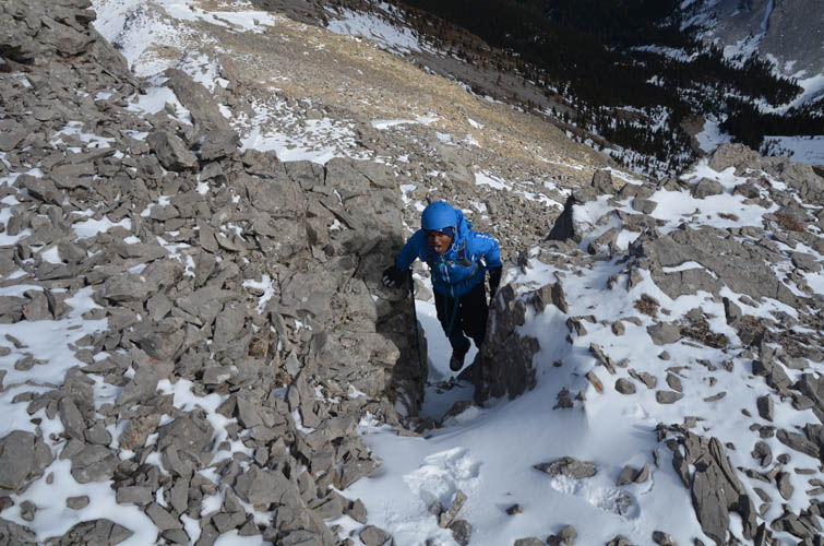
Priyesh “levitates” through a chimney.
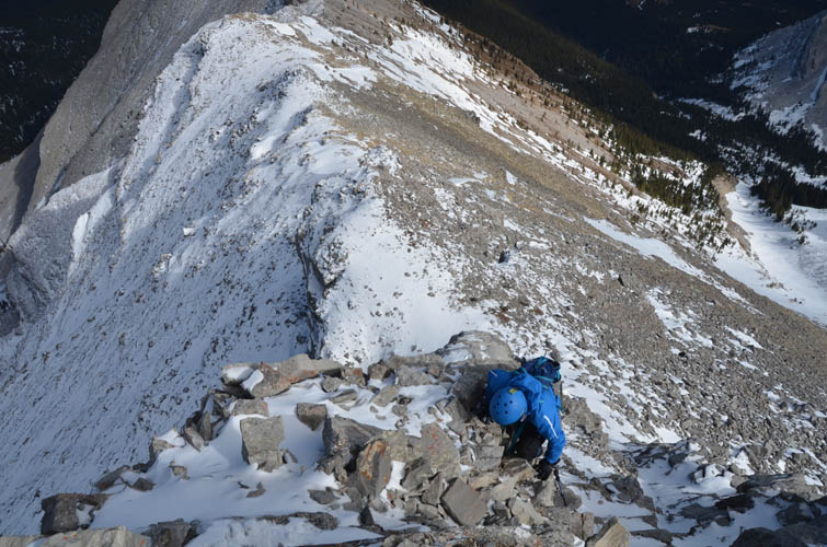
Most of the scrambling here is easy to moderate if you search for the simplest route.
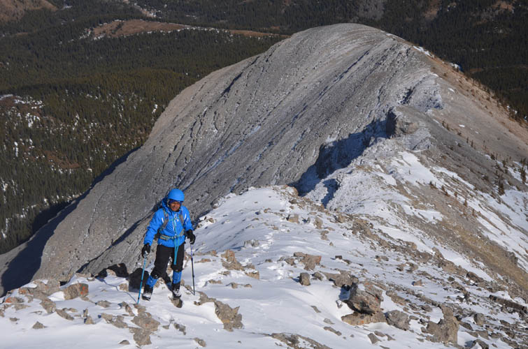
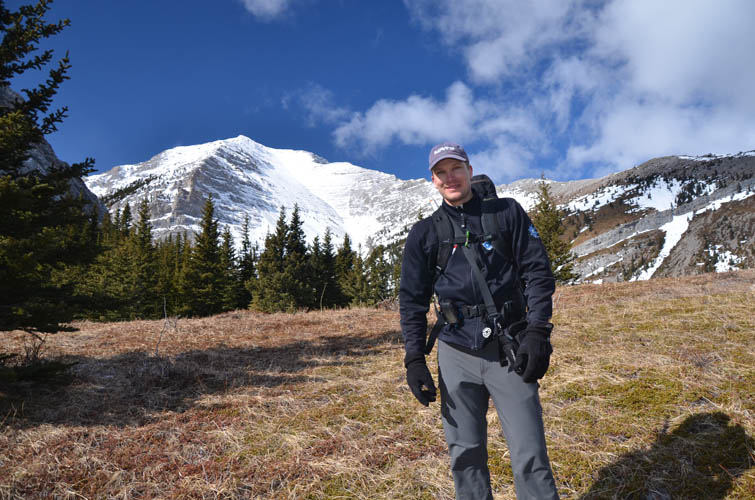
“Man in blue”
The bright sun made everything look more beautiful, but what you can’t see here is the wind that steadily grew stronger as we gained height.
Coming over a short exposed section of the ridge, but not the summit yet. Mount Head is on the left.
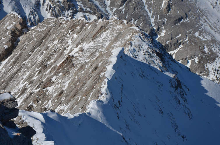
The final summit ridge.
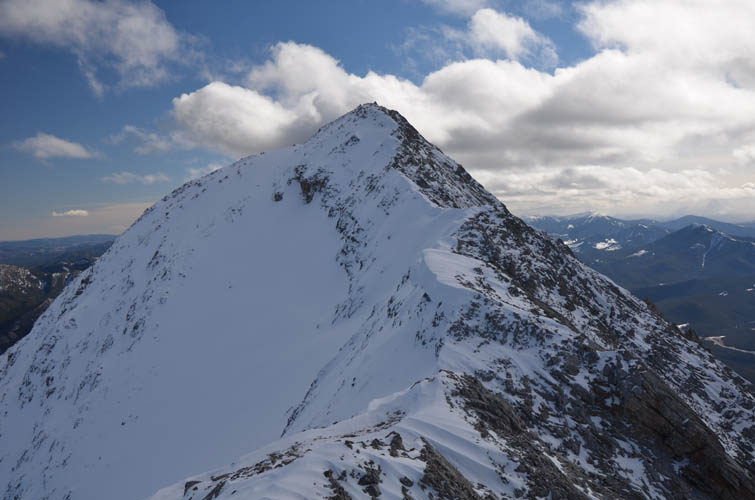
Looking back down the final ridge from the summit. Mount Head is the high point in the centre to the north.
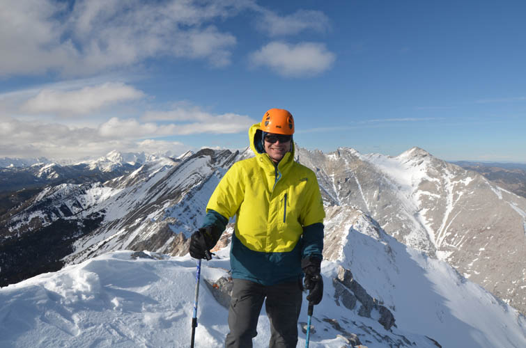
A closer look at the summit ridge.
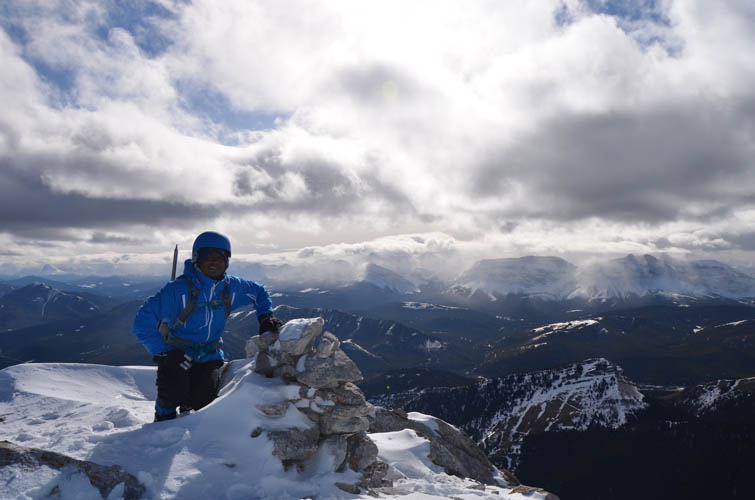
Summit shot!
It looks beautiful, but it was so cold and windy here that we just took a few quick snapshots and then immediately returned.
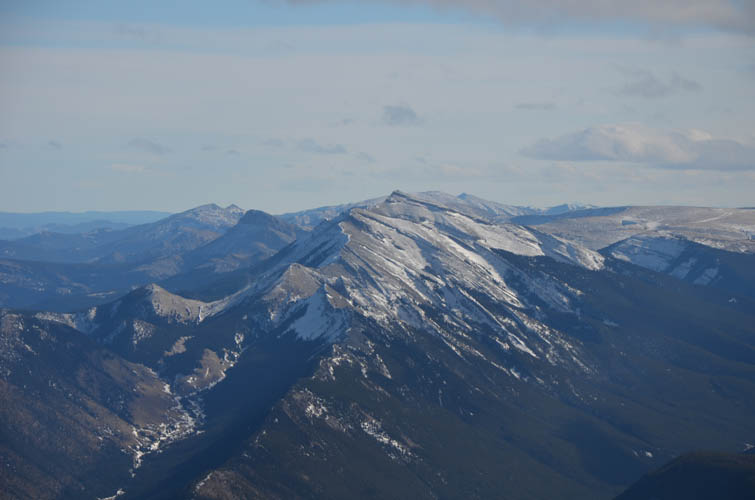
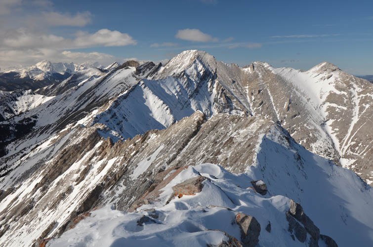
Mount Burke (centre) to the south.
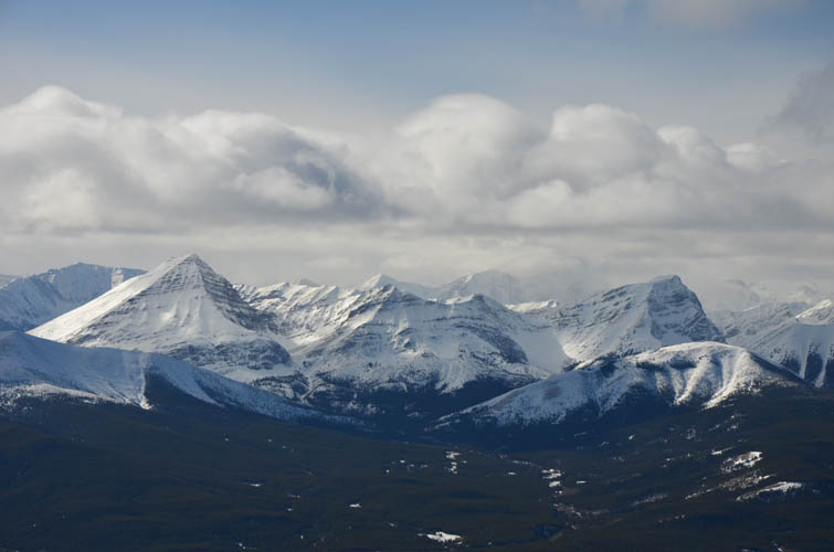
To the west we could see Mount McPhail (pyramid-shaped peak on the left) and Mount Bishop (above the rounded hill on the right).
IN MEMORIAM: Priyesh Menon
My dear friend and hiking partner Priyesh passed away in a tragic accident on Mount Lawson in Kananaskis on May 23rd, 2016. He was only 30 years old. He touched on countless lives with his most generous and loving spirit that will be remembered by many, many people in Canada, India and around the world. Like many other hikers and scramblers from Calgary, I feel hugely honoured to have met him and to have had the chance to hike with him. To preserve some of the beautiful moments we shared, I have decided to keep the reports of my trips with him on my site (after consultation with his family). We would like people to remember him for who he was: the most joyful, uplifting, kind, and selfless boy who never stopped smiling. As many of his fellow-hikers recounted, he had the unique ability to bring people together and bring positivity into their lives. There was genuine happiness wherever he was. A true ray of sunshine in our world! Thank you, Priyesh, for enriching our lives. You will be dearly missed.