Kananaskis, AB, Canada
31 May 2025
With Wen
Classic Southern Kananaskis hike with a twist
Mount Burke is an easy summit hike that I’ve added to my list of “let’s do this one again” objectives, especially for early winter or shoulder season trips. It’s also on my go-to list of trips for friends whom I want to introduce to mountain hiking in the Rockies.
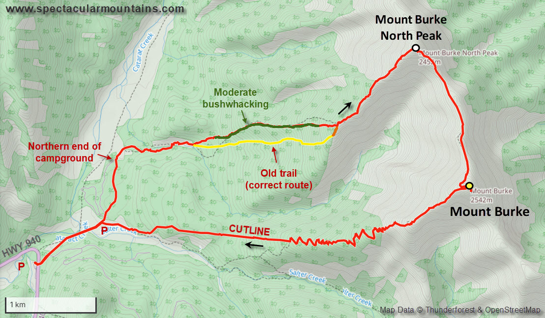
Having done Mount Burke a couple times before, once as a loop via the south ridge and once as a super long ridge walk via the Lookout Range, I sort of knew what to expect. I also knew there was another loop some people do from the regular parking lot by Cataract Creek but via the north summit, so this variation was on the menu for us to try out today.
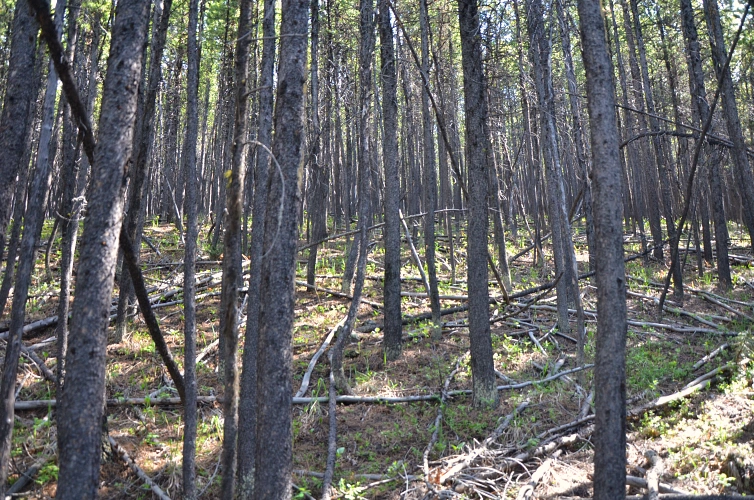
My concluding remarks first: I did not enjoy the ascent via the treed ridge that leads up the north summit. There is no trail and the bushwhacking – while not atrocious – was quite unpleasant, with lots of deadfall and fairly dense tree cover in places. [Edit: There is apparently an old trail, marked in yellow on the map below, that avoids bushwhacking through the forest. I need to come back some day to check it out.]
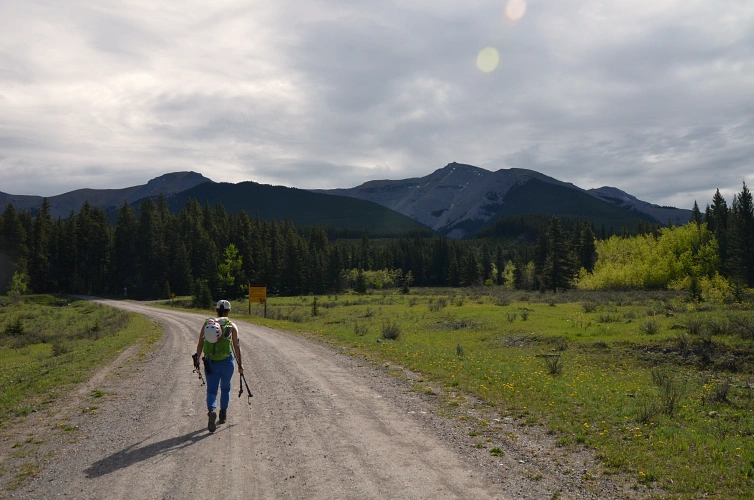
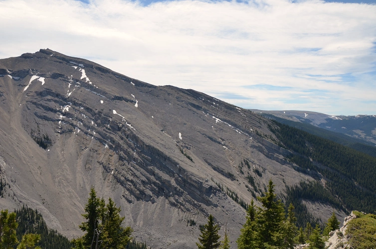
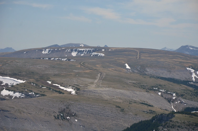
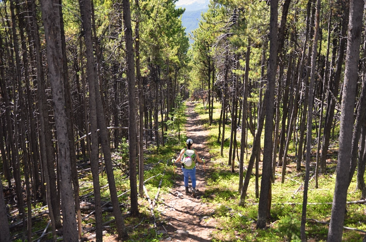
The trip starts out at the small parking lot near Cataract Creek Campground (in winter, when the access gate is closed, you’ll have to park a few hundred metres farther away at the parking lot by highway 940). From parking we first walked to the campground itself and at the very end of it, near the creek, we found a faint trail that we followed for about 400 m to a small side creek coming in from the right. Here we turned right (east) and up the small valley that the creek runs along. A cow trail made things pretty easy, eventually leading us up the start of a small, treed ridge – this is the ascent ridge that goes up directly to the north summit of Mount Burke.
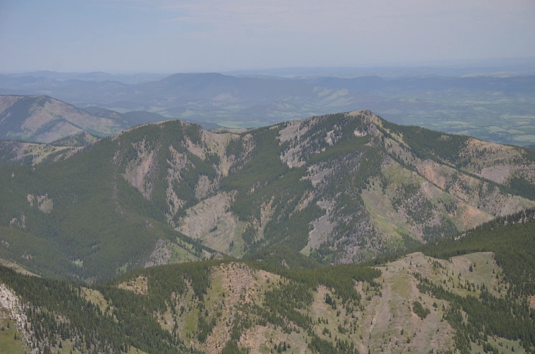
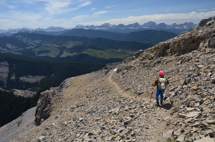
As mentioned above, hiking up the forest on this ridge was no fun. I really did not expect there to be this much deadfall and the trees to be this dense… There are also no views at all in this stretch. Eventually, almost two hours after leaving the parking lot, we reached a point where another side ridge joins from the southwest and this is where the terrain finally opened up. Looking over to the other side of the valley, we could make out groups of people making their way up to Mount Burke’s summit along its west ridge (where the trail is).
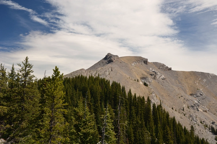
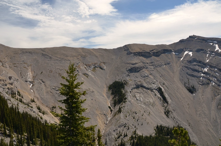
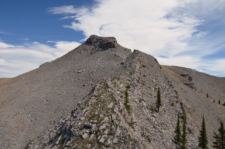
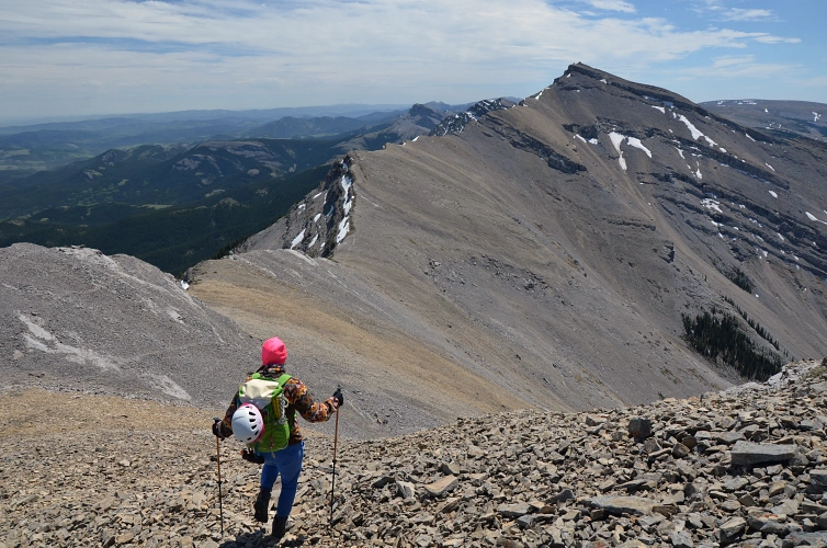
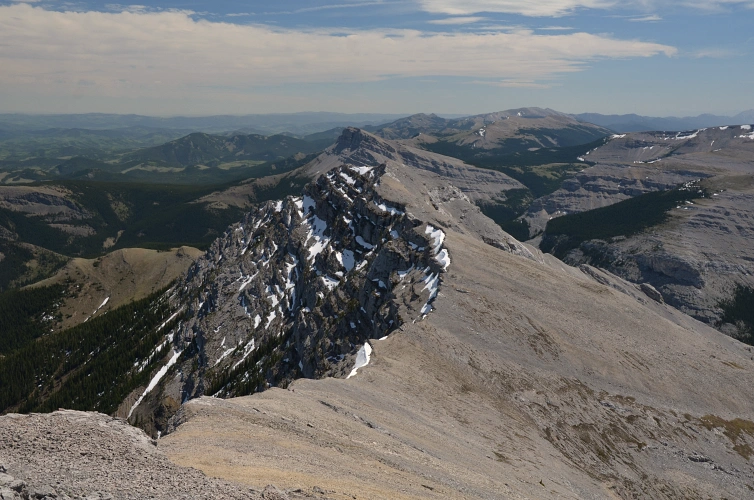
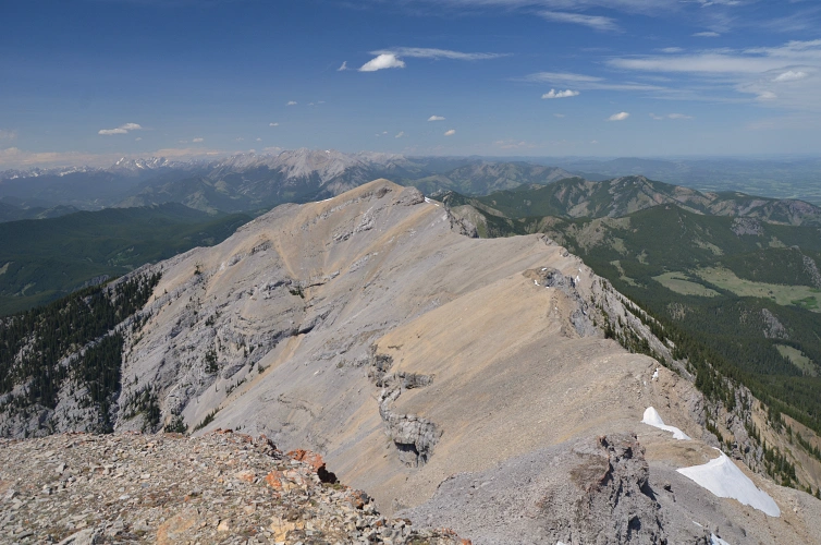
From hereon, the trip took a turn for the better and we actually quite enjoyed the remaining half of the now open ridge to the north summit. Despite only being a sub-peak or minor high point along Burke’s long north ridge, the north summit has a sizable cairn even holding its own register.
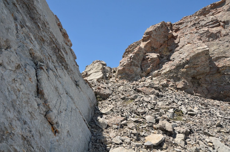
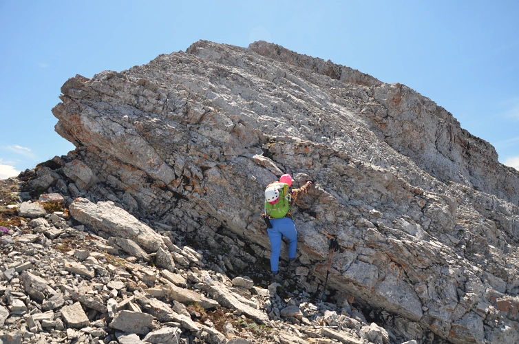
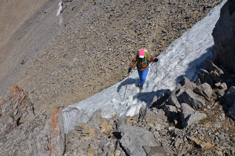
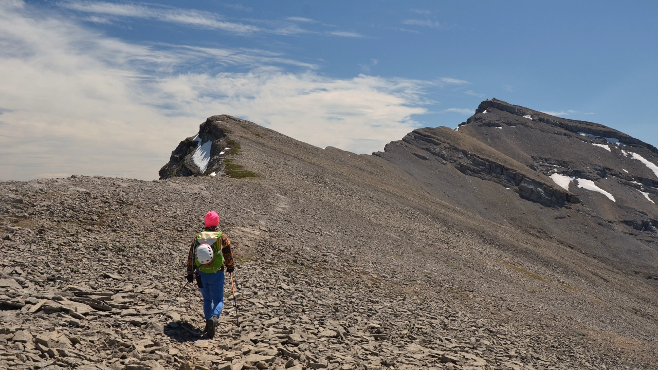
The traverse from the north to the main summit was the highlight of the day. It’s a relaxing ridge walk on a well-defined goat trail, with a few obstacles thrown in for some fun and easy route finding with no scrambling required if you pick the best line. Just below Burke’s main summit a vertical cliff band bars the way, but the goats know their way and you can easily overcome this hurdle by veering right and up a weakness (easy scrambling). In the dead of winter, this part can be a bit more challenging when hard, steep snow covers the weakness. To see some photos of the same traverse in wintry conditions, see my Lookout Range to Mount Burke trip report.
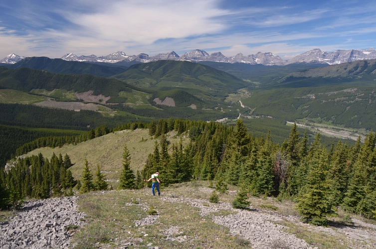
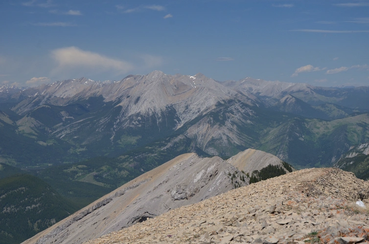
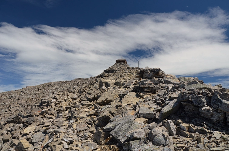
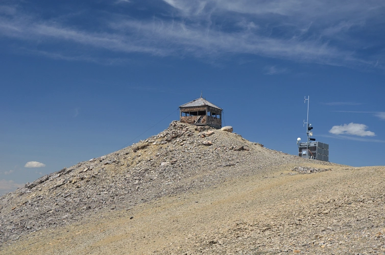
After showing Wen the old, dilapidated wooden lookout building on the summit of Mount Burke, which looks exactly like the one on Blackrock Mountain, we sat down in the shelter of the nearby weather station to enjoy a leisurely lunch break (there’s even cell phone reception up here, but don’t rely on it!). Braving the strong winds again, we headed down the established and well-beaten trail on the west ridge that took us straight back to the parking lot.
To me, Mount Burke stands out as one of those easy hikes that take you to a proper mountain summit with fairly scenic views. The easiest way is definitely up and down the trail on the west ridge. If you’re keen on visiting the north summit, do it from the main summit and return the same way – the alternative route we took up the parallel ridge is not worth it. Better yet, do a clockwise loop via the south ridge, which is my favourite variation… trip report coming soon…
Post-script: For comparison of our route and experience with those of others, also consult the trip reports of Bob Spirko and Vern Dewit. Bob pioneered this route and also mentions a fading trail that appears to avoid some of the bush on the way up!
|
Elevation: |
2546 m (Mount Burke true summit) |
|
Elevation gain: |
1300 m |
|
Time: |
7.0 h |
|
Distance: |
14.3 km |
|
Difficulty level: |
Easy (Kane), T2 (SAC) |
|
Comments: |
Loop route via north summit. |
|
Reference: |
Own route finding |
|
Personal rating: |
3 (out of 5) |
NOTE: This GPX track is for personal use only. Commercial use/re-use or publication of this track on printed or digital media including but not limited to platforms, apps and websites such as AllTrails, Gaia, and OSM, requires written permission.
DISCLAIMER: Use at your own risk for general guidance only! Do not follow this GPX track blindly but use your own judgement in assessing terrain and choosing the safest route. Please read the full disclaimer here.