Kananaskis, AB, Canada
14 June 2025
With Alan
Great ridge walking
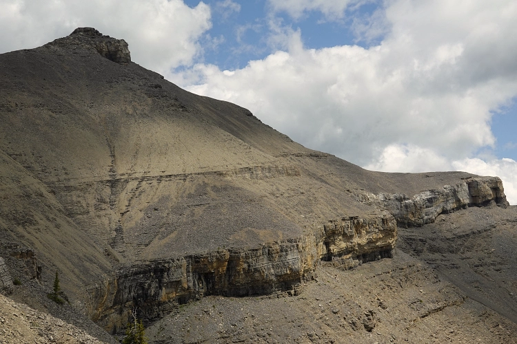
After years of seeking out objectives in other areas, the time finally came to tick off the last peaks I hadn’t done in the Elbow River area west of Bragg Creek and do Threepoint Mountain and Mount Rose with my buddy Alan. Although described as separate trips in Andrew Nugara’s famous More Scrambles book, it almost seems standard these days to do these two summits in one go via a route pioneered by Vern and Phil in 2015. There is a massive vertical cliff separating the two summits on Threepoint’s south side, but a break in the cliff – unseen from above – affords a straightforward way through that’s no more than moderate scrambling.
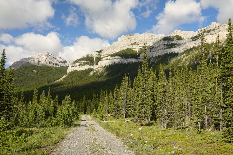
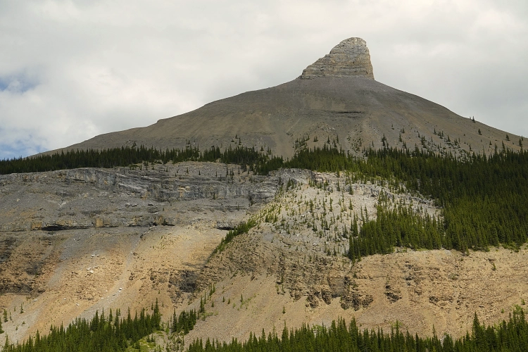
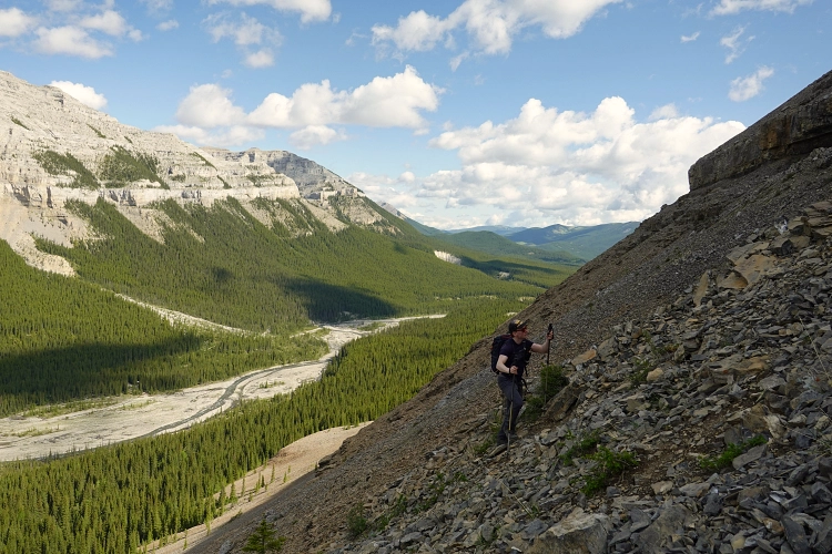
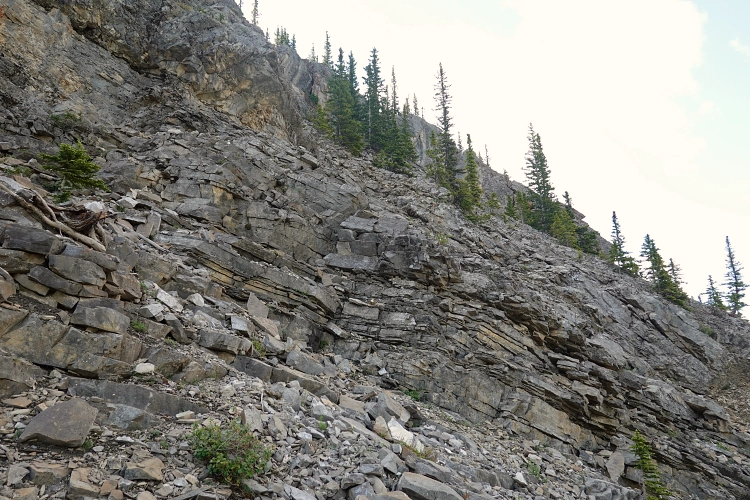
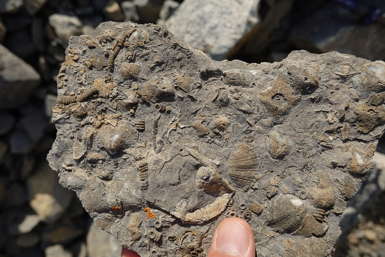
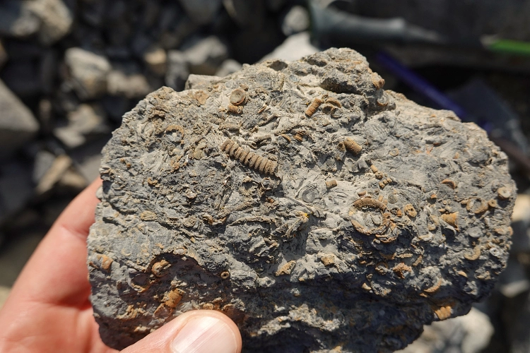
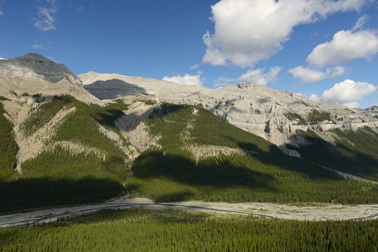
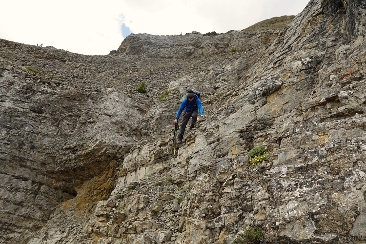
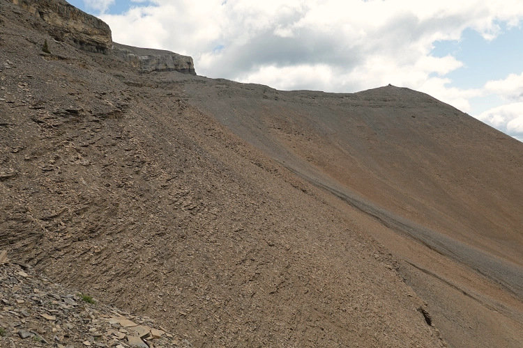
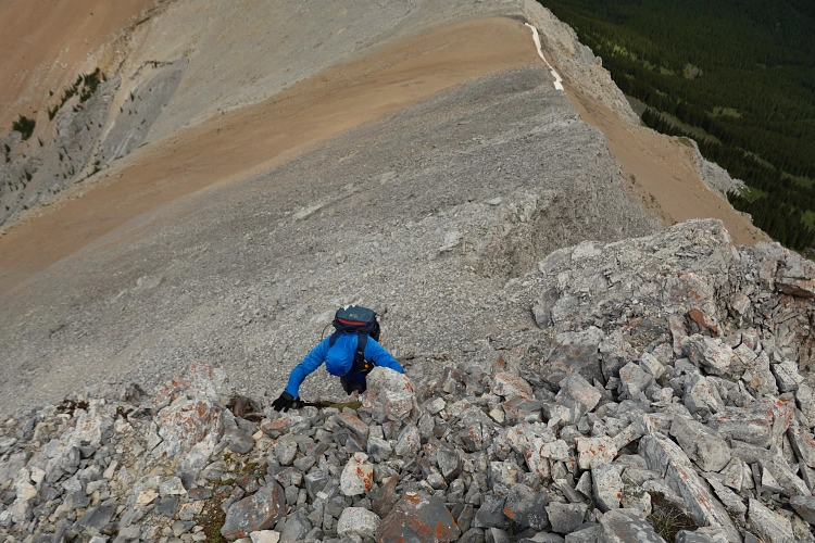
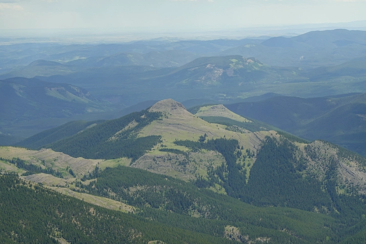
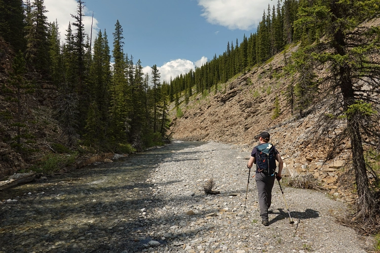
Alan and I took our mountain bikes for the initial approach, which is definitely the way to go as it speeds up the trip significantly and is super fun as you coast mostly downhill on the way back. The approach track is wide and excellent for biking. We tied up our bikes at a brand new bike rack set up at the Big Elbow Backcountry Campground, which even has a bike repair station complete with air pump! After crossing the Elbow River (about calf-deep at this time of the year), we continued south on the river flats on the other side until we spotted a break through the rock bands that are prominently featured on the west side of Threepoint Mountain. There are probably several ways through these small cliffs, but aiming for the part that is treed is probably the safest bet. Once through the rock bands and above treeline, it was a bit of a slog on a steep slope of brown rubble to the top of the northwest ridge and the base of a distinctive buttress that can be seen from miles away. We found some really neat rocks embedded with plenty of fossils on the way up here, including very well-preserved crinoid columnals and brachiopod shells.
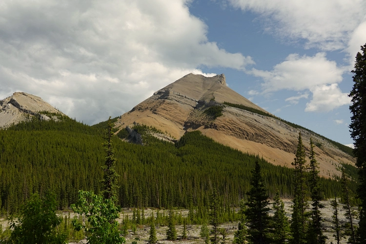
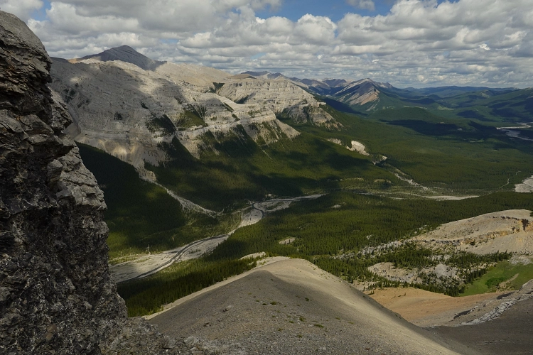
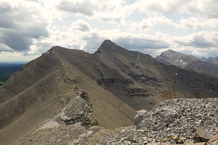
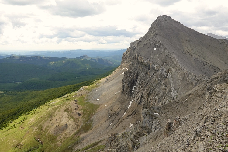
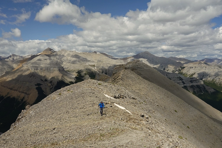
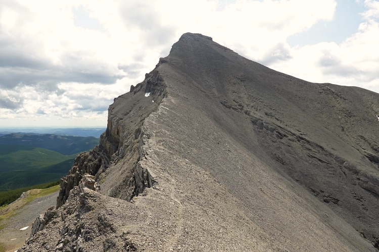
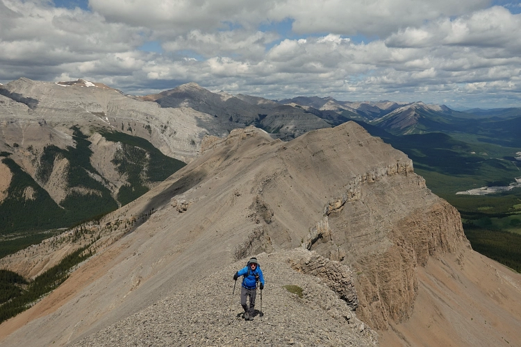
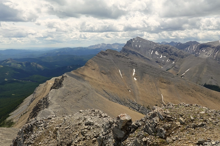
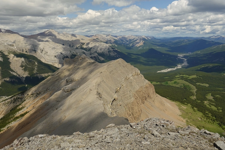
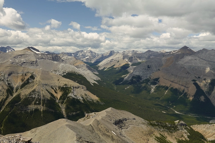
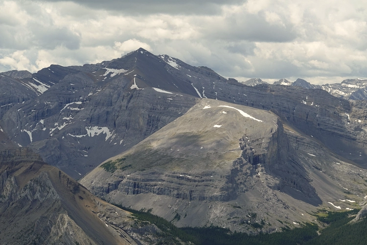
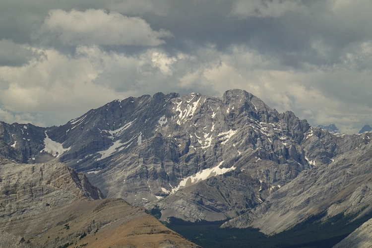
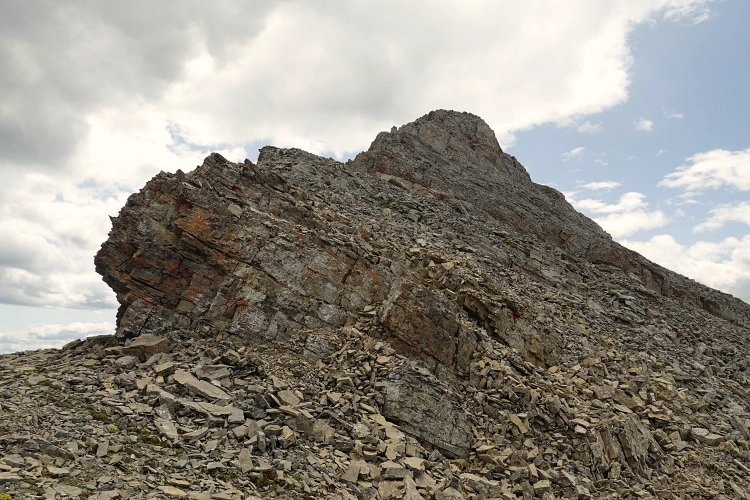
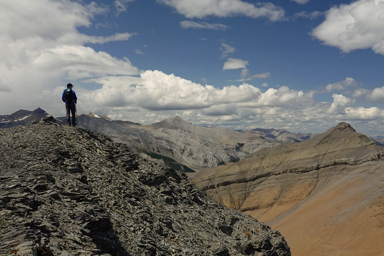
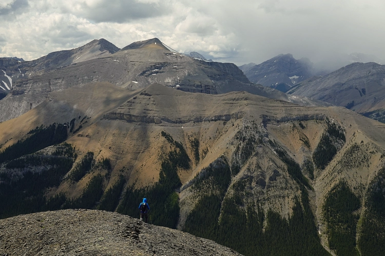
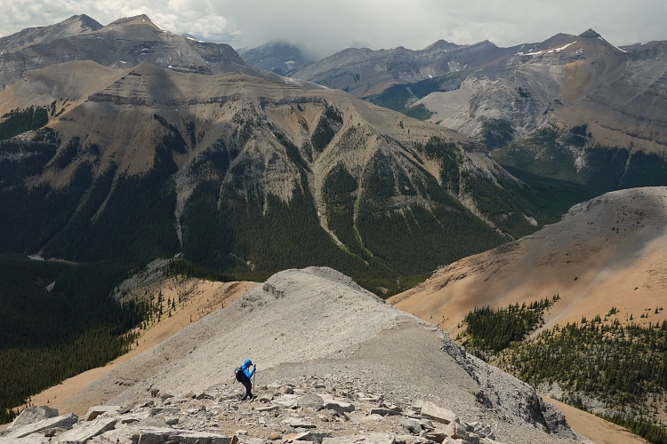
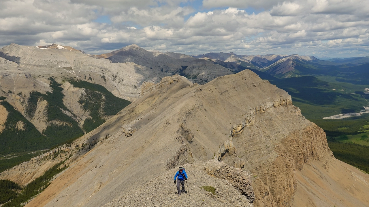
Once on the ridge top much of the hard work was done – at least for the ascent that is. The ridge walk over a minor high point and to the true summit of Threepoint Mountain is highly enjoyable, with route finding made easy by a fairly good game trail that parallels the ridge crest. The summit offers amazing views of both the foothills to the east and a whole range of Kananaskis peaks to the west, like Banded Peak, Cougar Mountain, and Mount Burns.
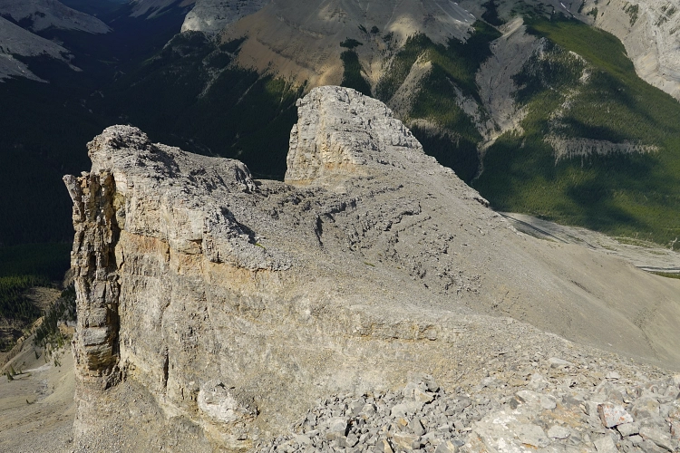
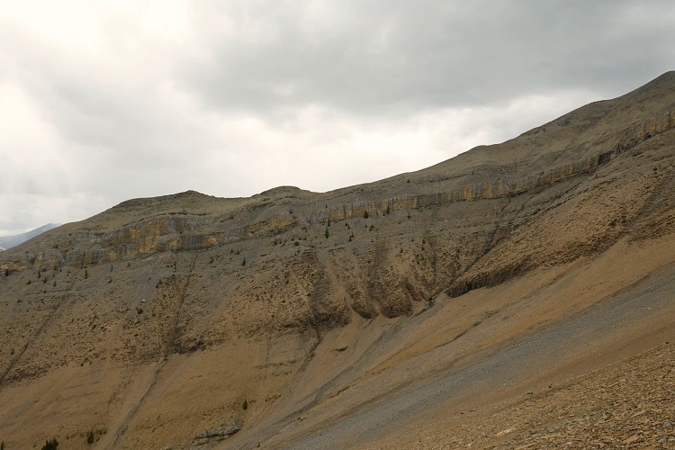
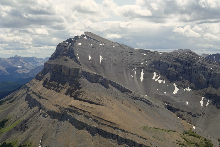
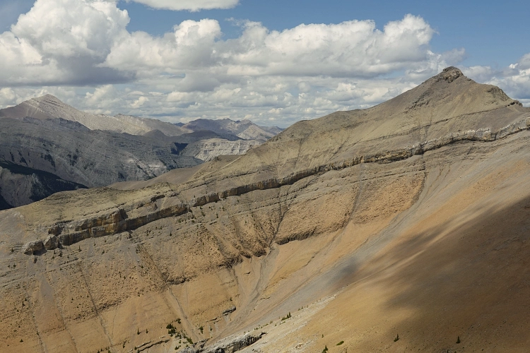
If it wasn’t for the break in the cliff that Vern and Phil “discovered”, this would most likely be the end of the road and you’d have to come back to do Mount Rose another day. Instead, head down the west ridge of Threepoint for about 700 m, then turn left (cairn) down a gully and with a few easy to moderate scrambling moves you’re down through the cliff.
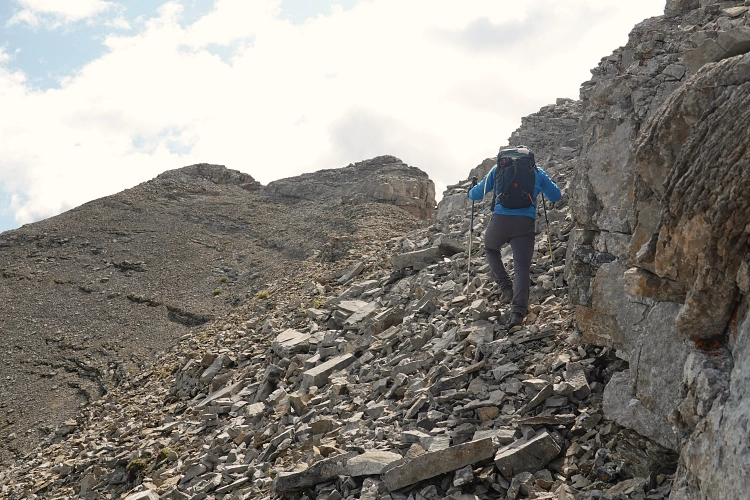
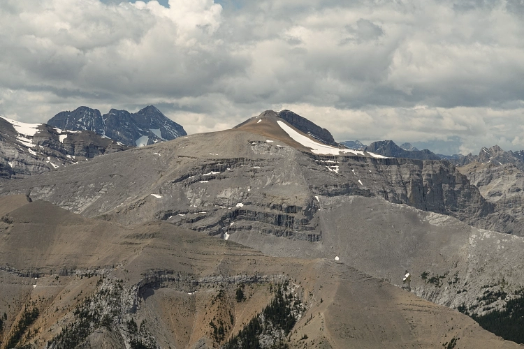
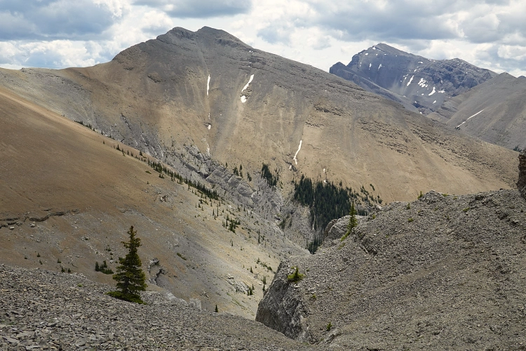
The flipside to this route is what follows: you’ll now have to re-gain some elevation loss by contouring around the rubbly hillside and sidesloping across rubble to get back to the ridge between Threepoint Mountain and Mount Rose. Surprisingly, no trail – game trail or otherwise – exists on these slopes and it’s not the most pleasant affair. Back on the ridge top we found a goat trail again that led us up the steep north side of Mount Rose, which includes a short section of hands-on moderate scrambling and brief exposure. I think this section may be avoided by going around the right (west) side.
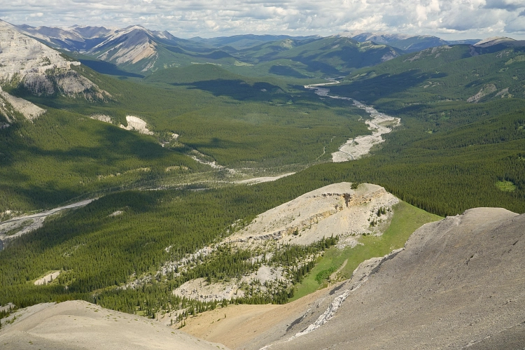
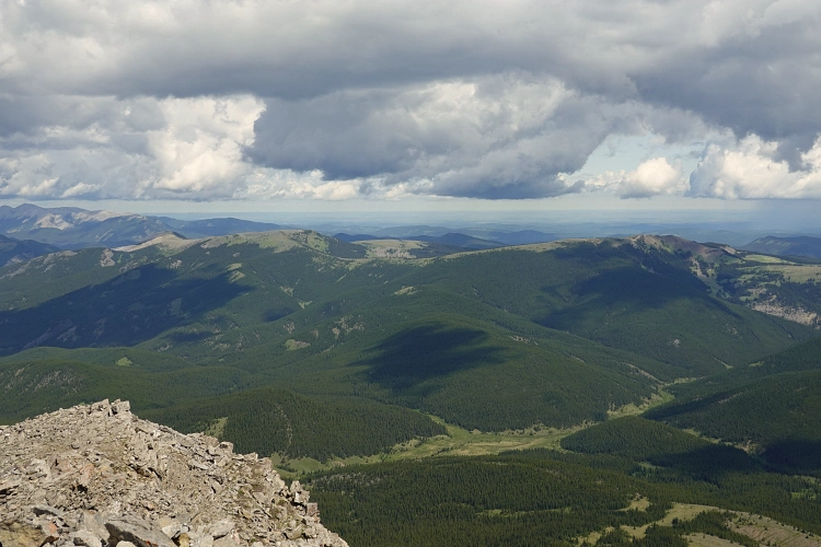
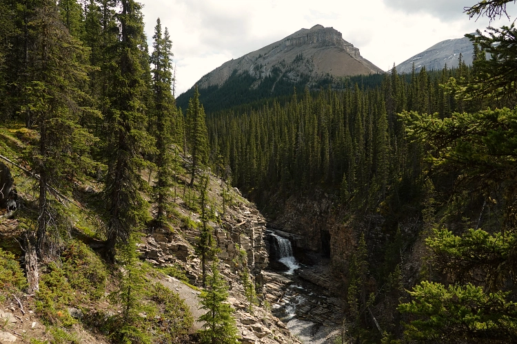
The relatively small summit cairn on Mount Rose is evidence of its lack of popularity. Too far from the road, and too long of a day for most people. There are vistas of lush green meadows, lonely ponds, and a sizable waterfall in the valleys down below, and Bluerock Mountain looks quite imposing from this vantage point.
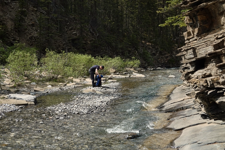
After a well-deserved lunch break spent admiring these sights, we headed down the west ridge. It’s an easy hike down to treeline, where we veered right (northwest) to follow a minor forested ridge (mostly light bush) into valley bottom at Cougar Creek. Not having read any of the existing trip reports properly, we were in for a bit of a surprise here. While we were expecting the smooth sailing to continue, it was not all that smooth: the route back along Cougar Creek has many bends and turns, with steep cliffs on its sides here and there, plus some waterfalls that have to be avoided by going up into the trees either on the left or right side. While the right side appears to be generally the best option, the bush isn’t always too inviting and it still requires a lot of work to make your way back to the wide track at the Elbow River. At one point, thinking we could tip-toe along the side of the creek past a rocky outcrop, Alan slipped on a slanted rock slab and took a full-on dip in the water before quickly recovering and rushing out on the other side. Thankfully, the water wasn’t too deep (perhaps a couple of feet) and he dried up quickly in the hot afternoon sun after his involuntary bath.
After what seemed like an eternity, we finally reached a small informal campsite where a minor horse trail took us back to the old road at the Elbow River. We walked back to our bikes and were glad to be sitting on two wheels again, thoroughly enjoying the quick ride back to the parking lot.
This is a long day and a bit of a mixed bag in terms of enjoyment factor, and I’d only recommend it to people who are ok with some sidesloping and light bushwhacking. However, it’s a really good route, a great adventure, and the views are definitely worth all the sweat!
|
Elevation: |
2596 m (Threepoint Mountain) 2545 m (Mount Rose) |
|
Elevation gain: |
1940 m |
|
Time: |
9.5 h |
|
Distance: |
32.6 km (of which 19.0 km by bike) |
|
Difficulty level: |
Moderate (Kane), T4 (SAC) |
|
Comments: |
River and creek crossings required – bring extra shoes. |
|
Reference: |
Nugara, Vern |
|
Personal rating: |
3 (out of 5) |

NOTE: This GPX track is for personal use only. Commercial use/re-use or publication of this track on printed or digital media including but not limited to platforms, apps and websites such as AllTrails, Gaia, and OSM, requires written permission.
DISCLAIMER: Use at your own risk for general guidance only! Do not follow this GPX track blindly but use your own judgement in assessing terrain and choosing the safest route. Please read the full disclaimer here.