Kananaskis, AB, Canada
9 August 2025
With Wen
A brilliant loop with a bit of everything
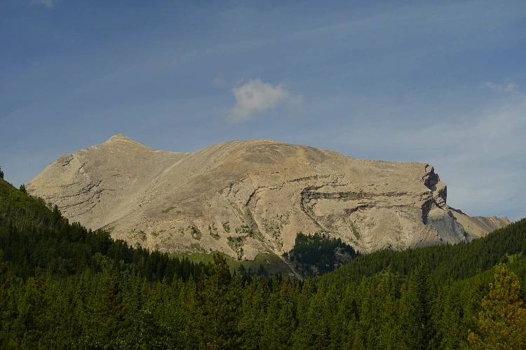
This is the unofficially named peak south of Highwood Peak in Kananaskis, described as an easy scramble (F rating – facile) in David P. Jones’ Rockies Central guidebook. Having passed by this peak on previous outings in the area to climb Highwood Peak and North Highwood Peak, I had a general idea that this was a pretty straightforward and much shorter trip, and I’ve been keeping it on the “backburner” for that type of day.
Today Wen and I were looking for an easy, scenic day out, and we found exactly that – plus more! This trip turned out to be a surprisingly pleasant loop with a bit of everything from good on-trail hiking away from the masses, to easy scrambling in the alpine, some fun route finding, a visit to beautiful mountain lakes, and a return on a popular, well-travelled trail full of day hikers.
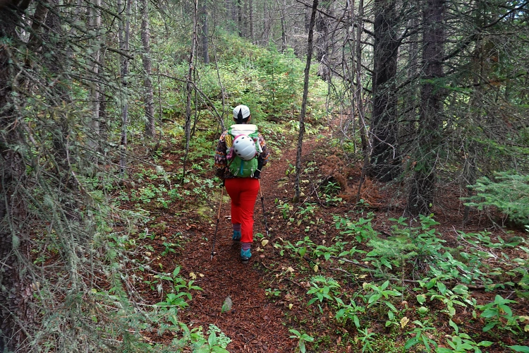
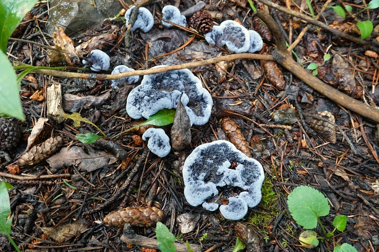
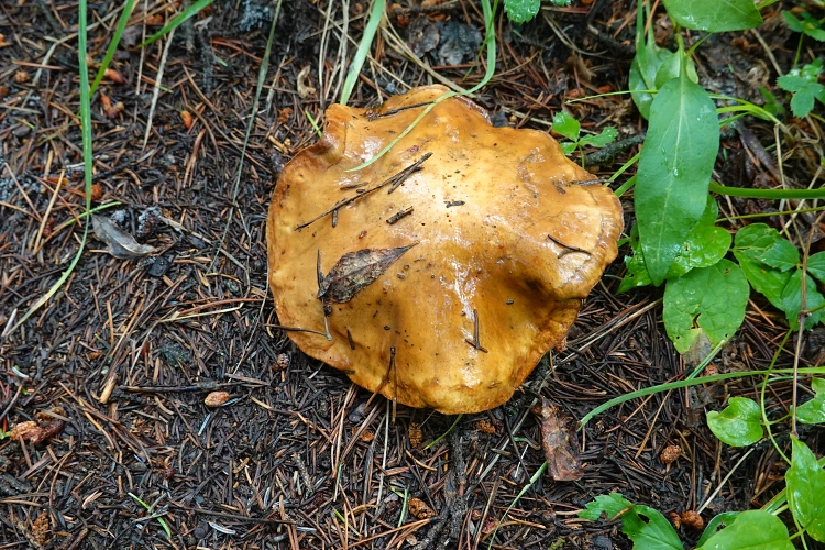
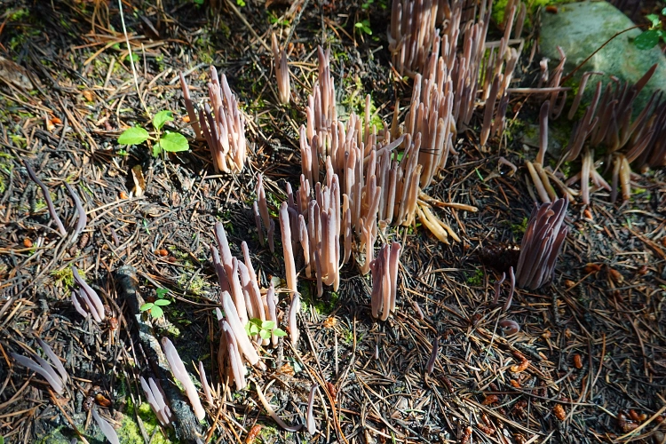
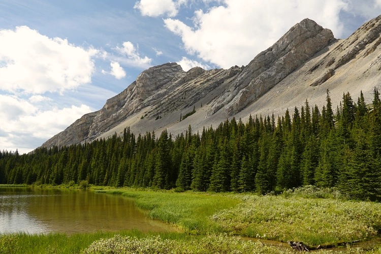
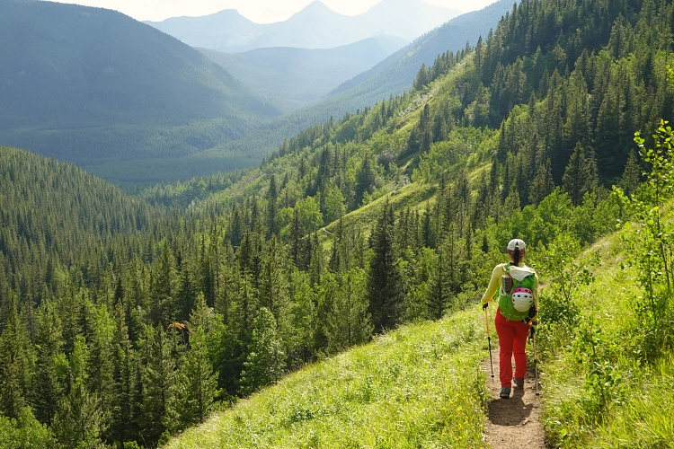
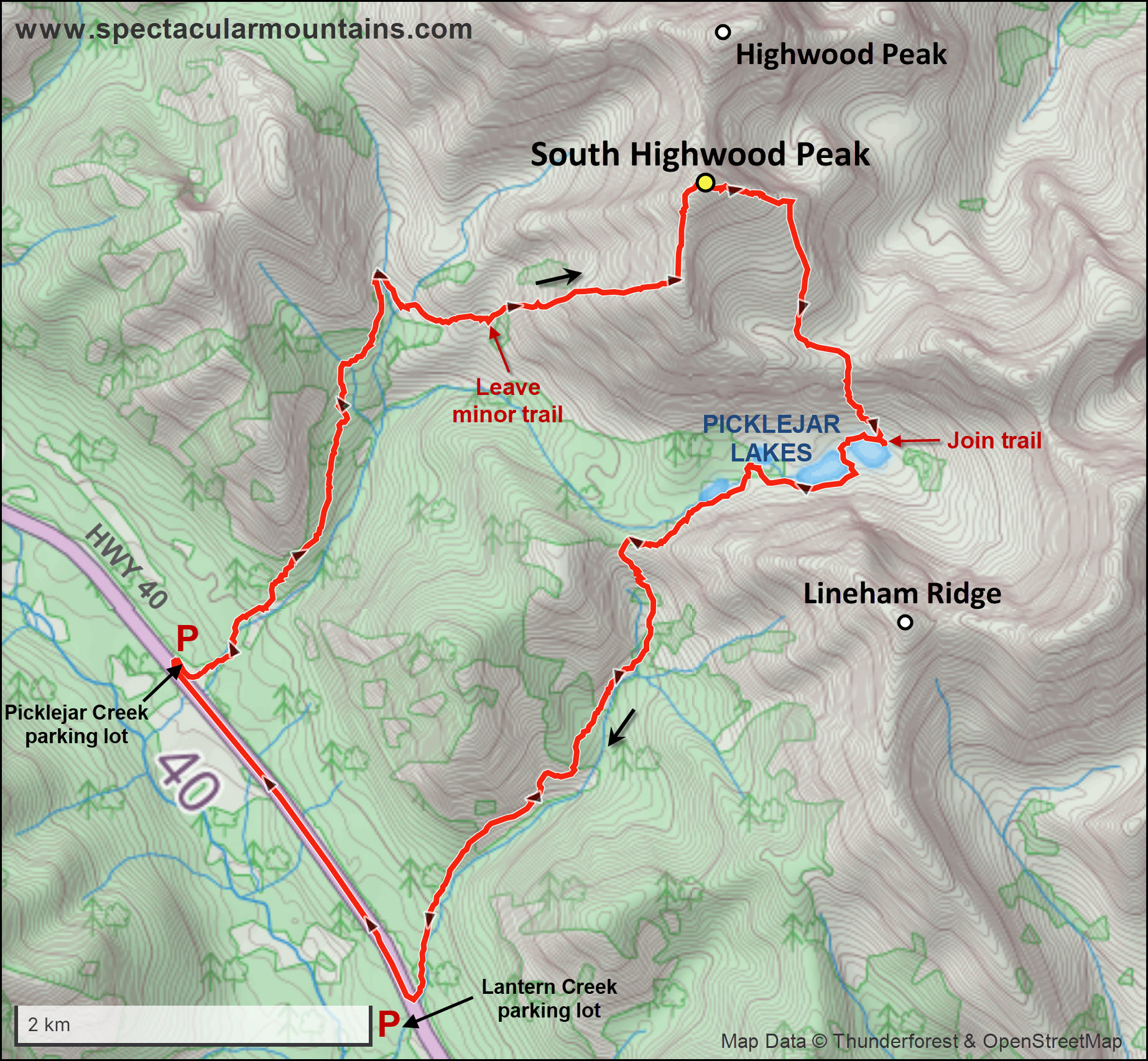
We parked at the now decommissioned (but still usable) Picklejar Creek parking lot along highway 40 – NOT the Lantern Creek lot with its popular trailhead to Picklejar Lakes. Ours was the only car in the small lot and, unsurprisingly, we didn’t see anyone else for the first three quarters of our trip. The trail that goes up Picklejar Creek was easy to follow despite a short section of an old washout right at the beginning. It was pretty much in the same condition as 6 years ago when I first visited the area: it’s not well-travelled, but a joy to hike as it gradually rises through the forest on the west side of the creek. There was an abundance of diverse and weird looking mushrooms that kept us entertained for the first couple of hours.
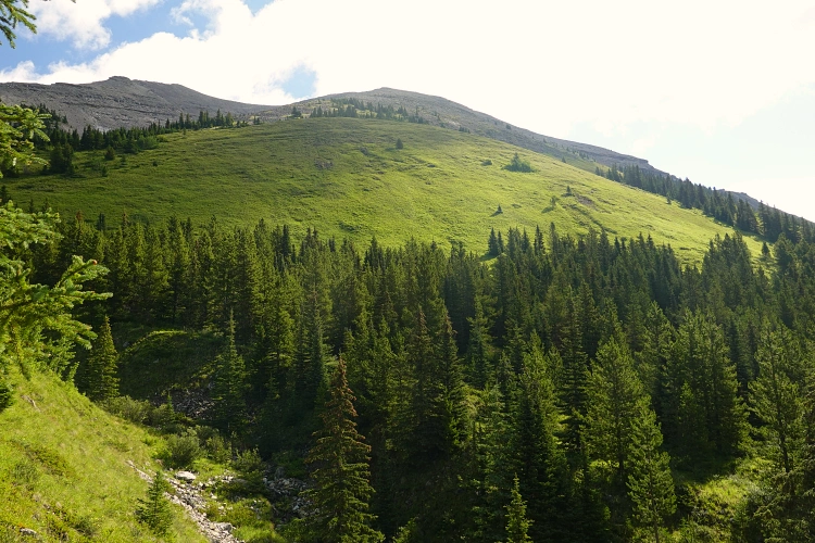
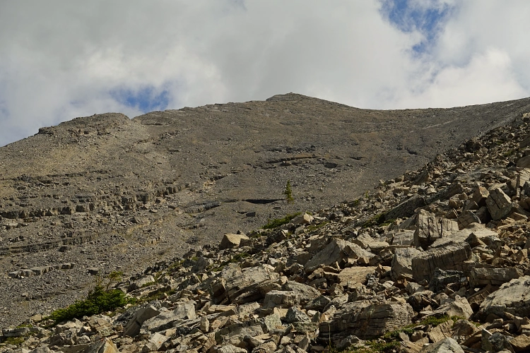
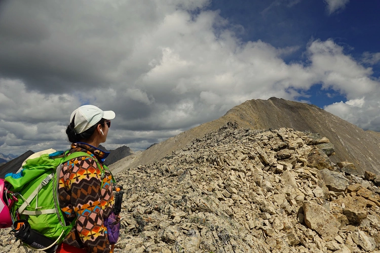
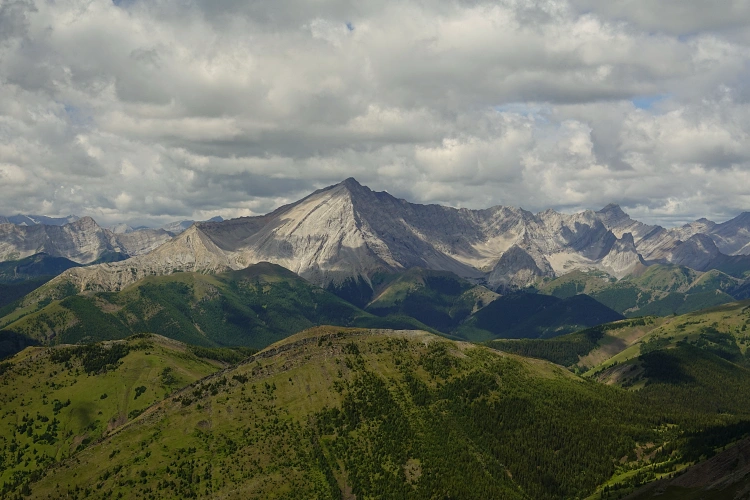
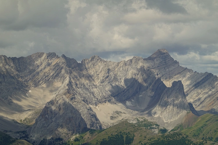
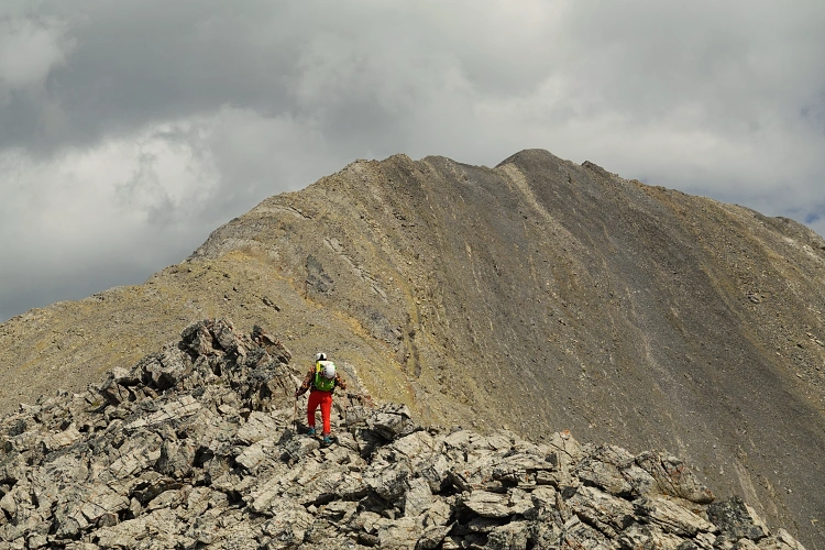
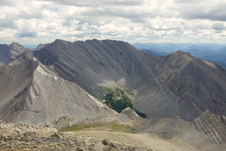
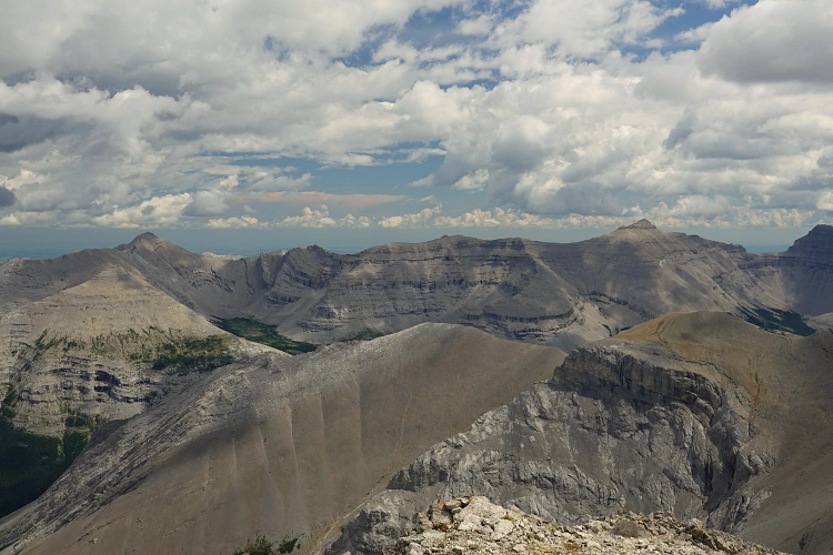
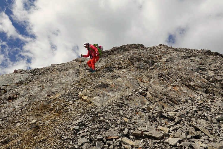
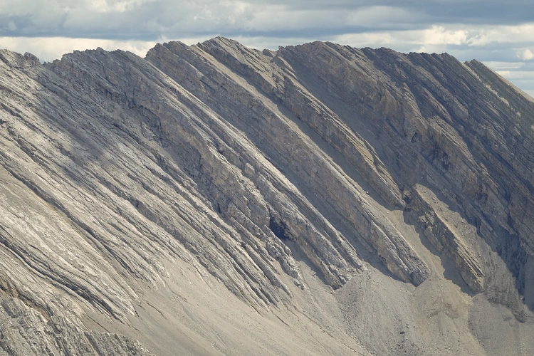
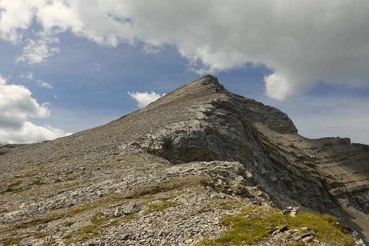
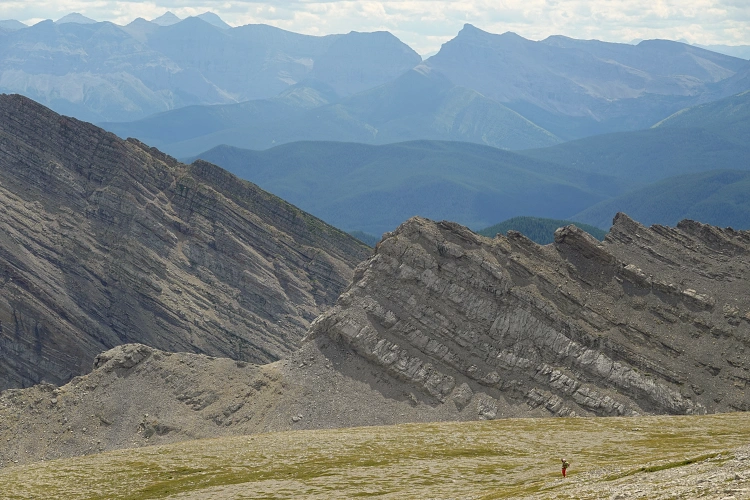
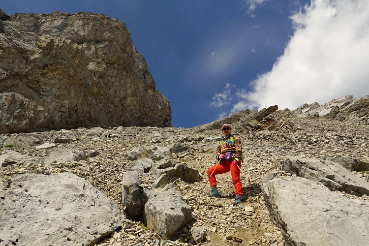
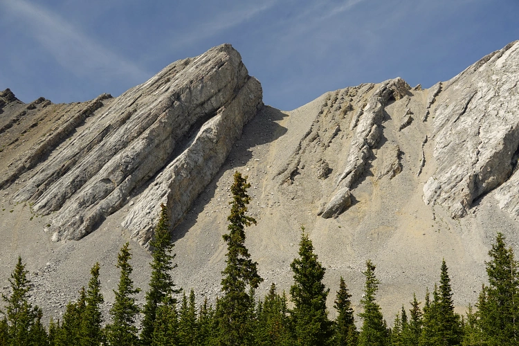
At about 3.1 km from the parking lot, not long after leaving the forest, we arrived at an unmarked junction – it’s easy to miss, but this is where the connector trail to Picklejar Lakes branches off to the right. We took this minor trail for another 800 m where we spotted a good place to head through light trees and up a wide grassy slopes to gain the southwest ridge of our objective. Half-way up the terrain transitioned into rubble and scree, thankfully of the (mostly) firm kind that didn’t move around too much. Fantastic views of the Highwood opened up, with Mist Ridge to the north and the higher, craggy peaks of the Continental Divide to the west. Soon we reached the start of the south ridge, which was easily followed to the summit at 2795 m. The terrain here was actually a lot tamer than we had expected – it’s just an off-trail ridge walk with a few easy scramble steps mixed in here and there.
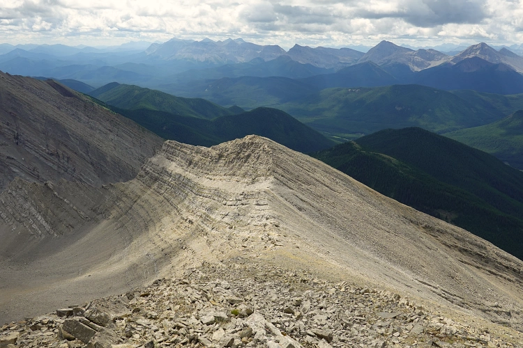
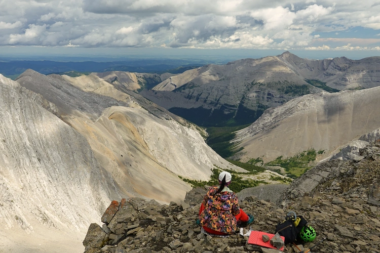
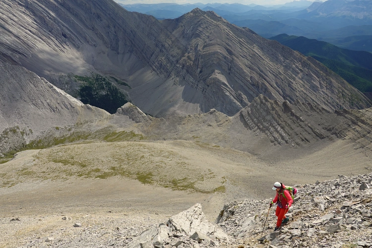
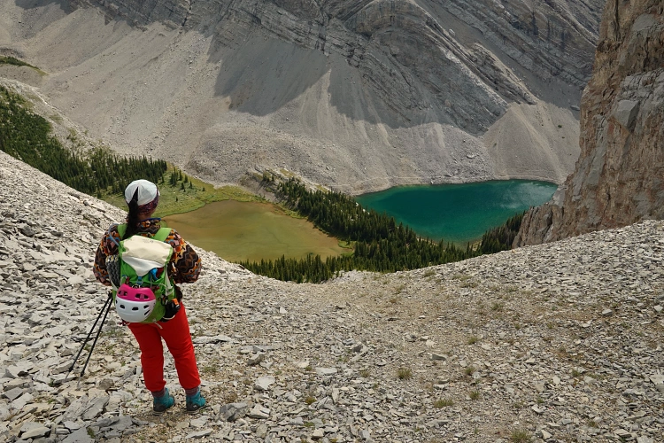
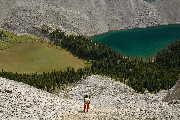
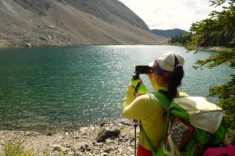
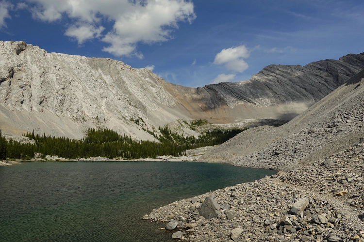
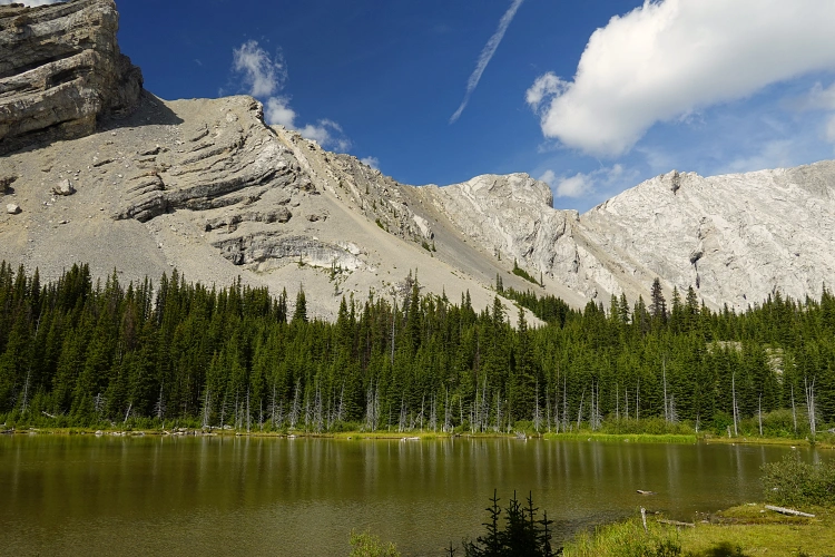
We enjoyed an extensive lunch break in a wind-sheltered spot near the summit cairn, soaking up views of the beautiful valleys to the east and the jagged ridge leading north to Highwood Peak. Looking down towards the valley in the southeast, an easy option for an alternative descent looked feasible – our aim was to head towards Picklejar Lakes and take the popular trail back to the highway. Indeed, it was an enjoyable easy scramble down the east ridge, then south into a small basin where we found a small creek and were able to fill up our water bottles again. From the basin we headed up a small saddle in the ridge separating us from the lakes. On the south side of this ridge a short but steep slope full of loose scree quickly brought us to the shore of the uppermost of the four Picklejar Lakes. Back on a good trail, we were thrilled to see how well this route worked out.
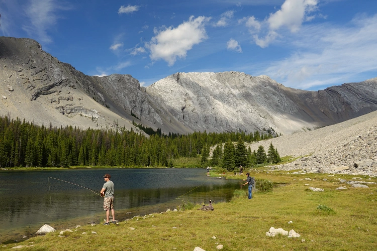
Wen had never been to the lakes before so it was a real treat for her. There were dozens of day hikers and lots of anglers, even some people camping in tents. After leisurely hanging around the lakes for a while, we went on our way and followed the good trail back out to the Lantern Creek parking lot.
Now the only (small) issue with this loop is that it leaves you about 2 km from your car, so you’d either have to do a car/bike drop, hitchhike back, or just suck it up and walk back along the side of the highway. Yes, it’s a boring highway, but it’s not that far really. Overall, this was a fantastic loop that I wouldn’t hesitate to do again!
|
Elevation: |
2795 m |
|
Elevation gain: |
1100 m |
|
Time: |
9.0 h |
|
Distance: |
16.1 km |
|
Difficulty level: |
East (Kane), T3 (SAC) |
|
Comments: |
Start and end point of loop are about 2 km apart on hwy 40. |
|
Reference: |
Own routefinding |
|
Personal rating: |
5 (out of 5) |
NOTE: This GPX track is for personal use only. Commercial use/re-use or publication of this track on printed or digital media including but not limited to platforms, apps and websites such as AllTrails, Gaia, and OSM, requires written permission.
DISCLAIMER: Use at your own risk for general guidance only! Do not follow this GPX track blindly but use your own judgement in assessing terrain and choosing the safest route. Please read the full disclaimer here.