Kananaskis, AB, Canada
1 July 2025
With Wen and Keegan
Fantastic Canada Day scramble
I can’t believe it’s been 13 years since I first climbed Mist Mountain in Kananaskis! That trip report was the first on my website, when I was still without a GPS device so I couldn’t include a gpx track. Now, more than a decade later, I was back in the great company of Wen and Keegan who joined me on a climb of this major objective in the Highwood Pass area.
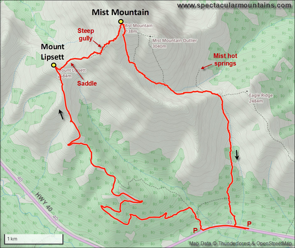
This time, however, we didn’t take the route suggested by Alan Kane in his famous Scrambles in the Rocky Mountains guidebook. That route had been quite the adventure with plenty of unforeseen challenges on the descent off the northwest side of the mountain. This time, we chose to approach from the south via the Mount Lipsett trail, an old coal exploration road, then scramble up the west side of the mountain, and finally descend off the “hiker’s route” in the rubbly south bowl. My conclusion up front: the loop from the south is far more enjoyable and less dangerous than the classic Kane route (sorry Alan!), and Keegan, Wen and I all agreed that this was a fabulous trip that can be recommended to experienced scramblers.
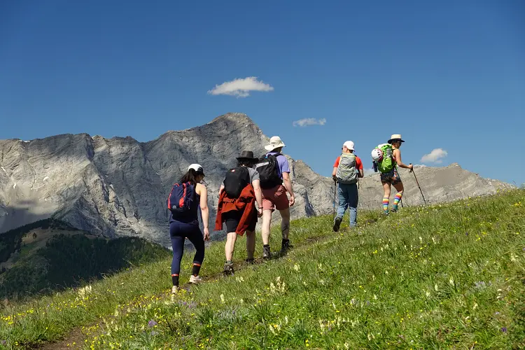
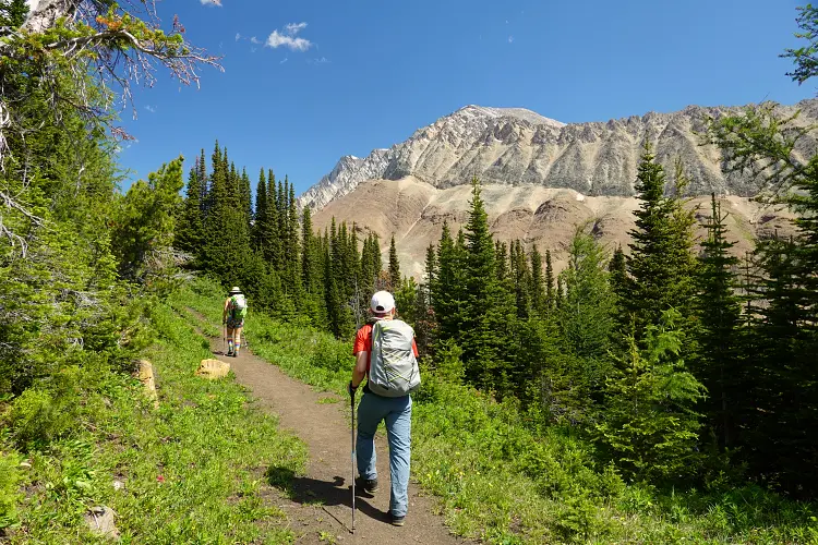
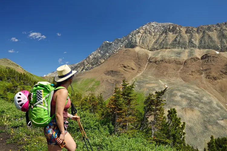
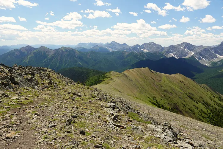
We started from the Mist hot springs parking area and first hiked up a few hundred metres along the highway to the trailhead for Mount Lipsett (you could also park here). From here, a good trail snakes its way up the south side of Mount Lipsett along a former exploration road, with many lazy zig-zags that add distance but make for a very relaxed warm-up hike. Much of it is in the forest and there are no views until you get about two thirds of the way behind you. Beautiful vistas of the Highwood opened up, the gentle grassy slopes sprinkled with colourful flowers reminding me a little of the Swiss Alps and making this trip alone well worth it. And apparently, plenty of other hikers felt the same – we must’ve run into dozens of people on the way up, plus there were at least 20 people hanging out at the summit.
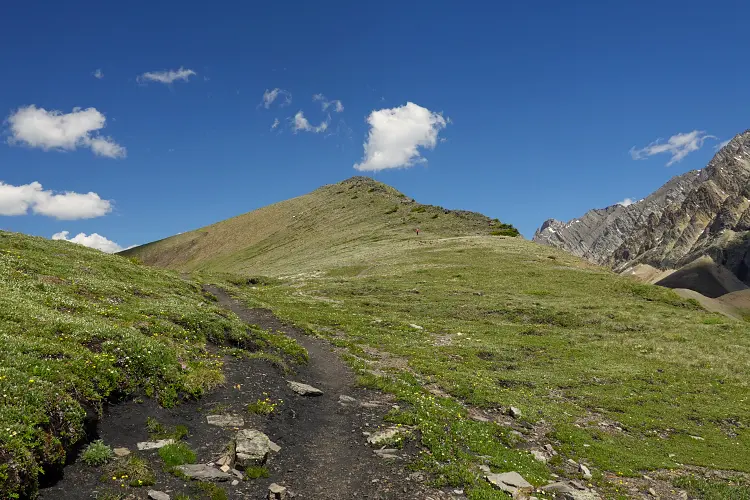
We all wondered why Mount Lipsett deserves to have its own “peak name”, given its low prominence and looking rather like a side bump next to its much bigger neighbour Mist Mountain. While Keegan and Wen couldn’t be bothered with the extra elevation gain and chose to sideslope directly to the saddle separating Mist from Lipsett, the “peakbagger” in me pushed me to pay this diminutive mountain a quick visit before heading down steep grass and rubble off the east side to rejoin my group.
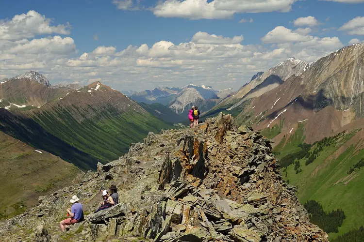
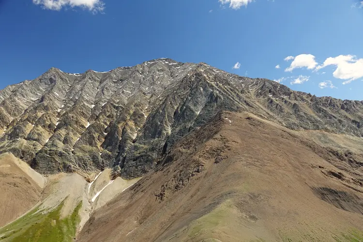
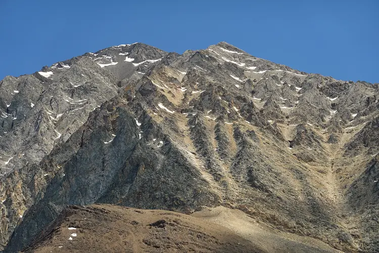
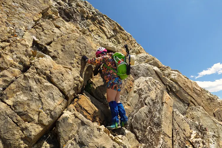
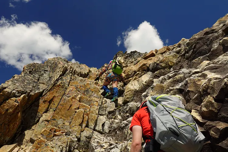
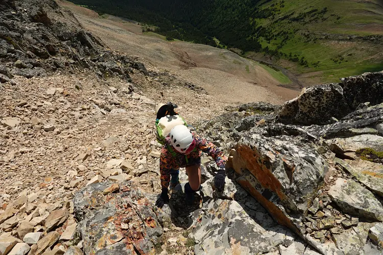
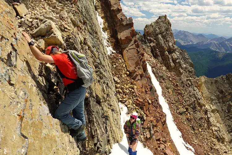
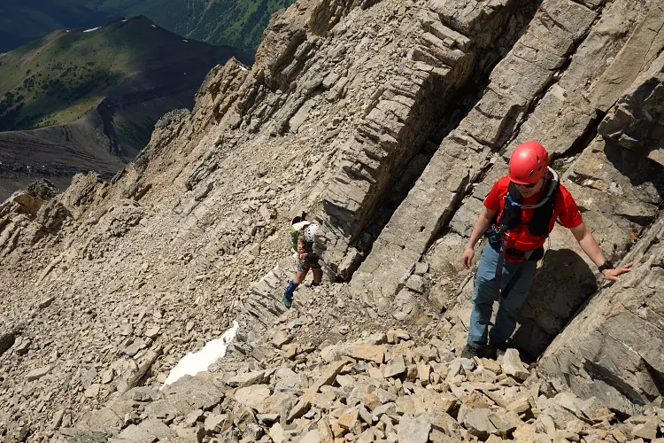
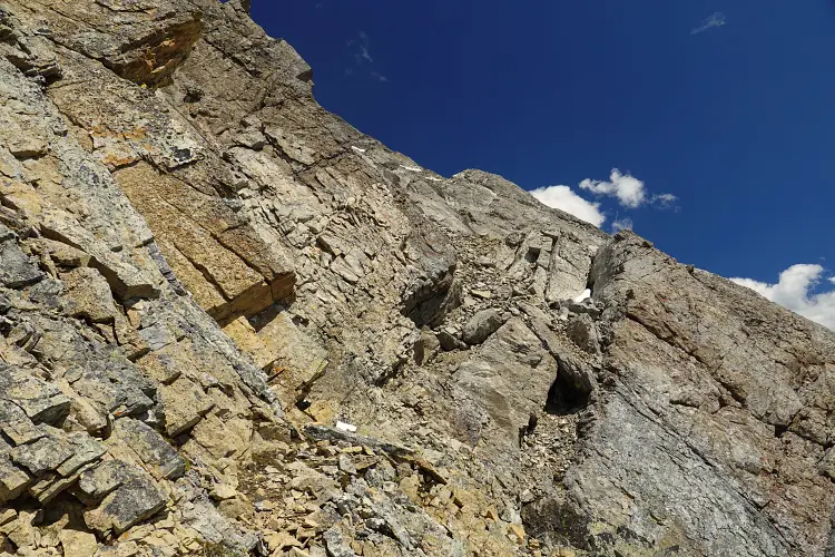
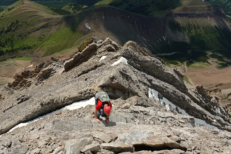
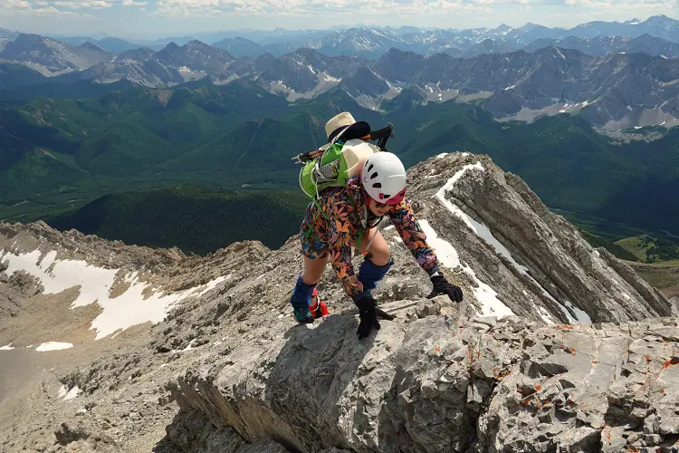
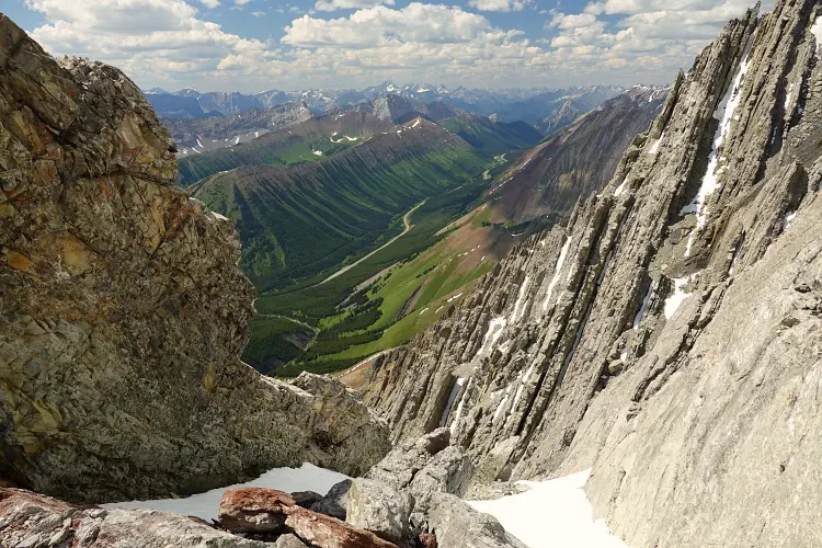
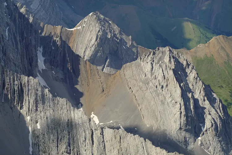
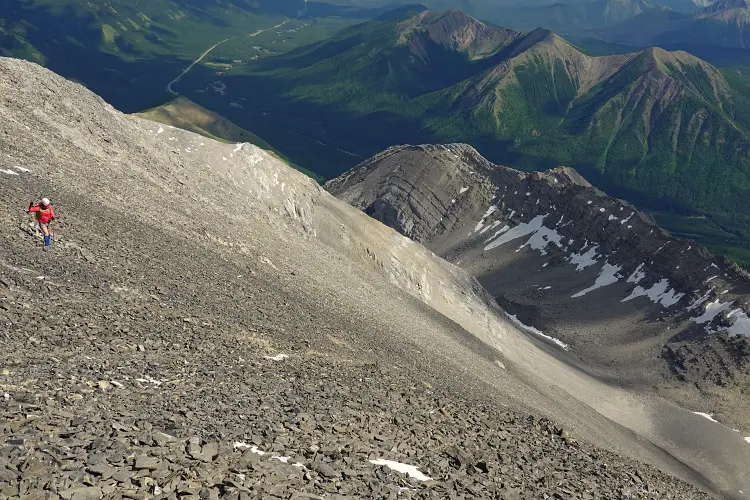
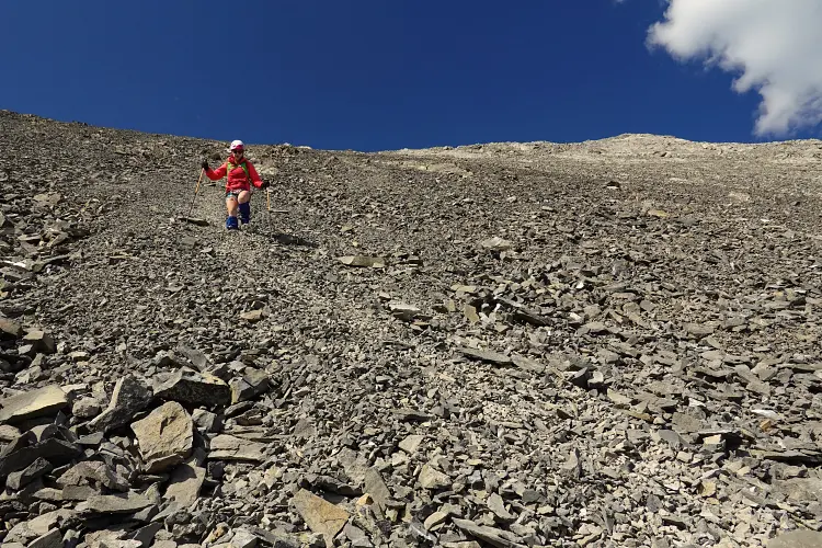
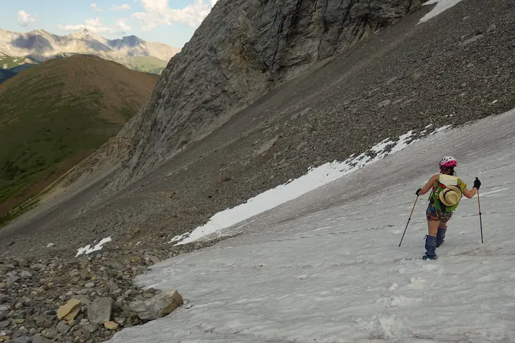
From the saddle there is a short stretch of misery that needs to be overcome to get to the start of the actual scramble: a pile of loose brown scree that was a bit of a pain to plod up. Thankfully, this was the only unpleasant part of the whole loop, and it was pretty short. Right at the top of the scree pile the rock changes drastically: from shale/siltstone to light grey limestone that steeply rises to the summit in a series of complicated chutes, ribs, and jagged ridges. Having done this part before as part of my previous trip, I knew that it looked worse than it is. We put our poles away, slowly scrambled up a small “wall” to enter the main gully, and slowly picked our way up, mostly on the sides of the gully where the rock was firmer. We enjoyed a long stretch of sustained hands-on scrambling up this gully, each of us picking our own little route in this micro-terrain where so many variations are possible. One thing to note is that you definitely don’t want to have anyone below you in this gully as you’ll inevitably have rocks being dislodged and raining down on whoever happens to be below. Smaller groups are thus better and we felt that three was the max number of people to be scrambling up here. Needless to say that helmets are essential and you want to stick as closely together as possible.
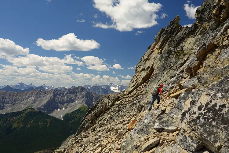
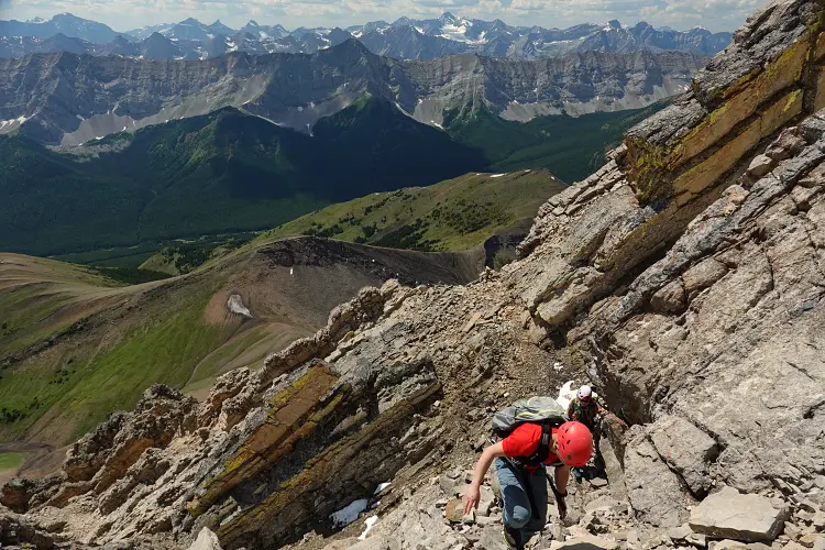
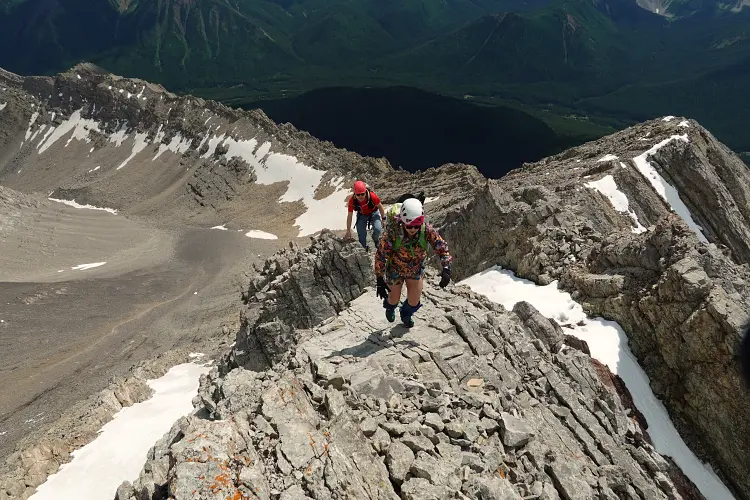
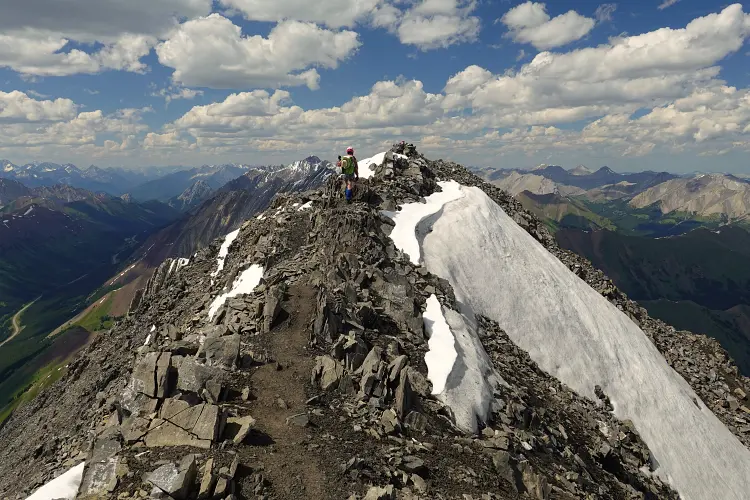
Near the upper end the gully forced us into a v-shaped wall that had some water tricking down and was a bit tricky to scramble up, but the holds were solid. We then veered to climber’s right, bypassing some overhangs on the ridge crest (cairns in places), before aiming left again to reach the top of the ridge. There was some more fun hands-on moderate scrambling here for a couple hundred metres with some exposure in a few places and one or two slightly awkward downclimbs, but nothing overly difficult.
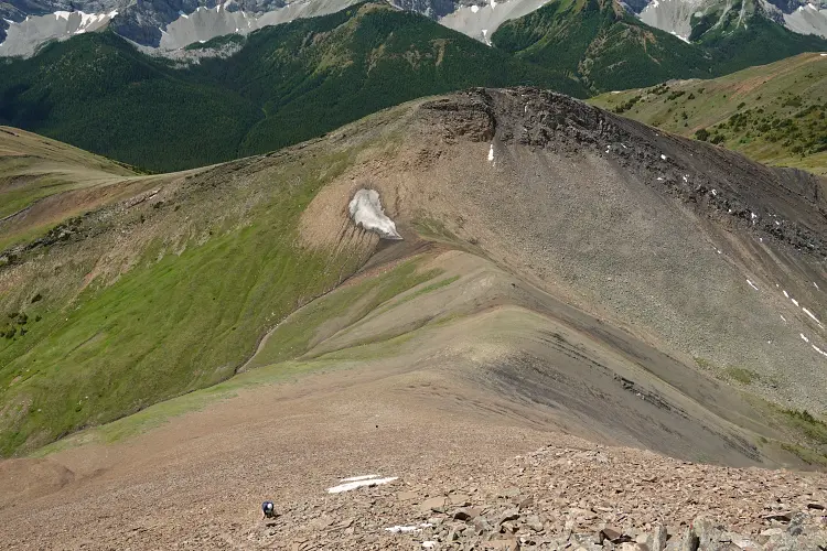
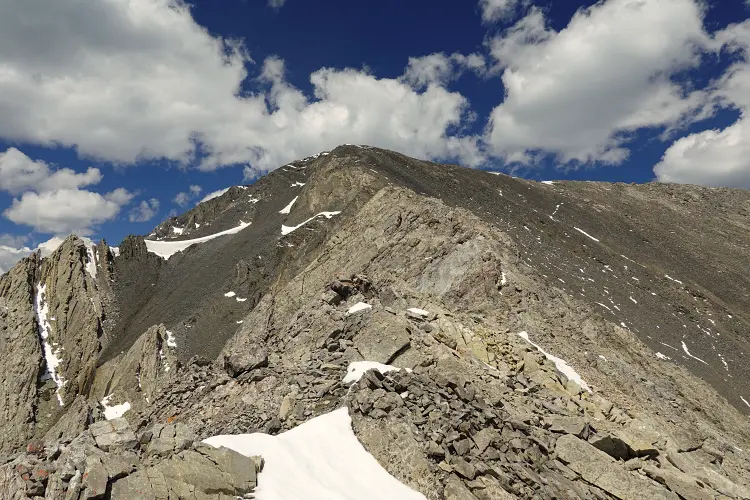
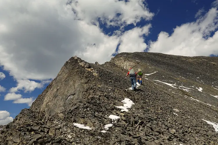
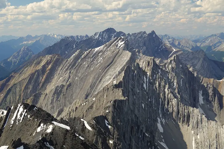
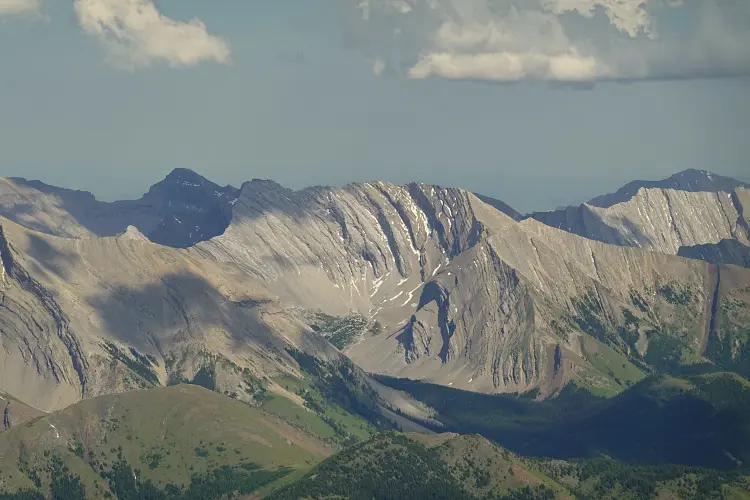
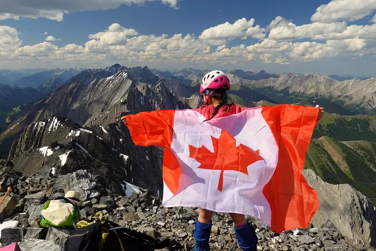
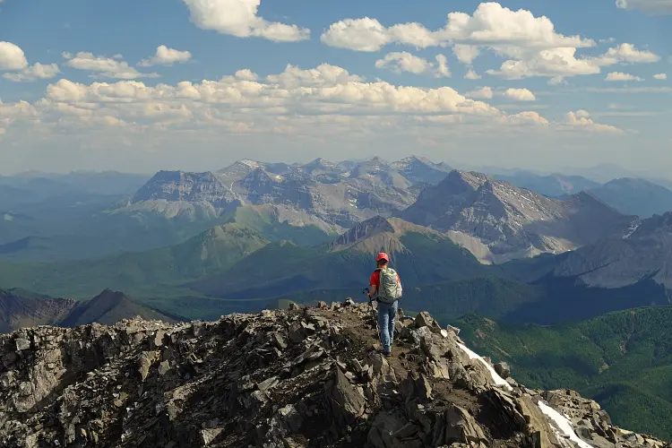
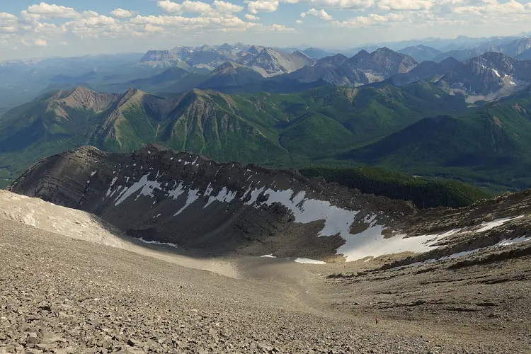
Finally, the jagged ridge tapered off and all we had to do is follow a game trail for the last few hundred metres to the summit. With a near absence of wind and the afternoon sun warming us up, we found it easy to while away for almost an hour in this gorgeous spot, enjoying magnificent views all around us. The craggy ridge of near-vertically tilted slabs to the north is particularly impressive, with Highwood Pass in the distance to the northwest. Further to the east is the long, grassy Mist Ridge, a fine shoulder season objective, and behind it Gibraltar Mountain, Mount Burns, Jägermeister Peak, and many more to the south.
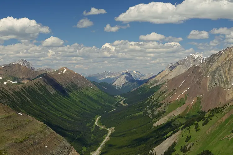
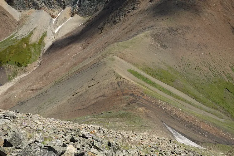
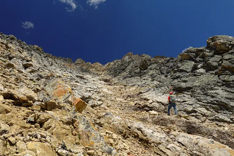
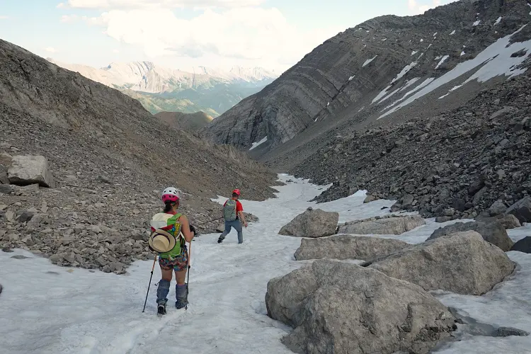
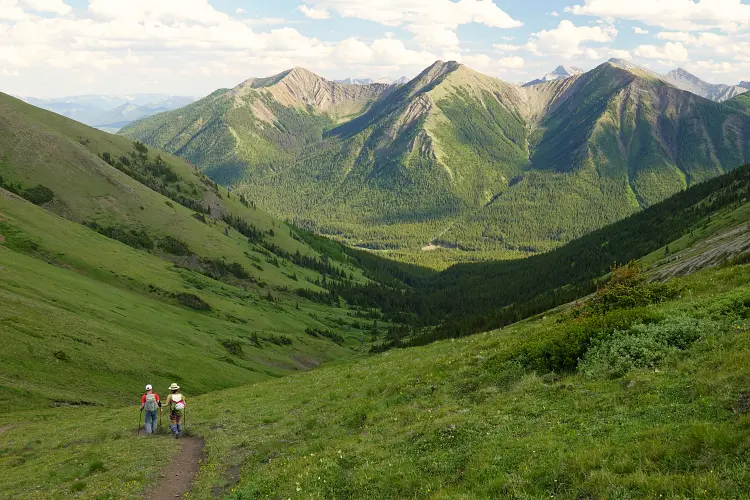
Our descent route followed the classic “hiking route” to Mist Mountain: a beaten trail drops down scree and rubble into the huge bowl south of the summit. It’s a pretty barren place filled with grey rocks, but it makes for quick travel and is easy. A couple of firm snow patches at the bottom of the bowl made it even easier on the knees and added some nice variety. After losing a significant amount of elevation, the trail then joins the main Mist hot springs trail as it rises over a small saddle and descends into a lush, green valley that ends near the parking lot. The perfect way to wind down a long day’s adventure.
This is a highly recommended loop for those who enjoy a variety of terrain and landscapes, from easy hiking trails to short stints of scree to upper moderate scrambling in more demanding terrain. Definitely one I’d do again!
|
Elevation: |
3140 m |
|
Elevation gain: |
1400 m |
|
Time: |
9.0 h |
|
Distance: |
15.6 km |
|
Difficulty level: |
Moderate (Kane), T4 (SAC) |
|
Comments: |
Helmet required for west ridge! |
|
Reference: |
Kane, own routefinding |
|
Personal rating: |
5 (out of 5) |
NOTE: This GPX track is for personal use only. Commercial use/re-use or publication of this track on printed or digital media including but not limited to platforms, apps and websites such as AllTrails, Gaia, and OSM, requires written permission.
DISCLAIMER: Use at your own risk for general guidance only! Do not follow this GPX track blindly but use your own judgement in assessing terrain and choosing the safest route. Please read the full disclaimer here.